Happy Earth Day! Many NEON field sites are hosted by or colocated with organizations that do conservation and restoration work. The data NEON collects at these sites provide a window into how ecosystems are changing and the impact of restoration efforts.
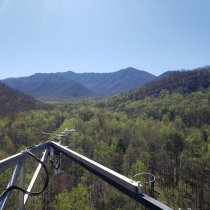
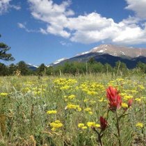
Domain 07, in the heartland of the U.S., is a land of rolling hills, steep ridges, gentle valleys, and many shades of green. The Appalachians and Cumberland Plateau feature some of the world's oldest mountains and the world's largest hardwood-forested plateau. The region's rich geologic history and temperate, moist climate have made it one of the most biodiverse areas of North America.
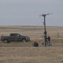
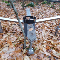
MDPs are mobile, modular NEON field stations that can go practically anywhere with road access. They put the power of NEON's instrumented systems into the hands of PIs, academic institutions, and research organizations.
The National Center for Ecological Analysis and Synthesis (NCEAS) and NEON have developed an open resource onboarding document geared to support researchers beginning their postdoctoral work with NEON - it can be easily adapted for other early career scientists entering roles.
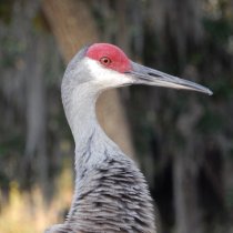
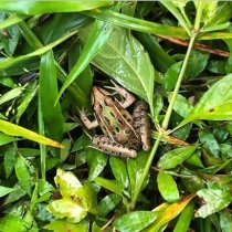
Happy World Wildlife Day! At the NEON program, we are lucky enough to share our workspaces with all kinds of wild creatures, great and small. And while we only collect data on a few (mosquitos, ticks, beetles, small mammals, birds, and fish, to be specific), we celebrate them all.
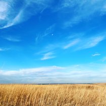
In the middle of North America, the eastern forests give way to the tallgrass prairie. This is the Prairie Peninsula (D06), in the heartland of the U.S. Sometimes called "America's Breadbasket," this region provides ample opportunity to study the impact of agriculture and land management practices on tallgrass prairie ecosystems. It also provides a unique view of a transitional zone between the prairies and the eastern deciduous forest.
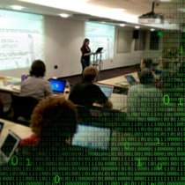
The pandemic has created new challenges for educators—but that doesn't mean learning has to stop. The Ecological Research as Education Network (EREN) collaborated with the NEON program in 2020 to create a series of Flexible Learning Projects that enable students to practice hands-on field ecology wherever they are—on campus or at home.
AGU's Thriving Earth Exchange Program has welcomed the newest cohort of Community Science Fellows, and first in partnership with NEON! This cohort is comprised of field staff across 12 of NEON’s Domains. Beginning in February 2021, they will be conducting outreach to communities within their Domains, and ultimately working with them to launch collaborative, co-developed community science projects that produce on-the-ground impact through application of NEON’s data and resources.
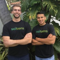
SciTeens is the brainchild of founders Carlos Mercado-Lara and John Sutor, who started the organization in 2018 when they were high school seniors. Their mission is to make free STEM resources – including data science resources – accessible to all students through online curricula, outreach, and mentoring. They leveraged ecological data from the NEON program to create their first data science projects.
NEON and the Ecological Society of America established a NEON-ESA Early Career Scholars (NECS) program for 2020 to support a group of early career scholars attending ESA2020. The chosen scholars received registration to the Annual Meeting, which centered on the theme of "Harnessing the ecological data revolution," and benefited from virtual networking with NEON.
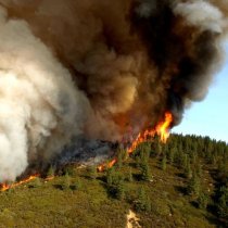
Dr. Jennifer Balch, a Fire Ecologist at University of Colorado Boulder, is studying wildfire-impacted areas in the western U.S. to answer burning questions about forest recovery and carbon storage potential. Her work could lead to improved models of the impact of wildfires on atmospheric carbon levels and environmental change.
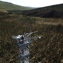
A new remote monitoring and near real-time alert system is helping NEON scientists rapidly detect and diagnose data anomalies that may indicate a problem with sensors or software.
The Great Lakes Domain (D05) is named for its most recognizable feature: the Great Lakes themselves. At our field sites in Wisconsin and Michigan, we're collecting data representing different management practices in the northern pine and hardwood forests. The data will help researchers understand how land management practices impact both terrestrial and aquatic ecosystems in the Great Lakes region.
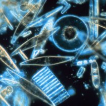
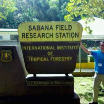
An investigation into freshwater diatoms from the NEON aquatic field sites in Puerto Rico led to a reclassification of diatom taxa in the region, and the possible discovery of a new diatom species. A paper recently published in Phytotaxa details the results of the research, which was enabled by samples from the NEON Biorepository.
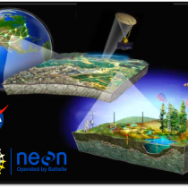
NEON's 2020 contributions demonstrate the significant impact this data has on ecological science. Here are 10 of the most exciting news items from the NEON program in the past year.
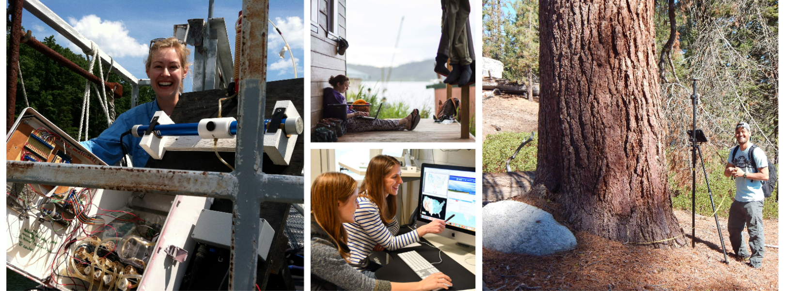
The NEON program is excited to welcome our first cohort of Postdoctoral Fellows! Starting in January 2021, these three early-career scientists will be working in collaboration with NEON staff and the wider user community to leverage NEON data for scientific discovery.
A newly signed MoU reaffirms the long-standing partnerships among six analogous but independent observing networks that monitor the ecosystems that underpin life on Earth, expressly committing to the development of the first-ever Global Ecosystem Research Infrastructure (GERI).
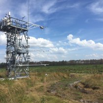
NASA monitors soil moisture levels and freeze/thaw conditions across the globe using a satellite orbiting 426 miles (685 km) above the Earth. To help validate and calibrate these satellite data, NASA relies on direct measurements taken by partners on the ground. Through a new collaboration with Battelle, soil moisture data collected at the National Ecological Observatory Network (NEON) field sites will now be part of those validation efforts.
Looking to predict beetle abundance and springtime greenness, among other things, the NEON Ecological Forecasting Challenge is looking to mobilize researchers and forecast answers to a complex set of ecological questions.
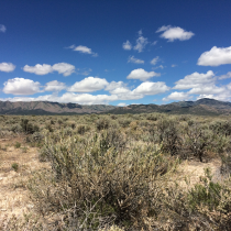
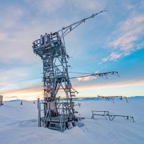
The Great Basin (Domain 15) is also home to the iconic Great Salt Lake, expansive salt flats, and rugged hills and canyons. The NEON program is monitoring changes in the desert ecosystems resulting from warming temperatures, decreased snowpack, and human activity.
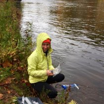
How much of the water that enters terrestrial systems is used by plants for growth, and how much simply escapes back into the atmosphere unused? Chris Adkison, a researcher at Texas A&M University, used data from the NEON program to compare the accuracy of different methods of partitioning evaporation and transpiration in a Texas oak woodland.
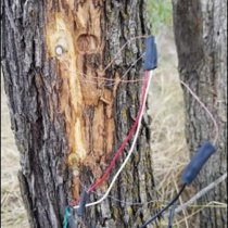
Battelle is testing applications of DAS technology at a National Ecological Observatory Network (NEON) program ecological field site. The Battelle-led and funded study leverages NEON infrastructure and data analytics expertise from Los Alamos National Laboratory (LANL) to test new applications of a DAS technology.
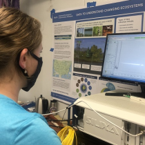
A new study published in Nature Geoscience uses soil from NEON field sites across the continent to look for insights into how ecosystem variables impact the formation and composition of SOM.
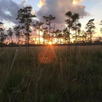
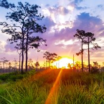
With field sites at the Disney Wilderness Preserve, The Jones Center at Ichauway, and the Ordway-Swisher Biological Station, NEON's Southeast Domain provides a model for collaboration between industry, academia, and large-scale research infrastructures to further ecological and conservation research.
Arbuscular mycorrhizal (AM) fungi are found in nearly every ecosystem, quietly helping plants absorb nutrients from the soil. Dr. Bala Chaudhary wants to build a better model of how these vital ecosystem players disperse across the continent. She is using NEON’s Assignable Assets program to examine the role of aerial dispersal in AM fungal movement.
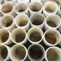
Dr. Zachary Kayler, an assistant professor in the Department of Soil and Water Systems at the University of Idaho, used NEON soil samples to test the ability of a widely-used soil health metric to detect changes from an extreme weather event - Hurricane Maria - in Puerto Rico.
Can technology fill in the missing pieces when humans can’t get to the field? While there will almost certainly be data gaps for NEON and other large-scale ecological programs this year, automated instrument programs can still provide a lot of ecological insights. In the future, emerging technologies such as drones, smart sensors, and robots could help ecologists collect field data even under challenging circumstances.
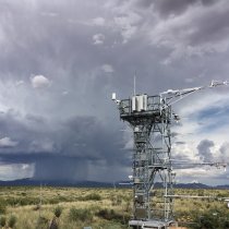
The NEON field sites in the Desert Southwest Domain (D14) collect data that can help researchers better understand how the monsoon impacts the ecology of the southwestern deserts and monitor how the monsoon season may be changing over time.