Groundwater
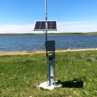
Groundwater well at the NEON PRLA site
Groundwater is water that exists in the pores in the soil or cracks in rocks below the land surface. Water and solutes can flow back and forth between groundwater and surface water. The saturated sediments adjacent to and underlying streams, rivers, and lakes where water is actively exchanged is known as the hyporheic zone. The chemical and physical properties of groundwater are often distinct from surface water, making the hyporheic zone an important location of biogeochemical reactions.
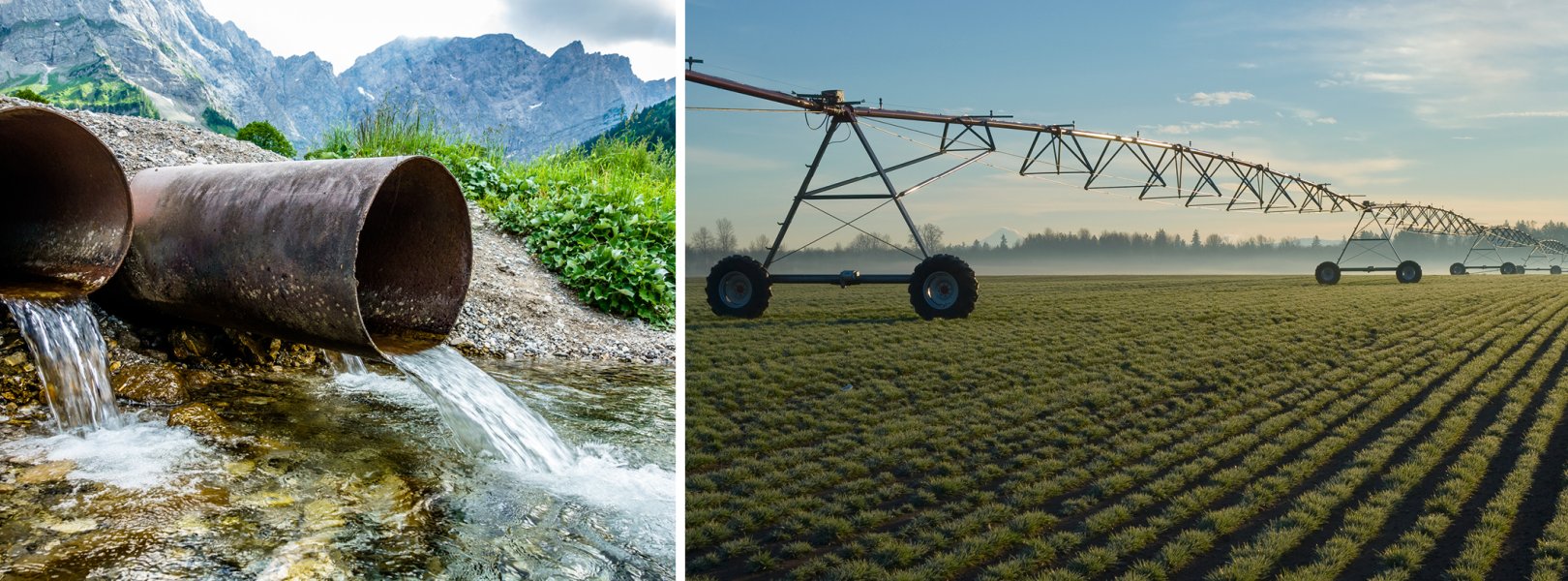
While land surface inputs and processes can change frequently due to external influences and seasonal drivers, groundwater tends to offer stability to many aquatic ecosystems by serving as a natural filter and temperature regulator. Groundwater-surface water interactions can drive nutrient cycling, temperature regimes, and instream habitats. For example, seasonal groundwater withdrawals for human uses in agriculturally dominated areas may drive groundwater height and flow direction, which will likely impact surface water level, temperature, and chemistry. Collecting data related to these linkages is an integral aspect of better understanding how aquatic ecosystems change over time.
The goals of NEON's groundwater sampling are to understand the hydrologic and geochemical interactions between the surface and groundwater. Shallow groundwater wells are installed at most aquatic field sites and equipped with instrumentation to measure water table elevation, temperature, and specific conductance at high temporal resolutions. Observational sampling at a subset of the wells provides more detailed water quality characteristics on a seasonal basis. At sites with permafrost, where part of the water in the ground remains frozen year-round, physical measurements during the warmer months describe melt and freeze dynamics.
Sampling Design and Methods
Up to eight wells are installed at each field site. Each well typically extends from the surface down to where solid bedrock occurs. The spatial orientation of groundwater wells at each site is informed by topographical and logistical considerations and is meant to capture hyporheic and shallow, unconfined aquifer hydrology and chemistry.
Wells are placed near the stream, river, or lake feature for each site to capture hyporheic flow. These groundwater wells are also placed in close proximity to sensor stations in the water body to enable direct comparisons to surface water temperature and chemistry data. Additional wells are located further from water bodies to allow for characterization of the magnitude and direction of shallow groundwater flow, and depending on local conditions, enable sampling of less directly connected groundwater flow paths.
Each well is equipped with a data logger to capture changes in groundwater elevation, temperature, and specific conductance at five minute intervals. Data loggers are located 0.5 m from the bottom of the screened interval for wells deeper than 3 m, while shallow wells less than 3 m deep have the data logger located 0.2 m from the bottom of the well screen.
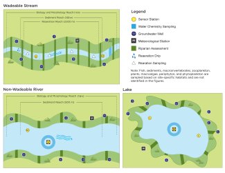
Schematics showing spatial placement of automated instruments at stream, river and lake sites.
Exceptions
Due to logistical and permitting issues, the following field sites do not have groundwater wells: LeConte Creek (LECO), McRae Creek (MCRA), Teakettle 2 Creek (TECR), and Rio Cupeyes (CUPE).
One exception to the method described above is NEON permafrost sites where the ground remains continuously frozen (OKSR, TOOK, and CARI). In these sites seasonal fluctuations in the underlying active layer, which is the ground layer above the permafrost that seasonally freezes and thaws, present significant challenges in measuring absolute groundwater elevation. During the melt season at these sites, key measurements of the active layer including the depth to liquid water from the ground surface, if present, and depth to the active layer thaw are collected weekly. Similar to groundwater elevation in stationary ecosystems, these data are useful for addressing water table related questions of groundwater availability and seasonal variability. As with all NEON sites, data loggers capture temperature and fluid electrical conductivity.
Using Colocated Sampling Methods
In addition to groundwater sensor data, groundwater samples are collected twice per year and analyzed for the same suite of water chemistry parameters measured in surface water samples. Water chemistry samples are collected from a subset of four wells at each site within two days of surface water sample collection.
For rivers and wadeable streams, the four sampling wells are selected in an attempt to cover all of the following categories: upstream, downstream, right bank, and left bank. Preference is also given to wells that are closer to the surface water chemistry sampling locations. For lakes, the four sampling wells are selected with two on the side of the lake with a higher water table elevation and two on the lower elevation side. A consistent sampling of the same set of four wells at each site is necessary for the evaluation of seasonal responses in groundwater constituent concentrations.
Data Products
Basic groundwater data related products include:
- Temperature of groundwater (DP1.20217.001)
- Elevation of groundwater (DP1.20100.001)
- Specific conductivity in groundwater (DP1.20015.001)
- Groundwater and active layer measurements at permafrost sites (DP1.20099.001)
Chemical analysis of groundwater products include:
- Chemical properties of groundwater (DP1.20092.001)
- Stable isotope concentrations in groundwater (DP1.20276.001)