Spatial Data Layers & Maps
NEON spatial data layers and maps are openly available for you to explore and download. These include shapefiles, kml/kmz files, and printable maps. Shapefiles can be opened in a GIS program like QGIS, ArcGIS, or a programming language like R or Python using GDAL libraries. kmz files can be opened directly in Google Earth.
Access ESRI ArcGIS Online
NEON spatial data layers and maps are openly available through ArcGIS Online.
Interactive Story Maps are also available to explore Domains and sites.
If you have an ArcGIS account, you can view additional NEON maps, layers and apps available within ArcGIS Online. If you don’t have an ArcGIS Online account, you can create and sign in to an ArcGIS public account using an ArcGIS login or a social login (Facebook and Google). An ArcGIS public account is designed for personal, noncommercial use. With a free public account you can create your own maps, store, and manage geospatial content, share content, and access content shared by Esri, NEON, and GIS users around the world. Just search the keyword “NEON” from your ArcGIS Online home page.
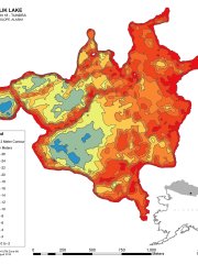
Quick Downloads
This is a selection of our most popular maps and spatial data files. For more, visit the AGOL portal.
Domain Polygons
A polygon shapefile defining NEON's Domain boundaries. Coordinate Reference system: Geographic WGS 84. Last updated Oct 2024.
Field Site Poster With Index
A poster of the NEON field sites map (max. size 33" x 18") with an index of all field sites and IDs. Last updated Dec 2024.
Field Site Poster Without Index
A poster of the NEON field sites map (max. size 36" x 24") that includes field site IDs on the map but no index of field sites. Last updated Dec 2024.
Field Site Locations
This KMZ file contains Domain boundaries, point locations for NEON tower locations, and both aquatic and terrestrial sampling boundaries. Version 20, last updated May 2025.
Terrestrial Observation System Sampling Locations
These shapefiles and documents describe monitoring locations for plants, insects, ticks, soils, soil microbes, small mammals and birds, measured by NEON's Terrestrial Observation Systems (TOS) team. Or download this KMZ version. Coordinate Reference system: Geographic WGS 84. Version 12, last updated March 2026.
Terrestrial Field Site Boundaries
This shapefile contains the polygon boundary (extent) of NEON terrestrial and colocated aquatic field sites but does not contain boundaries for non colocated aquatic field sites. Coordinate Reference system: Geographic WGS 84. Last updated March 2025.
Flight Boundaries
Shapefile polygon flight boundaries (areas) for D01 to D20 field sites surveyed with the NEON Airborne Observation Platform. Or download the KMZ version. Acquisition priority is assigned (high (P1), medium (P2) or low (P3)) but please note that flight boundaries may change from year to year. Contact us for the most current plans and to coordinate research activities on the ground. Last updated April 2024.
Aquatic Sites Watersheds
These shapefiles display the watershed boundaries (area), drainage lines, and pour points for NEON Aquatic Field Sites. Details of the Watershed Delineation for NEON Aquatic Sites can be found in NEON.DOC.005246. Coordinate Reference system: Geographic WGS 84. NLCD land cover metrics are also included in this download. Last updated: May 2024.