Frequently Asked Questions (FAQ)
If you have questions, please review the FAQs below, which are divided into sections by topic. If you cannot find an answer to your question, please contact us.
General
Q: What is the NEON program?
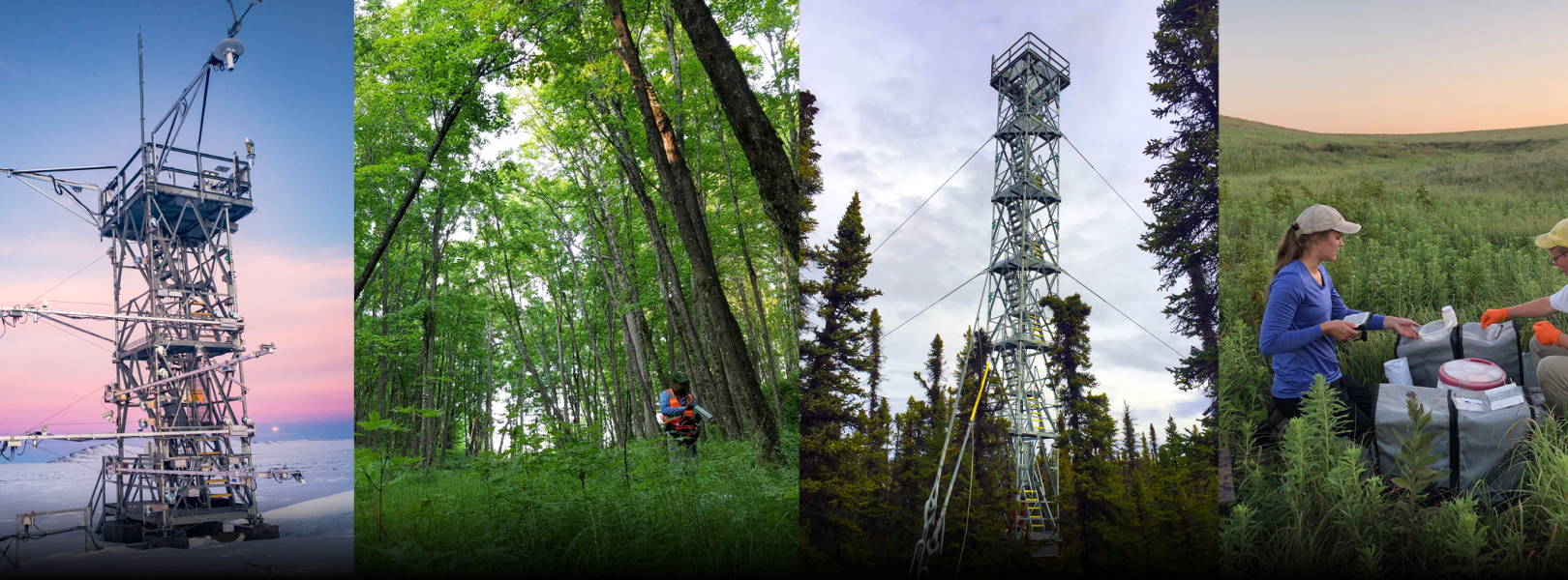
A: The National Ecological Observatory Network (NEON) is a large facility program operated by Battelle and funded by the U.S. National Science Foundation. NEON is a continental-scale research platform for discovering and understanding the impacts of climate change, land-use change, and invasive species on ecology. NEON gathers long-term data on ecological responses of the biosphere to changes in land use and climate and on feedbacks with the geosphere, hydrosphere, and atmosphere.
Q: Where is NEON? How were sites chosen?
A: The National Ecological Observatory Network includes 81 field sites across 20 ecoclimatic Domains that cover the contiguous 48 U.S. states, Alaska, Hawaii, and Puerto Rico. Each Domain represents a distinct region of vegetation, landforms, climate, and ecosystem performance. Domain boundaries were determined using a statistical clustering algorithm and data developed by William Hargrove and Forrest Hoffman of the Oak Ridge National Laboratory. Site locations were chosen for a variety of reasons, including scientific criteria and permitting logistics. NEON is a national Observatory, not a collection of regional observatories. Data are collected at field sites and sent to a headquarters location in Boulder, Colorado. Data are processed and then made available via the internet. NEON also has 18 field offices (Domain Support Facilities) staffed by field scientists who manage the observational data collection and instrumentation at field sites.
Q: Why are certain types of data collected?
A: The measurements being taken at NEON sites were determined through a lengthy planning process involving extensive input from the scientific community in the early stages of NEON's conception, as well as input from committees of subject matter experts. In 2009, a list of measurements was presented as part of reviews by the NEON Science, Technology, and Education, Advisory Committee (STEAC), a blue-ribbon panel coordinated by the NSF, as well as in the preliminary and final design reviews for NEON. The final selection of measurements was determined by analyzing whether the measurement was essential to provide a NEON data product to address specific science questions. Browse the Explore Data Products webpage for more information.
Q: What happens to research and projects already underway in areas where NEON sites were constructed?
A: Projects currently underway at sites will continue and we do not expect any disruption to occur.
Q: What was the construction schedule for the NEON Infrastructure?
A: NEON began construction in Summer 2012, and was completed in May 2019. Data are being collected at all 81 field sites. See Observatory Status for details.
Q: What formal reviews did NEON participate prior to construction?
A: The National Ecological Observatory Network passed a successful Preliminary Design Review (PDR) in June 2009 and Final Design Review (FDR) in November 2009 by panels convened by the NSF.
Q: Will there be NEON staff at each Domain? Did NEON construct facilities to support them?
A: There are 18 field offices that consist of a Field Operations Manager, administrative support, and approximately five technicians whose primary responsibilities are to operate and maintain field site infrastructure. In addition, seasonal staff are contracted to do biological field sampling. NEON does not construct new facilities for field staff; NEON leases existing office and laboratory space.
Q: Will NEON be developing new sensors and technologies for ecological observation?
A: No - NEON is not created to develop new technologies. At this point, NEON's design incorporates existing technologies (some at the cutting edge) to achieve its science mission.
Q: NEON is expected to endure for decades. Will the same technology be applied over the full deployment period?
A: We expect all sensors and instrumentation to have finite lifetimes, so as part of NEON planning, routine maintenance and instrument replacements will be scheduled. Replacements offer an opportunity for upgrades to new technology within the constraints of budget and measurement requirements for precision and accuracy. Quality control procedures will be implemented when instruments are replaced to assure data continuity and comparability.
Q: Will material from the NEON collections be available to users from the community? Can we do additional analyses on NEON material? How will I gain access?
A: Yes, material is available on an as-available basis from the NEON Biorepository, subject to sample preservation requirements. A curated collection of organisms, key body parts of organisms, and substrates are open to researchers for analysis, both now and in the future as new technologies emerge. Some portion of the collection will also allow for destructive analysis of samples, while preserving some material permanently. The collections are primarily stored at the NEON Biorepository, as well as a few other partner facilities (museums and other collections).
Q: What are NEON's Mobile Deployment Platforms?
A: NEON mobile sensor arrays, called Mobile Deployment Platforms (MDPs), were available on a request basis up until 2026. MDPs could be configured to collect a variety of meteorological, soil, and surface water data for short- to medium-term monitoring projects.
Q: What is the difference between NEON and the Long Term Ecological Research Network (LTER)? Is NEON just an expansion of the LTER program?
A: NEON is a centrally operated user facility that enables responses to challenging questions in the environmental sciences and enables ecological forecasting. In contrast, the LTER program is a collection of individual investigator projects aligned with common themes. Each individual LTER site has its own realization of those themes. NEON and LTER are separate programs that operate separately, although NEON will certainly use the experience and knowledge gained through LTER research.
Q: How will my institution benefit from NEON?
A: The NEON facility was designed to be a resource for any wishing to use it; regardless of institutional affiliation, scientists, students, educators, and the public will have open and equal access to NEON. Over time, we look forward to providing many different types of data, infrastructure, models, and education programs to engage anyone who wants to learn about and use ecological data.
Q: How do I get my students involved in NEON-related research?
A: NEON facilities are open to students and researchers at all levels, and they are welcome to access our data for any projects they would like to conduct. In addition, we offer online data skills tutorials, teaching modules designed for undergraduate classrooms, science videos, and other resources. We also recommend exploring the Faculty Mentoring Networks (FMN), which support faculty using NEON data in their classrooms, and a partnered internship program providing hands on experience.
Q: How do I find out about job opportunities at NEON?
A: Information about job opportunities is posted on our careers page. NEON has opportunities for permanent and term employment as well as visiting scientist opportunities for short term, focused tasks.
Q: Why did NEON build from the ground up when there is already a huge network of ecological monitoring activities available across the United States?
A: The U.S. National Science Foundation's goal with building the NEON facility is to enable analyses of ecological processes and patterns at regional to continental scales. This requires that measurements and samples be collected using highly standardized methods and instrumentation so that data can be easily compared among sites and scaled up over larger areas.
Q: Should I create a NEON User Account?
A: Although it is not required to create an account and log in, doing so can provide numerous benefits for you and for NEON. Please learn more about User Accounts. We will never give or sell your email address or other personal information to anyone. We have an obligation to record and report user demographic information and general data access activity to NEON's sole funder, the U.S. National Science Foundation. We may use your anonymized account information to help us develop usage metrics and to improve the quality of services for all users. It's free and easy! Just click on the Sign In button on the top right of the home page and fill out the form. When you have signed in, a My Account link will appear next to the Sign In link in the header area. Click on the link and you will be taken to the My Account screen where you can update your personal profile.
Data and Infrastructure Use
Q: What are the options for funding from NEON for NEON-related research?
A: NEON provides data, infrastructure and educational programs, but not funding. Research related to the Observatory may be supported through existing and future funding mechanism at Federal agencies, such as the U.S. National Science Foundation, and through other funding sources.
Q: What is the process for obtaining permission to use NEON data and/or physical infrastructure in my research?
A: Please see our Research Support Services page for complete guidance on conducting research involving NEON data and/or infrastructure.
Q: What types of documentation do you provide with the data?
A: First, check out the Document Library. This is a rich resource of many types of documents, including overarching science designs, site characterization reports, spatial data, protocols (both from NEON and external labs that NEON contracts work with), data processing documentation (also known as Algorithm Theoretical Basis Documents, or ATBDs), and User Guides for observational data products. If you use any of these documents, please cite them as you would with any other publication. Data packages may contain some of these documents, specific to the data product downloaded. Each data package also may contain a readme file, a machine-readable form of the readme file using the Ecological Metadata Language (EML) format, and a file that describes all of the variables available for the data product. Observational data products include a file that includes the validation rules used when ingesting the data.
Q: Do you update your documentation?
A: Yes, we update our documentation as frequently as needed. In the Document Library, you will find a few sub folders called "Obsolete Protocols" and "Past Versions". Most of our documents use a lettering system for versioning, starting with "DRAFT", then vA, vB, etc. We also update readme files and EML files on an as-needed basis. Newer data packages may have updates to their readme and EML files that are not present in older data packages.
Q: What is Ecological Metadata Language (EML)?
A: EML is a widely used, community supported XML schema that supports rich documentation of data related to ecological research, particularly including environmental, ecological, and earth science data. It is supported by The Knowledge Network for Biodiversity (KNB); more information may be found here. The EML available at this time is NEON’s first implementation of the schema and will continue to be improved. EML is valuable for batch-processing or integrating many data packages. KNB provides a stand-alone software package, Morpho, for generating EML-documented data packages. The emlpackage for reading and writing EML is available from rOpenSci,a community-driven organization that develops and provides free and open-source tools. Our Data Tutorials section includes Time Series 01: Why Metadata Are Important: How to Work with Metadata in Text & EML Formats well as numerous tutorials about R, python, and data.
Q: I’m new to the type of data I’ve downloaded. Where can I get help?
A: There are a number of resources available for training and self-learning about the different types of data that NEON provides. Check out the Resources link in the data portal's navigation menu, and the Data Product Details page for each data product (follow links on the Explore Data page). You can also ask specific questions through the data portal Feedback page - your question will be routed to the science team relevant to the data product you select from a drop down list.
Q: Do you provide guidelines for using and citing NEON data?
A: Yes, please see our open NEON Data Usage and Citation Policy. This policy is subject to revision as needed.
Q: Do you provide unique identifiers (like DOIs) for your datasets?
A: Digital Object Identifiers (DOIs) are associated with each data product in each static Data Release (release annually). DOIs are also provided for each Prototype Data set. For more information, please see our Data Product Revisions and Releases webpage.
Q: How much does NEON data cost to use?
A: Use of NEON data is free! Our data products are open data. We ask that users cite the data and NEON appropriately in your research.
Q: What is an API?
A: If you are unfamiliar with an API, think of it as a 'middleperson' that provides a communication path for a software application to obtain information from a digital data source. APIs are becoming a very common means of sharing digital information. Many of the apps that you use on your computer or mobile device to produce maps, charts, reports, and other useful forms of information pull data from multiple sources using APIs. In the ecological and environmental sciences, many researchers use APIs to programmatically query and obtain data for their analyses.
Q: How do I find data?
A: With many data products and field sites to choose from, exploring NEON data may feel a bit overwhelming. There are two ways to get started: Option 1: Type in what you are looking for in the search bar on the homepage of the data portal.You can search by any word or phrase of your choice, including by keyword, data product name, data product ID, year, site, or Domain. Phrases that have more than one word should be surrounded by quotes, for example "biological temperature". Click Enter and the search will take you to a pre-filtered selection of data products (if the search term was found) in the Explore Data Products page. Option 2: Navigate to the Explore Data Products page. Use the search bar and/or the filter options on the left side of the page to explore data products by search phrase or keyword, date range, availability, science team, location (site, state, domain), or theme. To reset your filters, click on the blue "Reset All Filters" button at the top left.To learn more about any given data product, click on the Product Details button to the right of a data product name.
Q: What information can I get if I use the API?
A: The NEON API will return information about NEON data products, research locations, sample relationships and custody, and taxonomic lists. Results are returned in a common machine-readable format, JSON (JavaScript Object Notation). Many software packages, like R, have add-ons that help translate JSON into other formats. In addition, the /data endpoint will return zipped data packages. Instructions on how to construct a URL, as well as a tool to build URLs to your specifications, are on NEON's API page. There are some examples on our GitHub repository, neon-data-api, and our R package neonUtilities (which also has a python wrapper) makes using the API a snap. neonUtilities can be downloaded from CRAN or from GitHub. Also check out our Download and Explore NEON Data and Using the NEON API in R tutorials. We provide information, code examples, and an issue-tracking tool via NEON’s GitHub account, in the neon-data-api repository. We appreciate feedback and examples of how you are using the API. Visit our Code Hub for more details.
Q: What does the chart below each data product in the Explore Data Products page represent?
A: This chart shows whether data are available for any given spatial location for any given month. Gray represents that data are unavailable, and blue represents that at least some data are available. A blue box does not indicate that data are complete for that location/month combination. The default view, Summary, rolls up the availability of data across all sites. If data are available for at least one site for a given month, then the box at that month will appear blue. If the box is gray, there is no data available for that month at any site. If you click on the Site button, the graph will expand to show availability for each site denoted by its four-letter abbreviation. Clicking on State or Domain will roll up availability similarly to the Summary view. For example, if State is chosen and there is a blue box available for a given month, then data are available at least one site in that state for the month of interest.
Q: How do I download data?
A: Once you have selected data of interest in the Explore Data Products page, click on the Download Data button. The interface will guide you through several steps to select sites and date range, which documentation files to include, and other data-product specific items. It will ask you to affirm that you agree to the Data Usage and Citation Policies, and show the estimated size of the data package you are requesting. When all steps are complete, you will be at the last step and will be able to click the Download Data button to start your download.
Q: Can I download more than one data product at a time?
A: At this time, only one data product may be downloaded in a single download request, with the exception of the Bundled data products. However, data from the entire possible date range and several sites for a specific data product can be downloaded in a single request. Be careful to check the size of the download you have requested - they can be rather large and take a long time to download.
Q: Is there a limit to how much data I can download at one time?
A: There currently is no limit except for your patience. However, you may wish to check the size of your requested package before hitting the download button, as a package of many gigabytes could take a long time to download. If your request is much larger than you are comfortable with downloading, please contact us for help.
Q: What is a data product?
A: NEON measures a diverse suite of biological, physical, chemical and ecological characteristics at field sites across the continent. NEON data are sent to headquarters after site construction is complete and data collection begins. The Observatory processes these measurements to derive standard, quality-assured data products that support greater understanding of complex ecological processes at local, regional and continental scales. Available NEON data, supporting metadata, science designs, data collection documentation, and data processing documentation are accessible through the NEON Data Portal. For more information, please visit the Data Processing webpage on the NEON web portal.
Q: What is a data package?
A: A data package is a zip file containing a collection of data and metadata files. This zipped data package is dynamically generated when you submit a query consisting of a data product, one or more sites, and a date range to the data portal.
Q: How are data files organized?
A: Observational and instrumented data products (with the exception of eddy covariance data) are divided into many small files in the Comma Separated Values (CSV) format. Each file contains data for a single data product at one site over one month, and at an additional level of granularity. For observational data products, the level of granularity is a type of data collection activity. For example, in the ground beetle trapping data, this includes individual tables for field data, sorting, initial identification, and later expert identification (if needed). A file containing metadata about data validation is also included. For instrumented data products (except for eddy covariance), the level of granularity is the vertical and/or horizontal position of the sensor collecting the data. A single field site often has multiple sensors of the same type (for example, soil moisture sensors along an array), each at a different location. Eddy covariance data are delivered in the Hierarchical Data Format (HDF5)as a 'bundle' of many data products that are not delivered individually. Similarly to other instrumented data products, each data file contains data for a single site and month. The Airborne Observation Platform (AOP) only flies over each site once in a year. AOP data files are organized by data product and site (sometimes two sites if they are close to one another), and year of collection. The data portal and API allow for a more granular approach to downloading data files because files may be very large.Each science subsystem (observational, instrumental, eddy covariance, and airborne) uses its own naming convention for data files. For more information about these conventions, visit the File Naming Conventions webpage.
Q: What do I do with all of these zip files?
A: For any of our observational or instrumented data products, we provide R and python tools to help you combine the files into tables you can easily use in your analyses. We provide a tutorial, Download and Explore NEON Data, which explains how to use our neonUtilities R package.
Remote Sensing / Airborne Observation Platform (AOP)
Q: Where can I find information about when AOP will be surveying a particular NEON site?
A: Each year NEON posts the upcoming flight season’s campaign schedule, which includes start and end dates for airborne surveys at each site. Please see our flight schedule page for more information.
Q: Can I request that AOP survey a location outside of the NEON site network?
A: Yes. AOP participates in NEON Research Support Services, a service provided to researchers interested in collecting data at sites not directly affiliated with the NEON network. Please see Research Support Services for more information on AOP flight campaigns.
Q: What if I find flightline matching inconsistencies?
A: Flightlines may not (and in many cases will not) match from year to year if sites are flown with different sensors and are not linked to the spectrometer flightlines. The best way to find matching lines, if you are not using the tiled data, is to pull in the metadata kmls which show the boundaries of each line and then can be manually matched.
Q: Are AOP data available in cloud-computing environments like Google Earth Engine?
A: NEON has added a subset of Level 3 AOP datasets to Google Earth Engine (GEE). These datasets are the surface directional reflectance (DP3.30006.001), lidar-derived digital elevation models (terrain and surface models - DTM and DSM, DP3.30024.001), lidar-derived ecosystem structure (Canopy Height Model - CHM, DP3.30015.001), and the RGB camera data (DP3.30010.001). Data are currently only available on GEE for a portion of sites and years, but data at a site of interest can be added upon request. These data are planned to be publicly discoverable through the Earth Engine Datasets in mid-2024. Further updates will be communicated through NEON Science Data Notifications. For those interested in working with AOP data currently available on GEE, please refer to the Intro to AOP Data in Google Earth Engine Tutorial Series.
Q: Have AOP sensors changed over the years? How do different sensors affect the data?
A: Yes. NEON has operated the same Imaging Spectrometers (JPL AVIRIS-NG) over the lifetime of the observatory, however, the Lidar and Camera sensors have been upgraded over the years. Data produced from the more recently acquired camera and lidar sensors have improved resolution and capabilities. Most notably, the newer lidar sensors can operate at a higher Pulse Repetition Frequencies (PRF), which results in a higher point density. From 2013-2020, NEON operated Teledyne Optech Gemini sensors, with data typically collected at 33-100 kHz. The Riegl Q780 started collecting science data in 2018; this sensor operates at up to 400 PRF (with a max recorded PRF of 266 kHz). In 2021, NEON acquired an Optech Galaxy Prime sensor, which operates at up to 1000 kHz PRF; this sensor replaced the older Optech Gemini sensors. Note that differences in the lidar sensor used, the acquisition parameters (such as PRF, power settings, and flight altitude) and external factors such as the ground topography and atmospheric conditions during the flights will all impact the data, and so it is important to factor this into consideration when working with different lidar datasets. We encourage exploring the metadata, as well as reading the daily flight reports, QA reports, and the Algorithm Theoretical Basis Documents when working with the AOP data.
Q: What are the major differences between data acquired with NEON's different lidar sensors?
A: In addition to the differences in PRF described in the previous question, there are some other hardware differences between the lidar sensors. The Riegl sensor has a rotating mirror, while the Optech sensors have oscillating mirrors; these result in slightly different scan patterns on the ground. As operated by NEON, the Optech Gemini produces laser pulses with a beam divergence of 0.8 mRad and has an outgoing pulse width of 10 ns. The Riegl Q780 and Optech Galaxy are operated with a beam divergence of 0.3 mRad and have an outgoing pulse width of 3 ns. These hardware parameters have two important consequences for NEON data. The beam divergence defines how large the laser beam footprint will be when it interacts with the landscape. At the typical flying height of 1000 m, the 0.8 mRad and 0.3 mRad beam divergence settings results in a laser beam diameter of 0.8 and 0.3 meters respectively when the laser energy reaches the ground. A larger beam size results in increased ambiguity in the ground object that generated the return signal. The outgoing pulse width is directly related to the range resolution of the sensor. The range resolution defines the minimum separation between two objects required to generate multiple returns. The 10 ns and 3 ns outgoing pulse widths result in range resolutions of approximately 2 m and 2/3 m respectively. This indicates that objects shorter than the range resolution cannot be conclusively separated from the ground. This has direct implications for the Canopy Height Model data - for example, vegetation < 2 m in height cannot be resolved with the Optech Gemini sensors. Information about the sensor used to acquire data at a particular site and year can be found in the data product metadata (in the geotiff tags for the Lidar raster data products), as well as in the QA reports that are delivered along with the lidar data products. For more details about NEON's Lidar sensors, please see the Lidar Data Collection page.
EFI-NEON Ecological Forecasting Challenge
Q: Where do I get biomass data for NEON sites?
A: NEON does not produce a biomass data product, but the data to calculate biomass are available. Explore: Herbaceous clip harvest (DP1.10023.001); Vegetation structure (DP1.10098.001); Root sampling periodic (DP1.10067.001) and megapit (DP1.10066.001); Coarse downed wood bulk density sampling (DP1.10014.001) and log survey (DP1.10010.001); and Aquatic plant bryophyte macroalgae clip harvest (DP1.20066.001).
NEON Biorepository
Q: What is the NEON Biorepository?
A: The NEON Biorepository is a data-integrated collection of biological and environmental samples collected across NEON field sites in the United States. Managed by the ASU Center for Biological Collections and Discovery, it supports the long-term storage, curation, and use of NEON samples. These samples are directly connected to NEON data products, including biogeochemical, disease, and genetic datasets, and are made available for loan to support research on biodiversity, ecosystem processes, evolution, and long-term ecological change.
Q: What does the NEON Biorepository do?
A: The NEON Biorepository receives samples from NEON field sites, domain facilities, and external contractors, and is responsible for their curation, storage, and preparation for long-term use. This includes organizing and storing samples, rehousing or preparing specimens when needed, imaging specimens, and maintaining specialized storage. It also manages sample records, links samples to NEON data, and coordinates access by preparing and shipping samples for research through the loan process.
Q: What types of samples are available through the NEON Biorepository?
A: The NEON Biorepository includes a wide range of sample types spanning environmental, microbial, plant and algal, invertebrate, and vertebrate materials. These include voucher specimens (like pinned insects or prepared mammals), bulk samples (such as soil or unsorted invertebrates), tissues, and DNA extracts, often representing different stages of processing from the same sampling protocol. You can explore these through the Sample Types Browser, which links to a detailed profile for each sample type. Each profile provides an overview of the sample type, summary statistics, an example image, citation information, and links to related NEON data products and protocols to help you understand how each sample type was collected.
Q: Are all NEON samples stored at the NEON Biorepository?
A: No. While the NEON Biorepository is the primary location for most samples, not all NEON samples are stored there. Some materials are held at external institutions due to legacy collections (from before the Biorepository was established), regulatory requirements, or specific agreements with contractors or research partners. Information about where samples are stored can be found on the Sample Repositories page. We also work to maintain up-to-date information on these holdings within the portal, so you can discover them through the sample search. Accessing samples not held at the Biorepository requires contacting the relevant institution directly, though we can help facilitate.
Q: What makes NEON Biorepository different from other natural history collections?
A: The NEON Biorepository is designed specifically for long-term ecological research and differs from traditional natural history collections in a few key ways. In addition to voucher specimens, it includes a wide range of non-traditional sample types collected through standardized ecological protocols, such as soils, sediments, canopy foliage, and other environmental materials. It also archives analytical derivatives generated through downstream processing, including tissues and DNA extracts. Because samples are collected using consistent methods across sites and over time, they are highly standardized and fully digitized, allowing them to be directly linked to NEON data products. The Biorepository is also designed for active research use, and consumptive or destructive sampling is encouraged when appropriate.
Q: How are NEON samples collected and processed before reaching the Biorepository?
A: NEON samples are collected at field sites using standardized protocols, primarily via observational sampling. Sample processing can occur as early as the time of collection in the field, and may also take place at domain facilities, external contractors, or at the Biorepository itself, depending on the sample type and protocol. Processing often generates additional derived samples and data. Samples and any resulting materials are ultimately transferred to the NEON Biorepository, where they are received, curated, and prepared for long-term storage and research use.
Q: Why are there multiple sample types for a single protocol?
A: NEON protocols are often multi-step and involve collecting, sorting, subsampling, and analyzing materials, which can produce many different kinds of samples from a single collection event. For example, a single field collection may be split into multiple groups and used for different types of analyses, each resulting in a distinct sample. Processing can occur at different stages, including in the field, at domain facilities, by external contractors, or at the Biorepository, and can generate additional materials such as tissues or DNA extracts. Because each of these materials is tracked and stored separately, a single protocol can result in multiple sample types rather than a one to one relationship. Similarly, a single sample type can often be linked to multiple data products.
Q: How long does it take for samples to become available after collection?
A: It depends on the sample type and how it moves through the collection and processing workflow. Some samples are sent directly from the domain facilities and can become available relatively quickly, while others go through additional processing or external analyses before being transferred to the Biorepository. Many sample types are shipped in batches or only transferred at the end of a processing or contracting period. Because of this, it can take anywhere from a few days to multiple years for samples to become available for loan.
Q: How do I search for available samples in the portal?
A: You can search for samples via the NEON Biorepository Sample Portal. A sample type must be selected to run a search, and you can refine results using filters such as location (domain, site, state, or plot), collection date, taxonomic group, and sample properties like availability for loan, images, or linked genetic data. Search results provide an overview of matching records, along with tabs for viewing species lists, maps of collection locations, and available images. From there, you can click into individual specimen records to see detailed information, including identifiers, collection metadata, linked samples, and any associated data. Results can also be downloaded for further analysis. The tutorial "Exploring Sample Availability at the NEON Biorepository" provides further guidance.
Q: Why might I not find the samples I expect in the portal?
A: You may not find the samples you expect due to how samples move through NEON collection, processing, and storage workflows. The Biorepository does not receive all resulting samples from every protocol. Some are retained by domain facilities or external contractors, stored at other institutions, or only archived if material remains after analysis. In addition, many samples are transferred in bulk or only at the end of a processing or contracting period, which means it can take months or even years for them to become available in the portal. It is also important to note that some sample identifiers in NEON data products refer to initial field samples or intermediate materials that no longer exist and, thus, are not archived. Derivatives of those samples may exist in association with other sample identifiers. Collection protocols and goals can change over time, affecting what is collected, how samples are processed, and how they are represented in the portal. Finally, not all organisms at a site are collected, and collection strategies vary by protocol, which can influence what samples are ultimately available.
Q: What are species checklists?
A: Species checklists summarize the taxa collected at NEON sites or domains based on Biorepository specimens. They include species lists, images, and links to the underlying samples, and reflect the most current identifications available. They can be used to get a sense of what has been collected for a particular taxonomic group or location and to navigate to the associated sample records. Because they are generated from collected specimens only, they do not represent all species present or observed at a site. Identifications may vary in taxonomic rank and can change over time, so they should not be considered complete or authoritative taxonomic lists.
Q: How do I request samples for loan?
A: You can request samples by contacting the NEON Biorepository directly to initiate an inquiry. You may also browse the Sample Type Browser or search the NEON Biorepository Sample Portal to explore available materials before reaching out, but a finalized sample list is not required. After a request is submitted, the team works with you to refine the sample list and develop a Sample Use Agreement outlining the research scope, loan terms, and data and citation requirements. Once finalized, samples are prepared and shipped for research use.
Q: What is a Sample Use Agreement and what does it include?
A: A Sample Use Agreement is a mutually developed and signed agreement between the researcher and the NEON Biorepository that must be in place before any samples are used, processed, or shipped. It outlines the terms under which samples are provided and ensures there is a shared understanding of the approved research and responsibilities associated with their use. Each agreement is developed on a case-by-case basis. While the exact contents vary, agreements generally include the approved sample list and quantities, research scope and permitted uses, loan period and return requirements, handling and storage expectations, and requirements for data sharing, publication, and citation. They may also include provisions related to data access, licensing, or other conditions depending on the request.
Q: Do I need funding to request samples?
A: No. Funding is not required to request samples. Most requests can be supported without funding, though unusually large or complex requests may require additional coordination or support.
Q: What is the typical timeline for a sample request?
A: The timeline varies depending on the request, but most follow a similar general process. After you contact us, we typically respond within five business days to discuss your request and help identify appropriate samples. Developing and finalizing a Sample Use Agreement usually takes around two weeks. Once the agreement is in place, samples are prepared and shipped, which typically takes about four weeks. More complex requests may take longer, particularly if additional staffing or preparation is required. Loan periods are generally set for about six to twelve months, but can be extended by communicating with the Biorepository when no overlapping requests exist. As part of the agreement, researchers are expected to return any data generated from the samples to NEON, typically within two years of receiving the samples or at the time of publication, whichever comes first.
Q: Can I request destructive or consumptive use of samples?
A: Yes. Sample use can be non-invasive, invasive, consumptive, or destructive, depending on how the material will be used. These range from uses that do not alter a sample to those that partially or fully consume it. All requests are evaluated on a case-by-case basis. Requests involving substantial consumptive or destructive use may require additional review and stronger justification, particularly if they approach limits for how much material can be used from a given sample type. Considerations include sample availability, condition, species rarity, suitability for the proposed research, and alignment with NEON’s mission. Approved uses and any limitations are defined in the Sample Use Agreement.
Q: Can I visit the NEON Biorepository or work on-site?
A: Yes. The NEON Biorepository can accommodate visits, tours, and some on-site research activities, and visiting researchers are welcome. The facility is not open to the public, so visits must be arranged in advance by contacting us. Any use of samples, including on-site analysis, requires a Sample Use Agreement, and no bench fees are required. The NEON Biorepository is located alongside the Arizona State University Biocollections and is located at 734 W Alameda Drive, Tempe, AZ 85282.
Q: How should I cite NEON Biorepository samples and data?
A: Citation requirements depend on how NEON Biorepository samples and data are used, but generally include both sample data citations and physical sample citations. Sample data should be cited following NEON data citation guidance, including attribution, access date, and licensing (CC BY 4.0), and may also require citation of related NEON data products. For studies using physical samples, individual specimens must be cited using their identifiers (IGSN), and publications should include an acknowledgment of NEON. Additional guidance, templates, and specific requirements are provided through the Sample Use Agreement and NEON Biorepository citation resources.
2026 NEON Data Product Updates
Q: Why is NEON making these changes in 2026?
A: NEON conducts an annual planning process with NSF to ensure that program priorities align with available resources and long-term scientific goals. In 2026, NEON is directing resources toward NEON Biorepository capacity, critical sensor replacements, and cyberinfrastructure advancements—all essential for maintaining high quality ecological data over time.
Q: Which data products are affected?
A: NEON is discontinuing nine of its approximately 180 data products (<5%) and modifying an additional 14 data products (<8%) across all data collection systems (i.e., airborne, instrumented, and observational systems). Each affected data product includes an updated Issue Log that outlines the nature of the change and impacts to data availability.
Q: How can I find out the last collection month of a particular data product?
A: You can find the months of data available from each NEON site on the landing page for each data product under the heading ‘Availability and Download’ (e.g., https://data.neonscience.org/data-products/DP1.00013.001#availabilityAndDownload).
Q: How did NEON make the decisions about which data products would be discontinued or modified?
A: These decisions, in addressing both near-term and long-term program health were made with input from the Science, Technology, and Education Advisory Committee and after discussion with and concurrence by the NSF. When evaluating priorities, we considered several factors: the level of data product use to date, the scientific value for the user community, and the cost to continue data collection.
Q: Will discontinued products return in the future?
A: Discontinued data products are not expected to return.
Q: So how many data products will NEON be serving now?
A: NEON has served over 180 data products since 2019. Even accounting for the nine discontinued data products, there remain 180 data products available to the research community. To note, the math is a little complicated, as multiple data products may be involved in the development of a ‘single’ data product in the data catalog, and revised products also contribute to the count. The current data product catalog includes 200 products. When a product is discontinued, the data that have been collected remain available and are therefore not removed from the catalog.
Q: What is meant by NEON Biorepository ‘capacity enhancement’?
A: NEON is investing in additional storage and preservation capability for the biological and environmental samples that are annually collected as part of its operations. These materials, collected for use by the community, are deeply interconnected with the diversity of NEON data products, forming an archive that grows more valuable with every field season. Expanding capacity ensures these collections remain available for long-term ecological research and future discovery.
Q: How might the various sensor changes and updates affect my analyses?
A: New instrument models and measurement locations may introduce shifts in data continuity or comparability across time. Researchers should review updated metadata, documentation, and issue logs included with each data product to understand potential impacts on long-term or cross-site analyses. NEON will also provide intercomparison plan documents for each new sensor.
Q: Where can I track specific changes to data products?
A: Each affected data product page includes detailed documentation under: 1) Issue Log (reason for change, impact, timeline), 2) Metadata updates (changes to methods, instrumentation, or processing), and 3) Product documentation (quick start guides, algorithm documents, user guides).
Q: Who can I contact with questions?
A: Please reach out via NEON Program HQ Contact Form. To help the team respond quickly, include: 1) the Product ID, if applicable, and 2) a description of the issue or question.