Spotlight
Meet Some NEON Airborne Sensor Operators!
July 20, 2022

As they fly around the U.S. collecting data from Domain to Domain, our Airborne Sensor Operators (ASOs) take some pretty good photos! Here we introduce you to three of our ASOs and showcase some pictures taken aboard NEON's Airborne Observation Platform (AOP)—along with some other fun photos of life as a NEON ASO.
Airborne Remote Sensing surveys are conducted over the NEON Domains and field sites at "peak greenness"—the time of year when vegetation is at its most lush. That date varies from region to region, so the flight schedule keeps our ASOs hopping throughout the summer months. Each Twin Otter plane carries a payload of sensors including a discrete and full-waveform lidar, an imaging spectrometer, and a high-resolution digital camera, along with GPS equipment to provide high-accuracy positioning and orientation information. NEON's AOPs are also available through the NEON Assignable Asset Program to support a range of Principal Investigator research activities, from mapping three-dimensional variation in leaf mass to socio-environmental systems research.
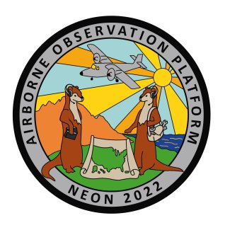
Each year, a different ASO also has the opportunity to design that season's unique AOP flight patch. ASOs Cameron Chapman, Elissa Barris, and Mike Wussow have each taken a turn—check out their designs and photos below and learn a little bit more about life in the sky!
Cameron Chapman
2016 AOP flight patch designed by Cam Chapman.
What is your background, and how did you get interested in remote sensing data and working for the AOP?
My educational background is in Geography/GIS, but I also have prior experience in aviation. I joined the AOP team in 2013. It was a unique opportunity to be able to join an ecological observatory in its construction phase and help build it into what it is today!
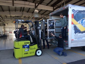
Cam on the forklift unloading the rack components and preparing for a system install in Boulder. Photo credit: Cam Chapman.
What is the most interesting part about being an ASO for NEON? What is the most challenging?
Traveling to all the Domains and seeing the various landscapes from 1000m up is definitely my favorite part of the job! The most challenging part of the job is dealing with the weather. Because we have very strict conditions in which we can collect data, we spend a lot of our time analyzing the weather and clouds.
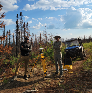
Airborne Sensor Operators Mike Mussow and Cam Chapman set up ground-truthing points using a GPS at D19 (Taiga) site BONA. Photo credit: Cam Chapman.
Which Domain or field site is your favorite to fly?
Every Domain has its charm; however, one of my favorite Domains to fly is D16. When there, we base our aircraft in Hillsboro, OR. It's hard to beat views in the area. Mount Reiner and Mount Hood are in the distance, and Mount St. Helens is near our transit path. The Cascades are stunning to view from the air!
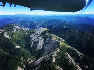
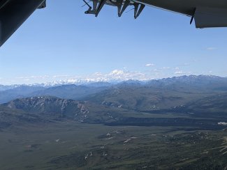
Taken while flying in D16 (Pacific Northwest). The prominent mountain peaks can be seen in the distance. Photo credit: Cam Chapman.
What do you do to pass the time if cloud cover or weather delays the survey flight?
I like to explore the city and neighboring towns and check out their local cuisines, museums, disc golf, and breweries!
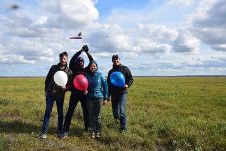
Photo was taken while in D18 (Tundra) Deadhorse around 10 pm in 2019. ASOs were there for the 4th of July and decided to go out and celebrate a little. Photo credit: Cam Chapman.
Elissa Barris
2022 flight patch, designed by Elissa Barris.
What is your background, and how did you get interested in remote sensing data and working for the AOP?
My background is in geophysics, but I got involved with NEON in 2015 when I applied for a temporary field tech position in Alaska. NEON sounded like an exciting project, and I was interested in learning about Alaskan ecology. I stayed on with NEON in different capacities over the years, working toward becoming an ASO. The chance to learn more about remote sensing as part of AOP really appealed to me since I had some prior experience with ground-based and shipboard lidar systems.
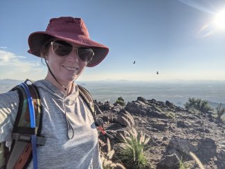
ASO Elissa Barris in Tucson, AZ. Photo credit: Elissa Barris.
What is the most interesting part about being an ASO for NEON? What is the most challenging?
I really enjoy the traveling component of AOP. Having worked on the ground with NEON as a generalist field tech and a tower instrumentation tech, it's been very cool to visit so many different Domains and get the bigger picture. The travel is also probably the biggest challenge of the job. Every season has its ups and downs, and it's important to develop sustainable habits to stay focused on the mission.
Which Domain or field site is your favorite to fly?
It's hard to pick a favorite Domain to fly. I really enjoyed D14 out of Tucson, AZ, because it was my first time seeing that kind of desert, and it was beautiful to see from the air. But my favorite site to fly would have to be Healy, Alaska (HEAL). The southern ends of the flight lines butt up against the Alaska range, giving an amazing view of Denali National Park. After being involved in the establishment of the Healy ground sites years before, that was a really cool experience.
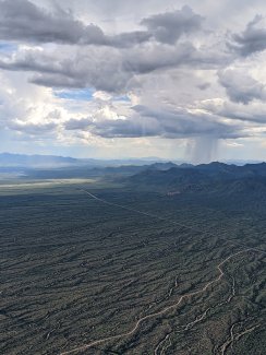
Rain near Tucson, AZ from an AOP flight. Photo credit: Elissa Barris.
Denali seen from the AOP flight. Photo credit: Elissa Barris.
Mike Wussow
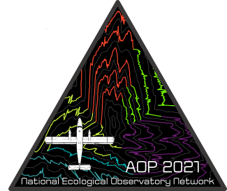
2021 flight patch, designed by Mike Wussow.
What is your background, and how did you get interested in remote sensing data and working for the AOP?
My background is in civil engineering, aviation, and the outdoors. I had been exposed to remote sensing in college while working as a field tech collecting geophysical data for the USGS. I really enjoyed the process of using specialized instruments to collect data in rugged environments. Then, after working a desk job for over a year in civil engineering, I knew it wasn't for me, so I switched gears and started pursuing my interests in aviation by learning more about drones and acquiring a sport pilot license. While taking some time to reset in the mountains, I saw the posting for the ASO position and immediately applied. It offered flying, a chance to learn about and operate really cool instruments, and travel. And it hasn't disappointed—this is my sixth season!
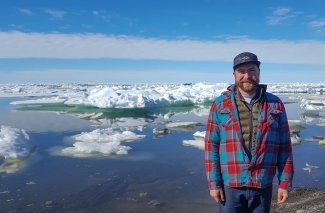
ASO Mike Wussow near ice in D18/D19. Photo credit: Mike Wussow.
Which Domain or field site is your favorite to fly?
I take pretty much every chance I can get to go to Alaska and have spent a lot of time in D18 and D19. Both offer some of the most amazing (in my opinion) flying. In D18, you're flying above tundra that is mind-bogglingly vast and on the coast of the Arctic Ocean. With the sun above the horizon nearly twenty-four hours a day, combined with the landscape, it feels like you're on another planet. In D19, we fly right next to Denali and the Alaska Range, offering views of glaciers and the highest mountains in North America. Both Domains are changing quickly, so I think they are super important places to collect data as well.
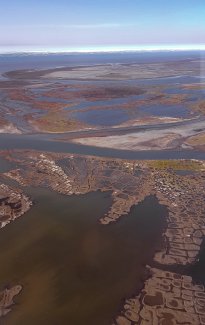
Photo of the tundra and Arctic Ocean from a flight over Alaska. Photo credit: Mike Wussow.
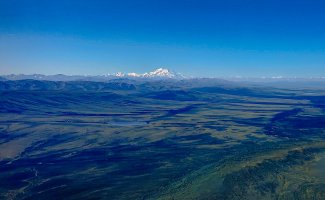
Photo of Denali from a flight over Alaska. Photo credit: Mike Wussow.
What's the most frequently asked question you get when talking to people about your job?
When I don't think people are ready for the long version, I usually say, "I'm in aerial surveying," and they immediately say, "Like with drones?" To which I explain that sometimes we use drones, but mostly it's with an airplane that flies low and slow and that my job is to run the missions and sit in the back and push all the buttons. A lot of times, people want us to say it's for a top-secret government organization we can't talk about, and we get a lot of winks, but then I explain it's the exact opposite – NSF-funded and open data!
---
Our AOP team makes stops all across the U.S. - check our flight schedules here to find when they might be coming to your region, and Contact Us about engaging with them! You can also get flight reports and sign up for emails on their progress here.
