CI Compass links atmospheric and ecological science communities
January 27, 2023
View the original blog post on the CI Compass website
Connecting models and datasets at two U.S. National Science Foundation (NSF) Major Facilities (MFs), one focused on modeling the atmosphere-land system including terrestrial ecosystems and the other measuring and monitoring terrestrial ecosystems, is a major challenge. Each facility has its own cyberinfrastructure for its independent use. Putting the two together to run model-data experiments requires another layer of expertise.
CI Compass began creating just such a link in 2019. The National Center of Atmospheric Research (NCAR) and the National Ecological Observatory Network (NEON) began an engagement with CI Compass, then the Cyberinfrastructure Center of Excellence (CI CoE). The work has resulted in the NCAR-NEON-Community Collaborations where those efforts now link atmospheric and ecological science communities to begin seeking meaningful data together.
"NEON focuses on getting environmental data that is gathered in great detail from specific sites. NCAR looks more at the entire atmosphere, and they have spent decades building expertise in building models in primarily a very large scale," said Robert Ricci, Senior Personnel with CI Compass and lead on the NCAR/NEON engagement. "NCAR and NEON wanted to build environments where it is easy to connect their observations and models so that those who are amateurs—on their way to becoming experts—use those models and the data that comes from them."
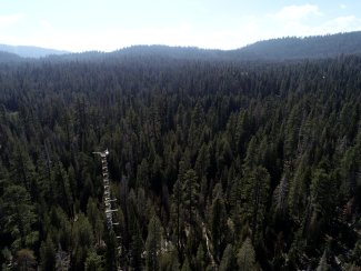
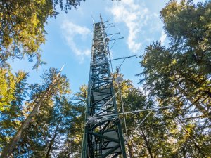
Tower at Lower Teakettle (TEAK)
"Building these bridges between ecological and atmospheric sciences and the network-scale observations and earth system modeling provides a great set of tools to improve our understanding of earth system processes and macroscale ecology."
CI Compass divided the challenge into three topical working groups: ingestion of the combined NCAR and NEON data, data visualization and sharing, and evaluation of containerized workflows. The containers that include Jupyter notebooks and Bokeh, allow processes and experiments in data to be run in a controlled, digital environment.
"It was clear that NCAR and NEON were interested in making it easy for scientists to publish their data and their work," said Valerio Pascucci, Co-Principal Investigator for CI Compass, and Founding Director of the Center for Extreme Data management Analysis and Visualization and Professor at the University of Utah. "They had a secondary need of publishing data into a dashboard on their website. We looked at what was possible, keeping in mind cost, and kept things looking intuitive for users."
Pascucci noted that when researchers do field work, they also must perform analytics. The ability to visualize data helps to identify events, trends, and more.
"It's truly exciting to be working at the intersection of two NSF Major Facilities and the potential for scientific discovery is massive. CI Compass has been a fantastic collaborator and their involvement was critical in developing the tools to link NEON observations and NCAR models. We look forward to future collaborations and continuing to work with the broader ecological and Earth science communities at our next NCAR-NEON Workshop this spring, and beyond," said Mike SanClements, Research Initiatives Lead, NEON, Battelle.
The engagement produced a number of products, including three Jupyter notebooks and a report that includes a comparative analysis of web-based visualization solutions that can be used for the development of Jupyter notebooks and in end-user web dashboards.
"Building these bridges between ecological and atmospheric sciences and the network-scale observations and earth system modeling provides a great set of tools to improve our understanding of earth system processes and macroscale ecology," said Dave Durden, Research Scientist, Surface-Atmosphere Exchange - Data Science, NEON. "We can use these tools to minimize bias in models, identify potential observation issues or limitations, test new hypotheses to improve our understanding of biosphere-atmosphere interactions, and move us forward from hindcasts toward near real-time forecasting."
"The collaborations among NCAR, NEON, and CI Compass represent a multidisciplinary investment of NSF's GEO, BIO, and CISE directorates to enhance Earth system science," said Gordon Bonan, NCAR senior scientist and project PI. "By expanding access to data, models, and computing, the NCAR-NEON modeling system will accelerate integration across ecology and climate science disciplines to advance understanding in Earth system science and global change. The cyberinfrastructure system grows the community of Earth system scientists by allowing other communities without advanced computing or with limited modeling experience to contribute to Earth system modeling."
On the NEON website, the products of the engagement between the two NSF MFs and CI Compass are available to the community. Researchers and the public have access to a "containerized Community Earth System Model/Community Land Model development environment including tools to gather NEON data sets, process them for model input, and for analysis and visualization" as well as a prototype of "pathways and infrastructure for the dissemination of CLM model outputs to the ecological community via NEON systems to facilitate data discovery and exploration".
View the NCAR-NEON-Community Collaborations: here.
About CI Compass
CI Compass is funded by the NSF Office of Advanced Cyberinfrastructure in the Directorate for Computer and Information Science and Engineering under grant number 2127548. Its participating research institutions include the University of Southern California, Indiana University, Texas Tech University, the University of North Carolina at Chapel Hill, the University of Notre Dame, and the University of Utah.
To learn more about CI Compass, please visit ci-compass.org.