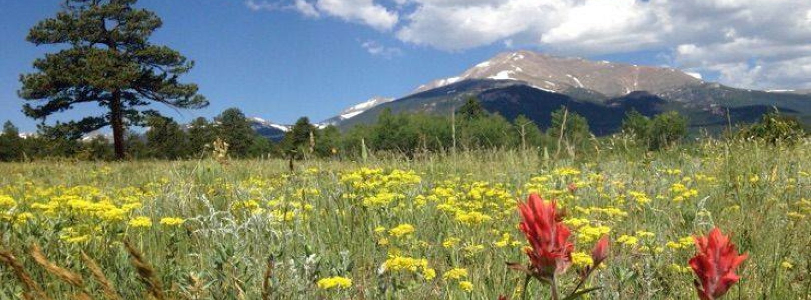
NSF NEON, Operated by Battelle

Main navigation

  • About Us
    • Overview
      • Spatial and Temporal Design
      • History
    • Vision and Management
    • Advisory Groups
      • Science, Technology & Education Advisory Committee
      • Technical Working Groups (TWGs)
    • FAQ
    • Contact Us
      • Contact NEON Biorepository
      • Field Offices
    • User Accounts
    • Staff
    • Code of Conduct

    About Us

  • Data & Samples
    • Data Portal
      • Explore Data Products
      • Data Availability Charts
      • Spatial Data & Maps
      • Document Library
      • API & GraphQL
      • Prototype Data
      • External Lab Data Ingest (restricted)
    • Data Themes
      • Biogeochemistry
      • Ecohydrology
      • Land Cover and Processes
      • Organisms, Populations, and Communities
    • Samples & Specimens
      • Discover and Use NEON Samples
        • Sample Types
        • Sample Repositories
        • Sample Explorer
        • Megapit and Distributed Initial Characterization Soil Archives
      • Sample Processing
      • Sample Quality
      • Taxonomic Lists
    • Collection Methods
      • Protocols & Standardized Methods
      • Airborne Remote Sensing
        • Flight Box Design
        • Flight Schedules and Coverage
        • Daily Flight Reports
          • AOP Flight Report Sign Up
        • Camera
        • Imaging Spectrometer
        • Lidar
      • Automated Instruments
        • Site Level Sampling Design
        • Sensor Collection Frequency
        • Instrumented Collection Types
          • Meteorology
          • Phenocams
          • Soil Sensors
          • Ground Water
          • Surface Water
      • Observational Sampling
        • Site Level Sampling Design
        • Sampling Schedules
        • Observation Types
          • Aquatic Organisms
            • Aquatic Microbes
            • Fish
            • Macroinvertebrates & Zooplankton
            • Periphyton, Phytoplankton, and Aquatic Plants
          • Terrestrial Organisms
            • Birds
            • Ground Beetles
            • Mosquitoes
            • Small Mammals
            • Soil Microbes
            • Terrestrial Plants
            • Ticks
          • Hydrology & Geomorphology
            • Discharge
            • Geomorphology
          • Biogeochemistry
          • DNA Sequences
          • Pathogens
          • Sediments
          • Soils
            • Soil Descriptions
        • Optimizing the Observational Sampling Designs
    • Data Notifications
    • Data Guidelines and Policies
      • Acknowledging and Citing NEON
      • Publishing Research Outputs
      • Usage Policies
    • Data Management
      • Data Availability
      • Data Formats and Conventions
      • Data Processing
      • Data Quality
      • Data Product Bundles
      • Data Product Revisions and Releases
        • Release 2021
        • Release 2022
        • Release 2023
        • Release 2024
        • Release-2025
      • NEON and Google
      • Externally Hosted Data

    Data & Samples

  • Field Sites
    • About Field Sites and Domains
    • Explore Field Sites
    • Site Management Data Product

    Field Sites

  • Impact
    • Observatory Blog
    • Case Studies
    • Papers & Publications
    • Newsroom
      • NEON in the News
      • Newsletter Archive
      • Newsletter Sign Up

    Impact

  • Resources
    • Getting Started with NEON Data & Resources
    • Documents and Communication Resources
      • Papers & Publications
      • Document Library
      • Outreach Materials
    • Code Hub
      • Code Resources Guidelines
      • Code Resources Submission
      • NEON's GitHub Organization Homepage
    • Learning Hub
      • Science Videos
      • Tutorials
      • Workshops & Courses
      • Teaching Modules
    • Research Support Services
      • Field Site Coordination
      • Letters of Support
      • Mobile Deployment Platforms
      • Permits and Permissions
      • AOP Flight Campaigns
      • Research Support FAQs
      • Research Support Projects
    • Funding Opportunities

    Resources

  • Get Involved
    • Advisory Groups
      • Science, Technology & Education Advisory Committee
      • Technical Working Groups
    • Upcoming Events
    • NEON Ambassador Program
      • Exploring NEON-Derived Data Products Workshop Series
    • Research and Collaborations
      • Environmental Data Science Innovation and Inclusion Lab
      • Collaboration with DOE BER User Facilities and Programs
      • EFI-NEON Ecological Forecasting Challenge
      • NEON Great Lakes User Group
      • NEON Science Summit
      • NCAR-NEON-Community Collaborations
        • NCAR-NEON Community Steering Committee
    • Community Engagement
      • How Community Feedback Impacts NEON Operations
    • Science Seminars and Data Skills Webinars
      • Past Years
    • Work Opportunities
      • Careers
      • Seasonal Fieldwork
      • Internships
        • Intern Alumni
    • Partners

    Get Involved

  • My Account
  • Search

Search

Field Sites

  • About Field Sites and Domains
  • Explore Field Sites
  • Site Management Data Product

Breadcrumb

  1. Field Sites
  2. Rocky Mountains NEON

Field Site

Rocky Mountains NEON / RMNP

brown circle white drop icon

Gradient Terrestrial, CO, D10: Central Plains

Wildflowers in a field at the Rocky Mountain National Park site

About Field Sites

The Rocky Mountain National Park (RMNP) field site is a terrestrial NEON site located 70 km (43.5 mi.) northwest of Denver, CO near Rocky Mountain National Park. The RMNP site is 46.5 km2 (11490 acres) and includes National Park and Forest Service land in the foothills of Colorado. As a mid-elevation site at 2750 m (9022 ft.) on the east side of the Continental Divide, the site is aptly situated to investigate the chemical climate (i.e., pollution) generated along the Front Range as well as dust deposition produced and transported from the Great Basin to higher elevations. The NEON tower and corresponding TOS plots are located in a property that is owned by the National Park Service but outside of Rocky Mountain National Park’s core boundaries. TOS distributed plots are located within the Roosevelt National Forest, managed by the U.S. Forest Service. The area is a popular destination for hiking, camping, shooting, and other recreational activities. The site is part of NEON's Central Plain Domain (D10), although it is physically located within the borders of NEON's Southern Rockies & Colorado Plateau Domain (D13). D10 has two other terrestrial sites and one aquatic site. The RMNP site is not colocated with an aquatic site. [1]

Climate

Due to elevational changes, the climate of Southern Rockies is characterized by dramatic differences in precipitation and temperature over very short distances. In general, precipitation decreases and temperature increases with a decrease in elevation. The summer months at RMNP are typically in the 20-27°C (68-80°F) range during the day and colder temperatures at night around 4°C (39°F). The higher elevation areas at the park above 2865 m (9400 ft.) can see light snow and colder temperatures during the summer. In the winter months temperatures can get as cold as -37°C (-35°F), but the lower elevation areas at RMNP typically don’t have accumulations of heavy snow. The higher elevation areas at the park tend to experience blizzards and deep snowpack. At the RMNP site, the mean annual temperature is 2.9°C (37°F) and the mean annual precipitation is 736 mm (29 in.). High winds, blizzards, and afternoon thunderstorms are common in the region. [4] [12] [13]

Geology

The geology at this site is dominated by granite and granodiorite from the Mesoproterozoic age. [2] [3]

Soils

The soil order found at the Rocky Mountain National Park site is mollisol, a soil family characterized as loamy-skeletal - mixed - superactive Ustic haplocryolls. [1]

Hydrology

Open water only makes up 0.02 km2 (5 acres) or 0.03% of the total land cover at NEON's site at RMNP. Evergreen forest covers 71.28 km2 (17,614 acres) of the site which totals 90.25% of the total land cover. [1]

Vegetation

The dominant vegetation in the lower elevation areas of RMNP are characteristic of the lower montane ecosystem and include an open canopy of ponderosa pine (Pinus ponderosa), juniper (Juniperus sp.), and Douglas fir (Pseudotsuga menziesii). Higher elevation vegetation has a tighter canopy dominated by Douglas fir (Pseudotsuga menziesii) and lodgepole pine (Pinus contorta var.latifolia). Stands of quaking aspen (Populus tremuloides) are scattered through the landscape. [1]

Fauna

Mammals common to this area include the mule deer (Odocoileus hemionus), beaver (Castor Canadensis), rocky mountain bighorn sheep (Ovis Canadensis), black bear (Ursus americanus), elk (Cervus canadensis), yellow-bellied marmot (Marmota flaviventris), coyote (Canis latrans), moose (Alces alces), mountain lion (Puma concolor), pika (Ochotona princeps), and the snowshoe hare (Lepus americanus). Collectively 67 mammal species are known to be native to the area. Over 270 species of birds have been reported in the national park including the white-tailed ptarmigan (Lagopus leucura), the three-toed woodpecker (Picoides Dorsalis), and the western tanager (Piranga ludoviciana). Native fish include the endangered greenback cutthroat trout (Oncorhynchus clarkii) and the Colorado River cutthroat trout (Oncorhynchus clarkii pleuriticus). NEON collects data at this site on small mammals, birds, mosquitoes, beetles, and ticks. Some of the target small mammal species include the red-backed vole (Myodes gapperi), the montane vole (Microtus montanus), and the North American deermouse (Peromyscus maniculatus). [1] [6] [7]

Past Land Management and Use

In the 1700s, the indigenous Ute Tribe inhabited the area now known as Rocky Mountain National Park. In 1803, the U.S. government completed the Louisiana Purchase, which included land that would later be turned into the national park. During the late 1800s a gold rush brought miners, ranchers, and homesteaders to Colorado. By the early 1900s the area was known for its beautiful landscapes and abundant wildlife, and in 1915, Rocky Mountain National Park was officially named the 10th national park in the U.S. In the 1930s, the Civilian Conservation Corps was created as part of President Franklin Roosevelt's "New Deal." This program employed people to build roads, trails, and structures at the national park, along with wildfire mitigation and wildlife management. By the 1960s the park became extremely popular and management of visitors became a priority. Today, the park sees millions of visitors every year ranging from scientists, bird watchers, fishermen, campers, photographers, and day hikers. [8] [9]

Current Land Management and Use

Land on which NEON's RMNP site sits is managed by the National Park Service (NPS) and the U.S. Forest Service. NPS manages 419 separate sites in all 50 U.S. states, the District of Columbia, and U.S. territories. NPS also manages national monuments, battlefields, preserves, parkways, scenic trails, and seashores. Several Universities are currently conducting research at Rocky Mountain National Park including Metropolitan State University of Denver and Colorado State University, studying topics of glacial change, noise and light pollution, biota, and ice patch archaeology and paleoecology. [10] [11]

NEON Site Establishment

The TIS tower started collecting data in 2014. TOS plot establishment was completed and observational sampling was initiated in 2017.

Additional Resources

[1] Terrestrial Observation System (TOS) Site Characterization Report: Domain 10. NEON.DOC.003883vB

[2] U.S. Geological Survey, 2005, Mineral Resources Data System: U.S. Geological Survey, Reston, Virginia. https://mrdata.usgs.gov/mrds/

[3] Fabian, C. (2019). NEON Site-Level Plot Summary, Rocky Mountain National Park (RMNP), February 2019. https://data.neonscience.org/documents/10179/2361410/RMNP_Soil_SiteSumm…

[4] https://www.nps.gov/romo/planyourvisit/weather.htm

[5] https://www.nps.gov/romo/learn/management/upload/ Final-NPS-Public-Review-Exotic-Plant-Management-EA- 11012018-508.pdf

[6] https://www.nps.gov/romo/learn/nature/animals.htm

[7] TOS Protocol and Procedure: Small Mammal Sampling NEON.DOC.000481

[8] https://www.nps.gov/romo/learn/historyculture/brief.htm

[9] https://www.nps.gov/romo/learn/management/statistics.htm

[10] https://www.nps.gov/aboutus/national-park-system.htm

[11] https://www.nps.gov/rlc/continentaldivide/research-highlights.htm

[12] https://climate.colostate.edu/climate_long.html

[13] PRISM Climate Group., Oregon State University, http://prism.oregonstate.edu, created 4 Feb 2004.

Field Site Information

Latitude/Longitude

40.275903, -105.54596

Geodetic Datum

WGS84

Location

Larimer County
CO, US

Elevation

Mean: 2742m
Minimum: 2454m
Maximum: 3042m

Mean Annual Temperature

2.9°C

Mean Canopy Height

19.0m

Dominant NLCD Classes

Evergreen Forest

Colocated Research

UNESCO Rocky Mountain Biosphere Reserve
Rocky Mountain NP Clean Air Status and Trends Network
Ameriflux

Field Operations Office

1685 38th Street, Suite 100
Boulder, CO 80301

Research Access

Non-NEON research activities are allowed in this area. Researchers must obtain their own permits with the site host(s).

Request Access

Observation Types

Remote Sensing

Remote sensing surveys of this field site collect lidar, spectrometer and high-resolution RGB camera data.

Meteorological Measurements

This site has a flux/meteorological tower that is 25 m (82 ft) tall with five measurement levels. The tower top extends above the vegetation canopy to allow sensors mounted at the top and along the tower to capture the full profile of atmospheric conditions from the top of the vegetation canopy to the ground. The tower collects physical and chemical properties of atmosphere-related processes, such as humidity, wind, and net ecosystem gas exchange. Precipitation data may be collected by a tipping bucket at the top of the tower, a Double Fence Intercomparison Reference (DFIR) near the tower, and a series of throughfalls located in the soil array.

Phenocams

One phenocam is attached to the top and the bottom of the tower. Here we show the images from the most recent hour. The full collection of images can be viewed on the Phenocam Gallery - click on either of the images below.

Tower top

NEON.D10.RMNP.DP1.10033

Tower bottom

NEON.D10.RMNP.DP1.10042

Soil Sensor Measurements

This site has five soil plots placed in an array within the airshed of the flux tower. Photosynthetically Active Radiation (PAR) at soil surface, soil heat flux, solar radiation, and throughfall are measured at the soil surface in each soil plot. Soil moisture, soil temperature, and CO2 concentration are measured at multiple depths in each soil plot.

Observational Sampling

At terrestrial sites, field ecologists observe birds and plants, and sample ground beetles, mosquitoes, small mammals, soil microbes, and ticks. Lab analyses are carried out to provide further data on DNA sequences, pathogens, soils, sediments, and biogeochemistry. Learn more about terrestrial observations or explore this site's data products.


Field Site Data

Site

Site Host

Roosevelt National Forest

Site Access Allowed

Yes

Site URL

https://www.fs.usda.gov/wps/portal/fsinternet/cs/main/!ut/p/z0/04_Sj9CPykssy0xPLMnMz0vMAfIjo8zijQwgwNHCwN_DI8zPwBcqYKBfkO2oCADIwpjI/?pname=Arapaho%2F&ss=110210&pnavid=null&navid=091000000000000&ttype=main&cid=null

Site Access Details

Researchers should coordinate directly with the US Forest Service for permitting and approval.

Site Host

National Park Service

Site URL

https://www.nps.gov/romo/index.htm

Operations Office

NEON Field Operations Office

Domain 10/13 Support Facility

NEON Field Operations Address

1685 38th Street, Suite 100
Boulder, CO 80301

NEON Field Operations Phone

720.836.2439

Location

Latitude

40.275903

Longitude

-105.54596

Geodetic Datum

WGS84

UTM Northing

4458524.20m

UTM Easting

453588.41m

UTM Zone

13N

County

Larimer

State

CO

Country

US

Mean Elevation

2742m

Minimum Elevation

2454m

Maximum Elevation

3042m

Climate

Mean Annual Temperature

2.9°C

Mean Annual Precipitation

731mm

Vegetation

Mean Canopy Height

19.0m

Dominant NLCD Classes

Evergreen Forest

Average number of green days

165

Average first greenness increase date

120 DOY

Average peak green date

180 DOY

Average first greenness decrease date

210 DOY

Average minimum greenness date

285 DOY

Tower

Tower Height

25m

Number of Tower Levels

5

Soils

Megapit Soil Family

Loamy-skeletal - mixed - superactive Ustic Haplocryolls

Soil Subgroup

Ustic Haplocryolls


Gallery

  • Photos
  • Videos

Related Field Sites

Other Domain D10 Field Sites

blue square white drop icon Arikaree River NEON
Core Aquatic
brown square white mountain icon Central Plains Experimental Range NEON
Core Terrestrial
brown circle white drop icon North Sterling NEON
Gradient Terrestrial

Other Field Sites in CO

blue square white drop icon Arikaree River NEON
Core Aquatic
brown square white mountain icon Central Plains Experimental Range NEON
Core Terrestrial
blue square white drop icon Como Creek NEON
Core Aquatic
brown square white mountain icon Niwot Ridge NEON
Core Terrestrial
brown circle white drop icon North Sterling NEON
Gradient Terrestrial
blue circle white drop icon West St Louis Creek NEON
Gradient Aquatic
NSF NEON, Operated by Battelle

Follow Us:

Join Our Newsletter

Get updates on events, opportunities, and how NEON is being used today.

Subscribe Now

Footer

  • About Us
  • Newsroom
  • Contact Us
  • Terms & Conditions
  • Careers
  • Code of Conduct

Copyright © Battelle, 2025

The National Ecological Observatory Network is a major facility fully funded by the U.S. National Science Foundation.

Any opinions, findings and conclusions or recommendations expressed in this material do not necessarily reflect the views of the U.S. National Science Foundation.