NSF NEON, Operated by Battelle

Main navigation

  • About Us
    • Overview
      • Spatial and Temporal Design
      • History
    • Vision and Management
    • Advisory Groups
      • Science, Technology & Education Advisory Committee
      • Technical Working Groups (TWGs)
    • FAQ
    • Contact Us
      • Contact NEON Biorepository
      • Field Offices
    • User Accounts
    • Staff
    • Code of Conduct

    About Us

  • Data & Samples
    • Data Portal
      • Explore Data Products
      • Data Availability Charts
      • Spatial Data & Maps
      • Document Library
      • API & GraphQL
      • Prototype Data
      • External Lab Data Ingest (restricted)
    • Data Themes
      • Biogeochemistry
      • Ecohydrology
      • Land Cover and Processes
      • Organisms, Populations, and Communities
    • Samples & Specimens
      • Discover and Use NEON Samples
        • Sample Types
        • Sample Repositories
        • Sample Explorer
        • Megapit and Distributed Initial Characterization Soil Archives
      • Sample Processing
      • Sample Quality
      • Taxonomic Lists
    • Collection Methods
      • Protocols & Standardized Methods
      • Airborne Remote Sensing
        • Flight Box Design
        • Flight Schedules and Coverage
        • Daily Flight Reports
          • AOP Flight Report Sign Up
        • Camera
        • Imaging Spectrometer
        • Lidar
      • Automated Instruments
        • Site Level Sampling Design
        • Sensor Collection Frequency
        • Instrumented Collection Types
          • Meteorology
          • Phenocams
          • Soil Sensors
          • Ground Water
          • Surface Water
      • Observational Sampling
        • Site Level Sampling Design
        • Sampling Schedules
        • Observation Types
          • Aquatic Organisms
            • Aquatic Microbes
            • Fish
            • Macroinvertebrates & Zooplankton
            • Periphyton, Phytoplankton, and Aquatic Plants
          • Terrestrial Organisms
            • Birds
            • Ground Beetles
            • Mosquitoes
            • Small Mammals
            • Soil Microbes
            • Terrestrial Plants
            • Ticks
          • Hydrology & Geomorphology
            • Discharge
            • Geomorphology
          • Biogeochemistry
          • DNA Sequences
          • Pathogens
          • Sediments
          • Soils
            • Soil Descriptions
        • Optimizing the Observational Sampling Designs
    • Data Notifications
    • Data Guidelines and Policies
      • Acknowledging and Citing NEON
      • Publishing Research Outputs
      • Usage Policies
    • Data Management
      • Data Availability
      • Data Formats and Conventions
      • Data Processing
      • Data Quality
      • Data Product Bundles
      • Data Product Revisions and Releases
        • Release 2021
        • Release 2022
        • Release 2023
        • Release 2024
        • Release-2025
      • NEON and Google
      • Externally Hosted Data

    Data & Samples

  • Field Sites
    • About Field Sites and Domains
    • Explore Field Sites
    • Site Management Data Product

    Field Sites

  • Impact
    • Observatory Blog
    • Case Studies
    • Papers & Publications
    • Newsroom
      • NEON in the News
      • Newsletter Archive
      • Newsletter Sign Up

    Impact

  • Resources
    • Getting Started with NEON Data & Resources
    • Documents and Communication Resources
      • Papers & Publications
      • Document Library
      • Outreach Materials
    • Code Hub
      • Code Resources Guidelines
      • Code Resources Submission
      • NEON's GitHub Organization Homepage
    • Learning Hub
      • Science Videos
      • Tutorials
      • Workshops & Courses
      • Teaching Modules
    • Research Support Services
      • Field Site Coordination
      • Letters of Support
      • Mobile Deployment Platforms
      • Permits and Permissions
      • AOP Flight Campaigns
      • Research Support FAQs
      • Research Support Projects
    • Funding Opportunities

    Resources

  • Get Involved
    • Advisory Groups
      • Science, Technology & Education Advisory Committee
      • Technical Working Groups
    • Upcoming Events
    • NEON Ambassador Program
      • Exploring NEON-Derived Data Products Workshop Series
    • Research and Collaborations
      • Environmental Data Science Innovation and Inclusion Lab
      • Collaboration with DOE BER User Facilities and Programs
      • EFI-NEON Ecological Forecasting Challenge
      • NEON Great Lakes User Group
      • NEON Science Summit
      • NCAR-NEON-Community Collaborations
        • NCAR-NEON Community Steering Committee
    • Community Engagement
      • How Community Feedback Impacts NEON Operations
    • Science Seminars and Data Skills Webinars
      • Past Years
    • Work Opportunities
      • Careers
      • Seasonal Fieldwork
      • Internships
        • Intern Alumni
    • Partners

    Get Involved

  • My Account
  • Search

Search

Field Sites

  • About Field Sites and Domains
  • Explore Field Sites
  • Site Management Data Product

Breadcrumb

  1. Field Sites
  2. Delta Junction NEON

Field Site

Delta Junction NEON / DEJU

brown circle white drop icon

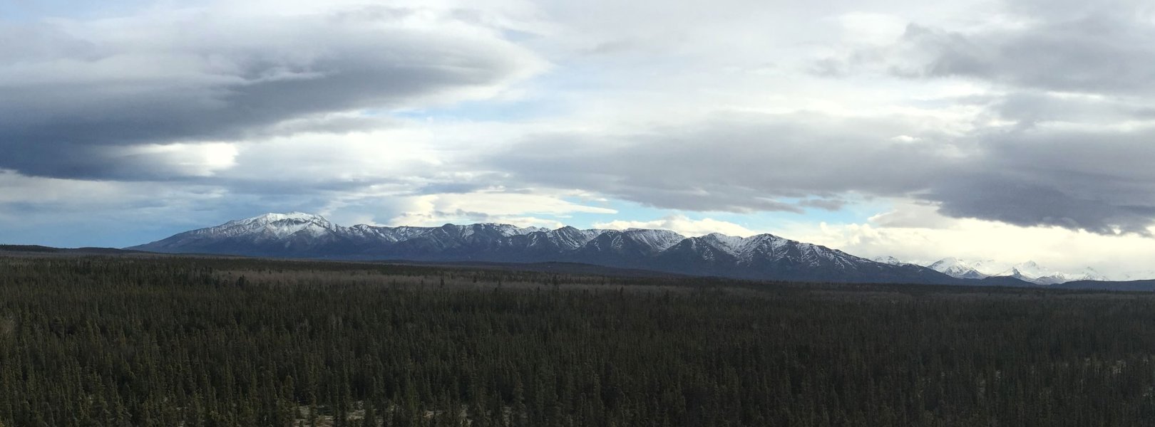
Gradient Terrestrial, AK, D19: Taiga

View from DEJU field site tower

About Field Sites

Delta Junction (DEJU) is a terrestrial NEON field site located in central Alaska, approximately 150 km (93 mi.) southeast of Fairbanks and 15 km (9 mi.) south of the community of Delta Junction. The 29.9 km2 (7390 acre) site is managed by the U.S. Bureau of Land Management. It sits within the Tanana Valley at an elevation of 440 - 485 m (1400 - 1600 ft.), 30 km (18 mi.) from the confluence of the Tanana and Delta Rivers. The location is bordered to the north by the White Mountains, to the southeast by the Granite Mountains, and to the southwest by the Alaska Range. DEJU is one of the four sites (three terrestrial and one aquatic) located in the NEON Taiga Domain (D19), which comprises Alaska’s interior and the Alaska Peninsula. [1]

Climate

This region’s climate is subarctic, characterized by long, cold winters and brief, mild summers. Delta Junction receives an average of only 305 mm (12 in.) of annual precipitation, three-quarters of which falls between May and September. As expected, temperatures are relatively low throughout the year, with an average annual temperature of -3°C (26.6°F), and average temperature highs staying below freezing from October to March. Temperature extremes are recorded from -52.7°C to 33.3°C (-63°F to 92°F). Due to its subarctic latitude, Delta Junction experiences no night (only twilight) from May to July, and only four to five daylight hours between November and January. [1] [2] [5] [6]

Geology

Local geology is typical of a glaciofluvial setting, where the dominant material is well-rounded gravel in a matrix of silt and sand. Geomorphological features include outwash plains, moraines, stream terraces and floodplains, all of which are characteristic of a formerly glaciated river valley. [2] [3] [4]

Soils

Soils at DEJU are typically eluvial deposits formed by weathering of the underlying parent material, which consists of gravelly glacial till and outwash covered by a thin layer of loess. Organic horizons vary in thickness across the site, with low, wet, frozen areas overlain by thick (>20 cm) organic deposits. The soil is subgelic (-4°C - 0°C/25°F - 32°F) with discontinuous permafrost, and there is evidence of cryoturbation in areas. [4]

Hydrology

Delta Junction sits near the glacially-fed Tenana River, which drains the north slope of the Alaska Range. [1] [5]

Vegetation

The predominant vegetation at Delta Junction is scrubby evergreen forest, where stunted trees like black spruce (Picea mariana), white spruce (Picea glauca) and American dwarf birch (Betula glandulosa, Betula nana) dominate the canopy. Vegetation at the site varies with differences in elevation and drainage; well-drained, upland zones feature quaking aspens (Populus tremuloides) and white spruce, while areas with poor drainage host sedges, mosses, and low-growing shrubs like lingonberry (Vaccinium vitis-idaea), crowberry (Empetrum nigrum), bog blueberry (Vaccinium uliginosum), bog Labrador tea (Ledum palustre), false toadflax (Geocaulon lividum), and bearberry (Arctostaphylos uva-ursi). [1] [7]

Fauna

Animals native to central Alaska and the Tenana Valley include coyote (Canis latrans), red fox (Vulpes vulpes), moose (Alces alces), lynx (Lynx canadensis), and gray wolf (Canis lupis). This area also falls within the range of wood bison (Bison bison athabascae), a northern subspecies of American bison identified as threatened under the Endangered Species Act. The small mammal species studied at DEJU include North American brown lemming (Lemmus trimucronatus), several vole species in the Microtus genus, northern red-backed vole (Myodes rutilus), northern bog lemming (Synaptomys borealis), and meadow jumping mouse (Zapus hudsonius). [8] [9] [10]

Past Land Management and Use

The earliest direct evidence of humans in Alaska is found in the Tanana River valley near Delta Junction, in the form of butchered animal bone and charcoal dating to roughly 14,000 years ago. Meanwhile, the earliest human remains in the valley date to 11,500 years ago, a period of rising temperatures, rising sea levels, and the gradual inundation of the Ice Free Corridor from Siberia at the end of the Pleistocene and the beginning of the Holocene (the geologic epoch which we are in today). Humans continued to occupy the valley (and, more broadly, central Alaska) throughout the Holocene, providing a constant in a region which saw dramatic changes in climate, alterations in vegetation structure and fauna, large flood events, and fluctuations in wildfire regimes. Russian contact (and, subsequently, colonization) in Alaska began in the 18th century, beginning a period of resource exploitation, fur-based trade economy, and conflict with indigenous populations. In 1867, Alaska was incorporated into the U.S. as the Department of Alaska. Non-native settlement near Delta Junction began with the construction of a roadhouse and, later, a telegraph station near the confluence of the Delta and Tanana Rivers along the Valdez-Fairbanks Trail (later the Richardson Highway) which connected Fairbanks to the coast.

In 1942, Fort Greely (currently an active U.S. military base) was established in an area including what is now DEJU, introducing a source of direct anthropogenic disturbance to the landscape. Recent disturbance history at the site includes forest fires, permafrost degradation, and the construction of roads (including the Richardson Highway), trails, and structures at Fort Greely. Ecological land surveys were performed at Fort Greely and adjacent BLM land in the early 2000s to assess the impacts of these human-mediated disturbances. [11] [12] [13] [14] [15] [16] [17] [18] [19] [20]

Current Land Management and Use

DEJU is located on land managed by BLM Alaska and surrounded by Fort Greely, an active U.S. military base. BLM Alaska manages 280,000 km2 (108,000 sq. mi.) of surface land and 890,000 km2 (344,000 sq. mi.) of subsurface land (mineral estate), comprising approximately 30% of federal public land in the state. The site is within the major land resource area (MLRA) 228, where the primary form of land use is remote wildland recreation (subsistence hunting, backcountry hiking, mountaineering, etc.) and many regions are actively logged. Fort Greely is a 2676 km2 (1033 sq. mi.) military base used for cold-weather training and is part of the Ballistic Missile Defense System. [1] [5] [19] [21] [22] [23]

NEON Site Establishment

Plot establishment at DEJU began in 2015, and the site was reviewed for sampling readiness in 2016. Dry runs of observational sampling began in late 2016, followed by the first publications of data products for most observational protocols. Instrumentation systems went online and began producing data in 2017.

Additional Resources

[1] Terrestrial Observation System (TOS) Site Characterization Report: Domain 19. NEON.DOC.003902vB.

[2] Terrestrial Instrument System (TIS, FIU) Site Characterization Supporting Data: Domain 19. NEON.DOC.011051vB.

[3] U.S. Geological Survey, 2005, Mineral Resources Data System: U.S. Geological Survey, Reston, Virginia. 

[4] Mulligan, Dennis. (2018). NEON Site-Level Plot Summary, Delta Junction, Alaska (DEJU), August 2018. 

[5] Land Resource Regions and Major Land Resource Areas of the United States, the Caribbean, and the Pacific Basin

[6] National Oceanic and Atmospheric Administration National Centers for Environmental Information’s (NCEI) 1981-2010 climate normals (NCEI 2015).

[7] https://www.nrcs.usda.gov/Internet/FSE_MANUSCRIPTS/alaska/AK657/0/Great…

[8] Alaska Department of Fish and Game - All Animals

[9] https://www.adfg.alaska.gov/index.cfm?adfg=specialstatus.akendangered

[10] TOS Protocol and Procedure: Small Mammal Sampling. NEON.DOC.000481vB. https://data.neonscience.org/documents/10179/2139401/NEON.DOC.000481vB/…

[11] Holmes, C. (2001). Tanana River Valley Archaeology circa 14,000 to 9000 B.P. Arctic Anthropology, 38(2), 154-170. Retrieved May 14, 2020, from www.jstor.org/stable/40316728

[12] Irish, J., Potter, B., & Reuther, J. (2015). An 11,500-Year-Old Human Cremation from Eastern Beringia (Central Alaska). In The Analysis of Burned Human Remains (2nd ed., pp. 295–306). Cambridge, MA: Academic Press. DOI: https://doi.org/10.1016/B978-0-12-800451-7.00016-4

[13] Holmes, C. (2008). The Taiga Period: Holocene Archaeology of the Northern Boreal Forest, Alaska. Alaska Journal of Anthropology, 6(1-2), 69–81.

[14] Mason, O., & Begét, J. (1991) Late Holocene Flood History of the Tanana River, Alaska, U.S.A. Arctic and Alpine Research, 23(4), 392-403. DOI: https://doi.org/10.1080/00040851.1991.12002859

[15] Kelly, R., Chipman, M., Higuera, P., Stefanova, I., Brubaker, L., & Hu, F. S. (2013). Recent burning of boreal forests exceeds fire regime limits of the past 10,000 years. Proceedings of the National Academy of Sciences of the United States of America, 110(32), 13055–13060. doi: https://doi.org/10.1073/pnas.1305069110

[16] Black, L. (2004). Russians in Alaska: 1732-1867. Fairbanks: University of Alaska Fairbanks.

[17] https://www.alaskacenters.gov/explore/culture/history

[18] http://dnr.alaska.gov/parks/aspunits/northern/bigdeltashp.htm

[19] https://apps.dtic.mil/dtic/tr/fulltext/u2/a391120.pdf

[20] https://www.blm.gov/documents/national-office/blm-library/report/tanana…

[21] https://www.blm.gov/about/what-we-manage/alaska

[22] http://dnr.alaska.gov/mlw/factsht/land_fs/land_own.pdf

[23] https://installations.militaryonesource.mil/in-depth-overview/fort-gree…

[24] https://www.fs.usda.gov/Internet/FSE_DOCUMENTS/stelprdb5320150.pdf

[25] Cortes-Burns, H, Harlson, M, Lipkin, R, Flagstad, L, and Yokel, D. (2009) Rare Vascular Plants of the North Slope: A Review of the Taxonomy, Distribution, and Ecology of 31 Rare Plant Taxa That Occur in Alaska’s North Slope Region. BLM Alaska Technical Report 58. https://accs.uaa.alaska.edu/wp-content/uploads/Rare_Vascular_Plant_Spec…

[26] Nawrocki, T., J. Fulkerson, and M. Carlson. (2013). Alaska Rare Plant Field Guide. Anchorage: University of Alaska.

[27] Racine, C, Lihvar, R, and Duffy, M. (2001) An Inventory of the Vascular Flora of Fort Greely, Interior Alaska. Hanover, NH: U.S. Army Engineer Research and Development Center.

Field Site Information

Latitude/Longitude

63.88112, -145.75136

Geodetic Datum

WGS84

Location

Southeast Fairbanks County
AK, US

Elevation

Mean: 517m
Minimum: 444m
Maximum: 581m

Mean Annual Temperature

-3.0°C

Dominant Wind Direction

E

Mean Canopy Height

10.0m

Dominant NLCD Classes

Evergreen Forest, Shrub/Scrub, Woody Wetlands

Colocated Research

North Slope Science Initiative
Critical Zone Exploration Network
Ameriflux

Field Operations Office

3352 College Rd.
Fairbanks, AK 99709

Research Access

Non-NEON research activities are allowed in this area. Researchers must obtain their own permits with the site host(s).

Request Access

Observation Types

Remote Sensing

Remote sensing surveys of this field site collect lidar, spectrometer and high-resolution RGB camera data.

Meteorological Measurements

This site has a flux/meteorological tower that is 22 m (72 ft) tall with five measurement levels. The tower top extends above the vegetation canopy to allow sensors mounted at the top and along the tower to capture the full profile of atmospheric conditions from the top of the vegetation canopy to the ground. The tower collects physical and chemical properties of atmosphere-related processes, such as humidity, wind, and net ecosystem gas exchange. Precipitation data are collected by a tipping bucket at the top of the tower and a series of throughfalls located in the soil array.

Phenocams

One phenocam is attached to the top and the bottom of the tower. Here we show the images from the most recent hour. The full collection of images can be viewed on the Phenocam Gallery - click on either of the images below.

Tower top

NEON.D19.DEJU.DP1.10033

Tower bottom

NEON.D19.DEJU.DP1.10042

Soil Sensor Measurements

This site has five soil plots placed in an array within the airshed of the flux tower. Photosynthetically Active Radiation (PAR) at soil surface, soil heat flux, solar radiation, and throughfall are measured at the soil surface in each soil plot. Soil moisture, soil temperature, and CO2 concentration are measured at multiple depths in each soil plot.

Observational Sampling

At terrestrial sites, field ecologists observe birds and plants, and sample ground beetles, mosquitoes, small mammals, soil microbes, and ticks. Lab analyses are carried out to provide further data on DNA sequences, pathogens, soils, sediments, and biogeochemistry. Learn more about terrestrial observations or explore this site's data products.


Field Site Data

Site

Site Host

Bureau of Land Management

Site Access Allowed

Yes

Site URL

https://www.blm.gov/office/eastern-interior-field-office

Site Access Details

Reseachers should coordinate with the site manager.

Operations Office

NEON Field Operations Office

Domain 18/19 Support Facility

NEON Field Operations Address

3352 College Rd.
Fairbanks, AK 99709

NEON Field Operations Phone

907.459.5040

Location

Latitude

63.88112

Longitude

-145.75136

Geodetic Datum

WGS84

UTM Northing

7084367.22m

UTM Easting

561330.06m

UTM Zone

6N

County

Southeast Fairbanks

State

AK

Country

US

Mean Elevation

517m

Minimum Elevation

444m

Maximum Elevation

581m

Climate

Mean Annual Temperature

-3.0°C

Mean Annual Precipitation

305mm

Dominant Wind Direction

E

Vegetation

Mean Canopy Height

10.0m

Dominant NLCD Classes

Evergreen Forest, Shrub/Scrub, Woody Wetlands

Average number of green days

120

Average first greenness increase date

130 DOY

Average peak green date

170 DOY

Average first greenness decrease date

210 DOY

Average minimum greenness date

250 DOY

Tower

Tower Height

22m

Number of Tower Levels

5

Soils

Megapit Soil Family

Coarse-loamy - mixed - superactive Typic Haplocryepts

Soil Subgroup

Typic Haplocryepts


Gallery

  • Photos
  • Videos

No Video


Related Field Sites

Other Domain D19 Field Sites

blue square white drop icon Caribou Creek NEON
Core Aquatic
brown square white mountain icon Caribou-Poker Creeks Research Watershed NEON
Core Terrestrial
brown circle white drop icon Healy NEON
Gradient Terrestrial

Other Field Sites in AK

blue square white drop icon Caribou Creek NEON
Core Aquatic
brown square white mountain icon Caribou-Poker Creeks Research Watershed NEON
Core Terrestrial
brown circle white drop icon Healy NEON
Gradient Terrestrial
blue square white drop icon Oksrukuyik Creek NEON
Core Aquatic
brown square white mountain icon Toolik Field Station NEON
Core Terrestrial
blue circle white drop icon Toolik Lake NEON
Gradient Aquatic
brown circle white drop icon Utqiaġvik NEON
Gradient Terrestrial
NSF NEON, Operated by Battelle

Follow Us:

Join Our Newsletter

Get updates on events, opportunities, and how NEON is being used today.

Subscribe Now

Footer

  • About Us
  • Newsroom
  • Contact Us
  • Terms & Conditions
  • Careers
  • Code of Conduct

Copyright © Battelle, 2025

The National Ecological Observatory Network is a major facility fully funded by the U.S. National Science Foundation.

Any opinions, findings and conclusions or recommendations expressed in this material do not necessarily reflect the views of the U.S. National Science Foundation.