NSF NEON, Operated by Battelle

Main navigation

  • About Us
    • Overview
      • Spatial and Temporal Design
      • History
    • Vision and Management
    • Advisory Groups
      • Science, Technology & Education Advisory Committee
      • Technical Working Groups (TWGs)
    • FAQ
    • Contact Us
      • Contact NEON Biorepository
      • Field Offices
    • User Accounts
    • Staff
    • Code of Conduct

    About Us

  • Data & Samples
    • Data Portal
      • Explore Data Products
      • Data Availability Charts
      • Spatial Data & Maps
      • Document Library
      • API & GraphQL
      • Prototype Data
      • External Lab Data Ingest (restricted)
    • Data Themes
      • Biogeochemistry
      • Ecohydrology
      • Land Cover and Processes
      • Organisms, Populations, and Communities
    • Samples & Specimens
      • Discover and Use NEON Samples
        • Sample Types
        • Sample Repositories
        • Sample Explorer
        • Megapit and Distributed Initial Characterization Soil Archives
      • Sample Processing
      • Sample Quality
      • Taxonomic Lists
    • Collection Methods
      • Protocols & Standardized Methods
      • Airborne Remote Sensing
        • Flight Box Design
        • Flight Schedules and Coverage
        • Daily Flight Reports
          • AOP Flight Report Sign Up
        • Camera
        • Imaging Spectrometer
        • Lidar
      • Automated Instruments
        • Site Level Sampling Design
        • Sensor Collection Frequency
        • Instrumented Collection Types
          • Meteorology
          • Phenocams
          • Soil Sensors
          • Ground Water
          • Surface Water
      • Observational Sampling
        • Site Level Sampling Design
        • Sampling Schedules
        • Observation Types
          • Aquatic Organisms
            • Aquatic Microbes
            • Fish
            • Macroinvertebrates & Zooplankton
            • Periphyton, Phytoplankton, and Aquatic Plants
          • Terrestrial Organisms
            • Birds
            • Ground Beetles
            • Mosquitoes
            • Small Mammals
            • Soil Microbes
            • Terrestrial Plants
            • Ticks
          • Hydrology & Geomorphology
            • Discharge
            • Geomorphology
          • Biogeochemistry
          • DNA Sequences
          • Pathogens
          • Sediments
          • Soils
            • Soil Descriptions
        • Optimizing the Observational Sampling Designs
    • Data Notifications
    • Data Guidelines and Policies
      • Acknowledging and Citing NEON
      • Publishing Research Outputs
      • Usage Policies
    • Data Management
      • Data Availability
      • Data Formats and Conventions
      • Data Processing
      • Data Quality
      • Data Product Bundles
      • Data Product Revisions and Releases
        • Release 2021
        • Release 2022
        • Release 2023
        • Release 2024
        • Release-2025
      • NEON and Google
      • Externally Hosted Data

    Data & Samples

  • Field Sites
    • About Field Sites and Domains
    • Explore Field Sites
    • Site Management Data Product

    Field Sites

  • Impact
    • Observatory Blog
    • Case Studies
    • Papers & Publications
    • Newsroom
      • NEON in the News
      • Newsletter Archive
      • Newsletter Sign Up

    Impact

  • Resources
    • Getting Started with NEON Data & Resources
    • Documents and Communication Resources
      • Papers & Publications
      • Document Library
      • Outreach Materials
    • Code Hub
      • Code Resources Guidelines
      • Code Resources Submission
      • NEON's GitHub Organization Homepage
    • Learning Hub
      • Science Videos
      • Tutorials
      • Workshops & Courses
      • Teaching Modules
    • Research Support Services
      • Field Site Coordination
      • Letters of Support
      • Mobile Deployment Platforms
      • Permits and Permissions
      • AOP Flight Campaigns
      • Research Support FAQs
      • Research Support Projects
    • Funding Opportunities

    Resources

  • Get Involved
    • Advisory Groups
      • Science, Technology & Education Advisory Committee
      • Technical Working Groups
    • Upcoming Events
    • NEON Ambassador Program
      • Exploring NEON-Derived Data Products Workshop Series
    • Research and Collaborations
      • Environmental Data Science Innovation and Inclusion Lab
      • Collaboration with DOE BER User Facilities and Programs
      • EFI-NEON Ecological Forecasting Challenge
      • NEON Great Lakes User Group
      • NEON Science Summit
      • NCAR-NEON-Community Collaborations
        • NCAR-NEON Community Steering Committee
    • Community Engagement
      • How Community Feedback Impacts NEON Operations
    • Science Seminars and Data Skills Webinars
      • Past Years
    • Work Opportunities
      • Careers
      • Seasonal Fieldwork
      • Internships
        • Intern Alumni
    • Partners

    Get Involved

  • My Account
  • Search

Search

Field Sites

  • About Field Sites and Domains
  • Explore Field Sites
  • Site Management Data Product

Breadcrumb

  1. Field Sites
  2. Blandy Experimental Farm NEON

Field Site

Blandy Experimental Farm NEON / BLAN

brown circle white drop icon

Gradient Terrestrial, VA, D02: Mid-Atlantic

Boardwalk to the BLAN tower

About Field Sites

The Blandy Experimental Farm (BLAN) is a terrestrial NEON field site located in Clarke County, Virginia, approximately 60 miles west of Washington, D.C. BLAN is subdivided between two locations, with 2.7 km2 (667 acres) at Blandy Experimental Farm and 3 km2 (741 acres) at Casey Tree Farm. The site includes a mix of land use types including woodland, hay fields, and tree nurseries. The surrounding region is characterized by general land use types including successional fields, pastures, woodlands, and small ponds. This site is located within NEON's Mid-Atlantic Domain (D02), a densely populated region bounded by the Atlantic Ocean on the east and stretching down the Eastern Seaboard from southern New Jersey to northern Georgia. The Mid-Atlantic Domain includes two other terrestrial sites and two aquatic sites. BLAN is located near the Lewis Run aquatic site. [1]

Climate

The climate here is temperate and humid, with annual mean temperatures of 12.1°C (53 °F). The coldest month of the year is January with an average temperature of -1.8°C (28.76°F), while July is the warmest month with an average temperature of 23.3°C (73.9°F). On average, this location gets an average of 982 mm (38.6 in.) of precipitation annually. May is the wettest month with an average monthly precipitation of 114.3 mm (4.5 in.) and February is the driest with only 63.5 mm (2.5 in.) of precipitation. [5] [13]

Geology

The Blandy Experimental Farm consists of limestone and dolostone of the Conocoheague Formation, while the Casey Tree Farm consists of limestone, dolostone, and shale. [2-4]

Soils

Soils are deep and well-drained with varying amounts of rock fragments. In general, Blandy and Casey Tree Farm soils lack organic horizons, though they are considered moderately to highly fertile. The elevated soil pH present across these sites presents an environment rich in biological activity. Soil types are predominantly Poplimento and Thurmont formed from shale, limestone, siltstone, and sandstone residual. The soil subgroup at the site are Ultic Hapludalfs. [4]

Hydrology

Groundwater aquifers are recharged by precipitation, which percolates through fractures in carbonate rock and is sometimes facilitated by geologic structures such as sinkholes or sinking streams. This water is eventually discharged to streams in the form of spring discharge. [5]

Vegetation

The Blandy Experimental Farm is predominantly a fallow scrubland consisting primarily of hay crops and goldenrod (Solidago altissima), though the site is surrounded by fragmented secondary forests and successional shrubs. Casey Tree Farm, as the name suggests, is a tree nursery with hay fields encompassed by deciduous woodlands of black oak (Quercus velutina), tulip poplar (Liriodendron tulipifera), and pawpaw (Asimina triloba). NEON plots are distributed throughout Deciduous Forest and Pasture Hay NLCD classes, and these monitor and provide presence and absence data for over 100 plant species, including goldenrod (Solidago altissima), buckthorn (Rhamnus davurica), and Amur honeysuckle (Lonicera maackii). [2] [6]

Fauna

Clarke County, Virginia is home to black bear (Ursus americanus), white-tailed deer (Odocoileus virginianus), coyote (Canis latrans), eastern gray fox (Urocyon cinereoargenteneus), and red fox (Vulpes vulpes) populations, among many small mammals. Bobcats (Lynx rufus) are present, though in smaller numbers than surrounding counties. [7]

Past Land Management and Use

The Blandy Experimental Farm property was bequeathed to the University of Virginia in 1926 by the widow of New York broker and railroad tycoon Graham F. Blandy. Blandy's 900-acre property supported orchards and grazing lands. Commercial farming operations continued under the management of University of Virginia until 1976, when the University's focus shifted to environmental research and establishment of the land as a community resource. Although agricultural research has never been a focus at this site, its location within the primarily agricultural Shenandoah valley has encouraged research projects focusing on plant, insect, avian, and mammalian biology across forest and field habitats at Blandy.

The Casey Tree Farm property was originally part of a 5-million-acre tract of land owned and managed by Lord Thomas Fairfax, 6th Lord of Fairfax from Cameron, from 1719 until its confiscation in 1781 by the Commonwealth of Virginia. Land use was primarily agricultural. Ownership of this land passed to Eugene Casey in 1958, and his widow, Betty Brown Casey, donated it to Casey Tree Farm (known locally as Springsbury Farm) in 2008. A tree nursery was established in 2011 for agroforestry research and production of trees for export to the canopy of Washington, D.C. [8] [9] [10]

Current Land Management and Use

The University of Virginia manages the Blandy Experimental Farm as an ecological field station centered around their mission to increase understanding of the natural environment through research and education. Ongoing research includes bumblebee foraging patterns, population structures of aquatic turtles, and ecological consequences of human activities. Blandy encompasses 2.88 km2 (712 acres), part of which has been incorporated into the State Arboretum of Virginia (0.7 km2/172 acres). The Arboretum features over 5000 woody trees and shrubs from around the world; volunteers continue to plant species such as tulip poplar, white oak, eastern red oak, redbud, pawpaw, black cherry, red maple, and serviceberry. The Foundation of the State Arboretum of Virginia (FOSA) is responsible for sustaining the Arboretum's collections, fundraising and supporting Blandy's research and educational goals.

The Casey Tree Farm manages 730 acres of land as a tree nursery for species not readily available commercially. Their mission is to restore, enhance, and protect the tree canopy of the nation's capital through research, collaboration, and environmental stewardship. Casey Tree Farm reaches this goal primarily through monitoring Washington, D.C.'s tree canopy and engaging the public in tree plantings and educational courses. This property is also home to several structures of historical importance from the late 1700s. [10-15]

NEON Site Establishment

The Domain 02 support facility in Front Royal, VA was constructed in December 2014. NEON plot establishment at BLAN was completed in May 2015. The site transitioned to operations in July 2015, when terrestrial observational sampling began. The site's 8 m (26.25 ft.) tower was not fully completed until September 2016.

Additional Resources

  1. Terrestrial Observation System (TOS) Site Characterization Report: Domain 02. NEON.DOC.003886vB
  2. U.S. Geological Survey, 2005, Mineral Resources Data System: U.S. Geological Survey, Reston, Virginia
  3. Michael SanClements, Robert H Lee, E D Ayres, Keli Goodman, Morgan Jones, David Durden, Katherine Thibault, Rommel Zulueta, Joshua Roberti, Claire Lunch, Adrian Gallo. 2020. Collaborating with NEON, BioScience, 70(2). https://doi.org/10.1093/biosci/biaa005.
  4. McDevitt Jr., M.P. (2018) NEON site-level plot summary Blandy Experimental Farm. USDA.
  5. Nelms, D. L., & Moberg Jr., R. M. (2005). Hydrogeology and groundwater availability in Clarke County, VA: U.S. Geological Survey Scientific Investigations Report 2010-5112. 119 p. https://pubs.usgs.gov/sir/2010/5112/pdf/sir20105112.pdf
  6. Terrestrial Instrument System (TIS, FIU) Site Characterization Supporting Data: Domain 02 NEON.DOC.011045vB
  7. Virginia Department of Wildlife Resources, Wildlife Information
  8. Bowers, M. A. (1997). University of Virginia’s Blandy Experimental Farm. Bulletin of the Ecological Society of America, 78(3), 220–225. http://www.jstor.org/stable/20168167 
  9. Virtual Tour through the History of Blandy Experimental Farm. Video.
  10. DC State Nursery at Casey Tree Farm
  11. UVA Blandy Experimental Farm: Mission
  12. Blandy Experimental Farm: Undergraduate Program in Population, Community, and Ecosystem Ecology
  13. PRISM Climate Group, Oregon State University
  14. UVA Blandy Experimental Farm: State Arboretum of Virginia
  15. UVA Blandy Experimental Farm: Foundation of the State Arboretum (FOSA) Memberships
  16. Casey Tree Farm: About

Field Site Information

Latitude/Longitude

39.033698, -78.041788

Geodetic Datum

WGS84

Location

Clarke County
VA, US

Elevation

Mean: 183m
Minimum: 119m
Maximum: 193m

Mean Annual Temperature

12.1°C

Dominant Wind Direction

NW

Mean Canopy Height

1.0m

Dominant NLCD Classes

Deciduous Forest, Pasture/Hay

Colocated Site(s)

Lewis Run NEON

Colocated Research

University of Virginia
Ameriflux

Field Operations Office

1500 Remount Road
MRC 5560, Bldg 90
Front Royal, VA 22630

Research Access

Non-NEON research activities are allowed in this area. Researchers must obtain their own permits with the site host(s).

Request Access

Observation Types

Remote Sensing

Remote sensing surveys of this field site collect lidar, spectrometer and high-resolution RGB camera data.

Meteorological Measurements

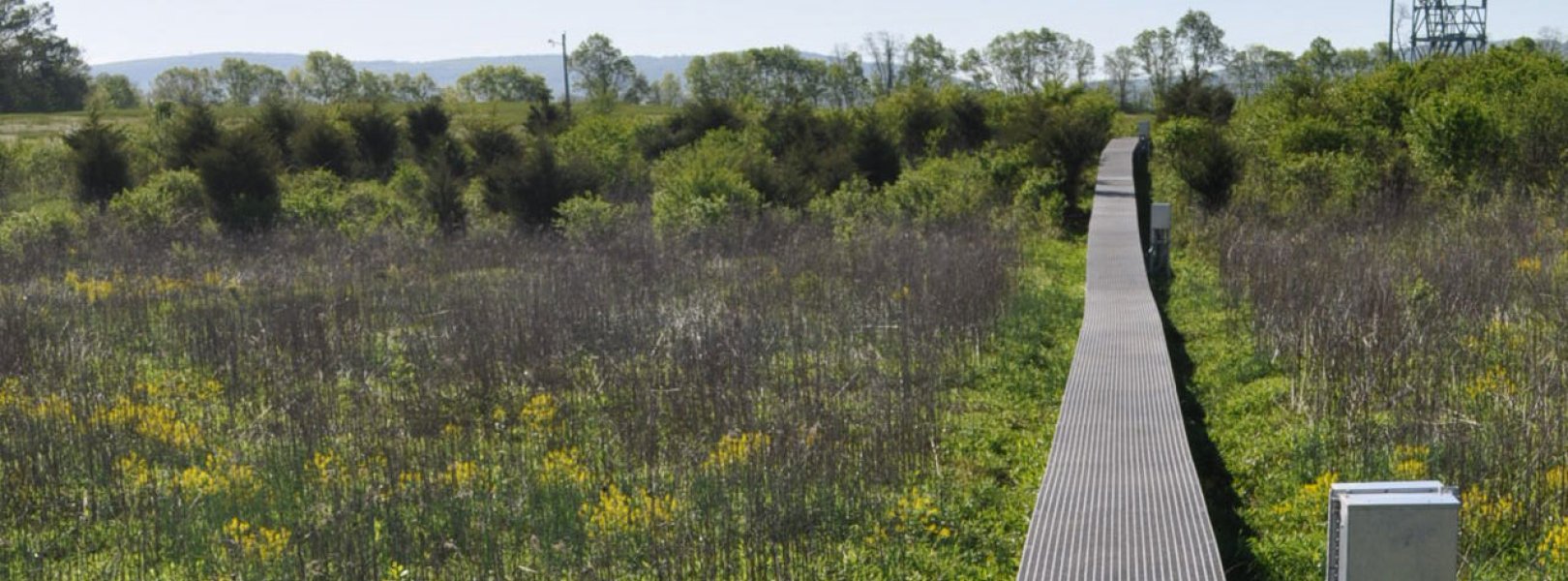
This site has a flux/meteorological tower that is 8 m (26 ft) tall with four measurement levels. The tower top extends above the vegetation canopy to allow sensors mounted at the top and along the tower to capture the full profile of atmospheric conditions from the top of the vegetation canopy to the ground. The tower collects physical and chemical properties of atmosphere-related processes, such as humidity, wind, and net ecosystem gas exchange. Precipitation data are collected by a tipping bucket at the top of the tower and a series of throughfalls located in the soil array.

Phenocams

One phenocam is attached to the top and the bottom of the tower. Here we show the images from the most recent hour. The full collection of images can be viewed on the Phenocam Gallery - click on either of the images below.

Tower top

NEON.D02.BLAN.DP1.10033

Tower bottom

NEON.D02.BLAN.DP1.10042

Soil Sensor Measurements

This site has five soil plots placed in an array within the airshed of the flux tower. Photosynthetically Active Radiation (PAR) at soil surface, soil heat flux, solar radiation, and throughfall are measured at the soil surface in each soil plot. Soil moisture, soil temperature, and CO2 concentration are measured at multiple depths in each soil plot.

Observational Sampling

At terrestrial sites, field ecologists observe birds and plants, and sample ground beetles, mosquitoes, small mammals, soil microbes, and ticks. Lab analyses are carried out to provide further data on DNA sequences, pathogens, soils, sediments, and biogeochemistry. Learn more about terrestrial observations or explore this site's data products.


Field Site Data

Site

Site Host

University of Virginia

Site Access Allowed

Yes (Tower and TIS)

Site URL

http://blandy.virginia.edu/research

Site Access Details

Research activity at the NEON tower area via University of Virginia

Site Host

Casey Tree Farm

Site Access Allowed

Very Limited

Site URL

https://caseytrees.org/about-us/casey-tree-farm/

Site Access Details

Very limited available via private land owner.

Operations Office

NEON Field Operations Office

Domain 02 Support Facility

NEON Field Operations Address

1500 Remount Road
MRC 5560, Bldg 90
Front Royal, VA 22630

NEON Field Operations Phone

540.692.1919

Location

Latitude

39.033698

Longitude

-78.041788

Geodetic Datum

WGS84

UTM Northing

4327545.88m

UTM Easting

753379.54m

UTM Zone

17N

County

Clarke

State

VA

Country

US

Mean Elevation

183m

Minimum Elevation

119m

Maximum Elevation

193m

Climate

Mean Annual Temperature

12.1°C

Mean Annual Precipitation

983mm

Dominant Wind Direction

NW

Vegetation

Mean Canopy Height

1.0m

Dominant NLCD Classes

Deciduous Forest, Pasture/Hay

Average number of green days

235

Average first greenness increase date

75 DOY

Average peak green date

150 DOY

Average first greenness decrease date

210 DOY

Average minimum greenness date

310 DOY

Tower

Tower Height

8m

Number of Tower Levels

4

Soils

Megapit Soil Family

Fine - mixed - subactive - mesic Ultic Hapludalfs

Soil Subgroup

Ultic Hapludalfs


Gallery

  • Photos
  • Videos

Related Field Sites

Other Domain D02 Field Sites

blue circle white drop icon Lewis Run NEON
Gradient Aquatic
blue square white drop icon Posey Creek NEON
Core Aquatic
brown square white mountain icon Smithsonian Conservation Biology Institute NEON
Core Terrestrial
brown circle white drop icon Smithsonian Environmental Research Center NEON
Gradient Terrestrial

Other Field Sites in VA

blue circle white drop icon Lewis Run NEON
Gradient Aquatic
brown circle white drop icon Mountain Lake Biological Station NEON
Gradient Terrestrial
blue square white drop icon Posey Creek NEON
Core Aquatic
brown square white mountain icon Smithsonian Conservation Biology Institute NEON
Core Terrestrial
NSF NEON, Operated by Battelle

Follow Us:

Join Our Newsletter

Get updates on events, opportunities, and how NEON is being used today.

Subscribe Now

Footer

  • About Us
  • Newsroom
  • Contact Us
  • Terms & Conditions
  • Careers
  • Code of Conduct

Copyright © Battelle, 2025

The National Ecological Observatory Network is a major facility fully funded by the U.S. National Science Foundation.

Any opinions, findings and conclusions or recommendations expressed in this material do not necessarily reflect the views of the U.S. National Science Foundation.