NSF NEON, Operated by Battelle

Main navigation

  • About Us
    • Overview
      • Spatial and Temporal Design
      • History
    • Vision and Management
    • Advisory Groups
      • Science, Technology & Education Advisory Committee
      • Technical Working Groups (TWGs)
    • FAQ
    • Contact Us
      • Contact NEON Biorepository
      • Field Offices
    • User Accounts
    • Staff
    • Code of Conduct

    About Us

  • Data & Samples
    • Data Portal
      • Explore Data Products
      • Data Availability Charts
      • Spatial Data & Maps
      • Document Library
      • API & GraphQL
      • Prototype Data
      • External Lab Data Ingest (restricted)
    • Data Themes
      • Biogeochemistry
      • Ecohydrology
      • Land Cover and Processes
      • Organisms, Populations, and Communities
    • Samples & Specimens
      • Discover and Use NEON Samples
        • Sample Types
        • Sample Repositories
        • Sample Explorer
        • Megapit and Distributed Initial Characterization Soil Archives
      • Sample Processing
      • Sample Quality
      • Taxonomic Lists
    • Collection Methods
      • Protocols & Standardized Methods
      • Airborne Remote Sensing
        • Flight Box Design
        • Flight Schedules and Coverage
        • Daily Flight Reports
          • AOP Flight Report Sign Up
        • Camera
        • Imaging Spectrometer
        • Lidar
      • Automated Instruments
        • Site Level Sampling Design
        • Sensor Collection Frequency
        • Instrumented Collection Types
          • Meteorology
          • Phenocams
          • Soil Sensors
          • Ground Water
          • Surface Water
      • Observational Sampling
        • Site Level Sampling Design
        • Sampling Schedules
        • Observation Types
          • Aquatic Organisms
            • Aquatic Microbes
            • Fish
            • Macroinvertebrates & Zooplankton
            • Periphyton, Phytoplankton, and Aquatic Plants
          • Terrestrial Organisms
            • Birds
            • Ground Beetles
            • Mosquitoes
            • Small Mammals
            • Soil Microbes
            • Terrestrial Plants
            • Ticks
          • Hydrology & Geomorphology
            • Discharge
            • Geomorphology
          • Biogeochemistry
          • DNA Sequences
          • Pathogens
          • Sediments
          • Soils
            • Soil Descriptions
        • Optimizing the Observational Sampling Designs
    • Data Notifications
    • Data Guidelines and Policies
      • Acknowledging and Citing NEON
      • Publishing Research Outputs
      • Usage Policies
    • Data Management
      • Data Availability
      • Data Formats and Conventions
      • Data Processing
      • Data Quality
      • Data Product Bundles
      • Data Product Revisions and Releases
        • Release 2021
        • Release 2022
        • Release 2023
        • Release 2024
        • Release-2025
      • NEON and Google
      • Externally Hosted Data

    Data & Samples

  • Field Sites
    • About Field Sites and Domains
    • Explore Field Sites
    • Site Management Data Product

    Field Sites

  • Impact
    • Observatory Blog
    • Case Studies
    • Papers & Publications
    • Newsroom
      • NEON in the News
      • Newsletter Archive
      • Newsletter Sign Up

    Impact

  • Resources
    • Getting Started with NEON Data & Resources
    • Documents and Communication Resources
      • Papers & Publications
      • Document Library
      • Outreach Materials
    • Code Hub
      • Code Resources Guidelines
      • Code Resources Submission
      • NEON's GitHub Organization Homepage
    • Learning Hub
      • Science Videos
      • Tutorials
      • Workshops & Courses
      • Teaching Modules
    • Research Support Services
      • Field Site Coordination
      • Letters of Support
      • Mobile Deployment Platforms
      • Permits and Permissions
      • AOP Flight Campaigns
      • Research Support FAQs
      • Research Support Projects
    • Funding Opportunities

    Resources

  • Get Involved
    • Advisory Groups
      • Science, Technology & Education Advisory Committee
      • Technical Working Groups
    • Upcoming Events
    • NEON Ambassador Program
      • Exploring NEON-Derived Data Products Workshop Series
    • Research and Collaborations
      • Environmental Data Science Innovation and Inclusion Lab
      • Collaboration with DOE BER User Facilities and Programs
      • EFI-NEON Ecological Forecasting Challenge
      • NEON Great Lakes User Group
      • NEON Science Summit
      • NCAR-NEON-Community Collaborations
        • NCAR-NEON Community Steering Committee
    • Community Engagement
      • How Community Feedback Impacts NEON Operations
    • Science Seminars and Data Skills Webinars
      • Past Years
    • Work Opportunities
      • Careers
      • Seasonal Fieldwork
      • Internships
        • Intern Alumni
    • Partners

    Get Involved

  • My Account
  • Search

Search

Impact

  • Observatory Blog
  • Case Studies
  • Papers & Publications
  • Newsroom

Breadcrumb

  1. Impact
  2. Observatory Blog
  3. NEON airborne data to help estimate and map vegetation health now available

NEON airborne data to help estimate and map vegetation health now available

January 22, 2016

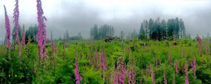
Plant diversity sampling at ABBY

NEON’s sampling design allows for data users to look at larger geographic areas around NEON fields site thanks in part to the Airborne Observation Platform (AOP). The AOP is comprised of a suite of instruments mounted on a Twin Otter aircraft that flies over selected NEON field sites annually. Data collected by the AOP can be used for many different research applications including predicting vegetation health within the ecosystem of a NEON field site. And although NEON is still in construction, some of these data, including vegetation indices, are already available for research from many NEON sites.

NEON AOP vegetation indices allow data users to estimate and map relative vegetation health, biomass and plant productivity in detail across the greater areas around NEON sites. These indices are produced from remote sensing data and algorithms going back to 1972 (Landsat MSS). This means they’re standardized across time, space and sensor.

“Linked with NEON’s ground data, this will be the first time scientists can scale from a network of standardized ground data (collected at NEON field sites), up through regional to continental and satellite scales,” says NEON staff scientist, Dave Hulslander. His hope is that “we will see a lot of discoveries and surprises about what Earth is up to when those dimensions and qualities are all linked.”

Some complimentary NEON data products to vegetation indices include foliar chemistry data, species surveys, LAI and fPAR for “ground truth” and scaling applications.

Land cover data that provides new scaling opportunities for research

NEON Airborne data are collected using a hyperspectral imaging spectrometer, a full waveform and discrete return LiDAR and a high-resolution Red, Blue Green (RGB) camera. These instruments will collect data over most of NEON’s core and relocatable field sites annually during the lifetime of each selected site. This will generally yield annual land cover data over the course of 30 years. These data also represent a crucial link in scaling NEON’s finer resolution ground and tower data to regional and continental scales as seen in satellite data and large scale models. Over time, these data can be used to show changes and trends in plant community health and will likely be a key component in predicting future land cover changes. 

Flights over each site take place at 90% or more of maximum greenness. Data collected include discrete LiDAR (point clouds), waveform LiDAR, high resolution color digital camera (25 cm pixel), and 428-band NEON Imaging Spectrometer hyperspectral data at 1 m resolution. Data are processed to create derived products, including vegetation indices.

Accessing available vegetation indices data

Right now, data from more than 15 sites are freely available upon request. Selected sites have been flown in 2013, 2014, or 2015. To request and read about all the AOP data currently available from NEON, visit the Airborne Data page. Once you complete our online request form, a hard drive of data will be shipped to you.

Once NEON is fully operational, AOP data will be collected at all selected sites annually, when the region is at approximately 90% max greenness.

What types of scientists might be interested in these data?

Scientists with some established work who may be looking to solve problems of scale, i.e. either the context of how detailed points fit in the larger scene or how larger features resolve in a closer look, will be very excited to get this data. In a similar vein, earlier career scientists have a great opportunity with AOP data to work with these data through the lifetime of NEON to get at the discoveries hiding in those context gaps over the course of years or decades.

To date, over 100 requests have already been made for AOP data, and at the recent AGU 2015 conference, it was exciting to see dozens of posters and presentations featuring NEON AOP data. Researchers from both universities and agencies are using NEON data and services in a variety of ways. Examples include mapping tree species, studying bat populations and integrating these data with other datasets and networks at regional, continental, and global scales.

What type of data skills do you need to work with these data?

Users will need to be either basically functional with geospatial tools (GIS and remote sensing packages) or have some interest in the geospatial realm (Google Earth enthusiasts) and willingness to add a few sharper tools (GIS, ENVI or ERDAS, etc.). Programming is never bad for earth scientists, but it is not required to jump into NEON AOP remote sensing data. For true beginners, we can help! We also have great Data Skills resources at NEON if you want to start learning how to work with big data sets.
Share

Related Posts:

NEON Data Release 2025 is available

January 29, 2025

AOP Data Availability Notification – Release 2025

January 10, 2025

New code release: neonutilities package available in Python

September 24, 2024

NSF NEON, Operated by Battelle

Follow Us:

Join Our Newsletter

Get updates on events, opportunities, and how NEON is being used today.

Subscribe Now

Footer

  • About Us
  • Newsroom
  • Contact Us
  • Terms & Conditions
  • Careers
  • Code of Conduct

Copyright © Battelle, 2025

The National Ecological Observatory Network is a major facility fully funded by the U.S. National Science Foundation.

Any opinions, findings and conclusions or recommendations expressed in this material do not necessarily reflect the views of the U.S. National Science Foundation.