NSF NEON, Operated by Battelle

Main navigation

  • About
    • NEON Overview
      • Vision and Management
      • Spatial and Temporal Design
      • History
    • About the NEON Biorepository
      • ASU Biorepository Staff
      • Contact the NEON Biorepository
    • Observatory Blog
    • Newsletters
    • Staff
    • FAQ
    • Contact Us

    About

  • Data
    • Data Portal
      • Data Availability Charts
      • API & GraphQL
      • Prototype Data
      • Externally Hosted Data
    • Data Collection Methods
      • Airborne Observation Platform (AOP)
      • Instrument System (IS)
        • Instrumented Collection Types
        • Aquatic Instrument System (AIS)
        • Terrestrial Instrument System (TIS)
      • Observational System (OS)
        • Observation Types
        • Observational Sampling Design
        • Sampling Schedules
        • Taxonomic Lists Used by Field Staff
        • Optimizing the Observational Sampling Designs
      • Protocols & Standardized Methods
    • Getting Started with NEON Data
      • neonUtilities for R and Python
      • Learning Hub
      • Code Hub
    • Using Data
      • Data Formats and Conventions
      • Released, Provisional, and Revised Data
      • Data Product Bundles
      • Usage Policies
      • Acknowledging and Citing NEON
      • Publishing Research Outputs
    • Data Notifications
    • NEON Data Management
      • Data Availability
      • Data Processing
      • Data Quality

    Data

  • Samples & Specimens
    • Biorepository Sample Portal at ASU
    • About Samples
      • Sample Types
      • Sample Repositories
      • Megapit and Distributed Initial Characterization Soil Archives
    • Finding and Accessing Sample Data
      • Species Checklists
      • Sample Explorer - Relationships and Data
      • Biorepository API
    • Requesting and Using Samples
      • Loans & Archival Requests
      • Usage Policies

    Samples & Specimens

  • Field Sites
    • Field Site Map and Info
    • Spatial Layers & Printable Maps

    Field Sites

  • Resources
    • Getting Started with NEON Data
    • Research Support Services
      • Field Site Coordination
      • Letters of Support
      • Mobile Deployment Platforms
      • Permits and Permissions
      • AOP Flight Campaigns
      • Research Support FAQs
      • Research Support Projects
    • Code Hub
      • neonUtilities for R and Python
      • Code Resources Guidelines
      • Code Resources Submission
      • NEON's GitHub Organization Homepage
    • Learning Hub
      • Tutorials
      • Workshops & Courses
      • Science Videos
      • Teaching Modules
    • Science Seminars and Data Skills Webinars
    • Document Library
    • Funding Opportunities

    Resources

  • Impact
    • Research Highlights
    • Papers & Publications
    • NEON in the News

    Impact

  • Get Involved
    • Upcoming Events
    • Research and Collaborations
      • Environmental Data Science Innovation and Inclusion Lab
      • Collaboration with DOE BER User Facilities and Programs
      • EFI-NEON Ecological Forecasting Challenge
      • NEON Great Lakes User Group
      • NCAR-NEON-Community Collaborations
    • Advisory Groups
      • Science, Technology & Education Advisory Committee
      • Technical Working Groups
    • NEON Ambassador Program
      • Exploring NEON-Derived Data Products Workshop Series
    • Partnerships
    • Community Engagement
    • Work Opportunities

    Get Involved

  • My Account
  • Search

Search

Field Sites

  • Field Site Map and Info
  • Spatial Layers & Printable Maps

Breadcrumb

  1. Field Sites
  2. Yellowstone National Park NEON

Field Site

Yellowstone National Park NEON / YELL

brown square white mountain icon

Core Terrestrial, WY, D12: Northern Rockies

Tower and instrument hut in the snow at Yellowstone

About Field Sites

Yellowstone National Park (YELL) is a terrestrial NEON field site located 100 km (62 mi.) southeast of Bozeman, MT, just south of the Wyoming-Montana state line. The 72.5 km2 (17,900 acre) site lies within the northern reaches of Yellowstone National Park and is hosted by the National Park Service. The terrain consists of rolling hills, which span from 1840 - 2245 m (6036 - 7360 ft.) in elevation at the site. The site is a mosaic of pine-dominated forest mixed with open swaths of sage and grass and small wetlands. The area is visited by tourists and fisherman regularly during the summer. YELL is highly representative of a wildland area in NEON's Northern Rockies Domain (D12). The trophic structure and community interactions are probably more representative of those that were widespread in the region before Euro-American influence than any other place in the Domain. Thus, the site offers a rare opportunity to understand interactions among climate, natural disturbance, ecosystem processes, and community structure in integrated terrestrial and aquatic systems that are representative of those of intact wildlands across the Domain. Domain 12 comprises the northern part of the Rocky Mountain Range in western Montana, Idaho and northwestern Wyoming and has two field sites: YELL and the colocated BLDE aquatic site. [1] [7]

Climate

The climate in the NEON Northern Rockies Domain can be harsh. In Yellowstone National Park, elevation differences can produce greatly variable weather and temperature. At the NEON YELL site, the mean average temperature is 3.4°C (38°F) and the mean annual precipitation is 493 mm (19 in.). Summer temperatures can reach 25°C-30°C (70°F-80°F) depending on elevation. Snow typically extends through the fall, winter, and spring. In the spring and fall, snowfall of 300 mm (12 in.) per day can still be expected. Winter is typically below freezing, with average snowfall reaching 3800 mm (150 in.) per year, but in higher elevation portions of the park there can be substantially more snow. [1] [6] [10]

Geology

Yellowstone National Park contains geologic features that are the results of volcanism, glaciation, and geological processes fueled by a continental hotspot. The park encompasses the Yellowstone caldera as well as the fault-block mountain ranges that surround the caldera to the northeast and southwest. The underlying geology of YELL includes mostly basalt flows and intrusive igneous rocks, with some Absaroka Volcanic Supergroup, Sunlight Group. YELL plots are also characterized by glacial deposits and glaciated bedrock areas. [2] [7] [13]

Soils

Soils at the YELL NEON site fall into the Mollisol category. Most soils found in the area are within loamy-skeletal particle size families. The most common soil type found in the NEON sample plots was Hobacker gravelly loam. [2]

Hydrology

YELL is located in the western portion of the Oxbow Creek watershed. In general, climate change has altered the flow of water in Yosemite's watersheds. The Lamar River, which runs through part of the YELL site, has a substantially lower flow than in previous decades. [7] [11]

Vegetation

Grasslands, shrublands, and forests are the predominant features within the NEON sites at Yellowstone National Park. With over 1200 species of native plants, Yellowstone National Park features vegetation varieties across grasslands, shrubland, and forested areas. Abundant plant species within the NEON site include: mountain big sagebrush (Artemisia tridentata var. vaseyana), Idaho fescue (Festuca idahoensis), lodgepole pine (Pinus contorta*), Douglas fir (Pseudotsuga menziesii), and a wide variety of grass species. [1]

Fauna

Overall, Yellowstone National Park is home to extremely diverse and abundant wildlife population, including moose, elk, deer, bison, coyotes, foxes, and marmots. Black bears (Ursus americanus) and federally-listed threatened grizzly bears (Ursus arctos horribilis) are present in Yellowstone National Park. YELL is located within a Bear Management area; the site is managed to allow bears to reproduce without human interference. Following a reintroduction campaign from 1995 to 1997, a population of endangered Rocky Mountain wolves (Canis lupus) now exists within Yellowstone National Park as well. Birds also nest and migrate to Yellowstone National Park, with almost 300 species of birds reported within the park. [1] [3] [5] [7]

Past Land Management and Use

Archaeological features and oral histories provide evidence for the presence of people in Yellowstone dating back more than 11,000 years. A multitude of Native American tribes and groups inhabited the Yellowstone area, with multiple groups connected to the land within the park. The Tukudika band (Shoshone-Bannock Tribes), Tséstho’e (Cheyenne) and Apsaalooké (Crow) are some of the groups that share a history in the Yellowstone National Park area. Yellowstone National Park became established in 1872, at which point the Tukudika band persisted in the area. However, like many other Native American groups, European-American settlers and government action eventually forced them onto reservations.

In 1918, the park transferred from the management of the U.S. Army to the National Park Service. Over the years, the park continued to engage in wildlife and resource management, as well as visitor engagement. The Bear Management area and reintroduction of wolves are just some of the milestones in the ongoing management and history of the area. The Yellowstone area also has a history of natural fires before 1872, with vegetation adapting to and even relying on fire conditions. In the 1880s, fire suppression efforts began under the management of the U.S. Army. Growing evidence of the ecological role of fire led the National Park Service to eventually allow some fires to burn in Yellowstone National Park, beginning in 1972. [3] [4] [8] [9]

Current Land Management and Use

The National Park Service currently manages Yellowstone National Park to ensure a healthy ecosystem and protection of wildlife within the park. One of the main management considerations is fire. Fire facilitates certain plant populations and ecosystem balances in the Greater Yellowstone Ecosystem. For example, lodgepole pine seeds can be released by intense heat from fire. Prior to 1972, fires in Yellowstone were largely suppressed; nowadays, the National Park Service manages to facilitate naturally started fires as part of an ecologically beneficial process. In the present day, naturally started fires that do not present a danger to human life and infrastructure are permitted to burn within the park.

The presence of threatened species within the park, including wolves and grizzly bears, has influenced wildlife management strategies as well. A Bear Management area, which YELL is contained within, allows the bears to reproduce without interference by humans. The reintroduction of threatened wolf populations following extermination campaigns in the Rocky Mountain area is another key management strategy that extends beyond wildlife populations. When wolves hunt grazing mammals, it can affect the entire ecosystem and landscape. While wolves are no longer considered endangered in all states in the Greater Yellowstone Area, hunting wolves within Yellowstone National Park is prohibited. Lastly, Yellowstone hosts scientific research unaffiliated with the U.S. National Park Service. In 2018, 142 permits were issued for research on biological resources, wildlife and vegetation, microbiology, ecology, and more. [3] [4] [9] [12]

NEON Site Establishment

The National Park Service conducted an Environmental Assessment in June 2017 for a potential NEON site near Blacktail Deer Creek. Multiple other sites within Yellowstone National Park were evaluated in 2008, but did not meet the scientific, logistical, and management criteria considered. Site characterization began in May 2018, with vegetation structure measurements conducted during May 2018 and plant diversity data collected between June and August 2018. The tower came online starting October 2018. [1] [7]

Additional Resources

[1] Terrestrial Observation System (TOS) Site Characterization Report: Domain 12. NEON.DOC.003895vA

[2] Fabian, C. (2019). NEON Site-Level Plot Summary: Yellowstone (YELL). U.S. Department of Agriculture. https://data.neonscience.org/documents/10179/2361410/YELL_Soil_SiteSumm…

[3] Grizzly Bear. (n.d). National Park Service. Retrieved April 30, 2020, from https://www.nps.gov/yell/learn/nature/grizzlybear.htm

[4] Gray Wolf. (n.d). National Park Service. Retrieved April 30, 2020 from https://www.nps.gov/yell/learn/nature/wolves.htm

[5] Birds. (n.d.). National Park Service. Retrieved April 30, 2020 from https://www.nps.gov/yell/learn/nature/birds.htm

[6] Climate. (n.d.). National Park Service. Retrieved May 1, 2020 from https://www.nps.gov/yell/planyourvisit/weather.htm

[7] United States Department of the Interior: National Park Service, Yellowstone National Park. (2017). National Ecological Observatory Network: Northern Rockies, Domain 12 – Core site Environmental Assessment. National Park Service. https://parkplanning.nps.gov/document.cfm?parkID=111&projectID=54573&do…

[8] “History of the Park.” 2020. Yellowstone Resources and Issues Handbook. National Park Service. Retrieved from https://www.nps.gov/yell/learn/resources-and-issues.htm

[9] “Fire.” 2020. Yellowstone Resources and Issues Handbook. National Park Service. Retrieved from https://www.nps.gov/yell/learn/resources-and-issues.htm

[10] PRISM Climate Group, Oregon State University, http://prism.oregonstate.edu, created 4 Feb 2004.

[11] McMenamin, S. K., Hadly, E. A., & Wright, C. K. (2008). Climatic change and wetland desiccation cause amphibian decline in Yellowstone National Park. Proceedings of the national Academy of Sciences, 105(44), 16988-16993.

[12] https://www.nps.gov/yell/learn/nature/research.htm

[13] U.S. Geological Survey, 2005, Mineral Resources Data System: U.S. Geological Survey, Reston, Virginia. https://mrdata.usgs.gov/mrds/

Field Site Information

Latitude/Longitude

44.95348, -110.53914

Geodetic Datum

WGS84

Location

Park County
WY, US

Elevation

Mean: 2133m
Minimum: 1847m
Maximum: 2244m

Mean Annual Temperature

3.4°C

Dominant Wind Direction

SSE

Mean Canopy Height

14.0m

Dominant NLCD Classes

Evergreen Forest, Grassland/Herbaceous, Shrub/Scrub

Colocated Site(s)

Blacktail Deer Creek NEON

Colocated Research

Yellowstone Biosphere Reserve
Yellowstone National Park-Tower Falls National Atmospheric Deposition Program
Critical Zone Exploration Network
Ameriflux

Field Operations Office

2360 N 7th Avenue
Bozeman, MT 59715

Research Access

If your proposed research requires access to field sites where NEON is present, we can help.

Request Access

Observation Types

Remote Sensing

Remote sensing surveys of this field site collect lidar, spectrometer and high-resolution RGB camera data.

Meteorological Measurements

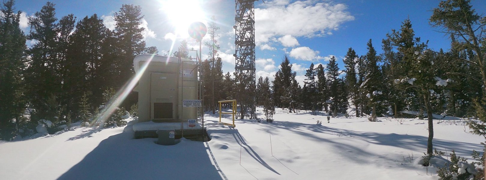
This site has a flux/meteorological tower that is 18 m (59 ft) tall with five measurement levels. The tower collects weather and climate data, including fluxes of carbon, water, and energy between the terrestrial ecosystem and the atmosphere. Precipitation data are collected by a Double Fence Intercomparison Reference (DFIR) near the tower and a series of throughfalls located in the soil array.

Phenocams

One phenocam is attached to the top and the bottom of the tower. Here we show the images from the most recent hour. The full collection of images can be viewed on the Phenocam Gallery - click on either of the images below.

Tower top

NEON.D12.YELL.DP1.10033

Tower bottom

NEON.D12.YELL.DP1.10042

Soil Sensor Measurements

This site has five soil plots placed in an array within the airshed of the flux tower. Photosynthetically Active Radiation (PAR) at soil surface, soil heat flux, solar radiation, and throughfall are measured at the soil surface in each soil plot. Soil moisture, soil temperature, and CO2 concentration are measured at multiple depths in each soil plot.

Observational Sampling

At terrestrial sites, field ecologists observe birds and plants, and sample ground beetles, mosquitoes, small mammals, soil microbes, and ticks. Lab analyses are carried out to provide further data on DNA sequences, pathogens, soils, sediments, and biogeochemistry. Learn more about terrestrial observations or explore this site's data products.


Field Site Data

Site

Site Host

Yellowstone National Park

Site URL

https://irma.nps.gov/rprs/

Site Access Details

The National Park Service allows for additional research activities in this area. Please apply through the IRMA Permitting portal. Reach out to NEON Domain Manager prior to contacting NPS permitting for additional assistance in process. The NEON research area has limited access due to the sensitivity of the area. No access into the tower or tower airshed area (includes all tower plots) due to Bear Exclosure annually March 10 - June 30.

Operations Office

NEON Field Operations Office

Domain 12 Support Facility

NEON Field Operations Address

2360 N 7th Avenue
Bozeman, MT 59715

NEON Field Operations Phone

406.551.7069

Location

Latitude

44.95348

Longitude

-110.53914

Geodetic Datum

WGS84

UTM Northing

4977885.94m

UTM Easting

536352.20m

UTM Zone

12N

County

Park

State

WY

Country

US

Mean Elevation

2133m

Minimum Elevation

1847m

Maximum Elevation

2244m

Terrestrial Sampling Boundary Area

72.50km^2

Climate

Mean Annual Temperature

3.4°C

Mean Annual Precipitation

493mm

Dominant Wind Direction

SSE

Vegetation

Mean Canopy Height

14.0m

Dominant NLCD Classes

Evergreen Forest, Grassland/Herbaceous, Shrub/Scrub

Average number of green days

144

Average first greenness increase date

125 DOY

Average peak green date

169 DOY

Average first greenness decrease date

193 DOY

Average minimum greenness date

269 DOY

Tower

Tower Height

18m

Number of Tower Levels

5

Soils

Megapit Soil Family

Fine-loamy - mixed - superactive - frigid Pachic Argiustolls

Soil Subgroup

Pachic Argiustolls


Gallery

  • Photos
  • Videos

No Video


Related Field Sites

Other Domain D12 Field Sites

blue square white drop icon Blacktail Deer Creek NEON
Core Aquatic

Other Field Sites in WY

blue square white drop icon Blacktail Deer Creek NEON
Core Aquatic
NSF NEON, Operated by Battelle

Follow Us:

Join Our Newsletter

Get updates on events, opportunities, and how NEON is being used today.

Subscribe Now

Footer

  • About Us
  • Contact Us
  • Terms & Conditions
  • Careers
  • Code of Conduct

Copyright © Battelle, 2026

The National Ecological Observatory Network is a major facility fully funded by the U.S. National Science Foundation.

Any opinions, findings and conclusions or recommendations expressed in this material do not necessarily reflect the views of the U.S. National Science Foundation.