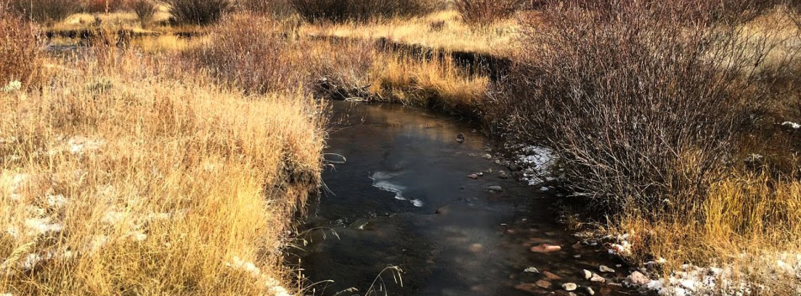
NSF NEON, Operated by Battelle

Main navigation

  • About
    • NEON Overview
      • Vision and Management
      • Spatial and Temporal Design
      • History
    • About the NEON Biorepository
      • ASU Biorepository Staff
      • Contact the NEON Biorepository
    • Observatory Blog
    • Newsletters
    • Staff
    • FAQ
    • Contact Us

    About

  • Data
    • Data Portal
      • Data Availability Charts
      • API & GraphQL
      • Prototype Data
      • Externally Hosted Data
    • Data Collection Methods
      • Airborne Observation Platform (AOP)
      • Instrument System (IS)
        • Instrumented Collection Types
        • Aquatic Instrument System (AIS)
        • Terrestrial Instrument System (TIS)
      • Observational System (OS)
        • Observation Types
        • Observational Sampling Design
        • Sampling Schedules
        • Taxonomic Lists Used by Field Staff
        • Optimizing the Observational Sampling Designs
      • Protocols & Standardized Methods
    • Getting Started with NEON Data
      • neonUtilities for R and Python
      • Learning Hub
      • Code Hub
    • Using Data
      • Data Formats and Conventions
      • Released, Provisional, and Revised Data
      • Data Product Bundles
      • Usage Policies
      • Acknowledging and Citing NEON
      • Publishing Research Outputs
    • Data Notifications
    • NEON Data Management
      • Data Availability
      • Data Processing
      • Data Quality

    Data

  • Samples & Specimens
    • Biorepository Sample Portal at ASU
    • About Samples
      • Sample Types
      • Sample Repositories
      • Megapit and Distributed Initial Characterization Soil Archives
    • Finding and Accessing Sample Data
      • Species Checklists
      • Sample Explorer - Relationships and Data
      • Biorepository API
    • Requesting and Using Samples
      • Loans & Archival Requests
      • Usage Policies

    Samples & Specimens

  • Field Sites
    • Field Site Map and Info
    • Spatial Layers & Printable Maps

    Field Sites

  • Resources
    • Getting Started with NEON Data
    • Research Support Services
      • Field Site Coordination
      • Letters of Support
      • Mobile Deployment Platforms
      • Permits and Permissions
      • AOP Flight Campaigns
      • Research Support FAQs
      • Research Support Projects
    • Code Hub
      • neonUtilities for R and Python
      • Code Resources Guidelines
      • Code Resources Submission
      • NEON's GitHub Organization Homepage
    • Learning Hub
      • Tutorials
      • Workshops & Courses
      • Science Videos
      • Teaching Modules
    • Science Seminars and Data Skills Webinars
    • Document Library
    • Funding Opportunities

    Resources

  • Impact
    • Research Highlights
    • Papers & Publications
    • NEON in the News

    Impact

  • Get Involved
    • Upcoming Events
    • Research and Collaborations
      • Environmental Data Science Innovation and Inclusion Lab
      • Collaboration with DOE BER User Facilities and Programs
      • EFI-NEON Ecological Forecasting Challenge
      • NEON Great Lakes User Group
      • NCAR-NEON-Community Collaborations
    • Advisory Groups
      • Science, Technology & Education Advisory Committee
      • Technical Working Groups
    • NEON Ambassador Program
      • Exploring NEON-Derived Data Products Workshop Series
    • Partnerships
    • Community Engagement
    • Work Opportunities

    Get Involved

  • My Account
  • Search

Search

Field Sites

  • Field Site Map and Info
  • Spatial Layers & Printable Maps

Breadcrumb

  1. Field Sites
  2. Blacktail Deer Creek NEON

Field Site

Blacktail Deer Creek NEON / BLDE

blue square white drop icon

Core Aquatic, WY, D12: Northern Rockies

BLDE stream site in the fall

About Field Sites

Blacktail Deer Creek (BLDE) is an aquatic NEON field site located in Yellowstone National Park. It is 100 km (62 mi.) southeast of Bozeman, MT, just south of the Wyoming-Montana state line. It is hosted by the National Park Service. BLDE is a small perennial stream that flows through the northern part of Yellowstone National Park and into the Yellowstone River east of Mammoth Hot Springs. The creek flows through relatively open terrain, with a dense riparian willow canopy on the stream banks, and drains a watershed of 37.81 km2 (8100 acres). It is shallow with clear water and has the potential to flood during snowmelt and heavy rainfall events. The area is visited by tourists and fisherman regularly during the summer. BLDE is highly representative of a wildland area in NEON's Northern Rockies Domain (D12). The trophic structure and community interactions are probably more representative of those that were widespread in the region before Euro-American influence than any other place in the Domain. Thus, the site offers a rare opportunity to understand interactions among climate, natural disturbance, ecosystem processes, and community structure in integrated terrestrial and aquatic systems that are representative of those of intact wildlands across the Domain. Domain 12 comprises the northern part of the Rocky Mountain Range in western Montana, Idaho and northwestern Wyoming. D12 has two colocated field sites: BLDE and the YELL terrestrial site. [1] [2] [12]

Climate

The climate in the NEON Northern Rockies Domain can be harsh. In Yellowstone National Park, elevation differences can produce greatly variable weather and temperature. At the NEON BLDE site, the mean average temperature is 3.6°C (38°F) and the mean annual precipitation is 482 mm (19 in.). Summer temperatures can reach 25°C-30°C (70°F-80°F) depending on elevation. Snow typically extends through the fall, winter, and spring. In the spring and fall, snowfall of 300 mm (12 in.) per day can still be expected. Winter is typically below freezing, with average snowfall reaching 3800 mm (150 in.) per year, but in higher elevation portions of the park there can be substantially more snow. [13] [11]

Geology

Yellowstone National Park contains geologic features that are the results of volcanism, glaciation, and geological processes fueled by a continental hotspot. The park encompasses the Yellowstone caldera as well as the fault-block mountain ranges that surround the caldera to the northeast and southwest. BLDE is located on the Blacktail Deer Plateau between the Gallatin and Washburn mountain ranges. The geology underlying BLDE includes mostly undivided alluvium, colluvium, and glacial and landslide deposits with some rhyolite flows, tuff, and intrusive igneous rocks. Geomorphic attributes of Blacktail Deer Creek include riffle-pool sections with a medium to large cobble sediment regime and clear water. [1] [12] [14]

Soils

Soils in BLDE consist of Cryaquolls and Histosols Undifferentiated Group. These soils are medium- to fine-textured sandy loam, loam, and loamy sands formed in aquatic environments; sand loams, sandy clayey loams, and loams formed in glacial till and alluvium (Shook Family-Badwater Family-Passcreek Family Complex); and loams formed in till and alluvium derived from volcanic rocks (Gallatin Family). These soil types make up 100% of the soil in the BLDE site. [10]

Hydrology

Blacktail Deer Creek is a small stream that drains a 37.8 km2 (14.6 sq. mi.) watershed. Flow records from an inactive United States Geological Survey gauge on Blacktail Deer Creek next to the NEON aquatic site show mean annual flow ranging from 4 cubic feet per second (cfs) to 13 cfs and peak stream flow ranging from 37 cfs to 198 cfs (period record of 1938–1993). Snowmelt dominates seasonal patterns in the surface water regime of Blacktail Deer Creek. Warming temperatures in late spring (May-June) causes the heavy snowpack to melt and discharge to consequently rise until peak flow, typically in June and July. After this point, discharge steadily falls until September, after which base flows remain relatively low and stable until the following spring melt. Discharge rarely, if ever, reaches zero. [1] [10] [12]

Vegetation

The riparian canopy is dominated by willows (Salix spp.). Vegetation at the site is composed of short grasses in the fields surrounding the stream and a dense corridor of cottonwoods and briar bushes at the streams edge. Understory vegetation also consists of roses and grasses. The upstream portion of the stream has some surrounding lodgepole pines that have been burned in a forest fire (not recent). Some of these trees have fallen across the stream and obstruct flow in the channel. [1] [2]

Fauna

The aquatic invertebrate community is dominated by 11 mayfly (Ephemoptera) genera including Drunella doddsi and Ameletus sp., 5 stonefly genera (Plecoptera) including Suwallia sp. and Classenia sp., and 4 genera of caddisfly (Trichoptera) including Glossomatidae and Hydropsychidae. This community likely provides adequate food resources for the stream's population of non-native brook trout (Salvelinus fontinalis). Yellowstone National Park is home to 13 native fish and six non-native fish species. Two species of native fish in the park, the Yellowstone cutthroat trout (YCT) and arctic grayling, have historic ranges in the NEON BLDE site. Currently, there are efforts underway to restore populations of the YCT to streams in Yellowstone. Some of the common non-native species in Yellowstone include brook trout, brown trout, and rainbow trout. Yellowstone is also home to moose, elk, bison, bears, and wolves. [1] [10]

Past Land Management and Use

Yellowstone National Park has ties with 26 Native American tribes. Blacktail Deer Creek is traditionally the territory of the Shoshone-Bannock, Tséstho’e (Cheyenne), and Apsaalooké (Crow). Yellowstone National Park was established in 1872 and was managed by the U.S. Army from 1886-1918. In 1916, the National Park Service, who now manages the area, was created.

In 1988, fires in the watershed and surrounding areas affected 793,880 acres of Yellowstone National Park. Trees downed by the fire created pools in Blacktail Deer Creek and the creek saw a rise in nitrate and phosphate levels.

Science has always been an integral component of Yellowstone's approach to park management, from as early as 1877 when Park Superintendent Philetus Norris made the case for a resident Park scientist. One of Yellowstone's better known conservation initiatives, the reintroduction of Grey Wolves in 1995, resulted in increased willow heights along Blacktail Deer Creek by 2004 due to the reduced grazing by the resident elk population. [1] [3] [4] [5] [6] [7]

Current Land Management and Use

Blacktail Deer Creek is located within Yellowstone National Park and is managed by the U.S. National Park Service. Sustaining Yellowstone's ecosystem is a priority in the management of the park. Yellowstone has in place plans for bear management, bison management, fire management, native fish conservation, visitor use management, and winter use management. Blacktail Deer Creek is located within the Bear Management Area, where access is restricted to occasional site visits as required by NEON activities from March 10-June 30th. Additionally, Yellowstone hosts scientific research unaffiliated with the U.S. National Park Service. In 2018, 142 permits were issued for research on biological resources, wildlife and vegetation, microbiology, ecology, and more. [8] [9] [10]

NEON Site Establishment

In June 2017, the National Park Service conducted an Environmental Assessment for sampling at Black Deer Creek. Following that, a sampling readiness review was conducted at Blacktail Deer Creek in February 2018. Initial operations capability reviews were conducted for aquatic observation systems (AOS) and aquatic instrumentation systems (AIS) in August 2018 and October 2018 respectively. The actual transition to operations for AOS occurred on August 22, 2018 and AIS transitioned to operations on October 24, 2018. [12]

Additional Resources

  1. NEON. 2012. NEON Aquatic Site Summary, Site Information: D12, Blacktail Deer Creek.
  2. Aquatic Instrument System (AIS) Site Characterization Report: Domain 12. NEON.DOC.001669vA
  3. Native Land Digital, Territory Acknowledgement
  4. National Park Service, Yellowstone National Park, Park History
  5. National Park Service, Yellowstone National Park, 1988 Fires
  6. National Park Service, History of Science in Yellowstone
  7. Beschta, R. L., & Ripple, W. J. (2007). Increased willow heights along northern yellowstone's blacktail deer creek following wolf reintroduction. Western North American Naturalist, 67(4), 613–617.
  8. National Park Service, Yellowstone National Park, Management
  9. National Park Service, Yellowstone National Park, Research
  10. Rissler, Erik, et al. (2017). NEON Site-Specific EHS Plan: D12CA1BLDE
  11. National Park Service, Yellowstone National Park, Weather
  12. National Park Service. 2017. National Ecological Observatory Network: Northern Rockies, Domain 12 – Core site Environmental Assessment
  13. PRISM Climate Group, Oregon State University
  14. U.S. Geological Survey, 2005, Mineral Resources Data System: U.S. Geological Survey, Reston, Virginia. 

Field Site Information

Latitude/Longitude

44.95011, -110.58715

Geodetic Datum

WGS84

Location

Park County
WY, US

Elevation

Mean: 2053m

Mean Annual Temperature

3.6°C

Dominant NLCD Classes

Emergent Herbaceous Wetlands, Shrub/Scrub

Colocated Site(s)

Yellowstone National Park NEON

Colocated Research

Yellowstone Biosphere Reserve
Yellowstone National Park-Tower Falls National Atmospheric Deposition Program

Field Operations Office

2360 N 7th Avenue
Bozeman, MT 59715

Research Access

If your proposed research requires access to field sites where NEON is present, we can help.

Request Access

Observation Types

Remote Sensing

Remote sensing surveys of this field site collect lidar, spectrometer and high-resolution RGB camera data.

Meteorological Measurements

This site has a meteorological station located in the riparian area. The met station is outfitted with a subset of the same sensors used at terrestrial sites. Measurements include wind speed and direction, air temperature, barometric pressure, relative humidity, shortwave radiation, and PAR.

Phenocams

A phenocam is pointed toward the land-water interface of the site. Here we show the images from the most recent hour. The full collection of images can be viewed on the Phenocam Gallery - click on the image below.

NEON.D12.BLDE.DP1.20002


Field Site Data

Site

Site Host

Yellowstone National Park

Site URL

https://irma.nps.gov/rprs/

Site Access Details

The National Park Service allows for additional research activities in this area. Please apply through the IRMA Permitting portal. Reach out to the NEON Domain Manager, Amy Jacobs, prior to contacting NPS permitting for additional assistance in process. The NEON research area has limited access during the Bear Exclosure period annually March 10 - June 30. Advanced Coordination with NEON personnel if conducting activities for PI during this period is required.

Operations Office

NEON Field Operations Office

Domain 12 Support Facility

NEON Field Operations Address

2360 N 7th Avenue
Bozeman, MT 59715

NEON Field Operations Phone

406.551.7069

Location

Latitude

44.95011

Longitude

-110.58715

Geodetic Datum

WGS84

UTM Northing

4977491.17m

UTM Easting

532567.12m

UTM Zone

12N

County

Park

State

WY

Country

US

Mean Elevation

2053m

Climate

Mean Annual Temperature

3.6°C

Mean Annual Precipitation

481mm

Vegetation

Dominant NLCD Classes

Emergent Herbaceous Wetlands, Shrub/Scrub

Watershed

USGS HUC

h10070001

Watershed Name

Yellowstone Headwaters

Geology

USGS Geology Unit

WYQu;0

USGS Geology Name

Undivided surficial deposits

USGS Lithologic Constituents

Alluvium and colluvium

USGS Geology Age

Pleistocene to Holocene


Gallery

  • Photos
  • Videos

No Video


Related Field Sites

Other Domain D12 Field Sites

brown square white mountain icon Yellowstone National Park NEON
Core Terrestrial

Other Field Sites in WY

brown square white mountain icon Yellowstone National Park NEON
Core Terrestrial
NSF NEON, Operated by Battelle

Follow Us:

Join Our Newsletter

Get updates on events, opportunities, and how NEON is being used today.

Subscribe Now

Footer

  • About Us
  • Contact Us
  • Terms & Conditions
  • Careers
  • Code of Conduct

Copyright © Battelle, 2026

The National Ecological Observatory Network is a major facility fully funded by the U.S. National Science Foundation.

Any opinions, findings and conclusions or recommendations expressed in this material do not necessarily reflect the views of the U.S. National Science Foundation.