NSF NEON, Operated by Battelle

Main navigation

  • About Us
    • Overview
      • Spatial and Temporal Design
      • History
    • Vision and Management
    • Advisory Groups
      • Science, Technology & Education Advisory Committee
      • Technical Working Groups (TWGs)
    • FAQ
    • Contact Us
      • Contact NEON Biorepository
      • Field Offices
    • User Accounts
    • Staff
    • Code of Conduct

    About Us

  • Data & Samples
    • Data Portal
      • Explore Data Products
      • Data Availability Charts
      • Spatial Data & Maps
      • Document Library
      • API & GraphQL
      • Prototype Data
      • External Lab Data Ingest (restricted)
    • Data Themes
      • Biogeochemistry
      • Ecohydrology
      • Land Cover and Processes
      • Organisms, Populations, and Communities
    • Samples & Specimens
      • Discover and Use NEON Samples
        • Sample Types
        • Sample Repositories
        • Sample Explorer
        • Megapit and Distributed Initial Characterization Soil Archives
      • Sample Processing
      • Sample Quality
      • Taxonomic Lists
    • Collection Methods
      • Protocols & Standardized Methods
      • Airborne Remote Sensing
        • Flight Box Design
        • Flight Schedules and Coverage
        • Daily Flight Reports
          • AOP Flight Report Sign Up
        • Camera
        • Imaging Spectrometer
        • Lidar
      • Automated Instruments
        • Site Level Sampling Design
        • Sensor Collection Frequency
        • Instrumented Collection Types
          • Meteorology
          • Phenocams
          • Soil Sensors
          • Ground Water
          • Surface Water
      • Observational Sampling
        • Site Level Sampling Design
        • Sampling Schedules
        • Observation Types
          • Aquatic Organisms
            • Aquatic Microbes
            • Fish
            • Macroinvertebrates & Zooplankton
            • Periphyton, Phytoplankton, and Aquatic Plants
          • Terrestrial Organisms
            • Birds
            • Ground Beetles
            • Mosquitoes
            • Small Mammals
            • Soil Microbes
            • Terrestrial Plants
            • Ticks
          • Hydrology & Geomorphology
            • Discharge
            • Geomorphology
          • Biogeochemistry
          • DNA Sequences
          • Pathogens
          • Sediments
          • Soils
            • Soil Descriptions
        • Optimizing the Observational Sampling Designs
    • Data Notifications
    • Data Guidelines and Policies
      • Acknowledging and Citing NEON
      • Publishing Research Outputs
      • Usage Policies
    • Data Management
      • Data Availability
      • Data Formats and Conventions
      • Data Processing
      • Data Quality
      • Data Product Bundles
      • Data Product Revisions and Releases
        • Release 2021
        • Release 2022
        • Release 2023
        • Release 2024
        • Release-2025
      • NEON and Google
      • Externally Hosted Data

    Data & Samples

  • Field Sites
    • About Field Sites and Domains
    • Explore Field Sites
    • Site Management Data Product

    Field Sites

  • Impact
    • Observatory Blog
    • Case Studies
    • Papers & Publications
    • Newsroom
      • NEON in the News
      • Newsletter Archive
      • Newsletter Sign Up

    Impact

  • Resources
    • Getting Started with NEON Data & Resources
    • Documents and Communication Resources
      • Papers & Publications
      • Document Library
      • Outreach Materials
    • Code Hub
      • Code Resources Guidelines
      • Code Resources Submission
      • NEON's GitHub Organization Homepage
    • Learning Hub
      • Science Videos
      • Tutorials
      • Workshops & Courses
      • Teaching Modules
    • Research Support Services
      • Field Site Coordination
      • Letters of Support
      • Mobile Deployment Platforms
      • Permits and Permissions
      • AOP Flight Campaigns
      • Research Support FAQs
      • Research Support Projects
    • Funding Opportunities

    Resources

  • Get Involved
    • Advisory Groups
      • Science, Technology & Education Advisory Committee
      • Technical Working Groups
    • Upcoming Events
    • NEON Ambassador Program
      • Exploring NEON-Derived Data Products Workshop Series
    • Research and Collaborations
      • Environmental Data Science Innovation and Inclusion Lab
      • Collaboration with DOE BER User Facilities and Programs
      • EFI-NEON Ecological Forecasting Challenge
      • NEON Great Lakes User Group
      • NEON Science Summit
      • NCAR-NEON-Community Collaborations
        • NCAR-NEON Community Steering Committee
    • Community Engagement
      • How Community Feedback Impacts NEON Operations
    • Science Seminars and Data Skills Webinars
      • Past Years
    • Work Opportunities
      • Careers
      • Seasonal Fieldwork
      • Internships
        • Intern Alumni
    • Partners

    Get Involved

  • My Account
  • Search

Search

Field Sites

  • About Field Sites and Domains
  • Explore Field Sites
  • Site Management Data Product

Breadcrumb

  1. Field Sites
  2. University of Kansas Field Station NEON

Field Site

University of Kansas Field Station NEON / UKFS

brown circle white drop icon

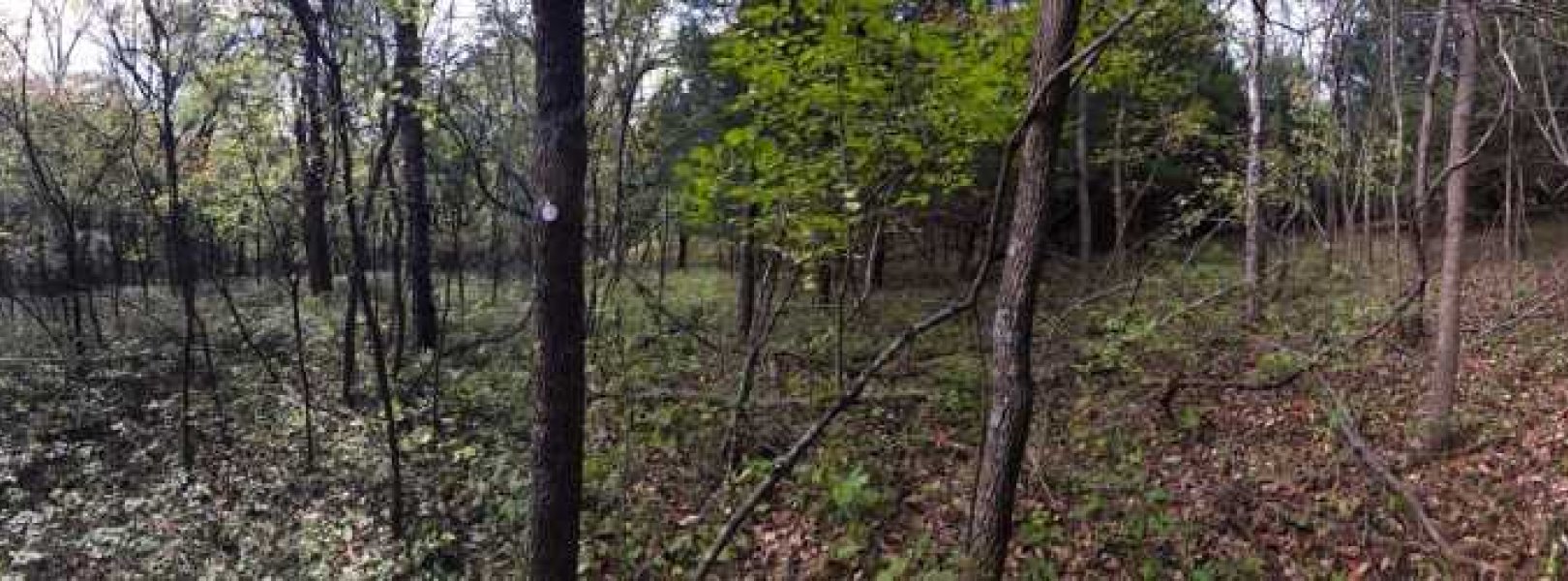
Gradient Terrestrial, KS, D06: Prairie Peninsula

Two seasons, one sampling plot at the UKFS field site

About Field Sites

UKFS is a terrestrial NEON field site located approximately 9 km (5.5 mi.) north of Lawrence, KS, near the eastern border of the state. The 6.2 km2 (1530 acre) site is encompassed within the University of Kansas Field Station, a biological field station owned and managed by KU. The location lies along an eastern deciduous forest and tallgrass prairie transition zone. The surrounding region consists of grasslands, forests, and agricultural land cover types and includes the largest remaining areas of unplowed tallgrass prairie in North America. Our UKFS site is part of the NEON Prairie Peninsula Domain (D06), which stretches from Kansas through Nebraska and Iowa to southern Minnesota, and moves east to encompass Illinois and most of Indiana. The Domain hosts four other NEON field sites: two aquatic and two additional terrestrial, all of which are located in Kansas. Land use and land use management are key grand challenge themes for this Domain. [1]

Climate

The University of Kansas Field station is in the eastern half of Kansas and has a continental climate characterized by warm, wet summers and cold, dry winters. Due to its mid-continental location, there are climatic fluctuations throughout the year. The mean annual temperature is 12.7°C (55°F). Temperatures can get as low as -18°C (0°F) in the winter and as high as 38°C (100°F) in the summer. There are intense storms during the spring and early summer caused by large amounts of moist air moving up from the Gulf of Mexico and mixing with colder, drier air from the north. The annual average precipitation is 990 mm (40 in.), and approximately 70% of it falls between April and September. Annual snowfall averages 460 mm (18 in.), mostly in January and February. [7] [8] [17]

Geology

Geologic characteristics of the University of Kansas Field Station are windblown sand and silt. These sediments are a result of glacial drift, having been lain down here after being transported by glaciers. [3]

Soils

The parent materials at the UKFS site are residuum, till, colluvium, and local alluvium. Major soil series on the site include Grundy, Martin, Oska, Pawnee, Rosendale, and Bendena. Landform positions that these soils occur on are residual summits, shoulder slopes, back slopes, colluvial foot slopes and toeslopes, and alluvial drainageways. The soil family is fine smectic-mesic Pachic Arguidolls, and the soil order is Mollisol. [1] [2]

Hydrology

The UKFS site drains into Mud Creek, which is a tributary of the Kansas River. It lies within the Lower Kansas River Watershed, which belongs to the larger Kansas River Basin. [9] [10]

Vegetation

About 66% of the land is covered in mixed hardwood forest, with the rest of the areas cleared for grassland, conservation, or agriculture. Forests are dominated by white ash (Fraxinus americana) and hackberry (Celtis occidentalis). Tallgrass prairie communities support perennial, warm-season grasses including big bluestem, indiangrass, and switchgrass. [1] [2]

Fauna

Wildlife typically found in and around the University of Kansas Field Station include the Virginia opossum (Didelphis virginiana), white-tailed deer (Odocoileus virginianus), raccoon (Procyon lotor), many small mammals, snakes, frogs, skinks, and over 250 species of migratory and resident birds. There is also a small population of bobcats (Felis rufus) present. NEON provides data on five types of wildlife: small mammals, ground beetles, mosquitoes, ticks, and birds. [4] [5] [6]

Past Land Management and Use

Northeastern Kansas is in the transition zone between the eastern deciduous forest and tall grass prairie. In the 16th century, the Otoe and Missouria tribes moved down from the Great Lakes Region into what is now Nebraska, Iowa, Missouri, and Kansas. They were mainly hunter-gatherers and followed migrating buffalo in the lower Missouri River Valley. Their lands were good for farming, which led to conflicts with settlers migrating from the east. The United States government eventually stepped in and forced the Otoe-Missouria people onto a reservation on the Big Blue River in southeast Nebraska in 1855. They were moved again in 1881 to Red Rock, Oklahoma where the tribe is still located today. As settlers moved in during the 1850s, trees were cut down and land was cleared for farming. As time went on, fire suppression and abandoned farms led to an increase in woody plants and forest encroachment. In 1911, land owned by the first governor of Kansas, Dr. Charles Robinson, and his wife Sara was donated to the University of Kansas. This land was then chosen as the site of the University of Kansas Field Station in 1947 to help advance research, environmental education, and natural resource stewardship. [12] [13] [14]

Current Land Management and Use

The University of Kansas Field Station includes more than 3400 acres of protected research land, public trails, and specialized facilities in northeastern Kansas. Its native and managed land, facilities, and research are available to a wide range of people interested in research, teaching, and conservation. It is also a member of the Organization of Biological Field Stations (OBFS) and the Association of Ecosystem Research Centers (AERC). The Field Station is managed by the Kansas Biological Survey, whose main focus is to develop environmental research that contributes to scientific knowledge on air and water quality, ecosystem health, and geospatial information. [12]

NEON Site Establishment

Plot establishment for the UKFS site was completed in 2014 and terrestrial sampling began in February 2016. The distributed plots were allocated according to a spatially balanced and stratified-random design. The 2006 National Land Cover Database (NLCD) was selected for stratification because of the consistent and comparable data availability across the United States. The tower, which stands 32.5 m (106 ft.) and has six instrument levels, began sampling in August 2016. The tower plots were allocated according to a spatially balanced design in and around the NEON tower airshed. [1] [11]

Additional Resources

[1] Terrestrial Observation System (TOS) Site Characterization Report: Domain 06 NEON.DOC.003890vB

[2] Busch, M. (2016). NEON Site Level Plot Summary University of Kansas Field Station (UKFS). United States Department of Agriculture.

[3] Kansas Geological Survey, University of Kansas http://maps.kgs.ku.edu/state_geology/

[4] Kansas Biological Survey: Mammals of the KU Field Station. https://kbs.drupal.ku.edu/mammals-ku-field-station

[5] Kansas Biological Survey: Amphibians and Reptiles of the KU Field Station. https://kbs.drupal.ku.edu/amphibians-and-reptiles-ku-field-station

[6] Kansas Biological Survey: University of Kansas Field Station, Birds. http://kufs.ku.edu/resources/bird-list/

[7] Goodin, D.G., Mitchell, J.E., Knapp, M.C., & Bivens, R.E. (1995). Climate and Weather Atlas of Kansas: An Introduction. Kansas Geologic Survey. https://www.k-state.edu/ksclimate/documents/kgsed.pdf

[8] Climate Synopsis for the University of Kansas Field Station. http://kufs.ku.edu/media/kufs/libres/Weather_station/Climate%20Synopsis…

[9] USGS Water Resources. https://water.usgs.gov/lookup/getwatershed?10270104

[10] https://streamstats.usgs.gov/ss/

[11] Terrestrial Instrument System (TIS, FIU) Site Characterization Supporting Data: Domain 06. NEON.DOC.011078vB

[12] The University of Kansas: Biological Survey. https://biosurvey.ku.edu/field-station

[13] The Otoe-Missouria Tribe. https://www.omtribe.org/who-we-are-history

[14] Hane, E. N., & Hamburg, S. P. (2002). Community dynamics of an ecotonal forest-prairie interface in northeastern Kansas. Great Plains Research, 275-294.

[15] U.S. Fish and Wildlife Service: Midwest Region Endangered Species, Mead’s Milkweed (Asclepias meadii). https://www.fws.gov/midwest/endangered/plants/meads/meadsmil.html

[16] U.S. Fish and Wildlife Service: Midwest Region Endangered Species, Eastern Prairie Fringed Orchid (Platanthera leucophaea). https://www.fws.gov/midwest/endangered/plants/epfo/epfo.html

[17] PRISM Climate Group., Oregon State University, http://prism.oregonstate.edu, created 4 Feb 2004.

Field Site Information

Latitude/Longitude

39.040431, -95.19215

Geodetic Datum

WGS84

Location

Douglas County
KS, US

Elevation

Mean: 322m
Minimum: 272m
Maximum: 332m

Mean Annual Temperature

12.7°C

Dominant Wind Direction

SE

Mean Canopy Height

19.0m

Dominant NLCD Classes

Deciduous Forest, Pasture/Hay

Colocated Research

University of Kansas Field Station
Kansas Biological Survey
Ameriflux

Field Operations Office

1500 Hayes Drive
Manhattan, KS 66502

Research Access

Non-NEON research activities are allowed in this area. Researchers must obtain their own permits with the site host(s).

Request Access

Observation Types

Remote Sensing

Remote sensing surveys of this field site collect lidar, spectrometer and high-resolution RGB camera data.

Meteorological Measurements

This site has a flux/meteorological tower that is 35 m (115 ft) tall with six measurement levels. The tower top extends above the vegetation canopy to allow sensors mounted at the top and along the tower to capture the full profile of atmospheric conditions from the top of the vegetation canopy to the ground. The tower collects physical and chemical properties of atmosphere-related processes, such as humidity, wind, and net ecosystem gas exchange. Precipitation data are collected by a tipping bucket at the top of the tower and a series of throughfalls located in the soil array.

Phenocams

One phenocam is attached to the top and the bottom of the tower. Here we show the images from the most recent hour. The full collection of images can be viewed on the Phenocam Gallery - click on either of the images below.

Tower top

NEON.D06.UKFS.DP1.10033

Tower bottom

NEON.D06.UKFS.DP1.10042

Soil Sensor Measurements

This site has five soil plots placed in an array within the airshed of the flux tower. Photosynthetically Active Radiation (PAR) at soil surface, soil heat flux, solar radiation, and throughfall are measured at the soil surface in each soil plot. Soil moisture, soil temperature, and CO2 concentration are measured at multiple depths in each soil plot.

Observational Sampling

At terrestrial sites, field ecologists observe birds and plants, and sample ground beetles, mosquitoes, small mammals, soil microbes, and ticks. Lab analyses are carried out to provide further data on DNA sequences, pathogens, soils, sediments, and biogeochemistry. Learn more about terrestrial observations or explore this site's data products.


Field Site Data

Site

Site Host

University of Kansas

Site Access Allowed

Yes

Site URL

https://biosurvey.ku.edu/research

Site Access Details

This site host welcomes and encourages research use that fits their mission and is compatible with their abilities as a host. Please plan on at more than two weeks advance notice to request and plan site access.

Operations Office

NEON Field Operations Office

Domain 06 Support Facility

NEON Field Operations Address

1500 Hayes Drive
Manhattan, KS 66502

NEON Field Operations Phone

785.789.3402

Location

Latitude

39.040431

Longitude

-95.19215

Geodetic Datum

WGS84

UTM Northing

4323549.85m

UTM Easting

310276.30m

UTM Zone

15N

County

Douglas

State

KS

Country

US

Mean Elevation

322m

Minimum Elevation

272m

Maximum Elevation

332m

Climate

Mean Annual Temperature

12.7°C

Mean Annual Precipitation

990mm

Dominant Wind Direction

SE

Vegetation

Mean Canopy Height

19.0m

Dominant NLCD Classes

Deciduous Forest, Pasture/Hay

Average number of green days

255

Average first greenness increase date

75 DOY

Average peak green date

160 DOY

Average first greenness decrease date

210 DOY

Average minimum greenness date

330 DOY

Tower

Tower Height

35m

Number of Tower Levels

6

Soils

Megapit Soil Family

Fine - smectitic - mesic Pachic Argiudolls

Soil Subgroup

Pachic Argiudolls


Gallery

  • Photos
  • Videos

Related Field Sites

Other Domain D06 Field Sites

blue square white drop icon Kings Creek NEON
Core Aquatic
brown circle white drop icon Konza Prairie Agroecosystem NEON
Gradient Terrestrial
brown square white mountain icon Konza Prairie Biological Station NEON
Core Terrestrial
blue circle white drop icon McDiffett Creek NEON
Gradient Aquatic

Other Field Sites in KS

blue square white drop icon Kings Creek NEON
Core Aquatic
brown circle white drop icon Konza Prairie Agroecosystem NEON
Gradient Terrestrial
brown square white mountain icon Konza Prairie Biological Station NEON
Core Terrestrial
blue circle white drop icon McDiffett Creek NEON
Gradient Aquatic
NSF NEON, Operated by Battelle

Follow Us:

Join Our Newsletter

Get updates on events, opportunities, and how NEON is being used today.

Subscribe Now

Footer

  • About Us
  • Newsroom
  • Contact Us
  • Terms & Conditions
  • Careers
  • Code of Conduct

Copyright © Battelle, 2025

The National Ecological Observatory Network is a major facility fully funded by the U.S. National Science Foundation.

Any opinions, findings and conclusions or recommendations expressed in this material do not necessarily reflect the views of the U.S. National Science Foundation.