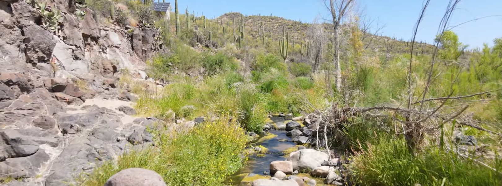
NSF NEON, Operated by Battelle

Main navigation

  • About Us
    • Overview
      • Spatial and Temporal Design
      • History
    • Vision and Management
    • Advisory Groups
      • Science, Technology & Education Advisory Committee
      • Technical Working Groups (TWGs)
    • FAQ
    • Contact Us
      • Contact NEON Biorepository
      • Field Offices
    • User Accounts
    • Staff
    • Code of Conduct

    About Us

  • Data & Samples
    • Data Portal
      • Explore Data Products
      • Data Availability Charts
      • Spatial Data & Maps
      • Document Library
      • API & GraphQL
      • Prototype Data
      • External Lab Data Ingest (restricted)
    • Data Themes
      • Biogeochemistry
      • Ecohydrology
      • Land Cover and Processes
      • Organisms, Populations, and Communities
    • Samples & Specimens
      • Discover and Use NEON Samples
        • Sample Types
        • Sample Repositories
        • Sample Explorer
        • Megapit and Distributed Initial Characterization Soil Archives
      • Sample Processing
      • Sample Quality
      • Taxonomic Lists
    • Collection Methods
      • Protocols & Standardized Methods
      • Airborne Remote Sensing
        • Flight Box Design
        • Flight Schedules and Coverage
        • Daily Flight Reports
          • AOP Flight Report Sign Up
        • Camera
        • Imaging Spectrometer
        • Lidar
      • Automated Instruments
        • Site Level Sampling Design
        • Sensor Collection Frequency
        • Instrumented Collection Types
          • Meteorology
          • Phenocams
          • Soil Sensors
          • Ground Water
          • Surface Water
      • Observational Sampling
        • Site Level Sampling Design
        • Sampling Schedules
        • Observation Types
          • Aquatic Organisms
            • Aquatic Microbes
            • Fish
            • Macroinvertebrates & Zooplankton
            • Periphyton, Phytoplankton, and Aquatic Plants
          • Terrestrial Organisms
            • Birds
            • Ground Beetles
            • Mosquitoes
            • Small Mammals
            • Soil Microbes
            • Terrestrial Plants
            • Ticks
          • Hydrology & Geomorphology
            • Discharge
            • Geomorphology
          • Biogeochemistry
          • DNA Sequences
          • Pathogens
          • Sediments
          • Soils
            • Soil Descriptions
        • Optimizing the Observational Sampling Designs
    • Data Notifications
    • Data Guidelines and Policies
      • Acknowledging and Citing NEON
      • Publishing Research Outputs
      • Usage Policies
    • Data Management
      • Data Availability
      • Data Formats and Conventions
      • Data Processing
      • Data Quality
      • Data Product Bundles
      • Data Product Revisions and Releases
        • Release 2021
        • Release 2022
        • Release 2023
        • Release 2024
        • Release-2025
      • NEON and Google
      • Externally Hosted Data

    Data & Samples

  • Field Sites
    • About Field Sites and Domains
    • Explore Field Sites
    • Site Management Data Product

    Field Sites

  • Impact
    • Observatory Blog
    • Case Studies
    • Papers & Publications
    • Newsroom
      • NEON in the News
      • Newsletter Archive
      • Newsletter Sign Up

    Impact

  • Resources
    • Getting Started with NEON Data & Resources
    • Documents and Communication Resources
      • Papers & Publications
      • Document Library
      • Outreach Materials
    • Code Hub
      • Code Resources Guidelines
      • Code Resources Submission
      • NEON's GitHub Organization Homepage
    • Learning Hub
      • Science Videos
      • Tutorials
      • Workshops & Courses
      • Teaching Modules
    • Research Support Services
      • Field Site Coordination
      • Letters of Support
      • Mobile Deployment Platforms
      • Permits and Permissions
      • AOP Flight Campaigns
      • Research Support FAQs
      • Research Support Projects
    • Funding Opportunities

    Resources

  • Get Involved
    • Advisory Groups
      • Science, Technology & Education Advisory Committee
      • Technical Working Groups
    • Upcoming Events
    • NEON Ambassador Program
      • Exploring NEON-Derived Data Products Workshop Series
    • Research and Collaborations
      • Environmental Data Science Innovation and Inclusion Lab
      • Collaboration with DOE BER User Facilities and Programs
      • EFI-NEON Ecological Forecasting Challenge
      • NEON Great Lakes User Group
      • NEON Science Summit
      • NCAR-NEON-Community Collaborations
        • NCAR-NEON Community Steering Committee
    • Community Engagement
      • How Community Feedback Impacts NEON Operations
    • Science Seminars and Data Skills Webinars
      • Past Years
    • Work Opportunities
      • Careers
      • Seasonal Fieldwork
      • Internships
        • Intern Alumni
    • Partners

    Get Involved

  • My Account
  • Search

Search

Field Sites

  • About Field Sites and Domains
  • Explore Field Sites
  • Site Management Data Product

Breadcrumb

  1. Field Sites
  2. Sycamore Creek NEON

Field Site

Sycamore Creek NEON / SYCA

blue square white drop icon

Core Aquatic, AZ, D14: Desert Southwest

SYCA field site stream and vegetation

About Field Sites

Sycamore Creek (SYCA) is an aquatic NEON field site in a shallow desert stream situated roughly 35 km (21.8 mi.) northeast of Phoenix, Arizona in the Tonto National Forest. The site is hosted and managed by the U.S. Forest Service. The catchment area of the drainage basin is 505 km² (124,788 acres). The creek’s headwaters begin on the eastern slopes of the Mazatzal Mountains and head south toward a confluence with the Verde River. In the lower reaches, the banks of the creek are surrounded by old-growth saguaro cacti/palo verde forests in a classic Sonoran Desert Scrub ecosystem. Sycamore Creek is a riverine wetland in an otherwise extremely dry environment. This unique feature creates an array of biotic activity ranging from algal mats to endemic fish species and plant species only seen in riparian or wetland habitats such as cottonwoods and cattails. This site is encompassed within NEON's Desert Southwest Domain (D14). D14 has two terrestrial field sites and one aquatic site. SYCA is not colocated with a terrestrial site. [1] [2] [12]


Climate

SYCA is located in the Sonoran Desert, which is characterized by a semi-arid, hot climate. Winters are short and mild, while summers are long and hot. The mean annual temperature is 20.7°C (69.3°F). The Sonoran Desert is wetter than most deserts, and SYCA has a mean annual precipitation of 408.9 mm (16 in.) each year. Summers are exceptionally warm, often exceeding 40.5°C (105°F) for many days consecutively and can reach up to 48.7°C (120°F). Precipitation has a bimodal distribution in this region, with gentle, quenching rains in the winter and fierce thunderstorms during the summer monsoons. However, there are many months between the wet seasons, so both plants and animals in the area are adapted to arid conditions. The lack of prolonged freezing temperatures in the winter means that columnar cacti and other large succulents are common. Dry desert air and smaller canopy height common in the region results in considerable diurnal temperature changes. During any season, day to night temperatures can be a difference of up to 15°C (59°F) or more. [8] [9]

Geology

Geological formations that make up the Sycamore Creek Watershed include mostly volcanic basaltic flows composed of Precambrian metamorphic and igneous rocks. [3] [4]

Soils

Soils consist of unconsolidated sediments and are shallow and overlying. The substrate of the creek is composed of boulders and sand. [1] [12]

Hydrology

The hydrological patterns of Sycamore Creek are almost exclusively driven by a bimodal precipitation regime which consists of summer monsoon rains (June-September) and winter rains (January-March). As a desert stream, SYCA often has a low discharge rate (0-20 cfs) during the driest times of the year and up to 2000-3000 cfs during peak flows. Monsoonal rains in the summer months often result in intense flash floods. These storm events often drastically alter morphology of the stream by displacing gravel and compressing or contracting the channel. Annual precipitation for the SYCA watershed fluctuates between 390-510 mm (15-20 in.) and significant evapotranspiration can cause sections of the creek to dry up completely during spring and fall months. [1] [2] [6]

Vegetation

Sonoran Desert scrub flora dominates the Sycamore Creek site and includes saguaro cacti (Carnegiea gigantea), prickly pear (Opuntia spp.), velvet mesquite (Prosopis velutina), and palo verde (Parkinsonia microphylla) on the upland slopes. Along the creek’s edge, riparian tree species appear including Fremont’s cottonwood (Populus fremontii), Goodding's willow (Salix gooddingii), Arizona sycamore (Platanus wrightii), Arizona walnut (Juglans major), and Arizona ash (Fraxinus velutina). Prominent wetland species include Torrey’s rush (Juncus torreyi), southern cattail (Typha domingensis Pers.), chairmaker's bulrush (Schoenoplectus americanus), and knotgrass (Paspalum distichum). [1] [2]

Fauna

Native aquatic fauna that dominate the Sycamore Creek site include longfin dace (Agosia chrysogaster), desert sucker (Catostomus clarkii), Sonora sucker (Catostomus insignis), lowland leopard frog (Rana yavapaiensis), Sonoran mud turtle (Kinosternon sonoriense), and black-necked garter snake (Thamnophis cyrtopsis). SYCA also has a high prevalence of a non-native fish species, the fathead minnow (Pimephales promelas). The two species that are observed and collected for NEON aquatics observation sampling (AOS) at SYCA are longfin dace and fathead minnow. [5]

Past Land Management and Use

Sycamore Creek experiences powerful disturbance regimes in the summer during monsoon season in the form of flooding. These flash floods topple and kill trees, abrade the riverbed, and significantly alter the path of the channel while eroding and cutting banks. Sycamore Creek has an extensive, interdisciplinary research history including biology, ecology, geology, fluvial geomorphology, and botany. It has been an active LTER site for countless researchers and has served as a principal investigation site for Arizona State University biology and ecology programs since the 1980s. [1] [10] [11]

Current Land Management and Use

Tonto National Forest, a USFS unit in Arizona at over 11735 km2 (2.9 million acres), is the largest forest system in Arizona and the seventh largest in the United States. With over 3 million visitors each year, Tonto National Forest offers abundant resources for visitors including numerous recreational opportunities such as camping, boating, hiking, horseback riding, and mountain biking. The USFS manages Tonto National Forest with several key goals in mind. The USFS conducts research and management activities that support native flora and fauna (especially rare or endangered species), invasive species removal and monitoring, riparian resources protection, mining and grazing permitting, and wilderness areas management. [7]

NEON Site Establishment

Site characterization for Sycamore Creek commenced in February 2017. In October 2017, aquatic observation sampling (AOS) began at SYCA. A month later in November 2017, all aquatic instrumentations sampling (AIS) was set up and the site transitioned to full operations.

Additional Resources

[1] Jones Jr, J. B., Schade, J. D., Fisher, S. G., & Grimm, N. B. (1997). Organic matter dynamics in Sycamore Creek, a desert stream in Arizona, USA. Journal of the North American Benthological Society, 16(1), 78-82.

[2] Dong, X., Grimm, N. B., Ogle, K., & Franklin, J. (2016). Temporal variability in hydrology modifies the influence of geomorphology on wetland distribution along a desert stream. Journal of Ecology, 104(1), 18-30.

[3]. U.S. Geological Survey, 2005, Mineral Resources Data System: U.S. Geological Survey, Reston, Virginia. https://mrdata.usgs.gov/mrds/

[4]. Chronic, Halka, 2013. Roadside Geology of Arizona, Mountain Press Publishing Company, Missoula, Montana

[5]. Arizona Game and Fish, 2014. AZGFD Verde Watershed Management Unit Description

[6]. USGS: https://waterdata.usgs.gov/nwis/uv?site_no=09510200

[7]. USDA. https://www.fs.usda.gov/detail/tonto/home/?cid=fsbdev3_018924

[8]. NPS. https://www.nps.gov/im/sodn/ecosystems.htm

[9]. PRISM Climate Group., Oregon State University, http://prism.oregonstate.edu, created 4 Feb 2004.

[10]. Jones, J. B., Fisher, S. G., & Grimm, N. B. (1996). A long-term perspective of dissolved organic carbon transport in Sycamore Creek, Arizona, USA. Hydrobiologia, 317(3), 183-188. https://link.springer.com/article/10.1007/BF00036468.

[11]. Grimm, N. B. (1987). Nitrogen dynamics during succession in a desert stream. Ecology, 68(5), 1157-1170. doi:10.2307/1939200

[12] Aquatic Instrument System (AIS) Site Characterization Report: Domain 14. NEON.DOC.001592vB.

Field Site Information

Latitude/Longitude

33.750993, -111.50809

Geodetic Datum

WGS84

Location

Maricopa County
AZ, US

Elevation

Mean: 645m

Mean Annual Temperature

20.7°C

Dominant NLCD Classes

Shrub/Scrub

Field Operations Office

2115 East Valencia Rd, Suite 131
Tucson, AZ 85706

Research Access

Non-NEON research activities are allowed in this area. Researchers must obtain their own permits with the site host(s).

Request Access

Observation Types

Remote Sensing

Remote sensing surveys of this field site collect lidar, spectrometer and high-resolution RGB camera data.

Meteorological Measurements

This site has one meteorological station located in the riparian area. The met station is outfitted with a subset of the same sensors used at terrestrial sites. Measurements include wind speed and direction, air temperature, barometric pressure, relative humidity, shortwave radiation, and PAR.

Phenocams

A phenocam is pointed toward the land-water interface of the site. Here we show the images from the most recent hour. The full collection of images can be viewed on the Phenocam Gallery - click on the image below.

NEON.D14.SYCA.DP1.20002


Field Site Data

Site

Site Host

US Forest Service

Site Access Allowed

Limited

Site URL

https://www.fs.usda.gov/tonto/

Site Access Details

Researchers should coordinate directly with the US Forest Service for permitting and approval.

Operations Office

NEON Field Operations Office

Domain 14 Support Facility

NEON Field Operations Address

2115 East Valencia Rd, Suite 131
Tucson, AZ 85706

NEON Field Operations Phone

520.999.3518

Location

Latitude

33.750993

Longitude

-111.50809

Geodetic Datum

WGS84

UTM Northing

3734447.85m

UTM Easting

453051.14m

UTM Zone

12N

County

Maricopa

State

AZ

Country

US

Mean Elevation

645m

Climate

Mean Annual Temperature

20.7°C

Mean Annual Precipitation

409mm

Vegetation

Dominant NLCD Classes

Shrub/Scrub

Watershed

USGS HUC

h15060203

Watershed Name

Lower Verde

Geology

USGS Geology Unit

AZTb;0

USGS Geology Name

Late to middle Miocene basaltic rocks

USGS Lithologic Constituents

Mostly dark, mesa-forming basalt deposited as lava flows.

USGS Geology Age

Middle to Late Miocene


Gallery

  • Photos
  • Videos

Related Field Sites

Other Domain D14 Field Sites

brown circle white drop icon Jornada Experimental Range NEON
Gradient Terrestrial
brown square white mountain icon Santa Rita Experimental Range NEON
Core Terrestrial

Other Field Sites in AZ

brown square white mountain icon Santa Rita Experimental Range NEON
Core Terrestrial
NSF NEON, Operated by Battelle

Follow Us:

Join Our Newsletter

Get updates on events, opportunities, and how NEON is being used today.

Subscribe Now

Footer

  • About Us
  • Newsroom
  • Contact Us
  • Terms & Conditions
  • Careers
  • Code of Conduct

Copyright © Battelle, 2025

The National Ecological Observatory Network is a major facility fully funded by the U.S. National Science Foundation.

Any opinions, findings and conclusions or recommendations expressed in this material do not necessarily reflect the views of the U.S. National Science Foundation.