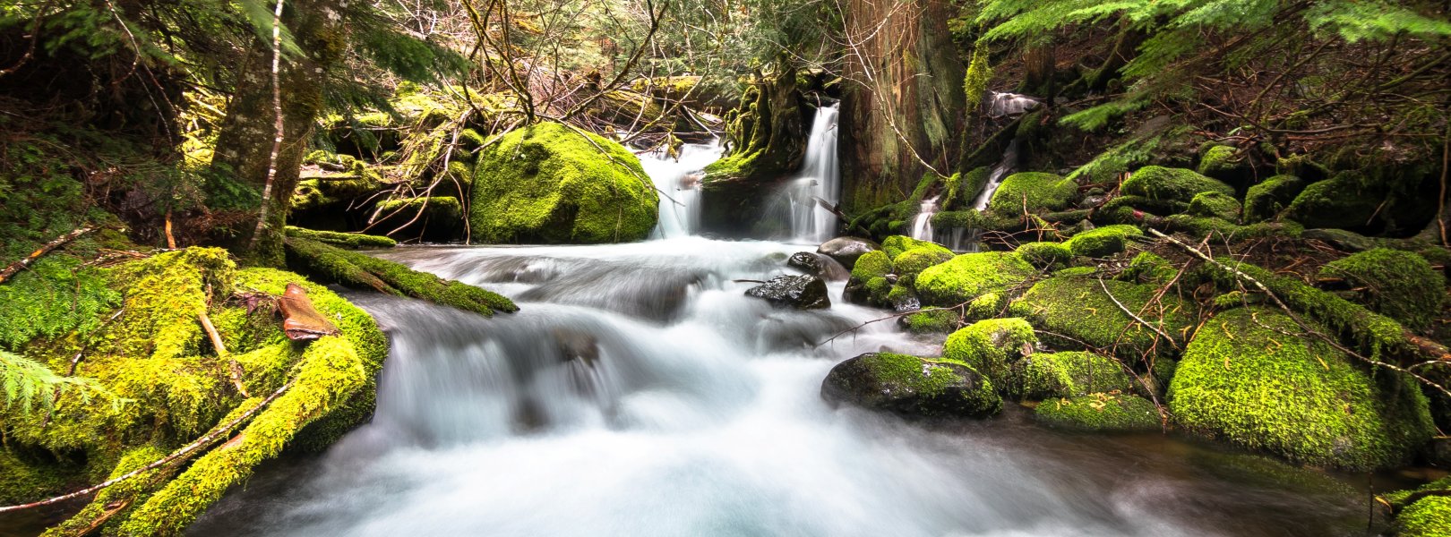
NSF NEON, Operated by Battelle

Main navigation

  • About Us
    • Overview
      • Spatial and Temporal Design
      • History
    • Vision and Management
    • Advisory Groups
      • Science, Technology & Education Advisory Committee
      • Technical Working Groups (TWGs)
    • FAQ
    • Contact Us
      • Contact NEON Biorepository
      • Field Offices
    • User Accounts
    • Staff
    • Code of Conduct

    About Us

  • Data & Samples
    • Data Portal
      • Explore Data Products
      • Data Availability Charts
      • Spatial Data & Maps
      • Document Library
      • API & GraphQL
      • Prototype Data
      • External Lab Data Ingest (restricted)
    • Data Themes
      • Biogeochemistry
      • Ecohydrology
      • Land Cover and Processes
      • Organisms, Populations, and Communities
    • Samples & Specimens
      • Discover and Use NEON Samples
        • Sample Types
        • Sample Repositories
        • Sample Explorer
        • Megapit and Distributed Initial Characterization Soil Archives
      • Sample Processing
      • Sample Quality
      • Taxonomic Lists
    • Collection Methods
      • Protocols & Standardized Methods
      • Airborne Remote Sensing
        • Flight Box Design
        • Flight Schedules and Coverage
        • Daily Flight Reports
          • AOP Flight Report Sign Up
        • Camera
        • Imaging Spectrometer
        • Lidar
      • Automated Instruments
        • Site Level Sampling Design
        • Sensor Collection Frequency
        • Instrumented Collection Types
          • Meteorology
          • Phenocams
          • Soil Sensors
          • Ground Water
          • Surface Water
      • Observational Sampling
        • Site Level Sampling Design
        • Sampling Schedules
        • Observation Types
          • Aquatic Organisms
            • Aquatic Microbes
            • Fish
            • Macroinvertebrates & Zooplankton
            • Periphyton, Phytoplankton, and Aquatic Plants
          • Terrestrial Organisms
            • Birds
            • Ground Beetles
            • Mosquitoes
            • Small Mammals
            • Soil Microbes
            • Terrestrial Plants
            • Ticks
          • Hydrology & Geomorphology
            • Discharge
            • Geomorphology
          • Biogeochemistry
          • DNA Sequences
          • Pathogens
          • Sediments
          • Soils
            • Soil Descriptions
        • Optimizing the Observational Sampling Designs
    • Data Notifications
    • Data Guidelines and Policies
      • Acknowledging and Citing NEON
      • Publishing Research Outputs
      • Usage Policies
    • Data Management
      • Data Availability
      • Data Formats and Conventions
      • Data Processing
      • Data Quality
      • Data Product Bundles
      • Data Product Revisions and Releases
        • Release 2021
        • Release 2022
        • Release 2023
        • Release 2024
        • Release-2025
      • NEON and Google
      • Externally Hosted Data

    Data & Samples

  • Field Sites
    • About Field Sites and Domains
    • Explore Field Sites
    • Site Management Data Product

    Field Sites

  • Impact
    • Observatory Blog
    • Case Studies
    • Papers & Publications
    • Newsroom
      • NEON in the News
      • Newsletter Archive
      • Newsletter Sign Up

    Impact

  • Resources
    • Getting Started with NEON Data & Resources
    • Documents and Communication Resources
      • Papers & Publications
      • Document Library
      • Outreach Materials
    • Code Hub
      • Code Resources Guidelines
      • Code Resources Submission
      • NEON's GitHub Organization Homepage
    • Learning Hub
      • Science Videos
      • Tutorials
      • Workshops & Courses
      • Teaching Modules
    • Research Support Services
      • Field Site Coordination
      • Letters of Support
      • Mobile Deployment Platforms
      • Permits and Permissions
      • AOP Flight Campaigns
      • Research Support FAQs
      • Research Support Projects
    • Funding Opportunities

    Resources

  • Get Involved
    • Advisory Groups
      • Science, Technology & Education Advisory Committee
      • Technical Working Groups
    • Upcoming Events
    • NEON Ambassador Program
      • Exploring NEON-Derived Data Products Workshop Series
    • Research and Collaborations
      • Environmental Data Science Innovation and Inclusion Lab
      • Collaboration with DOE BER User Facilities and Programs
      • EFI-NEON Ecological Forecasting Challenge
      • NEON Great Lakes User Group
      • NEON Science Summit
      • NCAR-NEON-Community Collaborations
        • NCAR-NEON Community Steering Committee
    • Community Engagement
      • How Community Feedback Impacts NEON Operations
    • Science Seminars and Data Skills Webinars
      • Past Years
    • Work Opportunities
      • Careers
      • Seasonal Fieldwork
      • Internships
        • Intern Alumni
    • Partners

    Get Involved

  • My Account
  • Search

Search

Field Sites

  • About Field Sites and Domains
  • Explore Field Sites
  • Site Management Data Product

Breadcrumb

  1. Field Sites
  2. McRae Creek NEON

Field Site

McRae Creek NEON / MCRA

blue circle white drop icon

Gradient Aquatic, OR, D16: Pacific Northwest

McRae Creek flows through the lush and mossy HJ Andrews Experimental Forest in central Oregon.

About Field Sites

McRae Creek (MCRA) is an aquatic NEON field site located within the H.J. Andrews Experimental Forest, 80 km (50 mi.) east of Eugene, OR in the Western Cascade Mountains. It is a third-order stream that drains a 3.93 km2 (970 acre) old-growth coniferous forested watershed. H.J. Andrews is a 64 km2 (15,800 acre) ecological research site that is administered by Oregon State University, the USDA Forest Service’s Pacific Northwest Research Station, and the Willamette National Forest. It has been a part of the National Science Foundation’s Long-Term Ecological Research Program since 1980. It mainly consists of dense forests filled with cedar, hemlock, and Douglas fir trees, many of which are at least 300 years old and can grow as high as 75 m (250 ft.). MCRA is located in NEON's Pacific Northwest Domain (D16), which is bounded by the Pacific on the west and Canada on the north. It includes the eastern halves of Washington and Oregon and parts of northern California. The Domain hosts three other field sites: one additional aquatic and two terrestrial. [1] [2]

Climate

Winters in H.J. Andrews are wet and mild with warm and dry summers. Mean annual temperature at MCRA is 8.8°C (48°F) and annual precipitation is approximately 2188 mm (86 in.). Multiple winter storms are caused by low-pressure zones brought in by the polar front jet stream. They are slowed by the Coast and Cascade mountain ranges, which lower storm intensity and prolong duration. The dry, warm weather in the summer is caused by a ridge of high pressure along the coast and eastern Pacific. [7] [8]

Geology

The geology of H.J. Andrews is characterized by miocene aged undifferentiated flows and clastic rocks of basalt and andesite. The substrate within the creek is dominated by boulders, with some patches of cobble. [1] [5]

Soils

The soils at MCRA are well-drained and a mixture of medial silty loam, cobbly loam, and gravelly medial loam. [6]

Hydrology

The flow regime of McRae Creek is considered stable and dominated by groundwater input. Base discharge typically increases in the fall, remains high during the winter, peaks in spring due to snowmelt, and decreases to annual lows during the summer dry season. Winter storms and snowmelt create high discharge events, with very rare zero-flow days in the summer months. [1]

Vegetation

The Western Cascades eco-region is almost exclusively covered in dense coniferous forests, with dominant tree species changing with elevation. Below 1200 m (4000 ft.), Douglas-fir and western hemlock are the most common trees. As elevation increases, Pacific silver fir, mountain hemlock and subalpine fir begin to dominate. Above 2100 m (7000 ft.), alpine parklands and dwarf shrubs become dominant as conditions become too harsh for tree growth. The riparian area adjacent to McRae Creek consists of mature western hemlock (Tsuga heterophylla) and Douglas fir (Pseudotsuga menziesii) dominating the over-story canopy. Groundcover consists of vine maple (Acer circinatum), Pacific yew (Taxus brevifolia), dogwood (Cornus nuttallii), and alder (Alnus rubra). Most mature trees are 60-90 m (200-300 ft.) tall, while groundcover is often thick in areas adjacent to the stream. [1] [3]

Fauna

The waterways of the Western Cascades are home to numerous fish, amphibians, and macroinvertebrates including coho salmon (Oncorhynchus kisutch) and rough skinned newt (Taricha granulosa). Within the streams of H.J. Andrews Experimental Forest, there are nine fish species: largescale sucker (Catostomus machrocheilus), mottled sculpin (Cottus bairdi), Paiute sculpin (Cottus beldingi), torrent sculpin (Cottus rhotheus), cutthroat trout (Oncorhyncus clarki), rainbow trout (Oncorhyncus mykiss), and Chinook salmon (Oncorhyncus tshawytscha). There are three amphibians: Cascade torrent salamander (Rhyacotriton cascadae), Pacific giant salamander (Dicamptodon tenebrosus), and tailed frog (Ascaphus truei). There are also approximately 90 species of macroinvertebrates. [2] [4]

Past Land Management and Use

H.J. Andrews was initially established as the Blue River Experimental Forest by the U.S. Forest Service in 1948. The name was changed in 1953 to honor Horace Justin Andrews, a U.S. Forest Service Region 6 Chief Forester, after he passed away during an automobile accident in 1951. Andrews was a strong supporter of forest research and helped select the location of the forest. H.J. Andrews was initially used to study possible improvements for forest operations, including forest regeneration and road engineering. Three experimental watersheds were created to study the effects of logging on hydrology, sediment yield, and nutrient loss. The watersheds were a clear-cut, partial cut, and an un-cut. The latter was left in its natural state as a control. In the 1970s, researchers from Oregon State University joined USFS scientists in new research topics that included nutrient fluxes, forest succession, disturbance ecology, and plant and animal diversity. Reference stands were also created for environmental monitoring. The forest became a member of the Long-term Ecological Research (LTER) Network in 1980, which led to the creation of new long-term studies that included landscape-level studies and different methods of ecosystem management. [2]

Current Land Management and Use

H.J. Andrews is administered cooperatively by the USDA Forest Service’s Pacific Northwest Research Station, Oregon State University and the Willamette National Forest. It has been a member of the Long-Term Ecological Research (LTER) Network since 1980. Most research at LTER sites is focused on how ecological processes change over long periods of time in relation to climate, management practices and other factors. At H.J. Andrews, research is focused on disturbance processes, landscape and water dynamics, carbon sequestration and fluxes, biological diversity, forest-stream interactions, spotted owl demography, soil and watershed processes, and cultural dimensions of forests and watersheds. [2]

NEON Site Establishment

Site characterization for McRae Creek began in October 2016 and establishment was completed in 2017. The aquatic observation system (AOS) began sampling in October 2017. The aquatic instrumentation system (AIS) began streaming in December 2017. The sampling strategy is based on hydrological data collected from nearby USGS hydrological monitoring locations in larger watersheds. The sampling strategy may not accurately represent the hydrologic conditions at this site and will be updated following annual data collections.

Additional Resources

[1] Aquatic Instrument System (AIS) Site Characterization Report: Domain 16. NEON.DOC.001856vB.

[2] HJ Andrews Experimental Forest: Long-Term Ecological Research. https://andrewsforest.oregonstate.edu/

[3] Oregon Conservation Strategy: West Cascades. https://www.oregonconservationstrategy.org/ecoregion/west-cascades/

[4] Tippery, S.E. & Jones, K.K. (2011). Amphibian Distribution in Wadeable Streams and Ponds in Western and Southeast Oregon, 2009-2010. Corvallis, OR: Oregon Department of Fish and Wildlife. Retrieved from https://www.dfw.state.or.us/conservationstrategy/docs/2011_Amphibian_Pr…

[5] U.S. Geological Survey, 2005, Mineral Resources Data System: U.S. Geological Survey, Reston, Virginia. https://mrdata.usgs.gov/mrds/

[6] USDA: Natural Resources Conservation Service. https://websoilsurvey.nrcs.usda.gov/app/WebSoilSurvey.aspx

[7] https://andrewsforest.oregonstate.edu/sites/default/files/lter/pubs/pdf…

[8] PRISM Climate Group, Oregon State University, http://prism.oregonstate.edu, created 4 Feb 2004.

[9] U.S. Fish and Wildlife Service. https://www.fws.gov/oregonfwo/articles.cfm?id=149489516

[10] Zouhar, K. (2013). Research Project Summary: Plant succession following clearcutting and slash burning in the western Cascade Range, Oregon. In: Fire Effects Information System, [Online]. U.S. Department of Agriculture, Forest Service, Rocky Mountain Research Station, Fire Sciences Laboratory (Producer). Available: www.fs.fed.us/database/feis/research_project_summaries/HJ_Andrews/all.h… [2020, May 22].

Field Site Information

Latitude/Longitude

44.259598, -122.16555

Geodetic Datum

WGS84

Location

Linn County
OR, US

Elevation

Mean: 876m

Mean Annual Temperature

8.8°C

Dominant NLCD Classes

Evergreen Forest

Colocated Research

Andrews Forest LTER
HJ Andrews Experimental Forest
Oregon State University
H.J. Andrews Experimental Forest National Atmospheric Deposition Program

Field Operations Office

1211 SE Cardinal Court, Suite 120
Vancouver, WA 98683

Research Access

Non-NEON research activities are allowed in this area. Researchers must obtain their own permits with the site host(s).

Request Access

Observation Types

Remote Sensing

Remote sensing surveys of this field site collect lidar, spectrometer and high-resolution RGB camera data.

Meteorological Measurements

This site has one meteorological station located in the riparian area. The met station is outfitted with a subset of the same sensors used at terrestrial sites. Measurements include wind speed and direction, air temperature, barometric pressure, relative humidity, shortwave radiation, and PAR.

Phenocams

A phenocam is pointed toward the land-water interface of the site. Here we show the images from the most recent hour. The full collection of images can be viewed on the Phenocam Gallery - click on the image below.

NEON.D16.MCRA.DP1.20002


Field Site Data

Site

Site Host

US Forest Service; Oregon State University

Site Access Allowed

Yes

Site URL

https://andrewsforest.oregonstate.edu/

Site Access Details

Researchers should coordinate directly with the US Forest Service and HJ Andrews Experimental Forest for permitting and approval.

Operations Office

NEON Field Operations Office

Domain 16 Support Facility

NEON Field Operations Address

1211 SE Cardinal Court, Suite 120
Vancouver, WA 98683

NEON Field Operations Phone

360.566.2857

Location

Latitude

44.259598

Longitude

-122.16555

Geodetic Datum

WGS84

UTM Northing

4901044.97m

UTM Easting

566608.63m

UTM Zone

10N

County

Linn

State

OR

Country

US

Mean Elevation

876m

Climate

Mean Annual Temperature

8.8°C

Mean Annual Precipitation

2188mm

Vegetation

Dominant NLCD Classes

Evergreen Forest

Watershed

USGS HUC

h17090004

Watershed Name

Mckenzie

Geology

USGS Geology Unit

ORTfc;0

USGS Geology Name

Flows and clastic rocks, undifferentiated

USGS Lithologic Constituents

Chiefly basaltic andesite and andesite lava flows and flow breccia.

USGS Geology Age

Miocene


Gallery

  • Photos
  • Videos

No Video


Related Field Sites

Other Domain D16 Field Sites

brown circle white drop icon Abby Road NEON
Gradient Terrestrial
blue square white drop icon Martha Creek NEON
Core Aquatic
brown square white mountain icon Wind River Experimental Forest NEON
Core Terrestrial
NSF NEON, Operated by Battelle

Follow Us:

Join Our Newsletter

Get updates on events, opportunities, and how NEON is being used today.

Subscribe Now

Footer

  • About Us
  • Newsroom
  • Contact Us
  • Terms & Conditions
  • Careers
  • Code of Conduct

Copyright © Battelle, 2025

The National Ecological Observatory Network is a major facility fully funded by the U.S. National Science Foundation.

Any opinions, findings and conclusions or recommendations expressed in this material do not necessarily reflect the views of the U.S. National Science Foundation.