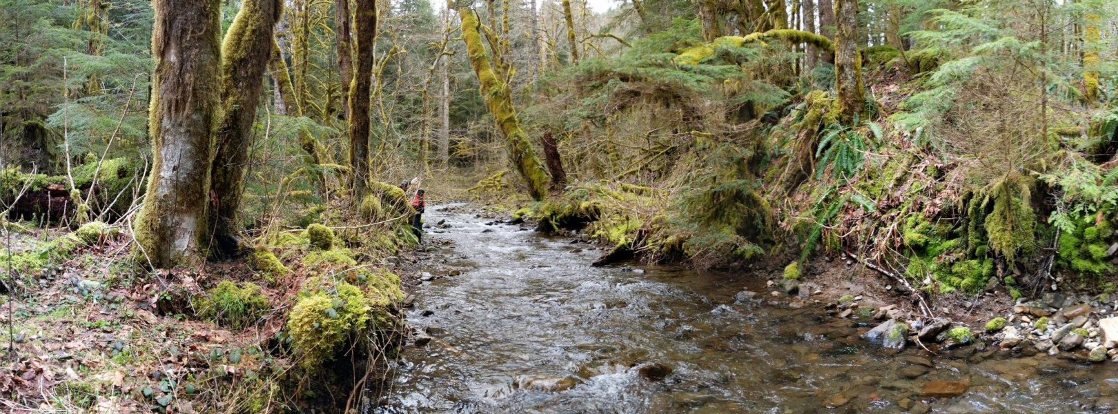
NSF NEON, Operated by Battelle

Main navigation

  • About
    • NEON Overview
      • Vision and Management
      • Spatial and Temporal Design
      • History
    • About the NEON Biorepository
      • ASU Biorepository Staff
      • Contact the NEON Biorepository
    • Observatory Blog
    • Newsletters
    • Staff
    • FAQ
    • Contact Us

    About

  • Data
    • Data Portal
      • Data Availability Charts
      • API & GraphQL
      • Prototype Data
      • Externally Hosted Data
    • Data Collection Methods
      • Airborne Observation Platform (AOP)
      • Instrument System (IS)
        • Instrumented Collection Types
        • Aquatic Instrument System (AIS)
        • Terrestrial Instrument System (TIS)
      • Observational System (OS)
        • Observation Types
        • Observational Sampling Design
        • Sampling Schedules
        • Taxonomic Lists Used by Field Staff
        • Optimizing the Observational Sampling Designs
      • Protocols & Standardized Methods
    • Getting Started with NEON Data
      • neonUtilities for R and Python
      • Learning Hub
      • Code Hub
    • Using Data
      • Data Formats and Conventions
      • Released, Provisional, and Revised Data
      • Data Product Bundles
      • Usage Policies
      • Acknowledging and Citing NEON
      • Publishing Research Outputs
    • Data Notifications
    • NEON Data Management
      • Data Availability
      • Data Processing
      • Data Quality

    Data

  • Samples & Specimens
    • Biorepository Sample Portal at ASU
    • About Samples
      • Sample Types
      • Sample Repositories
      • Megapit and Distributed Initial Characterization Soil Archives
    • Finding and Accessing Sample Data
      • Species Checklists
      • Sample Explorer - Relationships and Data
      • Biorepository API
    • Requesting and Using Samples
      • Loans & Archival Requests
      • Usage Policies

    Samples & Specimens

  • Field Sites
    • Field Site Map and Info
    • Spatial Layers & Printable Maps

    Field Sites

  • Resources
    • Getting Started with NEON Data
    • Research Support Services
      • Field Site Coordination
      • Letters of Support
      • Mobile Deployment Platforms
      • Permits and Permissions
      • AOP Flight Campaigns
      • Research Support FAQs
      • Research Support Projects
    • Code Hub
      • neonUtilities for R and Python
      • Code Resources Guidelines
      • Code Resources Submission
      • NEON's GitHub Organization Homepage
    • Learning Hub
      • Tutorials
      • Workshops & Courses
      • Science Videos
      • Teaching Modules
    • Science Seminars and Data Skills Webinars
    • Document Library
    • Funding Opportunities

    Resources

  • Impact
    • Research Highlights
    • Papers & Publications
    • NEON in the News

    Impact

  • Get Involved
    • Upcoming Events
    • Research and Collaborations
      • Environmental Data Science Innovation and Inclusion Lab
      • Collaboration with DOE BER User Facilities and Programs
      • EFI-NEON Ecological Forecasting Challenge
      • NEON Great Lakes User Group
      • NCAR-NEON-Community Collaborations
    • Advisory Groups
      • Science, Technology & Education Advisory Committee
      • Technical Working Groups
    • NEON Ambassador Program
      • Exploring NEON-Derived Data Products Workshop Series
    • Partnerships
    • Community Engagement
    • Work Opportunities

    Get Involved

  • My Account
  • Search

Search

Field Sites

  • Field Site Map and Info
  • Spatial Layers & Printable Maps

Breadcrumb

  1. Field Sites
  2. Martha Creek NEON

Field Site

Martha Creek NEON / MART

blue square white drop icon

Core Aquatic, WA, D16: Pacific Northwest

 Martha Creek (MART) aquatic site in Washington

About Field Sites

Martha Creek (MART) is an aquatic NEON field site located just north of the Columbia River Gorge in Gifford Pinchot National Forest. Martha Creek is a third-order wadeable stream that drains a 6.34 km2 (1570 acre) watershed and is a tributary of Trout Creek. The land is managed by the U.S. Forest Service. The watershed is dominated by old-growth coniferous forest and is designated a Tier I Key Watershed in the Northwest Forest Plan due to its importance in supporting threatened native fish populations. The 2012 removal of a dam to improve fish passage in the creek allows for the study of aquatic habitat restoration. MART is located in NEON's Pacific Northwest Domain (D16), which is bounded by the Pacific on the west and Canada on the north. It includes the eastern halves of Washington and Oregon and parts of northern California. The Domain hosts three other field sites: one additional aquatic and two terrestrial. MART is near the WREF terrestrial site. [1] [2]

Climate

Martha Creek’s climate is largely determined by its proximity to the Pacific Ocean and the Columbia River Gorge, with secondary orographic lifting effects from the Cascade Range. The area experiences strong winds in any season, and cold air draining into the valley can bring frosts almost any time of year. Warm and dry conditions dominate the summer months, whereas winters are characterized by cool, wet weather. Precipitation occurs as rain or snow during fall, winter, and spring, with annual accumulation averaging about 2328 mm (91.7 in.). The average annual temperature is 9.6°C (49°F). Interannual variation plays a major role in yearly precipitation levels; the El Niño Southern Oscillation is a driving force behind warmer, drier years, which leads to an increased chance of drought and wildfires. [3] [8] [9]

Geology

Martha Creek’s geology is primarily volcanic, featuring basalt and andesite bedrock with colluvial and glacial till. [3] [4]

Soils

The substrate in Martha Creek is dominated by cobbles, including riffles and pool habitats. [1]

Hydrology

Martha Creek’s drainage is largely in the “rain-on-snow” elevation zone, where alternating periods of snow accumulation and snowmelt are common throughout the winter. As a result, streamflow in Martha Creek typically peaks in response to these events in the late fall, winter, and spring, and decreases to annual lows during the summer dry season. [1] [2]

Vegetation

The mild, wet climate of lowland valleys in the Western Cascades promotes the growth of dense western hemlock-Douglas fir forests which give way to mountain hemlock, noble fir and Pacific silver fir at higher elevations. The riparian area at Martha Creek consists of mixed deciduous forest of red alder (Alnus rubra), Pacific dogwood (Cornus nuttallii), and large conifers including Western hemlock (Tsuga heterophylla) and Pacific silver fir (Abies amabilis). Some areas of the stream bank have dense growth of understory shrubs and devil’s club (Oplopanax horridus). [1] [5]

Fauna

The old growth forests surrounding Martha Creek host many species that serve as indicators of forest health including the threatened northern spotted owl (Strix occidentalis caurina). The creek itself is home to frogs, mollusks, and salamanders and provides critical habitat for anadromous fish, particularly the Lower Columbia River steelhead (Oncorhynchus mykiss). [2]

Past Land Management and Use

Martha Creek and the adjacent Wind River Experimental Forest (WREF) share a rich history dating back to 1909, when water from the creek was diverted to irrigate the experimental site’s initial nurseries. The continued expansion of the nurseries and support facilities at Wind River prompted calls for improvements to the existing irrigation, and in 1924 a 12 m (40 ft.) concrete dam was built across the creek that could provide water even during dry summer months. Martha Creek continued providing water for the site until it was replaced by a new water system on Trout Creek in 1933; however, Martha Creek water continued to supply the administrative buildings with water until a well was constructed in 1948. By the 1950’s, the dam was abandoned, and by the end of the century, coarse sediment had filled many of the channels upstream of the dam. In 2012, as part of a series of dam removals in the Wind River watershed, Martha Creek’s dam was removed, allowing the creek to run unimpeded for the first time in 88 years. [2] [6]

Current Land Management and Use

Together with Wind River Experimental Forest (WREF), Martha Creek serves as a major center for ecological research in Pacific Northwest forests, and accommodates a variety of long term ecological studies. Managed by the U.S. Forest Service as part of its Pacific Northwest Research Station, the site hosts collaborators including the U.S. Department of Energy, the Environmental Protection Agency, Smithsonian Institution, and universities across the western United States. Research at Martha Creek focuses on pollutant monitoring, nutrient cycling, biological diversity, ecosystem function, and the testing of remote sensing equipment. Martha Creek continues to provide valuable data about aquatic habitat protection and restoration in the wake of its dam removal. [7]

NEON Site Establishment

MART’s site characterization began in February 2017, and was completed by early November. By February 2018, the site’s aquatic instrument system (AIS) began streaming data, and by June 2018 the aquatic observation system commenced sampling.

Additional Resources

[1] Aquatic Instrument System (AIS) Site Characterization Report: Domain 16. NEON.DOC.001856vB.

[2] Coffin, Bengt. Environmental Assessment: Fish Passage at Martha Creek Dam; USDA Forest Service, Mt Adams Ranger District, Gifford Pinchot National Forest. 2011

[3] https://www.fs.usda.gov/pnw/experimental-forests-and-ranges/wind-river-…

[4] U.S. Geological Survey, 2005, Mineral Resources Data System: U.S. Geological Survey, Reston, Virginia. https://mrdata.usgs.gov/mrds/

[5] Oregon State University Ecoregions of Oregon; http://people.oregonstate.edu/~muirp/FuelsReductionSWOregon/ToolsResour…

[6] Florip, Eric. Forgotten Martha Creek Dam Removed; The Columbian. August 28, 2012

[7] https://www.fs.fed.us/pnw/pubs/brochures/wind-river-print.pdf

[8] PRISM Climate Group., Oregon State University, http://prism.oregonstate.edu, created 4 Feb 2004.

[9] https://www.fs.fed.us/pnw/pubs/pnw_gtr977.pdf

Field Site Information

Latitude/Longitude

45.790835, -121.933788

Geodetic Datum

WGS84

Location

Skamania County
WA, US

Elevation

Mean: 337m

Mean Annual Temperature

9.6°C

Dominant NLCD Classes

Evergreen Forest

Colocated Research

Wind River Experimental Forest

Field Operations Office

1211 SE Cardinal Court, Suite 120
Vancouver, WA 98683

Research Access

If your proposed research requires access to field sites where NEON is present, we can help.

Request Access

Observation Types

Remote Sensing

Remote sensing surveys of this field site collect lidar, spectrometer and high-resolution RGB camera data.

Meteorological Measurements

This site has one meteorological station located in the riparian area. The met station is outfitted with a subset of the same sensors used at terrestrial sites. Measurements include wind speed and direction, air temperature, barometric pressure, relative humidity, shortwave radiation, and PAR.

Phenocams

A phenocam is pointed toward the land-water interface of the site. Here we show the images from the most recent hour. The full collection of images can be viewed on the Phenocam Gallery - click on the image below.

NEON.D16.MART.DP1.20002


Field Site Data

Site

Site Host

Gifford Pinchot National Forest

Site URL

https://www.fs.usda.gov/r06/giffordpinchot

Site Access Details

Please coordinate with the US Forest Service site host to submit a site research permit. The NEON Domain Manager can provide up-to-date contact information. There are on-going research projects to be aware of at site. NOAA permit may also be required to due sensitive fish species in stream.

Site Host

Pacific Northwest Research Station

Site URL

https://www.fs.usda.gov/pnw/

Site Access Details

Please coordinate with the US Forest Service site host to submit a site research permit. The NEON Domain Manager can provide up-to-date contact information. There are on-going research projects to be aware of at site. NOAA permit may also be required to due sensitive fish species in stream.

Operations Office

NEON Field Operations Office

Domain 16 Support Facility

NEON Field Operations Address

1211 SE Cardinal Court, Suite 120
Vancouver, WA 98683

NEON Field Operations Phone

360.566.2857

Location

Latitude

45.790835

Longitude

-121.933788

Geodetic Datum

WGS84

UTM Northing

5071408.75m

UTM Easting

583011.25m

UTM Zone

10N

County

Skamania

State

WA

Country

US

Mean Elevation

337m

Climate

Mean Annual Temperature

9.6°C

Mean Annual Precipitation

2329mm

Vegetation

Dominant NLCD Classes

Evergreen Forest

Watershed

USGS HUC

h17070105

Watershed Name

Middle Columbia-Hood

Geology

USGS Geology Unit

WAQv;0

USGS Geology Name

Pleistocene-Recent volcanic rocks

USGS Lithologic Constituents

Predominantly dark-gray to black vesicular basalt; olivine-rich in part. Includes andesite flows and pyroclastic rocks.

USGS Geology Age

Pleistocene to Holocene


Gallery

  • Photos
  • Videos

No Video


Related Field Sites

Other Domain D16 Field Sites

brown circle white drop icon Abby Road NEON
Gradient Terrestrial
blue circle white drop icon McRae Creek NEON
Gradient Aquatic
brown square white mountain icon Wind River Experimental Forest NEON
Core Terrestrial

Other Field Sites in WA

brown circle white drop icon Abby Road NEON
Gradient Terrestrial
brown square white mountain icon Wind River Experimental Forest NEON
Core Terrestrial
NSF NEON, Operated by Battelle

Follow Us:

Join Our Newsletter

Get updates on events, opportunities, and how NEON is being used today.

Subscribe Now

Footer

  • About Us
  • Contact Us
  • Terms & Conditions
  • Careers
  • Code of Conduct

Copyright © Battelle, 2026

The National Ecological Observatory Network is a major facility fully funded by the U.S. National Science Foundation.

Any opinions, findings and conclusions or recommendations expressed in this material do not necessarily reflect the views of the U.S. National Science Foundation.