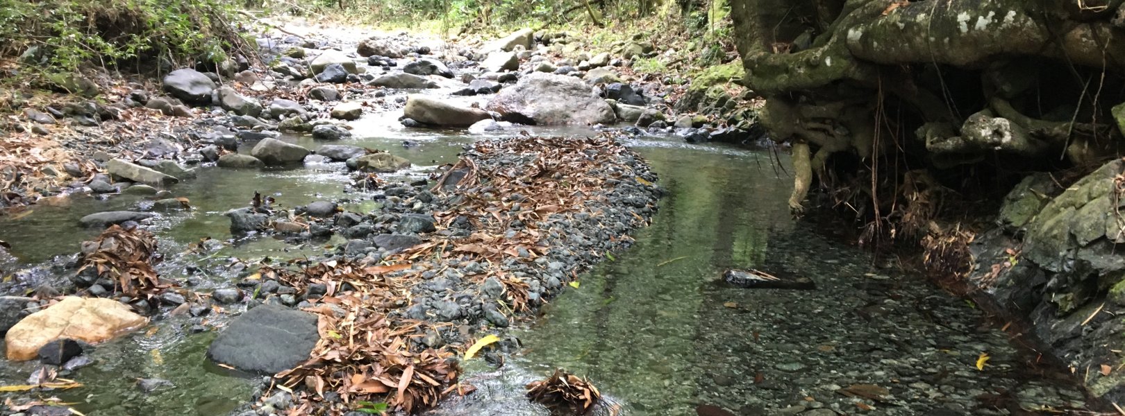
NSF NEON, Operated by Battelle

Main navigation

  • About Us
    • Overview
      • Spatial and Temporal Design
      • History
    • Vision and Management
    • Advisory Groups
      • Science, Technology & Education Advisory Committee
      • Technical Working Groups (TWGs)
    • FAQ
    • Contact Us
      • Contact NEON Biorepository
      • Field Offices
    • User Accounts
    • Staff
    • Code of Conduct

    About Us

  • Data & Samples
    • Data Portal
      • Explore Data Products
      • Data Availability Charts
      • Spatial Data & Maps
      • Document Library
      • API & GraphQL
      • Prototype Data
      • External Lab Data Ingest (restricted)
    • Data Themes
      • Biogeochemistry
      • Ecohydrology
      • Land Cover and Processes
      • Organisms, Populations, and Communities
    • Samples & Specimens
      • Discover and Use NEON Samples
        • Sample Types
        • Sample Repositories
        • Sample Explorer
        • Megapit and Distributed Initial Characterization Soil Archives
      • Sample Processing
      • Sample Quality
      • Taxonomic Lists
    • Collection Methods
      • Protocols & Standardized Methods
      • Airborne Remote Sensing
        • Flight Box Design
        • Flight Schedules and Coverage
        • Daily Flight Reports
          • AOP Flight Report Sign Up
        • Camera
        • Imaging Spectrometer
        • Lidar
      • Automated Instruments
        • Site Level Sampling Design
        • Sensor Collection Frequency
        • Instrumented Collection Types
          • Meteorology
          • Phenocams
          • Soil Sensors
          • Ground Water
          • Surface Water
      • Observational Sampling
        • Site Level Sampling Design
        • Sampling Schedules
        • Observation Types
          • Aquatic Organisms
            • Aquatic Microbes
            • Fish
            • Macroinvertebrates & Zooplankton
            • Periphyton, Phytoplankton, and Aquatic Plants
          • Terrestrial Organisms
            • Birds
            • Ground Beetles
            • Mosquitoes
            • Small Mammals
            • Soil Microbes
            • Terrestrial Plants
            • Ticks
          • Hydrology & Geomorphology
            • Discharge
            • Geomorphology
          • Biogeochemistry
          • DNA Sequences
          • Pathogens
          • Sediments
          • Soils
            • Soil Descriptions
        • Optimizing the Observational Sampling Designs
    • Data Notifications
    • Data Guidelines and Policies
      • Acknowledging and Citing NEON
      • Publishing Research Outputs
      • Usage Policies
    • Data Management
      • Data Availability
      • Data Formats and Conventions
      • Data Processing
      • Data Quality
      • Data Product Bundles
      • Data Product Revisions and Releases
        • Release 2021
        • Release 2022
        • Release 2023
        • Release 2024
        • Release-2025
      • NEON and Google
      • Externally Hosted Data

    Data & Samples

  • Field Sites
    • About Field Sites and Domains
    • Explore Field Sites
    • Site Management Data Product

    Field Sites

  • Impact
    • Observatory Blog
    • Case Studies
    • Papers & Publications
    • Newsroom
      • NEON in the News
      • Newsletter Archive
      • Newsletter Sign Up

    Impact

  • Resources
    • Getting Started with NEON Data & Resources
    • Documents and Communication Resources
      • Papers & Publications
      • Document Library
      • Outreach Materials
    • Code Hub
      • Code Resources Guidelines
      • Code Resources Submission
      • NEON's GitHub Organization Homepage
    • Learning Hub
      • Science Videos
      • Tutorials
      • Workshops & Courses
      • Teaching Modules
    • Research Support Services
      • Field Site Coordination
      • Letters of Support
      • Mobile Deployment Platforms
      • Permits and Permissions
      • AOP Flight Campaigns
      • Research Support FAQs
      • Research Support Projects
    • Funding Opportunities

    Resources

  • Get Involved
    • Advisory Groups
      • Science, Technology & Education Advisory Committee
      • Technical Working Groups
    • Upcoming Events
    • NEON Ambassador Program
      • Exploring NEON-Derived Data Products Workshop Series
    • Research and Collaborations
      • Environmental Data Science Innovation and Inclusion Lab
      • Collaboration with DOE BER User Facilities and Programs
      • EFI-NEON Ecological Forecasting Challenge
      • NEON Great Lakes User Group
      • NEON Science Summit
      • NCAR-NEON-Community Collaborations
        • NCAR-NEON Community Steering Committee
    • Community Engagement
      • How Community Feedback Impacts NEON Operations
    • Science Seminars and Data Skills Webinars
      • Past Years
    • Work Opportunities
      • Careers
      • Seasonal Fieldwork
      • Internships
        • Intern Alumni
    • Partners

    Get Involved

  • My Account
  • Search

Search

Field Sites

  • About Field Sites and Domains
  • Explore Field Sites
  • Site Management Data Product

Breadcrumb

  1. Field Sites
  2. Río Cupeyes NEON

Field Site

Río Cupeyes NEON / CUPE

blue square white drop icon

Core Aquatic, PR, D04: Atlantic Neotropical

A biological habitat unit that transitions from a riffle to pool (D04 CUPE).

About Field Sites

Río Cupeyes (CUPE) is an aquatic NEON field site located in southwestern Puerto Rico. Río Cupeyes is managed by the Department of Natural and Environmental Resources (el Departamento de Recursos Naturales y Ambientales, DRNA) under delegation from the Commonwealth of Puerto Rico. This is a 2nd-order wadeable stream and tributary of Río Guanijibo. The watershed is a 4.26 km2 (1053 acre) catchment comprised of old- and secondary-growth subtropical moist and subtropical wet forest. The NEON reach is located in a montane area with steep slopes where landslides may occasionally occur. Although the vegetation adjacent to the stream reach is dense and the stream exhibits a steep gradient, the channel is relatively free of vegetation and is stabilized by large boulders. It is considered a Type 2 Heritage River (Río Patrimonial), a relatively pristine body of water originating within the DRNA-protected State Forest of Maricao (el Bosque Estatal de Maricao). This location is part of the NEON Atlantic Neotropical Domain (D04), which includes the island of Puerto Rico and the southern tip of Florida. The Domain includes two terrestrial field sites and one additional aquatic field site. [1] [7]

Climate

Wet and dry seasons govern climate patterns in Maricao, Puerto Rico. Average precipitation is 50-100 mm (2-4 in.) during the dry season, and precipitation during the wet season exhibits a bi-modal pattern with increasing precipitation during April and May, a typical decrease in June, and increasing precipitation again through October. The average annual precipitation is 1168mm (46 in.) and the average annual temperature is 25°C (77°F). Extreme weather events, such as tropical storms or hurricanes, typically occur between June and December. [7] [9]

Geology

Parent material for Río Cupeyes is serpentinite, derived from ultramafic bedrock. [6] [7] [8]

Soils

The watershed is comprised of shallow, excessively drained serpentine soils derived from ultramafic bedrock, which exhibit low calcium/magnesium ratios; low nitrogen, potassium, and phosphorus; and high concentrations of nickel and chromium. These are generally considered poor agricultural soils, with poor fertility and low water-holding capacity. Interestingly, these clay soils are capable of absorbing unusually large amounts of water, but are unable to retain the moisture due to unique physical properties. Soils remain dry despite an abundance of rain. [2] [6] [7]

Hydrology

The flow regime is typical of Puerto Rican streams with watersheds comprised of subtropical moist and wet forests. Discharge occurs in strong, seasonal patterns with low flows during the mid- to late- dry season (December through March) and baseflow discharge 2-3 times higher during the annual wet season (May through November). Tropical storms or hurricanes, typically between June and December, may lead to extreme high flow events along this stream. Although much of the channel substrate consists of small particles that are likely to be displaced during high discharge events, large and relatively immobile boulders are ubiquitous along the channel margins. Substrate composition of the stream is a heterogeneous mix of sand, cobble, pebble, large boulder, and large areas of exposed bedrock. [7]

Vegetation

Forest cover consists of mature, mostly second-growth wet subtropical forest. Dominant tree species in the riparian zone include caimitillo (Micropholis chrysophylloides), white cogwood (Homalium racemosum), roble colorado (Tabebuia schumanniana), mango (Mangifera spp.), and Stahl's stopper (Eugenia stahlii). Undercover growth consists of dense stands of shrubs, small trees, and vines. It is common that thick vine masses descend from the canopy directly into the stream channel. [7]

Fauna

Aquatic fauna include many species of fish and freshwater crustaceans, including the freshwater shrimp (Xiphocaris elongata) and the freshwater crab (Epilobocera cinuatifrons). The Maricao Forest and Río Cupeyes watershed are home to many species of amphibians and reptiles, including the Puerto Rican Boa (Epicrates inornatus) and lizards of the genus Anolis. The watershed is also home to a variety of invertebrates, including tree snails (Caracolus caracolla), termites, and stinging wasps. [7]

Past Land Management and Use

Forest conservation has been recognized as an important resource for the protection of rivers and streams. Wet montane ecosystems were determined to be areas of special value to the public, starting with the Spanish in the late 19th century and later reinforced by U.S. policy for conservation and land management. Puerto Rico experienced a decline in forested area in the early 20th century, to as low as 6% forest cover in the 1940s. Cropland and pasture, primarily coffee plantations, made up 42% of the landscape at this time. Forest cover once again began to increase as many people migrated to the U.S. mainland and coastal cities as a result of Operation Bootstrap's effort to industrialize Puerto Rico. The newly forested regions were primarily private property, and the Department of Natural and Environmental Resources (DNER) has worked to expand protected regions to 15% through land acquisition programs, conservation easements and trainings for sustainable agroforestry practices.

Puerto Rican infrastructure and forest structure are periodically disrupted by hurricanes and wildfires, and other DNER-recognized threats include invasive species, pests and diseases, forest fragmentation and climate change. Hurricanes Irma and Maria in 2017 devastated Puerto Rico's infrastructure, both human and natural. While natural ecosystems are recovering from defoliation, it will take longer for forest structure to be rebuilt. Hurricane Hugo in 1989 caused wide destruction of trees and resulted in altered forest composition and changes in growth rates in affected areas. [4] [5]

Current Land Management and Use

The Commonwealth of Puerto Rico has delegated management of Río Cupeyes to the Department of Natural and Environmental Resources (Departamento de Recursos Naturales y Ambientales, DRNA). By administrative order of DRNA Secretary Guerrero Pérez, Río Cupeyes was incorporated into the Heritage River Program (el Programa de Ríos Patrimoniales), which protects rivers and streams with natural and relatively pristine attributes. Río Cupeyes passes through the State Forest of Maricao (el Bosque Estatal de Maricao), a high-altitude forest established in 1919 by Governor Arthur Yager. The mission of the DRNA, with respect to the State Forest of Maricao (el Bosque Estatal de Maricao), is to protect, conserve and manage natural and environmental resources for future generations to enjoy and obtain a better quality of life. The goal of conservation in this forest is to minimize habitat loss and fragmentation, with a focus on restoration or conservation of existing corridors. [1] [2] [3]

NEON Site Establishment

NEON site establishment at CUPE began in January 2015 with a site survey, which generated a site characterization report (NEON.DOC.001648). Reaches were established by June 2015, and a dry run of operations ran through September 2016, when the site transitioned to full operation. The aquatic instrumentation system came online in August 2018. [7]

Additional Resources

[1] Orden Administrativa 2016 - 07. Programa Ríos Patrimoniales de Puerto Rico. Comisión Estatal de Elecciones, CEE-SA-16-11450. .

[2] Ventosa-Febles, E. A., Camacho Rodríguez, M., Chabert Llompart, J. L., Sustache Sustache, J., & Dávila Casanova, D. (2005). Maricao State Forest, Mayagüez-San Germán-Maricao-Sabana Grande, Puerto Rico. In Puerto Rico Critical Wildlife Areas, pp. 271-275. Commonwealth of Puerto Rico, Department of Natural and Environmental Resources, Bureau of Fish and Wildlife, Terrestrial Resources Division. https://www.yumpu.com/en/document/view/16447049/puerto-rico-critical-wi…-

[3] Bosques de Puerto Rico: Bosque Estatal de Maricao. (Aug 2008). Hojas de Nuestro Ambiente: Estado Libre Asociado de Puerto Rico Departamento de Recursos Naturales y Ambientales, P-031. drna.pr.gov/wp-content/uploads/2015/04/El-Bosque-Estatal-de-Maricao.pdf

[4] Department of Natural and Environmental Resources. (2010). Puerto Rico statewide assessment and strategies for forest resources. Government of Puerto Rico. https://estadisticas.pr/files/BibliotecaVirtual/estadisticas/biblioteca…

[5] Forest Service International Institute of Tropical Forestry. (2019). A comprehensive inventory of protected areas and other land conservation mechanisms in Puerto Rico. United States Department of Agriculture. https://data.fs.usda.gov/research/pubs/iitf/iitf_gtr_50_eng_lowres.pdf

[6] SanClements, M., Lee, R.H., Ayres, E.D., Goodman, K., Jones, M., Durden, D., Thibault, K., Zulueta, R., Roberti, J., Lunch, C., & Gallo, A. (2020) Collaborating with NEON, BioScience 70 (2), 107-107, https://doi.org/10.1093/biosci/biaa005

[7] Aquatic Instrument System (AIS) Site Characterization Report: Domain 04. NEON.DOC.001648vC

[8] U.S. Geological Survey, 2005, Mineral Resources Data System: U.S. Geological Survey, Reston, Virginia. https://mrdata.usgs.gov/mrds/

[9] PRISM Climate Group, Oregon State University, http://prism.oregonstate.edu, created 4 Feb 2004.

Field Site Information

Latitude/Longitude

18.11352, -66.98676

Geodetic Datum

WGS84

Location

San German Municipio County
PR, US

Elevation

Mean: 157m

Dominant NLCD Classes

Evergreen Forest

Field Operations Office

45 Carr Ochoa
Guanica, Puerto Rico 00653

Research Access

Non-NEON research activities are allowed in this area. Researchers must obtain their own permits with the site host(s).

Request Access

Observation Types

Remote Sensing

Remote sensing surveys of this field site collect lidar, spectrometer and high-resolution RGB camera data.

Meteorological Measurements

This site has a meteorological station located in the riparian area. The met station is outfitted with a subset of the same sensors used at terrestrial sites. Measurements include wind speed and direction, air temperature, barometric pressure, relative humidity, shortwave radiation, and PAR.

Phenocams

A phenocam is pointed toward the land-water interface of the site. Here we show the images from the most recent hour. The full collection of images can be viewed on the Phenocam Gallery - click on the image below.

NEON.D04.CUPE.DP1.20002


Field Site Data

Site

Site Host

Commonwealth of Puerto Rico

Site Access Allowed

Limited

Site Access Details

Please note this area is an active farm. Research activities are limited and must not interfere with farming activites; gates must remain closed at all times to avoid cattle walking out. Start permitting > 6 months prior to scheduled start.

Site Host

Private (access)

Site Access Allowed

Limited

Site Access Details

Please note this area is an active farm. Research activities are limited and must not interfere with farming activites; gates must remain closed at all times to avoid cattle walking out. Start permitting > 6 months prior to scheduled start.

Operations Office

NEON Field Operations Office

Domain 04 Support Facility

NEON Field Operations Address

45 Carr Ochoa
Guanica, Puerto Rico 00653

NEON Field Operations Phone

787.821.1214

Location

Latitude

18.11352

Longitude

-66.98676

Geodetic Datum

WGS84

UTM Northing

2003908.95m

UTM Easting

713025.68m

UTM Zone

19N

County

San German Municipio

State

PR

Country

US

Mean Elevation

157m

Vegetation

Dominant NLCD Classes

Evergreen Forest

Watershed

USGS HUC

h21010003

Watershed Name

Culebrinas-Guanajibo

Geology

USGS Geology Unit

KJs

USGS Geology Name

Serpentinite

USGS Lithologic Constituents

Sheared light- to dark-green, serpentinite; chiefly altered harzburgite

USGS Geology Age

Cretaceous to Pre-Cretaceous (?)


Gallery

  • Photos
  • Videos

Related Field Sites

Other Domain D04 Field Sites

brown square white mountain icon Guanica Forest NEON
Core Terrestrial
brown circle white drop icon Lajas Experimental Station NEON
Gradient Terrestrial
blue circle white drop icon Río Yahuecas NEON
Gradient Aquatic

Other Field Sites in PR

brown square white mountain icon Guanica Forest NEON
Core Terrestrial
brown circle white drop icon Lajas Experimental Station NEON
Gradient Terrestrial
blue circle white drop icon Río Yahuecas NEON
Gradient Aquatic
NSF NEON, Operated by Battelle

Follow Us:

Join Our Newsletter

Get updates on events, opportunities, and how NEON is being used today.

Subscribe Now

Footer

  • About Us
  • Newsroom
  • Contact Us
  • Terms & Conditions
  • Careers
  • Code of Conduct

Copyright © Battelle, 2025

The National Ecological Observatory Network is a major facility fully funded by the U.S. National Science Foundation.

Any opinions, findings and conclusions or recommendations expressed in this material do not necessarily reflect the views of the U.S. National Science Foundation.