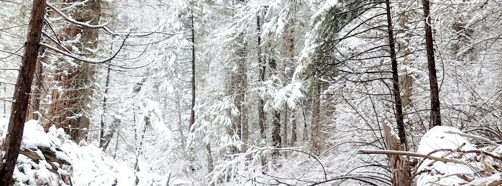
NSF NEON, Operated by Battelle

Main navigation

  • About Us
    • Overview
      • Spatial and Temporal Design
      • History
    • Vision and Management
    • Advisory Groups
      • Science, Technology & Education Advisory Committee
      • Technical Working Groups (TWGs)
    • FAQ
    • Contact Us
      • Contact NEON Biorepository
      • Field Offices
    • User Accounts
    • Staff
    • Code of Conduct

    About Us

  • Data & Samples
    • Data Portal
      • Explore Data Products
      • Data Availability Charts
      • Spatial Data & Maps
      • Document Library
      • API & GraphQL
      • Prototype Data
      • External Lab Data Ingest (restricted)
    • Data Themes
      • Biogeochemistry
      • Ecohydrology
      • Land Cover and Processes
      • Organisms, Populations, and Communities
    • Samples & Specimens
      • Discover and Use NEON Samples
        • Sample Types
        • Sample Repositories
        • Sample Explorer
        • Megapit and Distributed Initial Characterization Soil Archives
      • Sample Processing
      • Sample Quality
      • Taxonomic Lists
    • Collection Methods
      • Protocols & Standardized Methods
      • Airborne Remote Sensing
        • Flight Box Design
        • Flight Schedules and Coverage
        • Daily Flight Reports
          • AOP Flight Report Sign Up
        • Camera
        • Imaging Spectrometer
        • Lidar
      • Automated Instruments
        • Site Level Sampling Design
        • Sensor Collection Frequency
        • Instrumented Collection Types
          • Meteorology
          • Phenocams
          • Soil Sensors
          • Ground Water
          • Surface Water
      • Observational Sampling
        • Site Level Sampling Design
        • Sampling Schedules
        • Observation Types
          • Aquatic Organisms
            • Aquatic Microbes
            • Fish
            • Macroinvertebrates & Zooplankton
            • Periphyton, Phytoplankton, and Aquatic Plants
          • Terrestrial Organisms
            • Birds
            • Ground Beetles
            • Mosquitoes
            • Small Mammals
            • Soil Microbes
            • Terrestrial Plants
            • Ticks
          • Hydrology & Geomorphology
            • Discharge
            • Geomorphology
          • Biogeochemistry
          • DNA Sequences
          • Pathogens
          • Sediments
          • Soils
            • Soil Descriptions
        • Optimizing the Observational Sampling Designs
    • Data Notifications
    • Data Guidelines and Policies
      • Acknowledging and Citing NEON
      • Publishing Research Outputs
      • Usage Policies
    • Data Management
      • Data Availability
      • Data Formats and Conventions
      • Data Processing
      • Data Quality
      • Data Product Bundles
      • Data Product Revisions and Releases
        • Release 2021
        • Release 2022
        • Release 2023
        • Release 2024
        • Release-2025
      • NEON and Google
      • Externally Hosted Data

    Data & Samples

  • Field Sites
    • About Field Sites and Domains
    • Explore Field Sites
    • Site Management Data Product

    Field Sites

  • Impact
    • Observatory Blog
    • Case Studies
    • Papers & Publications
    • Newsroom
      • NEON in the News
      • Newsletter Archive
      • Newsletter Sign Up

    Impact

  • Resources
    • Getting Started with NEON Data & Resources
    • Documents and Communication Resources
      • Papers & Publications
      • Document Library
      • Outreach Materials
    • Code Hub
      • Code Resources Guidelines
      • Code Resources Submission
      • NEON's GitHub Organization Homepage
    • Learning Hub
      • Science Videos
      • Tutorials
      • Workshops & Courses
      • Teaching Modules
    • Research Support Services
      • Field Site Coordination
      • Letters of Support
      • Mobile Deployment Platforms
      • Permits and Permissions
      • AOP Flight Campaigns
      • Research Support FAQs
      • Research Support Projects
    • Funding Opportunities

    Resources

  • Get Involved
    • Advisory Groups
      • Science, Technology & Education Advisory Committee
      • Technical Working Groups
    • Upcoming Events
    • NEON Ambassador Program
      • Exploring NEON-Derived Data Products Workshop Series
    • Research and Collaborations
      • Environmental Data Science Innovation and Inclusion Lab
      • Collaboration with DOE BER User Facilities and Programs
      • EFI-NEON Ecological Forecasting Challenge
      • NEON Great Lakes User Group
      • NEON Science Summit
      • NCAR-NEON-Community Collaborations
        • NCAR-NEON Community Steering Committee
    • Community Engagement
      • How Community Feedback Impacts NEON Operations
    • Science Seminars and Data Skills Webinars
      • Past Years
    • Work Opportunities
      • Careers
      • Seasonal Fieldwork
      • Internships
        • Intern Alumni
    • Partners

    Get Involved

  • My Account
  • Search

Search

Field Sites

  • About Field Sites and Domains
  • Explore Field Sites
  • Site Management Data Product

Breadcrumb

  1. Field Sites
  2. Upper Big Creek NEON

Field Site

Upper Big Creek NEON / BIGC

blue circle white drop icon

Gradient Aquatic, CA, D17: Pacific Southwest

Field technician sampling at BIGC

About Field Sites

Upper Big Creek (BIGC) is an aquatic NEON field site located in central California. It is a wadeable stream on the western slope of the Sierra Nevada Mountains with a watershed size of approximately 10.9 km2 (2700 acres). BIGC spans an elevation range of 1003 - 1700 m (3290 - 5580 ft.) and passes through mixed mature cottonwood trees, short grasses, and shrubs. The BIGC catchment is entirely located in the Sierra National Forest. This site is part of the U.S. Forest Service’s Major Land Resource Area (MRLA) 22A – Sierra Nevada Mountains and is within the Southern Sierra Lower Montane Forest ecoregion. It is part of the Pacific Southwest Domain (D17), which is bounded by the Pacific Ocean on the west and the Sierra Nevada Mountains on the east, and encompasses most of California. There are four other NEON field sites in D17, including three terrestrial sites and one additional aquatic site. BIGC is colocated with the NEON terrestrial site Soaproot Saddle (SOAP). [1] [3]

Climate

The climate in the Big Creek (BIGC) watershed is considered Mediterranean with warm, dry summers with temperatures ranging from 14-20°C (57-68°F), and mild to moderate wet winters with temperatures ranging from 0-9°C (32-48°F). The annual mean temperature is 13.4°C (56°F). BIGC experiences a mean daily variability in air temperature of approximately 20°C. It is representative of moist sites of the Sierra Nevadas, with annual precipitation averaging 900.35 mm (35.4 in.). It is below the snow-dominated transition elevation with recently decreasing proportions of precipitation falling as snow between December and March. Precipitation is heaviest through the winter months and early spring with summer months being very dry. The bulk of precipitation at this site and elevation falls as rain. [1] [5]

Geology

The Big Creek Basin lies in the Sierra Nevada batholith within the southern extent of the Sierra Nevada mountain range. This batholith is comprised mainly of granodiorite and quartz monzonite and was formed approximately 200 million years ago. [1] [4]

Soils

Major soil series that are mapped at the colocated terrestrial SOAP site (just south of the aquatic BIGC site) in the Soil Survey of Sierra National Forest Area, California (Giger and Schmitt, 1983) are Holland (Fine-loamy, mixed, semi-active, mesic Ultic Haploxeralfs), Chaix (Coarse-loamy, mixed, superactive, mesic Typic Dystroxerepts), Chawanakee (Loamy, mixed, active, mesic, shallow Typic Dystroxerepts), and Tollhouse (Loamy, mixed, superactive, mesic, shallow Entic Haploxerolls). The soils in the region are poorly formed due to the climate (cold winters, dry summers), the resistance of the granite to weathering, and the removal of eroded material into drainages before further weather and soil formation can occur. Therefore, soils in this region have low horizonation, clay content, and weak structure. Weathering of granite rocks results in runoff with low dissolved solid content and leads to low nutrient waters. [1] [3]

Hydrology

The flow regime of Upper Big Creek (BIGC) is typical of snowmelt-dominated mountainous streams in the West. Base flows are lowest in the winter (November – March) and highest in the late spring (April – June). BIGC has a mean base flow of 10 liters per second in the autumn months. Snow melt begins in March and peaks in April. Discharge during the peak flow month of April is approximately 21 times greater than base flow. [1]

Vegetation

The Upper Big Creek Basin ecosystem is dominated by coniferous forest consisting of ponderosa and sugar pines (Pinus ponderosa and Pinus lambertiana), incense cedar (Calocedrus decurrens), sequoia (Sequoiadendron giganteum), and white fir (Abies concolor). The understory is primarily scrub-shrub. The riparian forest is dominated by cedar, pine, and fir with a small percentage (<1%) of California black oak (Quercus kelloggii), white alder (Alnus rhombifolia), Oregon ash (Fraxinus latifolia), and black and Fremont cottonwood (Populus trichocarpa and Populus fremontii), with an understory of scrub-shrub with ferns and grasses. The riparian forest floor contains much higher amounts of organic matter due to dead-fall, shading, and higher humidity. [1]

Fauna

BIGC hosts brown trout (Salmo trutta) and rainbow trout (Oncorhynchus mykiss). Native to Europe, Africa, and Asia, brown trout was introduced to California in 1884. Rainbow trout is an anadromous species native to the Pacific coast and coastal states. Other fishes native to the Sierra Nevada include Chinook salmon (Oncorhynchus tshawytscha), California roach (Lavinia symmetricus), hardhead (Mylopharodon conocephalus), prickly sculpin (Cottus asper), and riffle sculpin (Cottus gulosus). The California red-legged frog (Rana draytonii) is a federally-listed threatened species that occurs at BIGC. The western pond turtle (Actinemys marmorata) is a state-listed species of special concern at BIGC. [6] [7] [8] [9] [10]

Current Land Management and Use

Upper Big Creek (BIGC) is part of the U.S. Forest Service’s Major Land Resource Area (MRLA) 22A – Sierra Nevada mountains. The area is used for logging, grazing, and recreation, including quail, mule deer, and black bear hunting. BIGC is managed by the High Sierra Ranger Station and Blue Canyon work station, which conduct controlled burns, logging, and herbicide application to manage the forest for timber and livestock production, as well as fire suppression. The Critical Zone Observatory maintains an eddy-covariance flux tower and hydrological monitoring instruments to analyze the carbon and water balance and other atmospheric properties of the forest. [2] [11]

NEON Site Establishment

Site characterization for BIGC began in January 2016 and establishment was completed in November 2017. The aquatic instrumentation system (AIS) began streaming in June 2018. The aquatic observation system (AOS) began sampling in July 2018.

Additional Resources

[1] Aquatic Instrument System (AIS) Site Characterization Report: Domain 17. NEON.DOC.003536vA.

[2] O'Geen, A.; Safeeq, M.; Wagenbrenner, J.; Stacy, E.; Hartsough, P.; Devine, S.; Tian, Z.; Ferrell, R.; Hopmans, J.W.; and Bales, R. (2018): Southern Sierra Critical Zone Observatory and Kings River Experimental Watersheds: A Synthesis of Measurements, New Insights, and Future Directions. Vadose Zone Journal, 17:180081. DOI: 10.2136/vzj2018.04.0081 http://criticalzone.org/sierra/infrastructure/field-area/flux-tower-at-…

[3] Kunch,Theresa. (2019). NEON Site-Level Plot Summary, Soaproot Saddle (SOAP), May 2019. https://data.neonscience.org/documents/10179/2361410/SOAP_Soil_SiteSumm…)

[4]U.S. Geological Survey, 2005, Mineral Resources Data System: U.S. Geological Survey, Reston, Virginia. https://mrdata.usgs.gov/mrds/

[5] PRISM Climate Group., Oregon State University, http://prism.oregonstate.edu, created 4 Feb 2004.

[6] NEON (National Ecological Observatory Network). 2020. Data Product DP1.20107.001, Fish electrofishing, gill netting, and fyke netting counts. Provisional data downloaded from http://data.neonscience.org on May 4, 2020.

[7] Fuller, P., J. Larson, A. Fusaro, T.H. Makled, and M. Neilson, 2020, Salmo trutta Linnaeus, 1758: U.S. Geological Survey, Nonindigenous Aquatic Species Database, Gainesville, FL, https://nas.er.usgs.gov/queries/FactSheet.aspx?speciesID=931, Revision Date: 9/12/2019, Peer Review Date: 1/6/2015, Access Date: 5/4/2020

[8] Page, L.M., and B.M. Burr. 1991. A Field Guide to Freshwater Fishes of North America North of Mexico. The Peterson Field Guide Series, volume 42. Houghton Mifflin Company, Boston, MA.

[9] Sierra Nevada Ecosystem Project: Final report to Congress, vol. II, Assessments and scientific basis for management options. Davis: University of California, Centers for Water and Wildland Resources, 1996.

[10] NEON Domain 17 federal & state RTE species lists

[11] Land Resource Regions and Major Land Resource Areas of the United States, the Caribbean, and the Pacific Basin

Field Site Information

Latitude/Longitude

37.059719, -119.257549

Geodetic Datum

WGS84

Location

Fresno County
CA, US

Elevation

Mean: 1197m

Mean Annual Temperature

13.4°C

Dominant NLCD Classes

Evergreen Forest

Colocated Site(s)

Soaproot Saddle NEON

Colocated Research

Southern Sierra CZO

Field Operations Office

4727 West Shaw Avenue
Fresno, CA 93722

Research Access

Non-NEON research activities are allowed in this area. Researchers must obtain their own permits with the site host(s).

Request Access

Observation Types

Remote Sensing

Remote sensing surveys of this field site collect lidar, spectrometer and high-resolution RGB camera data.

Meteorological Measurements

This site has a meteorological station located in the riparian area. The met station is outfitted with a subset of the same sensors used at terrestrial sites. Measurements include wind speed and direction, air temperature, barometric pressure, relative humidity, shortwave radiation, and PAR.

Phenocams

A phenocam is pointed toward the land-water interface of the site. Here we show the images from the most recent hour. The full collection of images can be viewed on the Phenocam Gallery - click on the image below.

NEON.D17.BIGC.DP1.20002


Field Site Data

Site

Site Host

US Forest Service

Site Access Allowed

Yes

Site URL

https://www.fs.usda.gov/sierra/

Site Access Details

Researchers should coordinate directly with the US Forest Service for permitting and approval.

Operations Office

NEON Field Operations Office

Domain 17 Support Facility

NEON Field Operations Address

4727 West Shaw Avenue
Fresno, CA 93722

NEON Field Operations Phone

559.396.4119

Location

Latitude

37.059719

Longitude

-119.257549

Geodetic Datum

WGS84

UTM Northing

4103686.50m

UTM Easting

299408.58m

UTM Zone

11N

County

Fresno

State

CA

Country

US

Mean Elevation

1197m

Climate

Mean Annual Temperature

13.4°C

Mean Annual Precipitation

900mm

Vegetation

Dominant NLCD Classes

Evergreen Forest

Watershed

USGS HUC

h18030010

Watershed Name

Upper King

Geology

USGS Geology Unit

CAgrMZ3;0

USGS Geology Name

Mesozoic granitic rocks, unit 3 (Sierra Nevada, Death Valley area, Northern Mojave Desert and Transverse Ranges)

USGS Lithologic Constituents

Primarily granodiorite, tonalite, quartz monzonite, and granite

USGS Geology Age

Permian to Tertiary; most Mesozoic


Gallery

  • Photos
  • Videos

No Video


Related Field Sites

Other Domain D17 Field Sites

brown circle white drop icon Lower Teakettle NEON
Gradient Terrestrial
brown square white mountain icon San Joaquin Experimental Range NEON
Core Terrestrial
brown circle white drop icon Soaproot Saddle NEON
Gradient Terrestrial
blue square white drop icon Teakettle Creek - Watershed 2 NEON
Core Aquatic

Other Field Sites in CA

brown circle white drop icon Lower Teakettle NEON
Gradient Terrestrial
brown square white mountain icon San Joaquin Experimental Range NEON
Core Terrestrial
brown circle white drop icon Soaproot Saddle NEON
Gradient Terrestrial
blue square white drop icon Teakettle Creek - Watershed 2 NEON
Core Aquatic
NSF NEON, Operated by Battelle

Follow Us:

Join Our Newsletter

Get updates on events, opportunities, and how NEON is being used today.

Subscribe Now

Footer

  • About Us
  • Newsroom
  • Contact Us
  • Terms & Conditions
  • Careers
  • Code of Conduct

Copyright © Battelle, 2025

The National Ecological Observatory Network is a major facility fully funded by the U.S. National Science Foundation.

Any opinions, findings and conclusions or recommendations expressed in this material do not necessarily reflect the views of the U.S. National Science Foundation.