NSF NEON, Operated by Battelle

Main navigation

  • About Us
    • Overview
      • Spatial and Temporal Design
      • History
    • Vision and Management
    • Advisory Groups
      • Science, Technology & Education Advisory Committee
      • Technical Working Groups (TWGs)
    • FAQ
    • Contact Us
      • Contact NEON Biorepository
      • Field Offices
    • User Accounts
    • Staff
    • Code of Conduct

    About Us

  • Data & Samples
    • Data Portal
      • Explore Data Products
      • Data Availability Charts
      • Spatial Data & Maps
      • Document Library
      • API & GraphQL
      • Prototype Data
      • External Lab Data Ingest (restricted)
    • Data Themes
      • Biogeochemistry
      • Ecohydrology
      • Land Cover and Processes
      • Organisms, Populations, and Communities
    • Samples & Specimens
      • Discover and Use NEON Samples
        • Sample Types
        • Sample Repositories
        • Sample Explorer
        • Megapit and Distributed Initial Characterization Soil Archives
      • Sample Processing
      • Sample Quality
      • Taxonomic Lists
    • Collection Methods
      • Protocols & Standardized Methods
      • Airborne Remote Sensing
        • Flight Box Design
        • Flight Schedules and Coverage
        • Daily Flight Reports
          • AOP Flight Report Sign Up
        • Camera
        • Imaging Spectrometer
        • Lidar
      • Automated Instruments
        • Site Level Sampling Design
        • Sensor Collection Frequency
        • Instrumented Collection Types
          • Meteorology
          • Phenocams
          • Soil Sensors
          • Ground Water
          • Surface Water
      • Observational Sampling
        • Site Level Sampling Design
        • Sampling Schedules
        • Observation Types
          • Aquatic Organisms
            • Aquatic Microbes
            • Fish
            • Macroinvertebrates & Zooplankton
            • Periphyton, Phytoplankton, and Aquatic Plants
          • Terrestrial Organisms
            • Birds
            • Ground Beetles
            • Mosquitoes
            • Small Mammals
            • Soil Microbes
            • Terrestrial Plants
            • Ticks
          • Hydrology & Geomorphology
            • Discharge
            • Geomorphology
          • Biogeochemistry
          • DNA Sequences
          • Pathogens
          • Sediments
          • Soils
            • Soil Descriptions
        • Optimizing the Observational Sampling Designs
    • Data Notifications
    • Data Guidelines and Policies
      • Acknowledging and Citing NEON
      • Publishing Research Outputs
      • Usage Policies
    • Data Management
      • Data Availability
      • Data Formats and Conventions
      • Data Processing
      • Data Quality
      • Data Product Bundles
      • Data Product Revisions and Releases
        • Release 2021
        • Release 2022
        • Release 2023
        • Release 2024
        • Release-2025
      • NEON and Google
      • Externally Hosted Data

    Data & Samples

  • Field Sites
    • About Field Sites and Domains
    • Explore Field Sites
    • Site Management Data Product

    Field Sites

  • Impact
    • Observatory Blog
    • Case Studies
    • Papers & Publications
    • Newsroom
      • NEON in the News
      • Newsletter Archive
      • Newsletter Sign Up

    Impact

  • Resources
    • Getting Started with NEON Data & Resources
    • Documents and Communication Resources
      • Papers & Publications
      • Document Library
      • Outreach Materials
    • Code Hub
      • Code Resources Guidelines
      • Code Resources Submission
      • NEON's GitHub Organization Homepage
    • Learning Hub
      • Science Videos
      • Tutorials
      • Workshops & Courses
      • Teaching Modules
    • Research Support Services
      • Field Site Coordination
      • Letters of Support
      • Mobile Deployment Platforms
      • Permits and Permissions
      • AOP Flight Campaigns
      • Research Support FAQs
      • Research Support Projects
    • Funding Opportunities

    Resources

  • Get Involved
    • Advisory Groups
      • Science, Technology & Education Advisory Committee
      • Technical Working Groups
    • Upcoming Events
    • NEON Ambassador Program
      • Exploring NEON-Derived Data Products Workshop Series
    • Research and Collaborations
      • Environmental Data Science Innovation and Inclusion Lab
      • Collaboration with DOE BER User Facilities and Programs
      • EFI-NEON Ecological Forecasting Challenge
      • NEON Great Lakes User Group
      • NEON Science Summit
      • NCAR-NEON-Community Collaborations
        • NCAR-NEON Community Steering Committee
    • Community Engagement
      • How Community Feedback Impacts NEON Operations
    • Science Seminars and Data Skills Webinars
      • Past Years
    • Work Opportunities
      • Careers
      • Seasonal Fieldwork
      • Internships
        • Intern Alumni
    • Partners

    Get Involved

  • My Account
  • Search

Search

Field Sites

  • About Field Sites and Domains
  • Explore Field Sites
  • Site Management Data Product

Breadcrumb

  1. Field Sites
  2. Abby Road NEON

Field Site

Abby Road NEON / ABBY

brown circle white drop icon

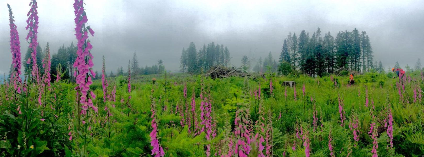
Gradient Terrestrial, WA, D16: Pacific Northwest

Plant diversity sampling at ABBY

About Field Sites

Abby Road (ABBY) is a terrestrial NEON field site located approximately 30 km (18 mi.) northeast of Vancouver, WA and situated in the western foothills of the Cascade Range in the Yacolt Burn State Forest. The 29.9 km2 (7390 acre) site is a conglomerate of parcels managed by the Washington Department of Natural Resources (WDNR) and is typical of WDNR land in the area. Different parcels have logging years that range from 1940 to 2016, allowing for the opportunity to collect NEON data on a dynamically managed forest landscape. ABBY is located in NEON's Pacific Northwest Domain (D16), which is bounded by the Pacific on the west and Canada on the north. It includes the eastern halves of Washington and Oregon and parts of northern California. The Domain hosts three other field sites: two aquatic and one additional terrestrial. [1]

Climate

The climate of ABBY is maritime, defined by its proximity to the Pacific Ocean and the Columbia River Gorge, with secondary orographic lifting effects from the Cascade Range. Warm, dry summers and cool, wet winters are typical. On average, 2450 mm (96.5 in.) of precipitation falls annually, with an average yearly temperature of 10°C (50 °F). Interannual variation plays a major role in yearly precipitation levels; the El Niño Southern Oscillation is a driving force behind warmer, drier years, which leads to an increased chance of drought and wildfires. [5] [12]

Geology

Historic volcanic and glacial activity largely defines the geology of ABBY. Basalt and andesite flows dominate the area, with pre-Fraser alpine glacial drift influence near the flux tower. [2] [7]

Soils

The physical and chemical weathering of igneous rock and volcanic ash produced the majority of soil types present at ABBY, including the Cinebar, Kinney, Larchmount, Olympic, Ferteg, Huss, and Aschoff soil series. Most series have only a minor presence; Cinebar silt loam and Kinney silt loam each make up about a third of the overall soil components across the site. Another minority series is the Yacolt soil series, formed by alpine glacial drift mixed with basalt, pumice and volcanic ash alluvium. Most ABBY soils classify as andisols or andic type soils, owing to a high presence of weathered volcanic glass. [2] [3] [7]

Hydrology

Situated in the East Fork Lewis River Watershed, ABBY contains many small streams and larger creeks converging to form Rock Creek, which flows into the East Fork of the Lewis River and travels westward to the Columbia River. [15]

Vegetation

Douglas fir (Pseudotsuga menziesii) and western hemlock (Tsuga heterophylla) dominate the upper canopy in older stands, with pockets of red alder (Alnus rubra) in mixed forest zones. In recently logged areas, western red cedar (Thuja plicata) grows between the planted Douglas fir. The understory varies with succession; short stature vine maple (Acer cercinatum) is often found in recently logged parcels while salmonberry (Rubus spectabilis) is more common in shrubby habitats. Salal (Gaultheria shallon) and Cascara buckthorn (Frangula purshiana) are found throughout the ABBY site. [1] [10]

Fauna

Elk (Cervus canadensis), black bear (Ursus americanus), black-tailed deer (Odocoileus hemionus columbianus), fisher (Martes pennanti), coyote (Canis latrans), mountain lion (Puma concolor), raptors, and various types of small mammals including reptiles and amphibians are found in the area. [1] [5] [8] [9]

Past Land Management and Use

The Yacolt Burn State Forest, in which ABBY is situated, is named after the Yacolt Fire, the largest of many wildfires that destroyed over 900 km2 (350 sq. mi.) of southwestern Washington State in the summer of 1902. Thirty-eight people died, hundreds of families were displaced, and billions of board-feet of lumber were destroyed in the span of three days. The first state fire warden was appointed the following year in response to the crisis, but it was not until 1905 that a state legislature-appointed fire suppression authority was formed. The true origins of the Yacolt Burn are unknown, but human carelessness is the prevailing theory, whether from loggers burning slash or settlers clearing land. Over the next fifty years, the area experienced many re-burns, including a particularly serious fire in 1952, until advanced fire management practices and intensive reforestation effectively reduced the severity of burns, though occasional small fires continue to the present day. [14]

Current Land Management and Use

The 365 km2 (227 sq. mi.) Yacolt Burn State Forest is managed by the Washington Department of Natural Resources (WDNR) as a working forest, providing opportunities for timber production, biomass byproducts, and numerous recreational activities. Undeveloped parcels increase water-retention potential to combat droughts and provide habitat for native species. The forest is contained within the WDNR's Pacific Cascade Region, which includes 1942 km2 (750 sq. mi.) of state-managed forests, agricultural land, and urban and conservation areas. [6] [11]

NEON Site Establishment

TOS Distributed Plots were allocated at ABBY according to a spatially balanced and stratified-random design. The 2011 National Land Cover Database (NLCD) was selected for stratification because of the consistent and comparable data availability across the United States. Due to active logging and seeding that takes place within the NEON terrestrial sampling boundary, a combination of NLCD map and logging years were used to create a vegetation map for stratification. For older stands (1940-2000), the 2011 NLCD map was used to determine NLCD classification, in particular to distinguish areas of evergreen forest, mixed forest and deciduous forest. For parcels that had been logged after 2000, a combination of logging year and field validation was used to assign a NLCD classification. TOS Tower Plots were allocated according to a spatially balanced design in and around the NEON tower airshed. Plot establishment was completed in December 2016; TOS and TIS sampling began in January and April 2017, respectively.

Additional Resources

  1. NEON. 2018. Terrestrial Observation System (TOS) Site Characterization Report: Domain 16. 
  2. Ufnar, Daniel. 2019. NEON Site-Level Plot Summary, Abby Road (ABBY). 
  3. McGee, D.A., McGee, S.S., Mayko, R.W., Call, W.A., & McMurphy, C.J. (1972). Soil Survey of Clark County, Washington. U.S. Department of Agriculture, Soil Conservation Service. U.S. Government Printing Office, Washington DC. https://archive.org/details/usda-microsoft-word---clark1doc
  4. McDaniel, P. A., & Wilson, M. A. (2007). Physical and Chemical Characteristics of Ash-influenced Soils of Inland Northwest Forests. In Volcanic-Ash-­Derived Forest Soils of the Inland Northwest: Properties and Implications for Management and Restoration. 9-10 November 2005; Coeur d'Alene, ID (pp. 31–45). Proceedings RMRS-P-44; Fort Collins, CO: U.S. Department of Agriculture, Forest Service, Rocky Mountain Research Station. https://www.fs.usda.gov/research/treesearch/26210
  5. Hudec, Jessica L., Halofsky, Jessica E., Peterson, David L., and Ho, Joanne J., Editors. 2019. Climate Change Vulnerability and Adaptation in Southwest Washington. USDA Forest Service General Technical Report PNW-GTR-977.  https://www.fs.usda.gov/pnw/pubs/pnw_gtr977.pdf
  6. DNR Regions and Districts. 2017. Washington State Department of Natural Resources. Retrieved from: https://www.dnr.wa.gov/about/dnr-regions-and-districts
  7. U.S. Geological Survey, 2005, Mineral Resources Data System: U.S. Geological Survey, Reston, Virginia. 
  8. USDA Forest Service. Gifford Pinchot National Forest, Viewing Wildlife. 
  9. USDA Forest Service. 2019. Gifford PInchot National Forest Visitor Guide.  
  10. Washington State Department of Natural Resources, Washington Natural Heritage Program. 2007. The Status of Huckleberries in Washington State. https://www.dnr.wa.gov/publications/amp_nh_huckleberry.pdf?afypk2ihpvi
  11. Washington State Department of Natural Resources. Yacolt Burn State Forest. https://www.dnr.wa.gov/Yacolt
  12. PRISM Climate Group, Oregon State University
  13. Washington State Department of Natural Resources. 2010. Western Yacolt Burn Forest Recreation Plan. https://www.dnr.wa.gov/publications/amp_rec_western_yacolt_burn_forest_recreation%20_plan2010.pdf
  14. USDA Forest Service. 2005. Fire Management Today. https://www.fs.usda.gov/sites/default/files/legacy_files/fire-management-today/65-1.pdf
  15. State of Washington Department of Ecology. 2018. East Fork Lewis River Watershed Bacteria and Temperature. Publication No. 18-03-019. https://apps.ecology.wa.gov/publications/documents/1803019.pdf

Field Site Information

Latitude/Longitude

45.762439, -122.330317

Geodetic Datum

WGS84

Location

Clark County
WA, US

Elevation

Mean: 365m
Maximum: 708m

Mean Annual Temperature

10.0°C

Mean Canopy Height

34.0m

Dominant NLCD Classes

Evergreen Forest, Grassland/Herbaceous, Shrub/Scrub

Colocated Research

Ameriflux
Critical Zone Exploration Network

Field Operations Office

1211 SE Cardinal Court, Suite 120
Vancouver, WA 98683

Research Access

The Washington State Department of Natural Resources does not currently allow other research activities in this area.

Request Access

Observation Types

Remote Sensing

Remote sensing surveys of this field site collect lidar, spectrometer and high-resolution RGB camera data.

Meteorological Measurements

This site has a flux/meteorological tower that is 19 m (62 ft) tall with five measurement levels. The tower top extends above the vegetation canopy to allow sensors mounted at the top and along the tower to capture the full profile of atmospheric conditions from the top of the vegetation canopy to the ground. The tower collects physical and chemical properties of atmosphere-related processes, such as humidity, wind, and net ecosystem gas exchange. Precipitation data are collected by a tipping bucket at the top of the tower and a series of throughfalls located in the soil array.

Phenocams

One phenocam is attached to the top and the bottom of the tower. Here we show the images from the most recent hour. The full collection of images can be viewed on the Phenocam Gallery - click on either of the images below.

Tower top

NEON.D16.ABBY.DP1.10033

Tower bottom

NEON.D16.ABBY.DP1.10042

Soil Sensor Measurements

This site has five soil plots placed in an array within the airshed of the flux tower. Photosynthetically Active Radiation (PAR) at soil surface, soil heat flux, solar radiation, and throughfall are measured at the soil surface in each soil plot. Soil moisture, soil temperature, and CO2 concentration are measured at multiple depths in each soil plot.

Observational Sampling

At terrestrial sites, field ecologists observe birds and plants, and sample ground beetles, mosquitoes, small mammals, soil microbes, and ticks. Lab analyses are carried out to provide further data on DNA sequences, pathogens, soils, sediments, and biogeochemistry. Learn more about terrestrial observations or explore this site's data products.


Field Site Data

Site

Site Host

Washington Department of Natural Resources

Site Access Allowed

No

Site URL

https://www.dnr.wa.gov/

Site Access Details

The Washington State Department of Natural Resources does not currently allow other research activities in this area.

Operations Office

NEON Field Operations Office

Domain 16 Support Facility

NEON Field Operations Address

1211 SE Cardinal Court, Suite 120
Vancouver, WA 98683

NEON Field Operations Phone

360.566.2857

Location

Latitude

45.762439

Longitude

-122.330317

Geodetic Datum

WGS84

UTM Northing

5067870.43m

UTM Easting

552075.54m

UTM Zone

10N

County

Clark

State

WA

Country

US

Mean Elevation

365m

Maximum Elevation

708m

Climate

Mean Annual Temperature

10.0°C

Mean Annual Precipitation

2451mm

Vegetation

Mean Canopy Height

34.0m

Dominant NLCD Classes

Evergreen Forest, Grassland/Herbaceous, Shrub/Scrub

Average number of green days

190

Average first greenness increase date

110 DOY

Average peak green date

165 DOY

Average first greenness decrease date

205 DOY

Average minimum greenness date

300 DOY

Tower

Tower Height

19m

Number of Tower Levels

5

Soils

Megapit Soil Family

Fine-lomay - isotic - mesic - Andic Humudepts

Soil Subgroup

Andic Humudepts


Gallery

  • Photos
  • Videos

No Video


Related Field Sites

Other Domain D16 Field Sites

blue square white drop icon Martha Creek NEON
Core Aquatic
blue circle white drop icon McRae Creek NEON
Gradient Aquatic
brown square white mountain icon Wind River Experimental Forest NEON
Core Terrestrial

Other Field Sites in WA

blue square white drop icon Martha Creek NEON
Core Aquatic
brown square white mountain icon Wind River Experimental Forest NEON
Core Terrestrial
NSF NEON, Operated by Battelle

Follow Us:

Join Our Newsletter

Get updates on events, opportunities, and how NEON is being used today.

Subscribe Now

Footer

  • About Us
  • Newsroom
  • Contact Us
  • Terms & Conditions
  • Careers
  • Code of Conduct

Copyright © Battelle, 2025

The National Ecological Observatory Network is a major facility fully funded by the U.S. National Science Foundation.

Any opinions, findings and conclusions or recommendations expressed in this material do not necessarily reflect the views of the U.S. National Science Foundation.