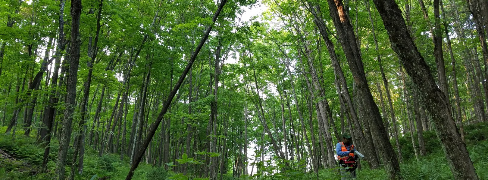
NSF NEON, Operated by Battelle

Main navigation

  • About Us
    • Overview
      • Spatial and Temporal Design
      • History
    • Vision and Management
    • Advisory Groups
      • Science, Technology & Education Advisory Committee
      • Technical Working Groups (TWGs)
    • FAQ
    • Contact Us
      • Contact NEON Biorepository
      • Field Offices
    • User Accounts
    • Staff
    • Code of Conduct

    About Us

  • Data & Samples
    • Data Portal
      • Explore Data Products
      • Data Availability Charts
      • Spatial Data & Maps
      • Document Library
      • API & GraphQL
      • Prototype Data
      • External Lab Data Ingest (restricted)
    • Data Themes
      • Biogeochemistry
      • Ecohydrology
      • Land Cover and Processes
      • Organisms, Populations, and Communities
    • Samples & Specimens
      • Discover and Use NEON Samples
        • Sample Types
        • Sample Repositories
        • Sample Explorer
        • Megapit and Distributed Initial Characterization Soil Archives
      • Sample Processing
      • Sample Quality
      • Taxonomic Lists
    • Collection Methods
      • Protocols & Standardized Methods
      • Airborne Remote Sensing
        • Flight Box Design
        • Flight Schedules and Coverage
        • Daily Flight Reports
          • AOP Flight Report Sign Up
        • Camera
        • Imaging Spectrometer
        • Lidar
      • Automated Instruments
        • Site Level Sampling Design
        • Sensor Collection Frequency
        • Instrumented Collection Types
          • Meteorology
          • Phenocams
          • Soil Sensors
          • Ground Water
          • Surface Water
      • Observational Sampling
        • Site Level Sampling Design
        • Sampling Schedules
        • Observation Types
          • Aquatic Organisms
            • Aquatic Microbes
            • Fish
            • Macroinvertebrates & Zooplankton
            • Periphyton, Phytoplankton, and Aquatic Plants
          • Terrestrial Organisms
            • Birds
            • Ground Beetles
            • Mosquitoes
            • Small Mammals
            • Soil Microbes
            • Terrestrial Plants
            • Ticks
          • Hydrology & Geomorphology
            • Discharge
            • Geomorphology
          • Biogeochemistry
          • DNA Sequences
          • Pathogens
          • Sediments
          • Soils
            • Soil Descriptions
        • Optimizing the Observational Sampling Designs
    • Data Notifications
    • Data Guidelines and Policies
      • Acknowledging and Citing NEON
      • Publishing Research Outputs
      • Usage Policies
    • Data Management
      • Data Availability
      • Data Formats and Conventions
      • Data Processing
      • Data Quality
      • Data Product Bundles
      • Data Product Revisions and Releases
        • Release 2021
        • Release 2022
        • Release 2023
        • Release 2024
        • Release-2025
      • NEON and Google
      • Externally Hosted Data

    Data & Samples

  • Field Sites
    • About Field Sites and Domains
    • Explore Field Sites
    • Site Management Data Product

    Field Sites

  • Impact
    • Observatory Blog
    • Case Studies
    • Papers & Publications
    • Newsroom
      • NEON in the News
      • Newsletter Archive
      • Newsletter Sign Up

    Impact

  • Resources
    • Getting Started with NEON Data & Resources
    • Documents and Communication Resources
      • Papers & Publications
      • Document Library
      • Outreach Materials
    • Code Hub
      • Code Resources Guidelines
      • Code Resources Submission
      • NEON's GitHub Organization Homepage
    • Learning Hub
      • Science Videos
      • Tutorials
      • Workshops & Courses
      • Teaching Modules
    • Research Support Services
      • Field Site Coordination
      • Letters of Support
      • Mobile Deployment Platforms
      • Permits and Permissions
      • AOP Flight Campaigns
      • Research Support FAQs
      • Research Support Projects
    • Funding Opportunities

    Resources

  • Get Involved
    • Advisory Groups
      • Science, Technology & Education Advisory Committee
      • Technical Working Groups
    • Upcoming Events
    • NEON Ambassador Program
      • Exploring NEON-Derived Data Products Workshop Series
    • Research and Collaborations
      • Environmental Data Science Innovation and Inclusion Lab
      • Collaboration with DOE BER User Facilities and Programs
      • EFI-NEON Ecological Forecasting Challenge
      • NEON Great Lakes User Group
      • NEON Science Summit
      • NCAR-NEON-Community Collaborations
        • NCAR-NEON Community Steering Committee
    • Community Engagement
      • How Community Feedback Impacts NEON Operations
    • Science Seminars and Data Skills Webinars
      • Past Years
    • Work Opportunities
      • Careers
      • Seasonal Fieldwork
      • Internships
        • Intern Alumni
    • Partners

    Get Involved

  • My Account
  • Search

Search

Field Sites

  • About Field Sites and Domains
  • Explore Field Sites
  • Site Management Data Product

Breadcrumb

  1. Field Sites
  2. University of Notre Dame Environmental Research Center NEON

Field Site

University of Notre Dame Environmental Research Center NEON / UNDE

brown square white mountain icon

Core Terrestrial, MI, D05: Great Lakes

Field technician setting mammal trap at UNDE

About Field Sites

UNDE is a terrestrial NEON sampling site located at the University of Notre Dame Environmental Research Center (UNDERC), found between Northern Wisconsin and Michigan’s Upper Peninsula on the southwestern edge of Ottawa National Forest. NEON samples 29.39 km2 (7262 acres) of area within UNDERC. This NEON site is very distinct from NEON's other terrestrial sites in this area, Treehaven and Steigerwaldt, because of its minimal forest management. The landscape at the site features primarily second-growth mixed forest dominated by red and sugar maple, aspen, and birch. It also contains 30 different lakes, including the NEON aquatic site at Crampton lake. UNDE is located within the Great Lakes Domain (D05), which includes northern Ohio, Michigan, northern Wisconsin, and parts of Indiana and Illinois. D05 hosts four other NEON field sites: two aquatic and two terrestrial, located in Wisconsin and Michigan. [1] [2]

Climate

The climate of northern Wisconsin is characterized by bitterly cold winters and generally cool summers with brief times of excessive heat. Precipitation varies from year to year, with the majority of precipitation usually falling during the warmer part of the year. Snowfall also varies from year to year, however, the very northern portion of the state can see heavy snowfall due to lake effect events along the southern shore of Lake Superior. The area can also be subject to severe winter storms and thunderstorms. NEON’s UNDE field site is typically cool for most of the year with an average yearly temperature of 4.3°C (40°F). The average precipitation per year in this area is 802 mm (31.6 in.). [6] [13] [14]

Geology

The geology of the site consists of migmatitic gneiss and amphibole. The bedrock is composed of Precambrian slate, greywacke, and gneiss. Much of this area’s geology has been affected by glacial activities, as late Wisconsin glacial deposits cover the bedrock. Additionally, the parent materials at this site consist of supraglacial and subglacial till and outwash. [5] [9]

Soils

The soils at UNDERC are primarily spodosols within the subgroup Argic Fragiaquods. The particle size control sections show that this site’s texture is dominantly sandy with small proportions of coarse-loamy, sandy or sandy-skeletal, coarse-silty, and coarse-loamy over sandy or sandy-skeletal. [5]

Hydrology

UNDE and the surrounding area are covered in open water areas from lakes, ponds, vernal ponds, and wetlands. The numerous open water areas are thought to be the result of ice block depressions formed by glacial activity in the area. [4] [5]

Vegetation

The dominant vegetation type at this NEON site is primarily second-growth Northern mesic forest. The dominant species of the area are red and sugar maple (Acer rubrum and saccharum), aspen (Populus tremuloides and P. grandidentata), and paper birch (Betula papyrifera). The evergreen forests are typically made up of balsam fir (Abies balsamea) but may include hemlock (Tsuga canadensis). Around this site you can also find wet areas that are home to cedar (Thuja accidentalis) and black spruce (Picea mariana). Some areas within the site are poorly drained, which can lead to open, acidic sphagnum bogs that contain tamarack (Larix laricina) and black spruce. [1]

Fauna

UNDERC East is located right on the border of Wisconsin and Michigan beside Ottawa National Forest. The proximity to the national forest provides a great abundance of wildlife habitat. This area is home to many species such as the bald eagle (Haliaeetus leucocephalus), fox (Vulpes), and grey wolf (Canis lupus). NEON’s target species are typically small mammals such as the southern red-backed vole (Myodes gapperi), North American deermouse (Peromyscus maniculatus), and the woodland jumping mouse (Napaeozapus insignis). [3] [10]

Past Land Management and Use

The main portion UNDERC East was donated to the University of Notre Dame in the 1930s by Martin J. Gillen. This area was marked by clearcutting from 1880 until the 1960s. Starting in the 1940s, there was an increase in frequency of clearcutting, which peaked in the 1950s. Since that time, the amount of cutting has decreased until the most recent logging operation in 1968; since then, there has been no large-scale cutting in UNDERC East. In the past, the most desirable wood to be harvested from this area was eastern white pine (Pinus strobus). This preference led to the clearing of large stands of trees just to reach the white pines. [7]

Current Land Management and Use

This site is currently maintained by the University of Notre Dame Environmental Research Center (UNDERC). A long history of clearcutting until the 1960s has resulted in a landscape dominated by a mixture of successional forest regrowth, with large portions of secondary growth. Since the last clearcutting, the forest has been minimally managed in order to maintain access for recreational, education and research goals. Much of the management of this area is to support the extensive aquatic systems on the land. They are focused on providing a unique research opportunity for systems, such as their aquatic ecosystem, that have a very limited amount of disturbance from the public. [1] [8]

NEON Site Establishment

UNDE had its initial sampling readiness review for terrestrial sampling in May 2014 but did not get cleared for TOS and TIS sampling until December 2014. The plot establishment took place in May 2015. TIS phase 3 was begun in February 2017.

Additional Resources

[1] Terrestrial Observation System (TOS) Site Characterization Report: Domain 05. NEON.DOC.003889vB

[2] https://underc.nd.edu/underc-east/the-environment/maps/

[3] https://www.fs.usda.gov/main/ottawa/about-forest

[4] Terrestrial Instrument System (TIS, FIU) Site Characterization Supporting Data: Domain 05. NEON.DOC.011057vB

[5] Parsley, J. (2016) NEON site-level plot summary univerisyt of notre dam environmental research center (UNDE). USDA.

[6] https://underc.nd.edu/underc-east/the-environment/

[7] Mahon, Brian. July 22, 2003. “A Clear­cutting History Survey of the UNDERC Property”. University of Notre Dame.

[8] https://underc.nd.edu/about/history/

[9] U.S. Geological Survey, 2005, Mineral Resources Data System: U.S. Geological Survey, Reston, Virginia. https://mrdata.usgs.gov/mrds/

[10] TOS Protocol and Procedure: Small Mammal Sampling, NEON.DOC.000481vM

[11] https://plants.usda.gov

[12]Group 34 list of D05 endangered and threatened species was used as well)

[13] https://statesummaries.ncics.org/chapter/wi/

[14] PRISM Climate Group., Oregon State University, http://prism.oregonstate.edu, created 4 Feb 2004.

Field Site Information

Latitude/Longitude

46.23391, -89.537254

Geodetic Datum

WGS84

Location

Gogebic County
MI, US

Elevation

Mean: 521m
Minimum: 501m
Maximum: 538m

Mean Annual Temperature

4.3°C

Dominant Wind Direction

SSW

Mean Canopy Height

24.0m

Dominant NLCD Classes

Deciduous Forest, Mixed Forest, Woody Wetlands

Colocated Research

University of Notre Dame - Environmental Research Center
Ameriflux

Field Operations Office

7647 Notre Dame Lane
Land O Lakes, WI 54540

Research Access

Non-NEON research activities are allowed in this area. Researchers must obtain their own permits with the site host(s).

Request Access

Observation Types

Remote Sensing

Remote sensing surveys of this field site collect lidar, spectrometer and high-resolution RGB camera data.

Meteorological Measurements

This site has a flux/meteorological tower that is 39 m (128 ft) tall with four measurement levels. The tower top extends above the vegetation canopy to allow sensors mounted at the top and along the tower to capture the full profile of atmospheric conditions from the top of the vegetation canopy to the ground. The tower collects physical and chemical properties of atmosphere-related processes, such as humidity, wind, and net ecosystem gas exchange. Precipitation data are collected by a tipping bucket at the top of the tower, a Double Fence Intercomparison Reference (DFIR) near the tower, and a series of throughfalls located in the soil array.

Phenocams

One phenocam is attached to the top and the bottom of the tower. Here we show the images from the most recent hour. The full collection of images can be viewed on the Phenocam Gallery - click on either of the images below.

Tower top

NEON.D05.UNDE.DP1.10033

Tower bottom

NEON.D05.UNDE.DP1.10042

Soil Sensor Measurements

This site has five soil plots placed in an array within the airshed of the flux tower. Photosynthetically Active Radiation (PAR) at soil surface, soil heat flux, solar radiation, and throughfall are measured at the soil surface in each soil plot. Soil moisture, soil temperature, and CO2 concentration are measured at multiple depths in each soil plot.

Observational Sampling

At terrestrial sites, field ecologists observe birds and plants, and sample ground beetles, mosquitoes, small mammals, soil microbes, and ticks. Lab analyses are carried out to provide further data on DNA sequences, pathogens, soils, sediments, and biogeochemistry. Learn more about terrestrial observations or explore this site's data products.


Field Site Data

Site

Site Host

University of Notre Dame

Site Access Allowed

Yes

Site URL

https://underc.nd.edu/underc-west/research-opportunities/

Site Access Details

UNDERC encourages research; subject to evaluation based on potential for scientific advancement, impact on the site, and consistency and compatibility with other designated, non-research, uses of the property.

Operations Office

NEON Field Operations Office

Domain 05 Support Facility

NEON Field Operations Address

7647 Notre Dame Lane
Land O Lakes, WI 54540

NEON Field Operations Phone

906.842.2119

Location

Latitude

46.23391

Longitude

-89.537254

Geodetic Datum

WGS84

UTM Northing

5123162.89m

UTM Easting

304366.95m

UTM Zone

16N

County

Gogebic

State

MI

Country

US

Mean Elevation

521m

Minimum Elevation

501m

Maximum Elevation

538m

Climate

Mean Annual Temperature

4.3°C

Mean Annual Precipitation

802mm

Dominant Wind Direction

SSW

Vegetation

Mean Canopy Height

24.0m

Dominant NLCD Classes

Deciduous Forest, Mixed Forest, Woody Wetlands

Average number of green days

165

Average first greenness increase date

120 DOY

Average peak green date

170 DOY

Average first greenness decrease date

215 DOY

Average minimum greenness date

285 DOY

Tower

Tower Height

39m

Number of Tower Levels

6

Soils

Megapit Soil Family

Coarse-loamy - mixed - superactive - frigid Argic Fragiaquods

Soil Subgroup

Argic Fragiaquods


Gallery

  • Photos
  • Videos

No Video


Related Field Sites

Other Domain D05 Field Sites

blue square white drop icon Crampton Lake NEON
Core Aquatic
blue circle white drop icon Little Rock Lake NEON
Gradient Aquatic
brown circle white drop icon Steigerwaldt-Chequamegon NEON
Gradient Terrestrial
brown circle white drop icon Treehaven NEON
Gradient Terrestrial
NSF NEON, Operated by Battelle

Follow Us:

Join Our Newsletter

Get updates on events, opportunities, and how NEON is being used today.

Subscribe Now

Footer

  • About Us
  • Newsroom
  • Contact Us
  • Terms & Conditions
  • Careers
  • Code of Conduct

Copyright © Battelle, 2025

The National Ecological Observatory Network is a major facility fully funded by the U.S. National Science Foundation.

Any opinions, findings and conclusions or recommendations expressed in this material do not necessarily reflect the views of the U.S. National Science Foundation.