AOP crew takes flight with new LiDAR system
March 17, 2015
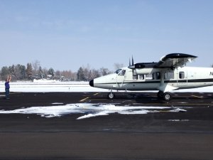
Signaling the imminent start of a new field and flight season, a Twin Otter airplane to be used by NEON’s Airborne Observation Platform (AOP), arrived at NEON’s Payload Installation Facility located at Boulder Municipal Airport earlier this month.
The leased aircraft has been retrofitted with a new full waveform and discrete LiDAR system and the crew is currently conducting training flights over Northern Colorado to become familiar in operating the new equipment.
The plane’s complete payload, which in addition to LIDAR, includes an imaging spectrometer and a high-resolution Red, Blue Green (RGB) camera, will be installed following these engineering flights in time to be deployed to the field. The plane will begin flying with the complete payload in April, with flights scheduled over the High Park burn scar (Northern Colorado), D07 (Appalachians & Cumberland Plateau) and D08 (Ozarks Complex) during June through August.
The measurements provided by AOP play a crucial role in generating truly continental-scale data sets. They help bridge the gap in spatial extent and resolution between measurements collected on the ground and measurements collected by instruments mounted to Earth-orbiting satellites maintained by organizations such as NASA.
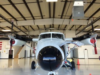
View of a twin otter from the nose in the hanger
High-level data products derived from AOP data include:
- Vegetation Leaf Area Index (LAI)
- Total biomass
- Vegetation indices (NDVI, EVI)
- Ecosystem structure
- Canopy biogeochemistry (multiple products)
- Land cover
- Ground elevation: Digital Elevation Model (DEM)
- Digital Surface Model (DSM)
Eventually, the team will fly over every NEON terrestrial and aquatic site, every year, during the period of peak greenness of the vegetation.
According to NEON’s Director of Remote Sensing, Tom Kampe, during each flight approximately1.0 to 1.5 TB (Terabytes) of raw data are collected. Following the flight, raw data are saved to multiple drives. From there, the data are sent to NEON Headquarters where it is processed to Level-1 data products before being made available to the public in the final format.
For further details on AOP, be sure to visit the Airborne Remote Sensing page on the NEON website.
