NSF NEON, Operated by Battelle

Main navigation

  • About Us
    • Overview
      • Spatial and Temporal Design
      • History
    • Vision and Management
    • Advisory Groups
      • Science, Technology & Education Advisory Committee
      • Technical Working Groups (TWGs)
    • FAQ
    • Contact Us
      • Contact NEON Biorepository
      • Field Offices
    • User Accounts
    • Staff
    • Code of Conduct

    About Us

  • Data & Samples
    • Data Portal
      • Explore Data Products
      • Data Availability Charts
      • Spatial Data & Maps
      • Document Library
      • API & GraphQL
      • Prototype Data
      • External Lab Data Ingest (restricted)
    • Data Themes
      • Biogeochemistry
      • Ecohydrology
      • Land Cover and Processes
      • Organisms, Populations, and Communities
    • Samples & Specimens
      • Discover and Use NEON Samples
        • Sample Types
        • Sample Repositories
        • Sample Explorer
        • Megapit and Distributed Initial Characterization Soil Archives
      • Sample Processing
      • Sample Quality
      • Taxonomic Lists
    • Collection Methods
      • Protocols & Standardized Methods
      • Airborne Remote Sensing
        • Flight Box Design
        • Flight Schedules and Coverage
        • Daily Flight Reports
          • AOP Flight Report Sign Up
        • Camera
        • Imaging Spectrometer
        • Lidar
      • Automated Instruments
        • Site Level Sampling Design
        • Sensor Collection Frequency
        • Instrumented Collection Types
          • Meteorology
          • Phenocams
          • Soil Sensors
          • Ground Water
          • Surface Water
      • Observational Sampling
        • Site Level Sampling Design
        • Sampling Schedules
        • Observation Types
          • Aquatic Organisms
            • Aquatic Microbes
            • Fish
            • Macroinvertebrates & Zooplankton
            • Periphyton, Phytoplankton, and Aquatic Plants
          • Terrestrial Organisms
            • Birds
            • Ground Beetles
            • Mosquitoes
            • Small Mammals
            • Soil Microbes
            • Terrestrial Plants
            • Ticks
          • Hydrology & Geomorphology
            • Discharge
            • Geomorphology
          • Biogeochemistry
          • DNA Sequences
          • Pathogens
          • Sediments
          • Soils
            • Soil Descriptions
        • Optimizing the Observational Sampling Designs
    • Data Notifications
    • Data Guidelines and Policies
      • Acknowledging and Citing NEON
      • Publishing Research Outputs
      • Usage Policies
    • Data Management
      • Data Availability
      • Data Formats and Conventions
      • Data Processing
      • Data Quality
      • Data Product Bundles
      • Data Product Revisions and Releases
        • Release 2021
        • Release 2022
        • Release 2023
        • Release 2024
        • Release-2025
      • NEON and Google
      • Externally Hosted Data

    Data & Samples

  • Field Sites
    • About Field Sites and Domains
    • Explore Field Sites
    • Site Management Data Product

    Field Sites

  • Impact
    • Observatory Blog
    • Case Studies
    • Papers & Publications
    • Newsroom
      • NEON in the News
      • Newsletter Archive
      • Newsletter Sign Up

    Impact

  • Resources
    • Getting Started with NEON Data & Resources
    • Documents and Communication Resources
      • Papers & Publications
      • Document Library
      • Outreach Materials
    • Code Hub
      • Code Resources Guidelines
      • Code Resources Submission
      • NEON's GitHub Organization Homepage
    • Learning Hub
      • Science Videos
      • Tutorials
      • Workshops & Courses
      • Teaching Modules
    • Research Support Services
      • Field Site Coordination
      • Letters of Support
      • Mobile Deployment Platforms
      • Permits and Permissions
      • AOP Flight Campaigns
      • Research Support FAQs
      • Research Support Projects
    • Funding Opportunities

    Resources

  • Get Involved
    • Advisory Groups
      • Science, Technology & Education Advisory Committee
      • Technical Working Groups
    • Upcoming Events
    • NEON Ambassador Program
      • Exploring NEON-Derived Data Products Workshop Series
    • Research and Collaborations
      • Environmental Data Science Innovation and Inclusion Lab
      • Collaboration with DOE BER User Facilities and Programs
      • EFI-NEON Ecological Forecasting Challenge
      • NEON Great Lakes User Group
      • NEON Science Summit
      • NCAR-NEON-Community Collaborations
        • NCAR-NEON Community Steering Committee
    • Community Engagement
      • How Community Feedback Impacts NEON Operations
    • Science Seminars and Data Skills Webinars
      • Past Years
    • Work Opportunities
      • Careers
      • Seasonal Fieldwork
      • Internships
        • Intern Alumni
    • Partners

    Get Involved

  • My Account
  • Search

Search

Field Sites

  • About Field Sites and Domains
  • Explore Field Sites
  • Site Management Data Product

Breadcrumb

  1. Field Sites
  2. Walker Branch NEON

Field Site

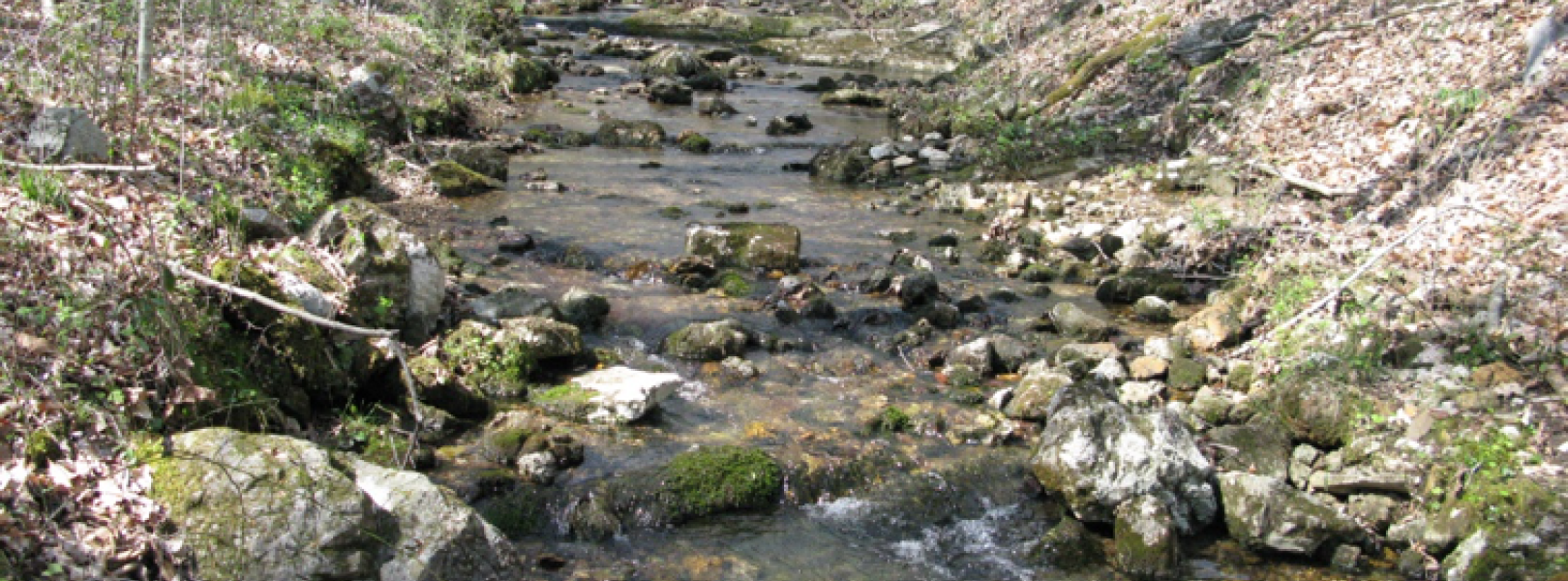
Walker Branch NEON / WALK

blue square white drop icon

Core Aquatic, TN, D07: Appalachians & Cumberland Plateau

Picture of stream at core aquatic site WALK

About Field Sites

Walker Branch Watershed (WALK) is an aquatic field site located in the Cumberland Plateau within Roane County, Tennessee. The site is located on the U.S. Department of Energy’s (DOE’s) Oak Ridge Reservation. WALK is managed by the DOE, specifically by the Oak Ridge National Laboratory’s Multiple Research Division. Walker Branch is a wadeable stream that drains a 1.1 km2 (270 acre) watershed and is surrounded by deciduous forest. The region's rivers and streams harbor some of the largest variety of fish and mollusk species in the U.S. WALK is part of NEON Domain 07 - Appalachians & Cumberland Plateau, which includes eastern Tennessee, most of Kentucky, southern Ohio, and parts of North Carolina, Georgia, Indiana, and Illinois. The Domain hosts four other NEON field sites, three terrestrial and one aquatic, three of which are located in Tennessee. WALK is colocated with the ORNL terrestrial field site. [1] [2] [3] [4] [5]

Climate

The climate at WALK is characterized by moderately large variations in temperature and abundant precipitation. In particular, WALK has hot and humid summers and cool, mild winters. The mean annual average temperature is 14.4°C (58°F) and mean average precipitation is 1340vmm (53 in.). The site is occasionally subjected to high wind events, thunderstorms, droughts, flooding and rare wildfires. Summer afternoon thunderstorms are common, and winters will see occasional snow accumulation which melts shortly afterwards (depending on elevation and sun exposure). [7] [8]

Geology

WALK is part of the Chase Group. The parent materials at the ORNL site are residuum, colluvium, and local alluvium derived from Cambrian and Lower to Middle Ordovician geologies. [6]

Soils

Forest soils found within the WALK watershed are acidic (pH 3.5 to 4.6), very cherty, infertile, and highly permeable. They are considered ancient and are part of the soil series Fullerton cherty silt loam (5-12% slopes), within the subgroup Typic Paleudults. Other relatively common soils found in the area are Montevallo, Bodine, Minvale, Sunlight, and Etwoah. [4] [6]

Hydrology

WALK is a wadeable, first-order stream with eleven springs flowing into it. [1]

Vegetation

WALK's canopy consists of a dense hardwood forest dominated by oaks and hickories. At and around WALK, there is a mixture of deciduous species in the valleys with patches of shortleaf pine (Pinus echineta) and Virginia pine (Pinus virginiana) on the ridges. Mixed hardwoods at the site include chestnut oak (Quercus prinus), tulip poplar (Liriodendron tulipifera), red maple (Acer rubrum), white oak (Quercus alba), and American beech (Fagus grandifolia). It is 90% closed canopy when leaves are out, and the understory is mostly leaves and groundcover. [1] [2] [6]

Fauna

The area surrounding WALK hosts about 60 species of fish and 60 species of reptiles and amphibians, ~200 species of migratory, transient and resident birds, and 35 species of mammals, as well as many invertebrate species. Among these, 17 were identified as federally- or state-listed (endangered, threatened, or in need of management) in surveys done in the 2000s. Some common water-loving mammals that can be found at WALK include beaver (Castor canadensis), mink (Mustela vison), and muskrat (Ondatra zibethica). The two most common fish species sampled at WALK are blacknose dace (Rhinichthys atratulus) and banded sculpin (Cottus carolinae). There are two threatened fish species that live in the region: blue sucker (Cycleptus elongatus) and spotfin chub (Erimonax monachus). The area also sees an abundance of semi-aquatic migratory birds and aquatic and semi-aquatic salamander species. [9] [10]

Past Land Management and Use

The Walker Branch watershed has a long history of research. In 1942, the United States government selected the rural area for the development of nuclear weapons and materials for the Manhattan project. Originally called the Clinton Engineering Works, the Oak Ridge Reservation includes three facilities: Oak Ridge National Laboratory, Y-12 National Security Plant and the Gaseous Diffusion Plant, now known as the East Tennessee Technology Park (ETTP). In 1943, the reservation housed the world's first operational nuclear reactor, used for the production of plutonium during World War II. After World War II, the U.S. government dissolved the Manhattan Project and established the Atomic Energy Commission to produce and control nuclear energy for military and civilian applications during peace time. In the 1960s, research at the reservation focused on environmental research such as energy efficiency, renewable energy technologies and nuclear technologies and systems. In 1989, the U.S. Department of Energy’s Environmental Management (DOE-EM) and National Nuclear Security Administration began to oversee nuclear clean up activates at the site. Today, the Oak Ridge National Laboratory continues to take part in cutting edge scientific research, Y-12 National Security Complex continues to be used for nuclear weapons processing and materials storage, and the East Tennessee Technology Park (ETTP) is considered a sensitive area with national security concerns.

The NEON site WALK has a long history of environmental research in particular. Intensive environmental research at the Walker Branch site began in the late 1960s following major funding from the DOE Office of Science Biological and Environmental Research Program (BER), Terrestrial Ecosystem Science (TES). The project initially focused on the geological and hydrologic processes that control the amounts and chemistry of water moving through the watershed. Over the next 40 years, research at the watershed focused on hydrological, biogeochemical and ecological studies that examined the impacts of climate variability and change in the region. This research has been headed by various agencies and groups, including the Atmospheric Turbulence and Diffusion Division, Air Resources Laboratory, National Oceanic and Atmospheric Administration in Oak Ridge, Tennessee, and many visiting university researchers. [11] [13] [14] [15]

Current Land Management and Use

The Department of Energy (DOE) currently oversees Walker Branch. The DOE strives to ensure America's future by overcoming energy, environmental, and nuclear challenges through scientific research. These projects have all contributed to a more complete understanding of how forest watersheds function and have provided insights into the solution of energy-related problems associated with air pollution, contaminant transport, and forest nutrient dynamics. This is one of a few sites in the world characterized by long-term, intensive environmental studies. Despite some of the long-term research projects being phased out, this type of research still continues to be an important activity in the watershed as NEON will collect data ecological data there for 30 years. [12]

NEON Site Establishment

WALK was established as a NEON field site in November 2014. It was trial tested in late 2015 and AOS and AIS operations were up and running early 2016. Data collection from the tower began in early 2015.

Additional Resources

[1] Aquatic Instrument System (AIS) Site Characterization Report: Domain 07. NEON.DOC.001372vB

[2] Terrestrial Observation System (TOS) Site Characterization Report: Domain 07. NEON.DOC.003891vB.

[3] Terrestrial Instrument System (TIS, FIU) Site Characterization Summary: Domain 07. NEON.DOC.011036vD

[4] https://walkerbranch.ornl.gov/about-us/

[5] https://www.nature.org/en-us/about-us/where-we-work/united-states/tenne…

[6] Mason, Jennifer. 2017. NEON Site-Level Plot Summary, Oak Ridge National Laboratory (ORNL), June 2017.

[7] https://statesummaries.ncics.org/chapter/tn/

[8] PRISM Climate Group., Oregon State University, http://prism.oregonstate.edu, created 4 Feb 2004.

[9] https://www.osti.gov/servlets/purl/921773

[10] https://nerp.ornl.gov/wp-content/uploads/2018/09/ORR_wildlife_managemen…

[11] https://walkerbranch.ornl.gov/history/

[12] https://www.energy.gov/about-us

[13] https://www.ornl.gov/content/seventy-five-years-great-science

[14] https://www.tn.gov/environment/program-areas/rem-remediation/rem-oak-ri…

[15] https://tes-sfa.ornl.gov/node/194

Field Site Information

Latitude/Longitude

35.957378, -84.279251

Geodetic Datum

WGS84

Location

Anderson County
TN, US

Elevation

Mean: 264m

Mean Annual Temperature

14.4°C

Dominant NLCD Classes

Deciduous Forest

Colocated Site(s)

Oak Ridge NEON

Colocated Research

Oak Ridge National Laboratory
Walker Branch Watershed National Atmospheric Deposition Program

Field Operations Office

154 Fairbanks Road, Fairbanks Plaza
Oak Ridge, TN 37830

Research Access

Non-NEON research activities are allowed in this area. Researchers must obtain their own permits with the site host(s).

Request Access

Observation Types

Remote Sensing

Remote sensing surveys of this field site collect lidar, spectrometer and high-resolution RGB camera data.

Meteorological Measurements

This site has one meteorological station located in the riparian area. The met station is outfitted with a subset of the same sensors used at terrestrial sites. Measurements include wind speed and direction, air temperature, barometric pressure, relative humidity, shortwave radiation, and PAR.

Phenocams

A phenocam is pointed toward the land-water interface of the site. Here we show the images from the most recent hour. The full collection of images can be viewed on the Phenocam Gallery - click on the image below.

NEON.D07.WALK.DP1.20002


Field Site Data

Site

Site Host

Department of Energy

Site Access Allowed

Very Limited

Site URL

https://www.ornl.gov/division/esd

Site Access Details

There is currently no system in place to authorize access for additional research activities to this federally secure area. Coordinate directly with site manager.

Operations Office

NEON Field Operations Office

Domain 07 Support Facility

NEON Field Operations Address

154 Fairbanks Road, Fairbanks Plaza
Oak Ridge, TN 37830

NEON Field Operations Phone

865.272.0055

Location

Latitude

35.957378

Longitude

-84.279251

Geodetic Datum

WGS84

UTM Northing

3982872.56m

UTM Easting

745264.06m

UTM Zone

16N

County

Anderson

State

TN

Country

US

Mean Elevation

264m

Climate

Mean Annual Temperature

14.4°C

Mean Annual Precipitation

1340mm

Vegetation

Dominant NLCD Classes

Deciduous Forest

Watershed

USGS HUC

h06010207

Watershed Name

Lower Clinch

Geology

USGS Geology Unit

TNOnc;10

USGS Geology Name

Unnamed (upper part of Knox Group), including Newala Formation, Mascot Dolomite, Kingsport Formation, Longview Dolomite, and Chepultepec Dolomite

USGS Lithologic Constituents

Limestone and dolostone, with sandstone

USGS Geology Age

Ordovician


Gallery

  • Photos
  • Videos

No Video


Related Field Sites

Other Domain D07 Field Sites

brown circle white drop icon Great Smoky Mountains National Park NEON
Gradient Terrestrial
blue circle white drop icon LeConte Creek NEON
Gradient Aquatic
brown circle white drop icon Mountain Lake Biological Station NEON
Gradient Terrestrial
brown square white mountain icon Oak Ridge NEON
Core Terrestrial

Other Field Sites in TN

brown circle white drop icon Great Smoky Mountains National Park NEON
Gradient Terrestrial
blue circle white drop icon LeConte Creek NEON
Gradient Aquatic
brown square white mountain icon Oak Ridge NEON
Core Terrestrial
NSF NEON, Operated by Battelle

Follow Us:

Join Our Newsletter

Get updates on events, opportunities, and how NEON is being used today.

Subscribe Now

Footer

  • About Us
  • Newsroom
  • Contact Us
  • Terms & Conditions
  • Careers
  • Code of Conduct

Copyright © Battelle, 2025

The National Ecological Observatory Network is a major facility fully funded by the U.S. National Science Foundation.

Any opinions, findings and conclusions or recommendations expressed in this material do not necessarily reflect the views of the U.S. National Science Foundation.