NSF NEON, Operated by Battelle

Main navigation

  • About
    • NEON Overview
      • Vision and Management
      • Spatial and Temporal Design
      • History
    • About the NEON Biorepository
      • ASU Biorepository Staff
      • Contact the NEON Biorepository
    • Observatory Blog
    • Newsletters
    • Staff
    • FAQ
    • Contact Us

    About

  • Data
    • Data Portal
      • Data Availability Charts
      • API & GraphQL
      • Prototype Data
      • Externally Hosted Data
    • Data Collection Methods
      • Airborne Observation Platform (AOP)
      • Instrument System (IS)
        • Instrumented Collection Types
        • Aquatic Instrument System (AIS)
        • Terrestrial Instrument System (TIS)
      • Observational System (OS)
        • Observation Types
        • Observational Sampling Design
        • Sampling Schedules
        • Taxonomic Lists Used by Field Staff
        • Optimizing the Observational Sampling Designs
      • Protocols & Standardized Methods
    • Getting Started with NEON Data
      • neonUtilities for R and Python
      • Learning Hub
      • Code Hub
    • Using Data
      • Data Formats and Conventions
      • Released, Provisional, and Revised Data
      • Data Product Bundles
      • Usage Policies
      • Acknowledging and Citing NEON
      • Publishing Research Outputs
    • Data Notifications
    • NEON Data Management
      • Data Availability
      • Data Processing
      • Data Quality

    Data

  • Samples & Specimens
    • Biorepository Sample Portal at ASU
    • About Samples
      • Sample Types
      • Sample Repositories
      • Megapit and Distributed Initial Characterization Soil Archives
    • Finding and Accessing Sample Data
      • Species Checklists
      • Sample Explorer - Relationships and Data
      • Biorepository API
    • Requesting and Using Samples
      • Loans & Archival Requests
      • Usage Policies

    Samples & Specimens

  • Field Sites
    • Field Site Map and Info
    • Spatial Layers & Printable Maps

    Field Sites

  • Resources
    • Getting Started with NEON Data
    • Research Support Services
      • Field Site Coordination
      • Letters of Support
      • Mobile Deployment Platforms
      • Permits and Permissions
      • AOP Flight Campaigns
      • Research Support FAQs
      • Research Support Projects
    • Code Hub
      • neonUtilities for R and Python
      • Code Resources Guidelines
      • Code Resources Submission
      • NEON's GitHub Organization Homepage
    • Learning Hub
      • Tutorials
      • Workshops & Courses
      • Science Videos
      • Teaching Modules
    • Science Seminars and Data Skills Webinars
    • Document Library
    • Funding Opportunities

    Resources

  • Impact
    • Research Highlights
    • Papers & Publications
    • NEON in the News

    Impact

  • Get Involved
    • Upcoming Events
    • Research and Collaborations
      • Environmental Data Science Innovation and Inclusion Lab
      • Collaboration with DOE BER User Facilities and Programs
      • EFI-NEON Ecological Forecasting Challenge
      • NEON Great Lakes User Group
      • NCAR-NEON-Community Collaborations
    • Advisory Groups
      • Science, Technology & Education Advisory Committee
      • Technical Working Groups
    • NEON Ambassador Program
      • Exploring NEON-Derived Data Products Workshop Series
    • Partnerships
    • Community Engagement
    • Work Opportunities

    Get Involved

  • My Account
  • Search

Search

Field Sites

  • Field Site Map and Info
  • Spatial Layers & Printable Maps

Breadcrumb

  1. Field Sites
  2. Lake Suggs NEON

Field Site

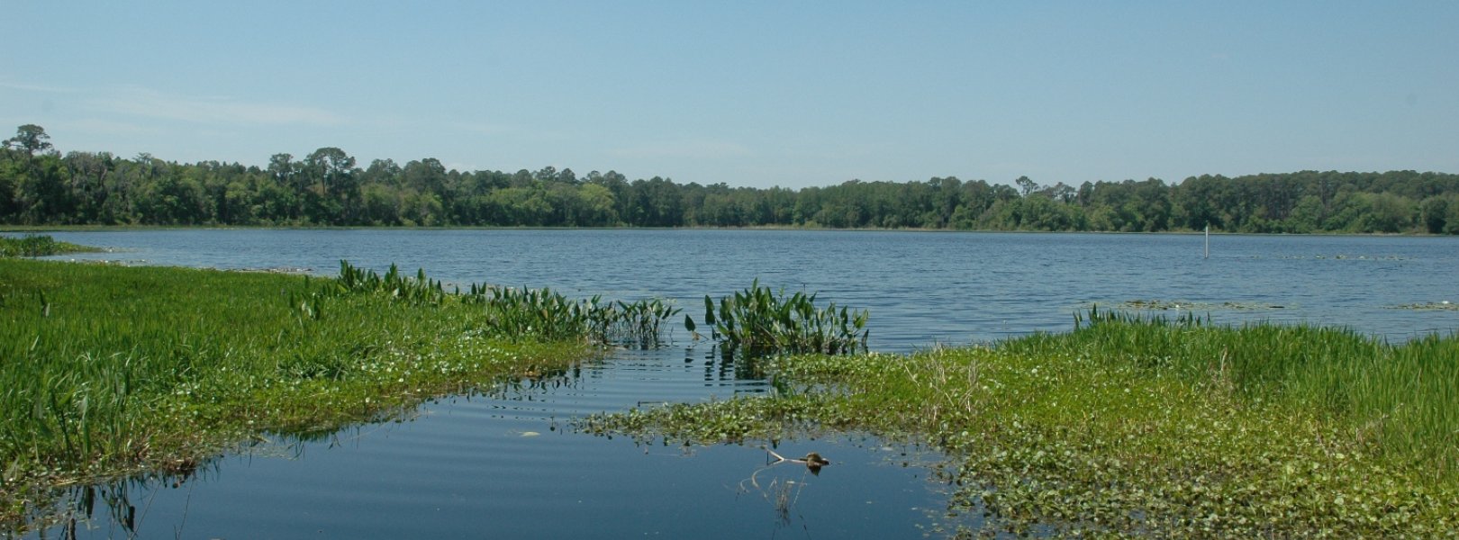
Lake Suggs NEON / SUGG

blue square white drop icon

Core Aquatic, FL, D03: Southeast

SUGG lake site in Domain 03

About Field Sites

Lake Suggs (SUGG) is an aquatic NEON field site located in Putman County, Florida about 20 miles east of Gainesville. It is part of the Ordway Swisher Biological Station (OSBS), a 38.5 km2 (9500 acre) property owned and managed by the University of Florida as a biological research center. Suggs Lake is 0.73 km2 (180 acres) in area. It is classified as a seepage lake dominated by groundwater flow with the local aquifer, but it is also fed by the local surface and subsurface flow through the wetland complex. The lake is situated on limestone geology overlain by a variable mixture of sand, gravel, clay, phosphate and carbonate sediments. The site is encompassed within the NEON Southeast Domain that is bounded by the Atlantic Ocean on the east and the Gulf of Mexico to the west. The Domain features a patchwork of forest, grassland and wetland communities embedded in a matrix that is increasingly dominated by a fast-growing human population. The Domain hosts five other NEON field sites, including two additional aquatic and three terrestrial sites, located in Florida and Georgia. SUGG is colocated with the OSBS terrestrial field site. The Barco Lake (BARC) aquatic site is also located within OSBS. [1] [2]

Climate

North-central Florida’s climate is humid subtropical. Summers at OSBS are generally hot and humid, with average summer highs around 32°C (89°F) and lows averaging around 21°C (70°F). Winters are drier and mild, with highs around 19°C (67°F) and lows near 4°C (40°F). Average annual temperature is 20.9° (70°F). Average annual precipitation is about 1308 mm (51.5 in). Rainfall occurs year-round, but is heaviest June through September. In summer months, afternoon and evening thunderstorms bring most of the rain. Winter rainfall is not as intense as the summer storms. Annual precipitation patterns at the site are highly variable and periods of below average precipitation (drought) are not uncommon. Both hurricane landfall and severe droughts occur about every 15 years on average, with the latter often leading to severe wildfire conditions. Hurricane Irma had major impacts on the site in September 2011, including over 305 mm (12 in.) of rain across a 24-hour period and sustained winds in the 18-24 mph range with frequent gusts ranging 30-51 mph. [8] [9] [12]

Geology

The Ordway Preserve is located in the Northern Highlands portion of Putnam County, where it sits atop roughly 4000 feet of limestone, dolomite, and anhydrite formations. The Miocene-aged Hawthorn Group is overlain by the Cypresshead Formation which was laid down during the Pliocene and consists of sand, mud and clay. Above the Cypresshead Formation, belonging to the recent age, are the quartz sands recognizable as the soil of Ordway. They have many karst features and are often described as belonging to the Anastasia Formation. [10]

Soils

The bank and sediment of Suggs Lake are primarily compacted sand. The soils in the nearby OSBS terrestrial site are Entisol-order soils that are uncoated, Typic Quartzipsamments. These soils are primarily well-drained and sandy, but low-lying areas near lakes and swamps can have relatively deep layers of organic soils. [1] [13] [14]

Hydrology

Suggs Lake is a moderately nutrient rich and partially clear lake with an average secchi depth of 0.5 m and chlorophyll a content of 4 ug/L. The lake water is turbid, with light penetrating through the first two feet of water surface. Suggs Lake is primarily surface water dominated, although it does interact with the regional aquifer to some extent. This lake lies within a greater flow-through wetland complex. Inflow lies on the southwest part of the lake with a smaller inflow from the eastern edge of the lake. Outflow is through the northwest part of the lake as part of the greater wetland complex. Fluctuation in the water table is between 1-1.5 m. Suggs Lake has a mean depth of 2.06 m (6.75 ft.) and a maximum depth of 3.23 m (10.6 ft.) and is isothermal (does not stratify). The lake is classified as acidic with a mean pH of 4.9. The 39.6 km2 (9,785 acre) watershed that encompasses Suggs Lake is replenished primarily by rainwater and overland flow inputs. Suggs Lake has a somewhat recognizable flow in from Lake Rowan and out towards Mill Creek Swamp and eventually Ross Lake. There is a gentle slope to the compacted sand banks with average angles of 160° to 170°. The eight groundwater wells situated amongst the site's rolling hills sample depths of 9-18 m (30-60 ft.). [1] [2] [3]

Vegetation

The dominant type of vegetation at Suggs Lake is a combination of evergreen forest and conifers. The riparian zone is dominated by red maple (Acer rubrum), tupelo (Nyssa sp.), pine (Pinus sp.), sweetgum (Liquidambar sp.), loblolly-bay (Gordonia lasianthus (L.) Ellis), bald cypress (Taxodium distichum (L.) Rich.), and oak (Quercus sp.). The riparian areas have an extensive cover of emergent macrophyte vegetation (e.g., weedy plants). The southern and western edges of the lake are dominated by wetland vegetation. [1] [3]

Fauna

Suggs Lake is home to a resident American alligator (Alligator mississippiensis) population. Common vertebrate species of Suggs Lake include Greater siren (Siren lacertina), southern leopard frog (Lithobates sphenocephalus), brown water snake (Nerodia taxispilota), banded water snake (Nerodia fasciata), topminnow (Fundulus sp.), and eastern mosquitofish (Gambusia holbrooki). Other vertebrate species found there include pig frog (Lithobates grylio), two-toed amphiuma (Amphiuma means), eastern mud snake (Farancia abacura), black swamp snake (Seminatrix pygaea), bluespotted sunfish (Enneacanthus gloriosus), and swamp darter (Etheostoma fusiforme). Fish are not sampled at Suggs Lake by NEON due to safety concerns presented by the alligator population. Aquatic fauna NEON collects data on include: aquatic macroinvertebrates, zooplankton, fish, and surface water microbes. [5]

Past Land Management and Use

The Ordway-Swisher Biological Field Station (OSBS) owes its origins to the contributions of land by the Swisher family in honor of Carl Swisher and a land purchase made in honor of Katharine Ordway by the Goodhill Foundation. The site was a former Nature Conservancy property, until ownership was transferred in 2006 to the University of Florida Foundation. Prior to this land acquisition, ownership changed hands through families that farmed and fished the land. Many of the lakes present on site, including NEON study sites Barco and Suggs Lakes, were named for families with farms present in the late 1800s. Remnant orange trees around Suggs Lake serve as a reminder of those early families. Similarly, remnants of turpentine production from the early 1900s litter OSBS. Clay pot fragments and tree stills are present in some of the NEON plots and left in place as cultural artifacts. [1] [7]

Current Land Management and Use

The Ordway Preserve is operated and managed to protect the natural communities within and to provide opportunities for scientific research and educational outreach primarily to users from University of Florida, but also to the greater scientific community. The site is closed to the public in order to protect the integrity of the site as well as the ongoing research taking place. Many of those ecosystems at OSBS are pyrogenic, and so most of the management onsite is in the form of controlled burns. Different parts of the site are managed on a variety of burn schedules. In some areas where woody species encroachment is high due to natural fire suppression, management also includes mechanical and chemical methods. Mechanical harvest of groundcover seeds occurs in some areas as part of a cooperative agreement with the St. John’s Water Management Agreement. These activities do not occur within NEON plots. In relation to its lake, the station collects data related to hydrology such as surface water quality, ground water levels and lake levels to monitor environment changes over time. In conjunction with the NEON program, additional research monitoring wells have been installed around Barco and Suggs Lakes. [4] [6] [15]

NEON Site Establishment

Suggs Lake establishment as a NEON AOS site began in 2012 and was ready for NEON AOS sampling in October 2014. AIS sensors were finalized for sampling in August 2017. Of the 2 OSBS lakes that NEON samples, Suggs Lake is part of the dark water system. [1]

Additional Resources

[1] Vance, J. 2016. D03 Aquatic Instrument System (AIS) Site Characterization Report. NEON Doc. #: NEON.DOC.001591

[2] NEON_D03_SUGG_20180408_BATHYMETRY_L4_VA

[3] NEON (National Ecological Observatory Network). 2020. Data Product DP1.20275.001, Riparian composition and structure. Provisional data downloaded from http://data.neonscience.org on May 20, 2020.

[4] https://ordway-swisher.ufl.edu/ResourceMgmt.aspx

[5] Sorensen, K. 2003. Trapping Success and Population Analysis of Siren lacertina and Amphiuma means. Master’s Thesis, University of Florida, 103pp.

[6] 2020, May 18. About. University of Florida IFAS Ordway-swisher Biological Station. https://ordway-swisher.ufl.edu/About.aspx.

[7] Livingston, Stephanie. 2014, August 14. 9,700 acres tell stories of Florida’s past. Florida Museum News & Blogs. https://www.floridamuseum.ufl.edu/science/9700-acres-tell-stories-of-fl…

[8] Chen, E., and Gerber, JF 1990. Climate. In Ecosystems of Florida. pp. 11-34. R. Myers and J. Ewel, eds. University of Central Florida Press, Orlando, Fla.

[9] Data from: https://fawn.ifas.ufl.edu/data/reports/

[10] Readle, E.L. 1990. Soil survey of Putnam county area, Florida. USDA, SCS. Pp 224.

[11] Sorensen, K. 2003. Trapping Success and Population Analysis of Siren lacertina and Amphiuma means. Master’s Thesis, University of Florida, 103pp.

[12] PRISM Climate Group, Oregon State University, http://prism.oregonstate.edu, created 4 Feb 2004.

[13] Terrestrial Observation System (TOS) Site Characterization Report: Domain 03. NEON.DOC.003887vB

[14] University of Florida IFAS Ordway-Swisher Biological Station. 2020, May 18. Ecological Resources. https://ordway-swisher.ufl.edu/Soils.aspx

[15] https://ordway-swisher.ufl.edu/EnvMonitoring.aspx

Field Site Information

Latitude/Longitude

29.68778, -82.017745

Geodetic Datum

WGS84

Location

Putnam County
FL, US

Elevation

Mean: 32m

Mean Annual Temperature

20.9°C

Dominant NLCD Classes

Evergreen Forest, Woody Wetlands

Colocated Site(s)

Ordway-Swisher Biological Station NEON

Colocated Research

University of Florida

Field Operations Office

4579 NW 6th Street, Unit B-2
Gainesville, FL 32609

Research Access

If your proposed research requires access to field sites where NEON is present, we can help.

Request Access

Observation Types

Remote Sensing

Remote sensing surveys of this field site collect lidar, spectrometer and high-resolution RGB camera data.

Meteorological Measurements

This site has one meteorological station located in the riparian area and one meteorological station above water on a buoy. The met stations are outfitted with the a subset of the same sensors used at terrestrial sites. Measurements include wind speed and direction, air temperature, barometric pressure, relative humidity, shortwave radiation, and PAR.

Phenocams

A phenocam is pointed toward the land-water interface of the site. Here we show the images from the most recent hour. The full collection of images can be viewed on the Phenocam Gallery - click on the image below.

NEON.D03.SUGG.DP1.20002


Field Site Data

Site

Site Host

University of Florida Foundation

Site URL

https://ordway-swisher.ufl.edu/researchers/

Site Access Details

This area has an active research community and requires a site research permit.

Operations Office

NEON Field Operations Office

Domain 03 Support Facility

NEON Field Operations Address

4579 NW 6th Street, Unit B-2
Gainesville, FL 32609

NEON Field Operations Phone

352.505.2019

Location

Latitude

29.68778

Longitude

-82.017745

Geodetic Datum

WGS84

UTM Northing

3284541.04m

UTM Easting

401683.97m

UTM Zone

17N

County

Putnam

State

FL

Country

US

Mean Elevation

32m

Climate

Mean Annual Temperature

20.9°C

Mean Annual Precipitation

1308mm

Vegetation

Dominant NLCD Classes

Evergreen Forest, Woody Wetlands

Geology

USGS Geology Unit

FLPOc;0

USGS Geology Name

Cypresshead Formation

USGS Lithologic Constituents

Reddish-brown to reddish-orange sands with clay, occasional quartz pebbles and mica. Crossbedding is common.

USGS Geology Age

Pliocene


Gallery

  • Photos
  • Videos

Related Field Sites

Other Domain D03 Field Sites

brown circle white drop icon Disney Wilderness Preserve NEON
Gradient Terrestrial
blue circle white drop icon Flint River NEON
Gradient Aquatic
blue square white drop icon Lake Barco NEON
Core Aquatic
brown square white mountain icon Ordway-Swisher Biological Station NEON
Core Terrestrial
brown circle white drop icon The Jones Center At Ichauway NEON
Gradient Terrestrial

Other Field Sites in FL

brown circle white drop icon Disney Wilderness Preserve NEON
Gradient Terrestrial
blue square white drop icon Lake Barco NEON
Core Aquatic
brown square white mountain icon Ordway-Swisher Biological Station NEON
Core Terrestrial
NSF NEON, Operated by Battelle

Follow Us:

Join Our Newsletter

Get updates on events, opportunities, and how NEON is being used today.

Subscribe Now

Footer

  • About Us
  • Contact Us
  • Terms & Conditions
  • Careers
  • Code of Conduct

Copyright © Battelle, 2026

The National Ecological Observatory Network is a major facility fully funded by the U.S. National Science Foundation.

Any opinions, findings and conclusions or recommendations expressed in this material do not necessarily reflect the views of the U.S. National Science Foundation.