NSF NEON, Operated by Battelle

Main navigation

  • About Us
    • Overview
      • Spatial and Temporal Design
      • History
    • Vision and Management
    • Advisory Groups
      • Science, Technology & Education Advisory Committee
      • Technical Working Groups (TWGs)
    • FAQ
    • Contact Us
      • Contact NEON Biorepository
      • Field Offices
    • User Accounts
    • Staff
    • Code of Conduct

    About Us

  • Data & Samples
    • Data Portal
      • Explore Data Products
      • Data Availability Charts
      • Spatial Data & Maps
      • Document Library
      • API & GraphQL
      • Prototype Data
      • External Lab Data Ingest (restricted)
    • Data Themes
      • Biogeochemistry
      • Ecohydrology
      • Land Cover and Processes
      • Organisms, Populations, and Communities
    • Samples & Specimens
      • Discover and Use NEON Samples
        • Sample Types
        • Sample Repositories
        • Sample Explorer
        • Megapit and Distributed Initial Characterization Soil Archives
      • Sample Processing
      • Sample Quality
      • Taxonomic Lists
    • Collection Methods
      • Protocols & Standardized Methods
      • Airborne Remote Sensing
        • Flight Box Design
        • Flight Schedules and Coverage
        • Daily Flight Reports
          • AOP Flight Report Sign Up
        • Camera
        • Imaging Spectrometer
        • Lidar
      • Automated Instruments
        • Site Level Sampling Design
        • Sensor Collection Frequency
        • Instrumented Collection Types
          • Meteorology
          • Phenocams
          • Soil Sensors
          • Ground Water
          • Surface Water
      • Observational Sampling
        • Site Level Sampling Design
        • Sampling Schedules
        • Observation Types
          • Aquatic Organisms
            • Aquatic Microbes
            • Fish
            • Macroinvertebrates & Zooplankton
            • Periphyton, Phytoplankton, and Aquatic Plants
          • Terrestrial Organisms
            • Birds
            • Ground Beetles
            • Mosquitoes
            • Small Mammals
            • Soil Microbes
            • Terrestrial Plants
            • Ticks
          • Hydrology & Geomorphology
            • Discharge
            • Geomorphology
          • Biogeochemistry
          • DNA Sequences
          • Pathogens
          • Sediments
          • Soils
            • Soil Descriptions
        • Optimizing the Observational Sampling Designs
    • Data Notifications
    • Data Guidelines and Policies
      • Acknowledging and Citing NEON
      • Publishing Research Outputs
      • Usage Policies
    • Data Management
      • Data Availability
      • Data Formats and Conventions
      • Data Processing
      • Data Quality
      • Data Product Bundles
      • Data Product Revisions and Releases
        • Release 2021
        • Release 2022
        • Release 2023
        • Release 2024
        • Release-2025
      • NEON and Google
      • Externally Hosted Data

    Data & Samples

  • Field Sites
    • About Field Sites and Domains
    • Explore Field Sites
    • Site Management Data Product

    Field Sites

  • Impact
    • Observatory Blog
    • Case Studies
    • Papers & Publications
    • Newsroom
      • NEON in the News
      • Newsletter Archive
      • Newsletter Sign Up

    Impact

  • Resources
    • Getting Started with NEON Data & Resources
    • Documents and Communication Resources
      • Papers & Publications
      • Document Library
      • Outreach Materials
    • Code Hub
      • Code Resources Guidelines
      • Code Resources Submission
      • NEON's GitHub Organization Homepage
    • Learning Hub
      • Science Videos
      • Tutorials
      • Workshops & Courses
      • Teaching Modules
    • Research Support Services
      • Field Site Coordination
      • Letters of Support
      • Mobile Deployment Platforms
      • Permits and Permissions
      • AOP Flight Campaigns
      • Research Support FAQs
      • Research Support Projects
    • Funding Opportunities

    Resources

  • Get Involved
    • Advisory Groups
      • Science, Technology & Education Advisory Committee
      • Technical Working Groups
    • Upcoming Events
    • NEON Ambassador Program
      • Exploring NEON-Derived Data Products Workshop Series
    • Research and Collaborations
      • Environmental Data Science Innovation and Inclusion Lab
      • Collaboration with DOE BER User Facilities and Programs
      • EFI-NEON Ecological Forecasting Challenge
      • NEON Great Lakes User Group
      • NEON Science Summit
      • NCAR-NEON-Community Collaborations
        • NCAR-NEON Community Steering Committee
    • Community Engagement
      • How Community Feedback Impacts NEON Operations
    • Science Seminars and Data Skills Webinars
      • Past Years
    • Work Opportunities
      • Careers
      • Seasonal Fieldwork
      • Internships
        • Intern Alumni
    • Partners

    Get Involved

  • My Account
  • Search

Search

Field Sites

  • About Field Sites and Domains
  • Explore Field Sites
  • Site Management Data Product

Breadcrumb

  1. Field Sites
  2. Steigerwaldt-Chequamegon NEON

Field Site

Steigerwaldt-Chequamegon NEON / STEI

brown circle white drop icon

Gradient Terrestrial, WI, D05: Great Lakes

Rime ice covers the Steigerwaldt (STEI) tower and surrounding treetops on a crisp midwinter day.

About Field Sites

Steigerwaldt Land Services (STEI) is a terrestrial site that consists of two geographically separate project areas in north-central Wisconsin. The Steigerwaldt Land Services property, where the tower plots are located, encompasses 0.3 km2 (77 acres) in Lincoln County, WI and is approximately 1.6 km (1 mi.) north of NEON’s Treehaven site (TREE). This property is owned and managed by Steigerwaldt Land Services, Inc., a forestry and real estate consulting business. This site is in Major Land Resource Area (MLRA) 94D - Northern Highland Sandy Drift. The distributed plots are within a section of the Chequamegon-Nicolet National Forest in eastern Price County, WI, about 30 miles northwest of the STEI tower. This land is managed by the U.S. Forest Service. This site encompasses 23.4 km2 (5785 acres) and is in MLRA 90A - Wisconsin and Minnesota Thin Loess and Till, Northern Part. STEI is located within the Great Lakes Domain (D05), which includes northern Ohio, Michigan, northern Wisconsin, and parts of Indiana and Illinois. D05 hosts four other NEON field sites: two aquatic and two terrestrial, located in Wisconsin and Michigan. [3] [4]

Climate

The climate of northern Wisconsin is characterized by bitterly cold winters and generally cool summers with brief times of excessive heat. Precipitation varies from year to year, with the majority of precipitation usually falling during the warmer part of the year. Snowfall also varies from year to year, however, the very northern portion of the state can see heavy snowfall due to lake effect events along the southern shore of Lake Superior. The area can also be subject to severe winter storms and thunderstorms. From late fall to early spring, most streams and lakes freeze over in northern Wisconsin. In the winter months, snow covers the landscape. In spring, when the snow begins to melt, frequent flooding occurs. At the tower plots the average temperature is 4.8°C (41°F), the average annual precipitation is 797 mm (31 in.), and there are approximately 125 frost free days a year. The distributed plots have the same climate but receive approximately 10 mm less (0.4 in.) precipitation a year. [4] [6] [10]

Geology

STEI is within the Superior Upland Province of the Laurentian Upland and has been formed by glaciation. The bedrock consists of primarily Early Proterozoic mafic metavolcanic rock with parts underlain by gneiss. The parent material at the tower site is dominantly sandy loam till, whereas the parent material at the distributed plot area consists of loamy glacial till, sandy glaciofluvial deposits, loess over loamy till, loamy glaciofluvial deposits over stratified sandy and gravelly outwash, sandy and/or gravelly outwash, and herbaceous and woody organic material. [4] [5]

Soils

Soils sampled at the STEI site were dominated by glacial till or loamy mantled outwash soils with material ranging from sandy to loamy, many of which had a considerable amount of coarse fragments including gravels, cobbles, and stones up to 600 mm (23.6 in.) in diameter. The soil series found at STEI is Moodig sandy loam (0 - 4% slopes), within the subgroup Alfic Epiaquods. [2] [4]

Vegetation

Plant communities at the distributed plot area are dominated by northern hardwood trees (sugar maple, red maple, aspen, paper and river birch, beech, and oaks) with intermixed conifers (white pine, red pine, jack pine, white spruce, balsam fir and hemlock). The site also contains acid bogs intermixed with black spruce and dominated by white cedar and black ash. The tower site is an early successional, even-aged aspen stand, interspersed with red maple and balsam fir trees. [4] [3]

Fauna

Mammals native to the Great Lakes region include the gray wolf (Canis lupus), moose (Alces alces), Canada lynx (Lynx canadensis), little brown bat (Myotis lucifugus), and river otters (Lontra canadensis). The lands surrounding the Great Lakes are also important habitats for migratory and resident birds like the bald eagle (Haliaeetus leucocephalus) and the endangered Kirtland’s warbler (Setophaga kirtlandii). NEON provides data on five types of wildlife at STEI including: small mammals, birds, ground beetles, mosquitoes, and ticks. [7]

Past Land Management and Use

The Chequamegon-Nicolet National Forests were heavily logged by the timber industry in the 1800s and early 1900s. The cleared land became farmland; however, many farmers could not afford to manage their farms in the 1920s and 1930s and forfeited their lands to the government, so the U.S. Forest Service took over management of the lands. During the Great Depression, the Civilian Conservation Corps (CCC) reforested much of the land. The U.S. Forest Service carefully stewarded the new forest growth over the next 80 years. The U.S. Forest Service continues to manage the distributed plot area, while Steigerwaldt Land Services, Inc. manages the tower area. In 1957, Steigerwaldt Land Services, Inc. was established as a forestry and real estate consulting firm offering land management services with sustainability in mind. They have been managing the tower site for timber production, recreation, and wildlife habitat ever since. [8] [9]

Current Land Management and Use

The tower site at STEI is the largest management unit owned by Steigerwaldt Land Services due to the shrinkage in forest management blocks in northern Wisconsin. The tower site is currently managed for timber production, recreation, and wildlife habitat. The aspen trees at the site are harvested for paper and are clear cut every 40 years. The last harvest was in 2005, leaving some scattered oak and hemlock trees for wildlife food and shelter. Roads are also planted with clover as an additional food source for deer and ruffed grouse. The distributed plots at STEI are managed as multiple-use lands by the U.S. Forest Service for forestry and natural areas management, wildlife habitat and recreational usage. The NEON study area on this land includes planted red and jack pine plantations. The Chequamegon-Nicolet National Forest’s (CNNF) timber program has recently been dominated by salvage timber projects following damage from extreme weather events and a decline in spruce trees, followed by a recent focus in over-mature aspen stands. Over the last several years, the CNNF in Price County has been moving out of salvage mode with recently approved vegetation management and forest health projects in pine and hardwood management areas. [1] [3] [9]

NEON Site Establishment

The tower site at STEI is located just north of the Treehaven (TREE) site. The STEI and TREE sites have different management practices, which could help isolate the effect of management practices on carbon cycling dynamics. The tower site at STEI was too small for NEON’s Distributed Plot activities, so NEON established a separate set of distributed plots 30 miles NW of the STEI tower. The distributed plots at STEI were chosen following the NEON standard criteria and avoiding existing research areas. The NEON study area in the Chequamegon-Nicolet National Forest (CNNF) is in close proximity to other research activities that have focused on land-atmosphere carbon interactions. The site characterization for the site was completed in 2011. The Terrestrial Observation System (TOS) was completed in October 2015, followed by plot establishment in November 2015. The tower at STEI was completed in September 2015. [3]

Additional Resources

[1] Terrestrial Instrument System (TIS, FIU) Site Characterization Supporting Data: Domain 05. NEON.DOC.011057vB

[2] Terrestrial Instrument System (TIS, FIU) Site Characterization Summary: Domain 05. NEON.DOC.011058vB

[3] Terrestrial Observation System (TOS) Site Characterization Report: Domain 05. NEON.DOC.003889vB

[4] NEON Site Level Plot Summary, Steigerwaldt Land Services (STEI), October 2016

[5] U.S. Geological Survey, 2005, Mineral Resources Data System: U.S. Geological Survey, Reston, Virginia. https://mrdata.usgs.gov/mrds/

[6] https://statesummaries.ncics.org/chapter/wi/

[7] https://www.nwf.org/Educational-Resources/Wildlife-Guide/Wild-Places/Gr….

[8] https://steigerwaldt.com

[9] https://www.fs.usda.gov/main/cnnf/learning/history-culture.

[10] PRISM Climate Group, Oregon State University, http://prism.oregonstate.edu, created 4 Feb 2004.

Field Site Information

Latitude/Longitude

45.50894, -89.58637

Geodetic Datum

WGS84

Location

Lincoln County
WI, US

Elevation

Mean: 476m
Minimum: 466m
Maximum: 536m

Mean Annual Temperature

4.8°C

Dominant Wind Direction

WSW

Mean Canopy Height

20.0m

Dominant NLCD Classes

Deciduous Forest, Mixed Forest, Woody Wetlands

Colocated Research

Ameriflux

Field Operations Office

7647 Notre Dame Lane
Land O Lakes, WI 54540

Research Access

Non-NEON research activities are allowed in this area. Researchers must obtain their own permits with the site host(s).

Request Access

Observation Types

Remote Sensing

Remote sensing surveys of this field site collect lidar, spectrometer and high-resolution RGB camera data.

Meteorological Measurements

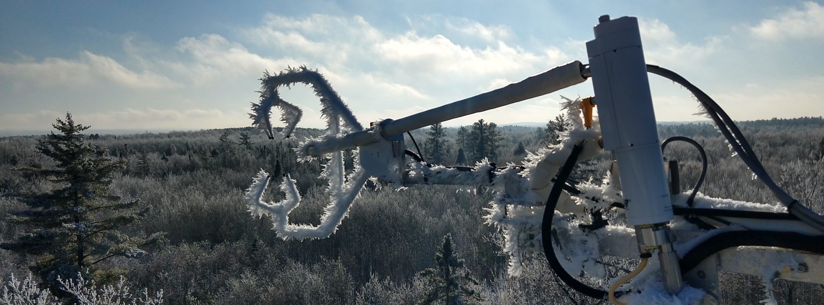
This site has a flux/meteorological tower that is 22 m (72 ft) tall with six measurement levels. The tower top extends above the vegetation canopy to allow sensors mounted at the top and along the tower to capture the full profile of atmospheric conditions from the top of the vegetation canopy to the ground. The tower collects physical and chemical properties of atmosphere-related processes, such as humidity, wind, and net ecosystem gas exchange. Precipitation data are collected by a tipping bucket at the top of the tower and a series of throughfalls located in the soil array.

Phenocams

One phenocam is attached to the top and the bottom of the tower. Here we show the images from the most recent hour. The full collection of images can be viewed on the Phenocam Gallery - click on either of the images below.

Tower top

NEON.D05.STEI.DP1.10033

Tower bottom

NEON.D05.STEI.DP1.10042

Soil Sensor Measurements

This site has five soil plots placed in an array within the airshed of the flux tower. Photosynthetically Active Radiation (PAR) at soil surface, soil heat flux, solar radiation, and throughfall are measured at the soil surface in each soil plot. Soil moisture, soil temperature, and CO2 concentration are measured at multiple depths in each soil plot.

Observational Sampling

At terrestrial sites, field ecologists observe birds and plants, and sample ground beetles, mosquitoes, small mammals, soil microbes, and ticks. Lab analyses are carried out to provide further data on DNA sequences, pathogens, soils, sediments, and biogeochemistry. Learn more about terrestrial observations or explore this site's data products.


Field Site Data

Site

Site Host

Private

Site Access Allowed

Very Limited

Site Access Details

Very limited available via private land owner.

Site Host

Chequamegon Nicolet National Forest

Site Access Allowed

Yes

Site URL

https://www.fs.usda.gov/cnnf/

Site Access Details

NEON sampling area of this field site is located in Chequamegon Nicolet National Forest. Additional research may take place in this area with site host permission.

Site Host

Steigerwaldt Land Services

Site URL

https://steigerwaldt.com/

Operations Office

NEON Field Operations Office

Domain 05 Support Facility

NEON Field Operations Address

7647 Notre Dame Lane
Land O Lakes, WI 54540

NEON Field Operations Phone

906.842.2119

Location

Latitude

45.50894

Longitude

-89.58637

Geodetic Datum

WGS84

UTM Northing

5042743.85m

UTM Easting

297968.69m

UTM Zone

16N

County

Lincoln

State

WI

Country

US

Mean Elevation

476m

Minimum Elevation

466m

Maximum Elevation

536m

Climate

Mean Annual Temperature

4.8°C

Mean Annual Precipitation

797mm

Dominant Wind Direction

WSW

Vegetation

Mean Canopy Height

20.0m

Dominant NLCD Classes

Deciduous Forest, Mixed Forest, Woody Wetlands

Average number of green days

170

Average first greenness increase date

120 DOY

Average peak green date

165 DOY

Average first greenness decrease date

215 DOY

Average minimum greenness date

290 DOY

Tower

Tower Height

22m

Number of Tower Levels

6

Soils

Megapit Soil Family

Coarse-loamy - mixed - superactive - frigid Alfic Epiaquods

Soil Subgroup

Alfic Epiaquods


Gallery

  • Photos
  • Videos

No Video


Related Field Sites

Other Domain D05 Field Sites

blue square white drop icon Crampton Lake NEON
Core Aquatic
blue circle white drop icon Little Rock Lake NEON
Gradient Aquatic
brown circle white drop icon Treehaven NEON
Gradient Terrestrial
brown square white mountain icon University of Notre Dame Environmental Research Center NEON
Core Terrestrial

Other Field Sites in WI

blue square white drop icon Crampton Lake NEON
Core Aquatic
blue circle white drop icon Little Rock Lake NEON
Gradient Aquatic
brown circle white drop icon Treehaven NEON
Gradient Terrestrial
NSF NEON, Operated by Battelle

Follow Us:

Join Our Newsletter

Get updates on events, opportunities, and how NEON is being used today.

Subscribe Now

Footer

  • About Us
  • Newsroom
  • Contact Us
  • Terms & Conditions
  • Careers
  • Code of Conduct

Copyright © Battelle, 2025

The National Ecological Observatory Network is a major facility fully funded by the U.S. National Science Foundation.

Any opinions, findings and conclusions or recommendations expressed in this material do not necessarily reflect the views of the U.S. National Science Foundation.