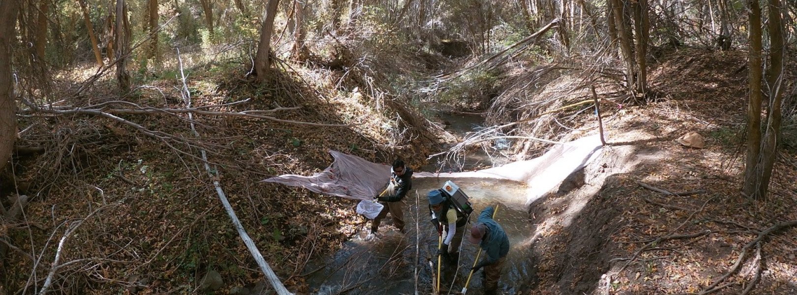
NSF NEON, Operated by Battelle

Main navigation

  • About Us
    • Overview
      • Spatial and Temporal Design
      • History
    • Vision and Management
    • Advisory Groups
      • Science, Technology & Education Advisory Committee
      • Technical Working Groups (TWGs)
    • FAQ
    • Contact Us
      • Contact NEON Biorepository
      • Field Offices
    • User Accounts
    • Staff
    • Code of Conduct

    About Us

  • Data & Samples
    • Data Portal
      • Explore Data Products
      • Data Availability Charts
      • Spatial Data & Maps
      • Document Library
      • API & GraphQL
      • Prototype Data
      • External Lab Data Ingest (restricted)
    • Data Themes
      • Biogeochemistry
      • Ecohydrology
      • Land Cover and Processes
      • Organisms, Populations, and Communities
    • Samples & Specimens
      • Discover and Use NEON Samples
        • Sample Types
        • Sample Repositories
        • Sample Explorer
        • Megapit and Distributed Initial Characterization Soil Archives
      • Sample Processing
      • Sample Quality
      • Taxonomic Lists
    • Collection Methods
      • Protocols & Standardized Methods
      • Airborne Remote Sensing
        • Flight Box Design
        • Flight Schedules and Coverage
        • Daily Flight Reports
          • AOP Flight Report Sign Up
        • Camera
        • Imaging Spectrometer
        • Lidar
      • Automated Instruments
        • Site Level Sampling Design
        • Sensor Collection Frequency
        • Instrumented Collection Types
          • Meteorology
          • Phenocams
          • Soil Sensors
          • Ground Water
          • Surface Water
      • Observational Sampling
        • Site Level Sampling Design
        • Sampling Schedules
        • Observation Types
          • Aquatic Organisms
            • Aquatic Microbes
            • Fish
            • Macroinvertebrates & Zooplankton
            • Periphyton, Phytoplankton, and Aquatic Plants
          • Terrestrial Organisms
            • Birds
            • Ground Beetles
            • Mosquitoes
            • Small Mammals
            • Soil Microbes
            • Terrestrial Plants
            • Ticks
          • Hydrology & Geomorphology
            • Discharge
            • Geomorphology
          • Biogeochemistry
          • DNA Sequences
          • Pathogens
          • Sediments
          • Soils
            • Soil Descriptions
        • Optimizing the Observational Sampling Designs
    • Data Notifications
    • Data Guidelines and Policies
      • Acknowledging and Citing NEON
      • Publishing Research Outputs
      • Usage Policies
    • Data Management
      • Data Availability
      • Data Formats and Conventions
      • Data Processing
      • Data Quality
      • Data Product Bundles
      • Data Product Revisions and Releases
        • Release 2021
        • Release 2022
        • Release 2023
        • Release 2024
        • Release-2025
      • NEON and Google
      • Externally Hosted Data

    Data & Samples

  • Field Sites
    • About Field Sites and Domains
    • Explore Field Sites
    • Site Management Data Product

    Field Sites

  • Impact
    • Observatory Blog
    • Case Studies
    • Papers & Publications
    • Newsroom
      • NEON in the News
      • Newsletter Archive
      • Newsletter Sign Up

    Impact

  • Resources
    • Getting Started with NEON Data & Resources
    • Documents and Communication Resources
      • Papers & Publications
      • Document Library
      • Outreach Materials
    • Code Hub
      • Code Resources Guidelines
      • Code Resources Submission
      • NEON's GitHub Organization Homepage
    • Learning Hub
      • Science Videos
      • Tutorials
      • Workshops & Courses
      • Teaching Modules
    • Research Support Services
      • Field Site Coordination
      • Letters of Support
      • Mobile Deployment Platforms
      • Permits and Permissions
      • AOP Flight Campaigns
      • Research Support FAQs
      • Research Support Projects
    • Funding Opportunities

    Resources

  • Get Involved
    • Advisory Groups
      • Science, Technology & Education Advisory Committee
      • Technical Working Groups
    • Upcoming Events
    • NEON Ambassador Program
      • Exploring NEON-Derived Data Products Workshop Series
    • Research and Collaborations
      • Environmental Data Science Innovation and Inclusion Lab
      • Collaboration with DOE BER User Facilities and Programs
      • EFI-NEON Ecological Forecasting Challenge
      • NEON Great Lakes User Group
      • NEON Science Summit
      • NCAR-NEON-Community Collaborations
        • NCAR-NEON Community Steering Committee
    • Community Engagement
      • How Community Feedback Impacts NEON Operations
    • Science Seminars and Data Skills Webinars
      • Past Years
    • Work Opportunities
      • Careers
      • Seasonal Fieldwork
      • Internships
        • Intern Alumni
    • Partners

    Get Involved

  • My Account
  • Search

Search

Field Sites

  • About Field Sites and Domains
  • Explore Field Sites
  • Site Management Data Product

Breadcrumb

  1. Field Sites
  2. Red Butte Creek NEON

Field Site

Red Butte Creek NEON / REDB

blue square white drop icon

Core Aquatic, UT, D15: Great Basin

Fish sampling at the REDB Field site

About Field Sites

Red Butte Creek (REDB) is an aquatic NEON field site located just east of Salt Lake City, UT near Fort Douglas. It is a second-order wadeable stream. The stream reach is located upstream of the Red Butte Reservoir and a U.S. Geological Survey gaging station. The stream is confined within a steep canyon drainage basin in the southwestern Rocky Mountains and drains a 16.7 km2 (4130 acre) watershed. REDB is managed by the United States Forest Service and the University of Utah. The site is part of NEON's Great Basin Domain (D15), which is bordered by the Sierra Nevada to the west, the Rocky Mountains and Colorado Plateau to the east, the Mojave Desert to the south, and the Columbia Plateau to the north. D15 has one other field site, the terrestrial site ONAQ. [1] [2]

Climate

The climate within Red Butte Canyon is characterized by hot, dry summers and long, cold winters. Most precipitation occurs in winter and spring, with the summer rains less predictable and dependent on the extent to which monsoonal systems penetrate into northern Utah. Mean annual precipitation ranges from about 500 mm (20 in.) at the lower elevation to approximately 900 mm (35 in.) at the higher elevations. Mean monthly air temperature at REDB are below freezing in December and January and above 20°C (68°F) in July and August. During the main growing period (May through September), daytime maximum temperatures range between 18.7 and 31.8°C (65 - 89°F) and nighttime minimum temperatures range between 5.2 and 16.4°C (41 - 62°F). Mean annual temperature is 7.7°C (46°F) and mean annual precipitation is 750.5 mm (29.5 in.). [3] [5] [6]

Geology

The geology of Red Butte Creek ranges from recent Holocene deposits to 360 million years old Mississippian rocks. Younger deposits are unconsolidated and derive mostly from landslides or stream-deposited alluvium. The majority of deposits at Red Butte Creek consist of shales and siltstones. [3] [4]

Soils

Dominant soil series at the site: Harkers-Wallsburg association, steep. The taxonomy of this soil is Order: Mollisols; Suborder: Xerolls; Great group: Palexerolls-Argixerolls; Subgroup: Typic Palexerolls-Lithic Argixerolls; Family: Fine, smectitic, frigid Typic Palexerolls-Clayey-skeletal, smectitic, frigid Lithic Argixerolls; Series: Harkers-Wallsburg association, steep. [5]

Hydrology

Red Butte Creek is a snowmelt-dominated system, and thus has a flow regime with large peak flows during spring and early summer. Often, the flows increase by a factor of 10 during spring snowmelt. Hydrograph fluctuations are driven by this snowmelt. During base flow conditions, stream widths are typically <2 m (<6.5 ft.) and depth <0.5 m (<1.6 ft.). [2]

Vegetation

Abundant hardwood trees and willows surround Red Butte Creek. Grasses and shrubs comprise the understory. Gambel oak (Quercus gambelii) is the dominant type of vegetation throughout the altitudinal range of Red Butte Canyon. Both walls of the canyon support often nearly impenetrable oak in association with bigtooth maple (Acer grandidentatum), the latter growing chiefly in drainage-ways. Few species thrive as understory with dense oak cover. The most common are catchweed bedstraw (Galium aparine) and Oregon grape (Mahonia repens). Others appearing seasonally under oak are dogtooth violet (Erythronium grandiflorum), lanceleaf spring beauty (Claytonia lanceolata), ballhead waterleaf (Hydrophyllum capitatum), and western waterleaf (H. occidentale). [2] [5]

Fauna

In 2009, Red Butte Creek (REDB) was not recognized by Salt Lake County as supporting any native or non-native fish species. In 2011, 2012, and 2014, the Utah Division of Wildlife Resources stocked REDB with Bonneville cutthroat trout (Oncorhynchus clarkia utah), which is native to the Bonneville basin of Idaho, Nevada, Utah, and Wyoming. REDB continues to support populations of Bonneville cutthroat trout, as demonstrated by NEON electrofishing data collected semi-annually since 2016. NEON also collects data on REDB macroinvertebrates. [7] [8] [9] [10]

Past Land Management and Use

After pioneer arrival to the area in 1848, the main use of Red Butte Creek (REDB) was to provide water from the stream and sandstone quarried from the surrounding canyon to be used for construction in Salt Lake City. The major use of REDB water was by the U.S. Army at Fort Douglas, which was established at the mouth of the canyon in 1862. However, due to the mining of sandstone and human activity, REDB water was contaminated. In 1890, the government declared that the waters of Red Butte were sole property of the U.S. Army. The present dam was constructed between 1928 and 1930, and the reservoir provided water for Fort Douglas until its closure in 1991. REDB was also used for timber and cattle grazing during this time.

In 1982, flooding destroyed beaver dams and the beaver population was removed to protect the Fort Douglas water supply. The following year, heavy snows followed by warm temperatures lead to the largest flooding event in recent times. Active beaver dams during this flooding event would have reduced impacts on wetland plants. In 1991, the U.S. Forest Service requested that the Utah Division of Wildlife Resources reintroduce beavers to REDB. In 1988, a fire from nearby Emigration Canyon moved into the headwaters of REDB. After the fire was contained, the U.S. Forest Service reseeded REDB with native species. In June of 2010, REDB was polluted by 36,000 gallons of crude oil from a nearby pipeline. In December of the same year, a second spill of 21,000 gallons polluted REDB. After intensive clean-up efforts for two years, REDB was declared clean by the Utah Division of Water Quality in December 2012.

In 1969, the U.S. Army declared REDB as surplus land and the U.S. Forest Service assumed responsibility for the area. The U.S. Forest Service designated REDB as a Research Natural Area (RNA) and it has been protected since that time. RNAs are set aside because they contain unusual or unique features of value to society. REDB acquired RNA status because it is one of the last undisturbed watersheds in the Great Basin and is adjacent to a major metropolitan area, Salt Lake Valley. Access to REDB is largely restricted to scientific investigators. Research on ecological processes and human-impacts is conducted at REDB by various members of the scientific community, often in association with the University of Utah. [3] [5] [13]

Current Land Management and Use

Red Butte Creek (REDB) is managed by the United States Forest Service and the University of Utah. The Forest Service acquired REDB in 1969 and declared it a Research Natural Area (RNA). RNAs are preserved natural ecosystems whose components and processes are studied by the scientific community. REDB bisects the campus of the University of Utah, who partnered with the Salt Lake County Watershed Planning and Restoration Program to promote research related to the sustainability and stewardship of the creek. The University of Utah, Research Park administrators, community members, and Salt Lake County municipal employees created the Red Butte Creek Strategic Vision, an initiative that addresses sustainability, environmental stewardship, and ecological planning. This diverse group of stakeholders, as well as other members of the scientific community, have conducted research at REDB for several decades. [3] [11] [12]

NEON Site Establishment

Site characterization for REDB began in October 2015 and establishment was completed in September 2016. The aquatic observation system (AOS) began sampling in January 2017. The aquatic instrumentation system (AIS) began streaming in July 2018.

Additional Resources

[1] Terrestrial Observation System (TOS) Site Characterization Report: Domain 15. NEON.DOC.003898vB.

[2] Aquatic Instrument System (AIS) Site Characterization Report: Domain 15. NEON.DOC.001857vB

[3] Ehleringer, J.R., Arnow, L.A., Arnow, T., McNulty, I.B., and Negus, N.C. (1992). Red Butte Canyon Research Natural Area: History, Flora, Geology, Climate, and Ecology. The Great Basin Naturalist, ISN 0017-3614.

[4] Schweitzer, P.N., 2019, Record quality tables for the Mineral Resources Data System: U.S. Geological Survey data release, https://doi.org/10.5066/P9DYLWMP.

[5] Terrestrial Instrument System (TIS, FIU) Site Characterization Supporting Data: Domain 15. NEON.DOC.011043vC.

[6] PRISM Climate Group., Oregon State University, http://prism.oregonstate.edu, created 4 Feb 2004.

[7] Salt Lake County Watershed Planning and Restoration Program (WPRP). (2009). Water Quality Stewardship Plan. Available online at: http://slco.org/watershed/wtrQualSteward/

[8] Utah Division of Wildlife Resources (UDWR). (2010-2015). Fish Stocking Reports. Available online at: https://dwrapps.utah. gov/fishstocking/Fish

[9] Behnke, R.J. 2002. Trout and salmon of North America. The Free Press, New York, NY.

[10] NEON (National Ecological Observatory Network). 2020. Data Product DP1.20107.001, Fish electrofishing, gill netting, and fyke netting counts. Provisional data downloaded from http://data.neonscience.org on May 8, 2020.

[11] https://redbuttecreek.utah.edu/projects/

[12] https://environment.utah.edu/redbuttecreek/

[13] https://daqy2hvnfszx3.cloudfront.net/wp-content/uploads/sites/5/2016/08…

Field Site Information

Latitude/Longitude

40.783934, -111.79789

Geodetic Datum

WGS84

Location

Salt Lake County
UT, US

Elevation

Mean: 1694m

Mean Annual Temperature

7.7°C

Dominant NLCD Classes

Deciduous Forest

Colocated Research

University of Utah
Red Butte Canyon Research Natural Area

Field Operations Office

2992 South Main Street
South Salt Lake City, UT 84115

Research Access

Non-NEON research activities are allowed in this area. Researchers must obtain their own permits with the site host(s).

Request Access

Observation Types

Remote Sensing

Remote sensing surveys of this field site collect lidar, spectrometer and high-resolution RGB camera data.

Meteorological Measurements

This site has one meteorological station located in the riparian area. The met station is outfitted with a subset of the same sensors used at terrestrial sites. Measurements include wind speed and direction, air temperature, barometric pressure, relative humidity, shortwave radiation, and PAR.

Phenocams

A phenocam is pointed toward the land-water interface of the site. Here we show the images from the most recent hour. The full collection of images can be viewed on the Phenocam Gallery - click on the image below.

NEON.D15.REDB.DP1.20002


Field Site Data

Site

Site Host

US Forest Service, University of Utah

Site Access Allowed

Limited

Site URL

https://www.fs.usda.gov/wps/portal/fsinternet/cs/detail/!ut/p/z1/04_Sj9CPykssy0xPLMnMz0vMAfIjo8zijQwgwNHCwN_DI8zPyBcqYKAfjlVBmA9cQRQx-g1wAEci9eNREIXf-HD9KKxWIPuAkBle-lHpOflJkOByzEsytkjXjypKTUstSi3SKy0CCmeUlBQUW6kaqBqUl5frpefnp-ek6iXn56oaYNOSkV9coh-BqlK_IDc0NMIgyzSnzMcRAIRE-zk!/dz/d5/L2dBISEvZ0FBIS9nQSEh/?position=Not%20Yet%20Determined.Html&ss=110419&navtype=BROWSEBYSUBJECT&pnavid=170000000000000&navid=170110000000000&ttype=detail&cid=fsem_035528

Site Access Details

Researchers should coordinate directly with the US Forest Service for permitting and approval.

Operations Office

NEON Field Operations Office

Domain 15 Support Facility

NEON Field Operations Address

2992 South Main Street
South Salt Lake City, UT 84115

NEON Field Operations Phone

385.235.7975

Location

Latitude

40.783934

Longitude

-111.79789

Geodetic Datum

WGS84

UTM Northing

4515056.81m

UTM Easting

432697.10m

UTM Zone

12N

County

Salt Lake

State

UT

Country

US

Mean Elevation

1694m

Climate

Mean Annual Temperature

7.7°C

Mean Annual Precipitation

751mm

Vegetation

Dominant NLCD Classes

Deciduous Forest

Watershed

USGS HUC

h16020204

Watershed Name

Jordan

Geology

USGS Geology Unit

UTTR2;3

USGS Geology Name

Ankareh Shale

USGS Lithologic Constituents

Siltstone-mudstone with conglomerates

USGS Geology Age

Middle to Late Triassic


Gallery

  • Photos
  • Videos

No Video


Related Field Sites

Other Domain D15 Field Sites

brown square white mountain icon Onaqui NEON
Core Terrestrial

Other Field Sites in UT

brown circle white drop icon Moab NEON
Gradient Terrestrial
brown square white mountain icon Onaqui NEON
Core Terrestrial
NSF NEON, Operated by Battelle

Follow Us:

Join Our Newsletter

Get updates on events, opportunities, and how NEON is being used today.

Subscribe Now

Footer

  • About Us
  • Newsroom
  • Contact Us
  • Terms & Conditions
  • Careers
  • Code of Conduct

Copyright © Battelle, 2025

The National Ecological Observatory Network is a major facility fully funded by the U.S. National Science Foundation.

Any opinions, findings and conclusions or recommendations expressed in this material do not necessarily reflect the views of the U.S. National Science Foundation.