NSF NEON, Operated by Battelle

Main navigation

  • About Us
    • Overview
      • Spatial and Temporal Design
      • History
    • Vision and Management
    • Advisory Groups
      • Science, Technology & Education Advisory Committee
      • Technical Working Groups (TWGs)
    • FAQ
    • Contact Us
      • Contact NEON Biorepository
      • Field Offices
    • User Accounts
    • Staff
    • Code of Conduct

    About Us

  • Data & Samples
    • Data Portal
      • Explore Data Products
      • Data Availability Charts
      • Spatial Data & Maps
      • Document Library
      • API & GraphQL
      • Prototype Data
      • External Lab Data Ingest (restricted)
    • Data Themes
      • Biogeochemistry
      • Ecohydrology
      • Land Cover and Processes
      • Organisms, Populations, and Communities
    • Samples & Specimens
      • Discover and Use NEON Samples
        • Sample Types
        • Sample Repositories
        • Sample Explorer
        • Megapit and Distributed Initial Characterization Soil Archives
      • Sample Processing
      • Sample Quality
      • Taxonomic Lists
    • Collection Methods
      • Protocols & Standardized Methods
      • Airborne Remote Sensing
        • Flight Box Design
        • Flight Schedules and Coverage
        • Daily Flight Reports
          • AOP Flight Report Sign Up
        • Camera
        • Imaging Spectrometer
        • Lidar
      • Automated Instruments
        • Site Level Sampling Design
        • Sensor Collection Frequency
        • Instrumented Collection Types
          • Meteorology
          • Phenocams
          • Soil Sensors
          • Ground Water
          • Surface Water
      • Observational Sampling
        • Site Level Sampling Design
        • Sampling Schedules
        • Observation Types
          • Aquatic Organisms
            • Aquatic Microbes
            • Fish
            • Macroinvertebrates & Zooplankton
            • Periphyton, Phytoplankton, and Aquatic Plants
          • Terrestrial Organisms
            • Birds
            • Ground Beetles
            • Mosquitoes
            • Small Mammals
            • Soil Microbes
            • Terrestrial Plants
            • Ticks
          • Hydrology & Geomorphology
            • Discharge
            • Geomorphology
          • Biogeochemistry
          • DNA Sequences
          • Pathogens
          • Sediments
          • Soils
            • Soil Descriptions
        • Optimizing the Observational Sampling Designs
    • Data Notifications
    • Data Guidelines and Policies
      • Acknowledging and Citing NEON
      • Publishing Research Outputs
      • Usage Policies
    • Data Management
      • Data Availability
      • Data Formats and Conventions
      • Data Processing
      • Data Quality
      • Data Product Bundles
      • Data Product Revisions and Releases
        • Release 2021
        • Release 2022
        • Release 2023
        • Release 2024
        • Release-2025
      • NEON and Google
      • Externally Hosted Data

    Data & Samples

  • Field Sites
    • About Field Sites and Domains
    • Explore Field Sites
    • Site Management Data Product

    Field Sites

  • Impact
    • Observatory Blog
    • Case Studies
    • Papers & Publications
    • Newsroom
      • NEON in the News
      • Newsletter Archive
      • Newsletter Sign Up

    Impact

  • Resources
    • Getting Started with NEON Data & Resources
    • Documents and Communication Resources
      • Papers & Publications
      • Document Library
      • Outreach Materials
    • Code Hub
      • Code Resources Guidelines
      • Code Resources Submission
      • NEON's GitHub Organization Homepage
    • Learning Hub
      • Science Videos
      • Tutorials
      • Workshops & Courses
      • Teaching Modules
    • Research Support Services
      • Field Site Coordination
      • Letters of Support
      • Mobile Deployment Platforms
      • Permits and Permissions
      • AOP Flight Campaigns
      • Research Support FAQs
      • Research Support Projects
    • Funding Opportunities

    Resources

  • Get Involved
    • Advisory Groups
      • Science, Technology & Education Advisory Committee
      • Technical Working Groups
    • Upcoming Events
    • NEON Ambassador Program
      • Exploring NEON-Derived Data Products Workshop Series
    • Research and Collaborations
      • Environmental Data Science Innovation and Inclusion Lab
      • Collaboration with DOE BER User Facilities and Programs
      • EFI-NEON Ecological Forecasting Challenge
      • NEON Great Lakes User Group
      • NEON Science Summit
      • NCAR-NEON-Community Collaborations
        • NCAR-NEON Community Steering Committee
    • Community Engagement
      • How Community Feedback Impacts NEON Operations
    • Science Seminars and Data Skills Webinars
      • Past Years
    • Work Opportunities
      • Careers
      • Seasonal Fieldwork
      • Internships
        • Intern Alumni
    • Partners

    Get Involved

  • My Account
  • Search

Search

Field Sites

  • About Field Sites and Domains
  • Explore Field Sites
  • Site Management Data Product

Breadcrumb

  1. Field Sites
  2. LeConte Creek NEON

Field Site

LeConte Creek NEON / LECO

blue circle white drop icon

Gradient Aquatic, TN, D07: Appalachians & Cumberland Plateau

LeConte Creek aquatic site

About Field Sites

LeConte Creek (LECO) is an aquatic NEON field site in the northwest part of the Great Smoky Mountains National Park, located in eastern Tennessee. LECO is hosted by the National Park Service. LeConte Creek is a second-order wadeable stream with a series of steps and pools, consisting of many large granitic boulders and bordered by thick vegetation. It drains a 9.13 km2 (2256 acre) watershed. The park is characterized by abundant rainfall, variable elevations, and an exceptional richness of biota hosted by closed-canopy deciduous old growth forests. As one of the largest protected areas in the eastern U.S., it is the most biodiverse park in the national park system and the most visited. LECO is part of NEON Domain 07 - Appalachians & Cumberland Plateau, which includes eastern Tennessee, most of Kentucky, southern Ohio, and parts of North Carolina, Georgia, Indiana, and Illinois. D07 includes four other NEON field sites, including three terrestrial sites and one additional aquatic site. LECO is colocated with the GRSM terrestrial field site. [1]

Climate

LeConte creek is found in mountainous terrain of the Great Smoky Mountains National Park. The park’s altitude variation simulates the climate and habitat changes you would experience traveling north or south across the eastern United States. The cool, moist environment found in higher elevations is juxtaposed against the drier, warmer lowlands. Temperature ranges are dependent on elevation and can vary 6-11°C (10-20°F) from mountain base to top. Average annual rainfall also varies with these elevation changes, ranging from approximately 1400 mm (55 in.) in the lower valleys to over 2160 mm (85 in.) on some of the highest peaks. Mean annual temperature is 13.1°C (56°F) and mean annual precipitation is 1375 mm (55 in.). With the exception of the Pacific Northwest, this park receives more annual rainfall than anywhere else in the contiguous United States. This heavy rainfall can cause extreme weather events such as flash flooding, particularly in the spring and summer months. During fall and winter, winds can become strong and damaging, reaching up to 80-100 mph as a result of a phenomenon known as mountain waves. [7]

Geology

The geology at LECO consists of alluvium, which is sand, clay or silt that was deposited relatively recently by a stream or other body of running water, as a sorted or semi-sorted sediment. [2]

Soils

Soils at this site are alluvium and highly weathered compared to other regions in the eastern United States. Typical substrates in the creek are mostly cobbles and coarse sediments. [4] [15]

Hydrology

LECO is a second-order, wadeable, high-gradient stream with an average fall of 10%. The creek contains numerous falls and rapids and a few deep pools and shoals. The stream comes to its only natural barrier at Rainbow Falls at an altitude of 1318 m (4326 ft), where the water makes a 26 m (85 ft.) drop. The flow is frequently interrupted by the heavy presence of small to large granitic boulders and is intercepted by falls and rapids. Hydrologic conditions can change rapidly as this area can received up to 85 inches of annual rainfall. [1] [3]

Vegetation

The area surrounding LECO is home to one of the largest stands of deciduous old growth forests in North America. Vegetation at LECO creek follows typical riparian vegetation and canopy cover which exists in a nearly homogenous pattern across the area. The site is dominated by tall deciduous and coniferous trees forming the canopy, and thick rhododendron bushes enclose along the edges of the stream reach. [1] [8]

Fauna

LECO is surrounded by the highly biodiverse Great Smoky Mountains National Park. Perch (Perca) and rainbow trout (Oncorhynchus mykiss) can be found at this particular site in addition to other creeks in the park. The abundance of salamanders (Urodela) is exceptional in and around the waters of the creek, with around 30 species recognized to inhabit the area. At LECO, NEON conducts biological sampling of fish and macroinvertebrates. [4] [9] [10]

Past Land Management and Use

Designated as a national park by the U.S. Congress in 1934, the Great Smoky Mountains National Park was officially dedicated by President Franklin D. Roosevelt in 1940. This designation was historically significant as it was the first national park paid for in part by the federal government. GRSM encompasses a rich mosaic of historical use including human influence from prehistoric Paleo Indians, 1880s European settlement and 20th century loggers. Prior to its establishment as a national park, many historic species were eradicated from the ecological framework including bison, elk, mountain lion, gray wolf, red wolf, river otter, and several species of fish. The extraordinary biodiversity exhibited in the park’s 2108 km2 (814 sq. mi.) of plant-covered, gently-contoured mountains led to its designation as one of the first UNESCO World Heritage Sites in 1983. The North American deciduous old growth forest was plagued by wildfires in late 2016, burning more than 10,000 acres of the park, including areas in the NEON sites. [8] [14] [16] [17]

Current Land Management and Use

LeConte Creek is incorporated in the Great Smoky Mountains National Park, making it a hotspot for ongoing ecological studies. Management decisions are informed by available scientific data. The park encourages scientists and students from a multitude of institutions and organizations to contribute to current research, which is ultimately accessible to the public. Scientists from these institutions and organizations focus their areas of research on acid deposition, vegetation communities, soil quality, water chemistry, freshwater communities, and climate change. LeConte Creek has been an enduring draw for visitors of the park. Of special interest is Rainbow Falls, which represents the single highest drop of water in the national park. [13] [14] [15]

NEON Site Establishment

NEON began data collection activities at LeConte creek in 2015 when the Airborne Observation Platform (AOP) was flown over both sites collecting lidar, hyperspectral, and high-resolution RGB ortho-photos of the surrounding vegetation and landscape. Observational sampling also began in 2015, with two full seasons of organismal and biogeochemical data collected before a significant wildfire in 2016. Fortunately, the fire caused little damage to all data collection sensors except for the soil sensors, which suffered dramatic damage. [18]

Additional Resources

[1] Aquatic Instrument System (AIS) Site Characterization Report: Domain 07. NEON.DOC.001372vB


[2] https://mrdata.usgs.gov/geology/state/sgmc-lith.php?text=alluvium#:~:te…

[3] An Ecological Study of the Distribution of Animals on Mt. LeConte and Along LeConte Creek (1929)

[4] Terrestrial Instrument System (TIS, FIU) Site Characterization Supporting Data: Domain 07. NEON.DOC.011037vD

[5] PRISM Climate Group., Oregon State University, http://prism.oregonstate.edu, created 4 Feb 2004.

[6] David M. Gaffin and David G. Hotz (2000). "A Precipitation and Flood Climatology with Synoptic Features of Heavy Rainfall across the Southern Appalachian Mountains" (PDF). 24 (3). National Weather Digest: 3–15.

[7] https://www.weather.gov/mrx/mountainwaves

[8] Terrestrial Observation System (TOS) Site Characterization Report: Domain 07. NEON.DOC.003891vB.

[9] Aquatic Site Sampling Design - NEON Domain 07. NEON.DOC.003606vA

[10] https://www.nps.gov/grsm/learn/nature/animals.htm

[11] https://www.nps.gov/grsm/learn/nature/index.htm

[12] https://www.nps.gov/grsm/planyourvisit/weather.htm

[13] https://www.nps.gov/grsm/learn/nature/datasets.htm

[14] https://www.nps.gov/grsm/learn/nature/index.htm

[15] https://www.nps.gov/im/aphn/grsm.htm

[16] https://www.nps.gov/grsm/learn/historyculture/index.htm

17] https://www.nps.gov/grsm/learn/management/globalcontext.htm

[18] https://www.battelleecology.org/observatory/observatory-blog/neons-grea…

Field Site Information

Latitude/Longitude

35.690428, -83.50379

Geodetic Datum

WGS84

Location

Sevier County
TN, US

Elevation

Mean: 579m

Mean Annual Temperature

13.1°C

Dominant NLCD Classes

Deciduous Forest

Colocated Site(s)

Great Smoky Mountains National Park NEON

Colocated Research

Great Smoky Mountains National Park-Elkmont National Atmospheric Deposition Program
UNESCO Southern Appalachian Man and the Biosphere International Reserve

Field Operations Office

154 Fairbanks Road, Fairbanks Plaza
Oak Ridge, TN 37830

Research Access

Non-NEON research activities are allowed in this area. Researchers must obtain their own permits with the site host(s).

Request Access

Observation Types

Remote Sensing

Remote sensing surveys of this field site collect lidar, spectrometer and high-resolution RGB camera data.

Meteorological Measurements

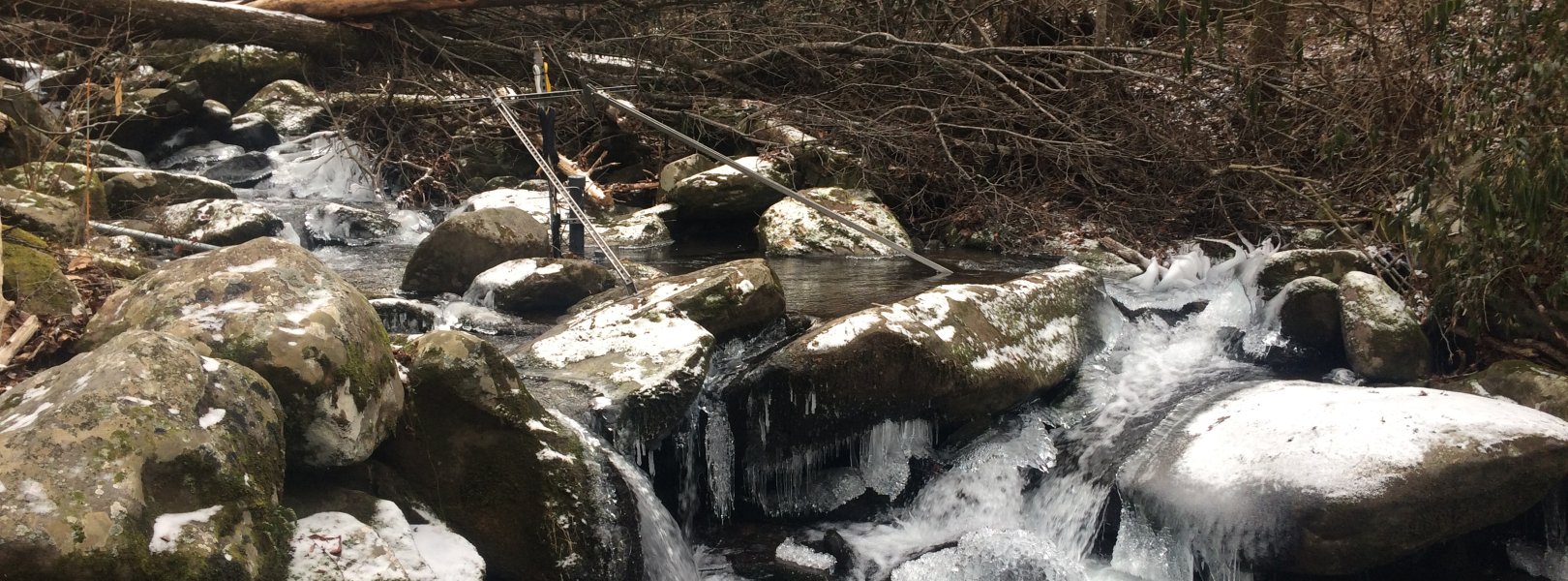
This site has a meteorological station located in the riparian area. The met station is outfitted with a subset of the same sensors used at terrestrial sites. Measurements include wind speed and direction, air temperature, barometric pressure, relative humidity, shortwave radiation, and PAR.

Phenocams

A phenocam is pointed toward the land-water interface of the site. Here we show the images from the most recent hour. The full collection of images can be viewed on the Phenocam Gallery - click on the image below.

NEON.D07.LECO.DP1.20002


Field Site Data

Site

Site Host

National Park Service

Site Access Allowed

Yes

Site URL

https://irma.nps.gov/rprs/

Site Access Details

The National Park Service is open to additional research activities taking place in this area. Apply via IRMA Permitting portal.

Operations Office

NEON Field Operations Office

Domain 07 Support Facility

NEON Field Operations Address

154 Fairbanks Road, Fairbanks Plaza
Oak Ridge, TN 37830

NEON Field Operations Phone

865.272.0055

Location

Latitude

35.690428

Longitude

-83.50379

Geodetic Datum

WGS84

UTM Northing

3952502.40m

UTM Easting

273437.50m

UTM Zone

17N

County

Sevier

State

TN

Country

US

Mean Elevation

579m

Climate

Mean Annual Temperature

13.1°C

Mean Annual Precipitation

1375mm

Vegetation

Dominant NLCD Classes

Deciduous Forest

Watershed

USGS HUC

h06010107

Watershed Name

Lower French Broad

Geology

USGS Geology Unit

TNpCAs;15

USGS Geology Name

Snowbird Group, including Pigeon Siltstone, Roaring Fork Sandstone, Metcalf Phyllite, Longarm Quartzite, and Wading Branch Formation

USGS Lithologic Constituents

Siltstone with sandstone

USGS Geology Age

Precambrian


Gallery

  • Photos
  • Videos

No Video


Related Field Sites

Other Domain D07 Field Sites

brown circle white drop icon Great Smoky Mountains National Park NEON
Gradient Terrestrial
brown circle white drop icon Mountain Lake Biological Station NEON
Gradient Terrestrial
brown square white mountain icon Oak Ridge NEON
Core Terrestrial
blue square white drop icon Walker Branch NEON
Core Aquatic

Other Field Sites in TN

brown circle white drop icon Great Smoky Mountains National Park NEON
Gradient Terrestrial
brown square white mountain icon Oak Ridge NEON
Core Terrestrial
blue square white drop icon Walker Branch NEON
Core Aquatic
NSF NEON, Operated by Battelle

Follow Us:

Join Our Newsletter

Get updates on events, opportunities, and how NEON is being used today.

Subscribe Now

Footer

  • About Us
  • Newsroom
  • Contact Us
  • Terms & Conditions
  • Careers
  • Code of Conduct

Copyright © Battelle, 2025

The National Ecological Observatory Network is a major facility fully funded by the U.S. National Science Foundation.

Any opinions, findings and conclusions or recommendations expressed in this material do not necessarily reflect the views of the U.S. National Science Foundation.