NSF NEON, Operated by Battelle

Main navigation

  • About Us
    • Overview
      • Spatial and Temporal Design
      • History
    • Vision and Management
    • Advisory Groups
      • Science, Technology & Education Advisory Committee
      • Technical Working Groups (TWGs)
    • FAQ
    • Contact Us
      • Contact NEON Biorepository
      • Field Offices
    • User Accounts
    • Staff
    • Code of Conduct

    About Us

  • Data & Samples
    • Data Portal
      • Explore Data Products
      • Data Availability Charts
      • Spatial Data & Maps
      • Document Library
      • API & GraphQL
      • Prototype Data
      • External Lab Data Ingest (restricted)
    • Data Themes
      • Biogeochemistry
      • Ecohydrology
      • Land Cover and Processes
      • Organisms, Populations, and Communities
    • Samples & Specimens
      • Discover and Use NEON Samples
        • Sample Types
        • Sample Repositories
        • Sample Explorer
        • Megapit and Distributed Initial Characterization Soil Archives
      • Sample Processing
      • Sample Quality
      • Taxonomic Lists
    • Collection Methods
      • Protocols & Standardized Methods
      • Airborne Remote Sensing
        • Flight Box Design
        • Flight Schedules and Coverage
        • Daily Flight Reports
          • AOP Flight Report Sign Up
        • Camera
        • Imaging Spectrometer
        • Lidar
      • Automated Instruments
        • Site Level Sampling Design
        • Sensor Collection Frequency
        • Instrumented Collection Types
          • Meteorology
          • Phenocams
          • Soil Sensors
          • Ground Water
          • Surface Water
      • Observational Sampling
        • Site Level Sampling Design
        • Sampling Schedules
        • Observation Types
          • Aquatic Organisms
            • Aquatic Microbes
            • Fish
            • Macroinvertebrates & Zooplankton
            • Periphyton, Phytoplankton, and Aquatic Plants
          • Terrestrial Organisms
            • Birds
            • Ground Beetles
            • Mosquitoes
            • Small Mammals
            • Soil Microbes
            • Terrestrial Plants
            • Ticks
          • Hydrology & Geomorphology
            • Discharge
            • Geomorphology
          • Biogeochemistry
          • DNA Sequences
          • Pathogens
          • Sediments
          • Soils
            • Soil Descriptions
        • Optimizing the Observational Sampling Designs
    • Data Notifications
    • Data Guidelines and Policies
      • Acknowledging and Citing NEON
      • Publishing Research Outputs
      • Usage Policies
    • Data Management
      • Data Availability
      • Data Formats and Conventions
      • Data Processing
      • Data Quality
      • Data Product Bundles
      • Data Product Revisions and Releases
        • Release 2021
        • Release 2022
        • Release 2023
        • Release 2024
        • Release-2025
      • NEON and Google
      • Externally Hosted Data

    Data & Samples

  • Field Sites
    • About Field Sites and Domains
    • Explore Field Sites
    • Site Management Data Product

    Field Sites

  • Impact
    • Observatory Blog
    • Case Studies
    • Papers & Publications
    • Newsroom
      • NEON in the News
      • Newsletter Archive
      • Newsletter Sign Up

    Impact

  • Resources
    • Getting Started with NEON Data & Resources
    • Documents and Communication Resources
      • Papers & Publications
      • Document Library
      • Outreach Materials
    • Code Hub
      • Code Resources Guidelines
      • Code Resources Submission
      • NEON's GitHub Organization Homepage
    • Learning Hub
      • Science Videos
      • Tutorials
      • Workshops & Courses
      • Teaching Modules
    • Research Support Services
      • Field Site Coordination
      • Letters of Support
      • Mobile Deployment Platforms
      • Permits and Permissions
      • AOP Flight Campaigns
      • Research Support FAQs
      • Research Support Projects
    • Funding Opportunities

    Resources

  • Get Involved
    • Advisory Groups
      • Science, Technology & Education Advisory Committee
      • Technical Working Groups
    • Upcoming Events
    • NEON Ambassador Program
      • Exploring NEON-Derived Data Products Workshop Series
    • Research and Collaborations
      • Environmental Data Science Innovation and Inclusion Lab
      • Collaboration with DOE BER User Facilities and Programs
      • EFI-NEON Ecological Forecasting Challenge
      • NEON Great Lakes User Group
      • NEON Science Summit
      • NCAR-NEON-Community Collaborations
        • NCAR-NEON Community Steering Committee
    • Community Engagement
      • How Community Feedback Impacts NEON Operations
    • Science Seminars and Data Skills Webinars
      • Past Years
    • Work Opportunities
      • Careers
      • Seasonal Fieldwork
      • Internships
        • Intern Alumni
    • Partners

    Get Involved

  • My Account
  • Search

Search

Field Sites

  • About Field Sites and Domains
  • Explore Field Sites
  • Site Management Data Product

Breadcrumb

  1. Field Sites
  2. Jornada Experimental Range NEON

Field Site

Jornada Experimental Range NEON / JORN

brown circle white drop icon

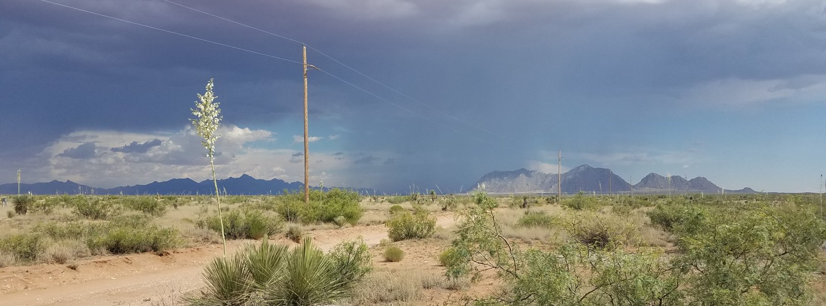
Gradient Terrestrial, NM, D14: Desert Southwest

About Field Sites

The Jornada LTER (JORN) terrestrial NEON field site is located about 40 km (24.9 mi.) from Las Cruces, New Mexico in the northern Chihuahuan Desert, the largest desert in North America. NEON samples approximately 45.7 km2 (11,293 acres) on the Jornada Experimental Range, which is managed by the USDA and New Mexico State University. NEON research at this site happens alongside two other ecological monitoring groups: the National Science Foundation’s Long Term Ecological Research (LTER) network, and the USDA Agricultural Research Service. The region is dominated by arid grasslands and desert shrubs. JORN is encompassed within NEON's Desert Southwest Domain (D14). D14 has one other terrestrial field site and one aquatic field site. JORN is not colocated with an aquatic site. [2] [3]

Climate

The Jornada Experimental Range has a desert climate. It is very sunny with very little humidity, making for extreme differences in day and night temperatures. Summers are very hot and winters that are relatively mild. Freezing temperatures can be common in winter. The little precipitation that occurs in this region does so in either gentle winter rains from December to February, or in intense convective thunderstorms during the summer monsoon from July to September. The mean annual temperature is 15.7°C (60°F), and the mean annual precipitation is 271.2 mm (10.7 in.). [1]

Geology

The geology at Jornada is characteristic of the Upper Santa Fe Group, which contains clastic sediments and other unconsolidated material. [10]

Soils

Soils at Jornada are typical of desert soils. All have low organic content with little to no organic horizon, have a high lime content, and have a caliche layer at the water percolation depth that prevents root penetration by plants. The soils are very sandy and little difference is seen in the content of surface soils when compared to subsoils. Many soils at the site are part of the subgroup Typic Petrocalcids. [1]

Hydrology

The Jornada site is located on a closed plain with no external outlet for water drainage. Because of this, water sometimes accumulates on the surface of the playas. [12]

Vegetation

Vegetation cover at Jornada is dominated by desert scrub and grassland. Large upland areas that were formerly dominated by perennial grasses, including black grama (Bouteloua eriopoda) and mesa drop seed (Sporobolus flexuosus), have been replaced by desert shrubland species, in particular creosote bush (Larrea tridentata) and honey mesquite (Prosopis glandulosa). [2]

Fauna

The Jornada site is home to many spectacular desert-adapted animals including badgers (Taxidea taxus) and banner tailed kangaroo rats (Dipodomys spectabilis). One of the most striking species is the oryx (Oryx gazelle gazelle). 95 of these large antelope were introduced to the nearby San Andres Wildlife refuge from 1969 to 1977 for the purposes of hunting. Native to the arid regions of Southern Africa, these aggressive antelope compete with native bighorn and deer for forage and potentially harbor disease that can devastate the native ungulate population. [1] [5]

Past Land Management and Use

At the end of the 19th century, rangelands across the arid West were in serious decline. This led to the establishment of several long-term agricultural research sites to study how to best manage livestock on arid grasslands. Built from the scattered holdings of a private land owner, Charles T. Turney, the Jornada Experimental Range was established by Presidential Executive Order in 1912 specifically to study the long-term effects of grazing in arid grasslands. In the late 1980s and early 1990s, data collected at the Jornada Experimental Range was instrumental in showing how desertification and woody shrub encroachment occurs. Scientists found that when arid grasslands are replaced with arid shrublands, a positive feedback cascade of nutrient loss and hydrological changes occurs, creating more disturbed, heterogeneous landscapes that encourage further encroachment by woody shrubs. [1]

Current Land Management and Use

Currently hosted by the USDA Agricultural Research Service in partnership with New Mexico State University, the Jornada Experimental Range’s research goals have broadened from an animal management focus to include large scale ecosystem services. Scientists at the Jornada study important ecosystem functions of the desert, such as dust movement and reseeding of native vegetation. Bordering the Jornada Experimental Range is the White Sands Missile Range where the United States military extensively tests new weapons. Within the borders of the White Sands Missile Range is the San Andres National Wildlife Refuge, designated an important bird area by the Audubon Society. It is one of the few places in the Chihuahuan Desert that has not been grazed in the last 50 years and has one of the only riparian areas in a vast desert spread between the Rio Grande and the Sacramento Mountains, making it an important stop for migrating birds. The site is also designated an UNESCO biosphere reserve. [1] [7] [8] [9]

NEON Site Establishment

Plot establishment for JORN began May 2015 with sampling commencing by September 2015. Construction on the tower began in 2013 and TIS sampling was able to begin by August 2014. [1]

Additional Resources

[1] https://jornada.nmsu.edu

[2] Terrestrial Observation System (TOS) Site Characterization Report: Domain 14. NEON.DOC.003897vA

[3] Havstad, K. M. (2011). ARS Long-Term Agro-Ecosystem Research Network Response to Request for Information Candidate Site: Jornada Experimental Range, Dona Ana County, New Mexico.

[4] Rango, A., Havstad, K., & Estell, R. (2011). The Utilization of Historical Data and Geospatial Technology Advances at the Jornada Experimental Range to Support Western America Ranching Culture. Remote Sensing

[5] U.S. Department of Interior Fish and Wildlife Service. (2007). Environmental Assessment/Assessment of Effect Opening for Hunting of Exotic Oryx San Andres National Wildlife Refuge

[6] UDSA-ARS: https://www.ars.usda.gov/plains-area/las-cruces-nm/range-management-res…

[7] UNESCO: http://www.unesco.org/mabdb/br/brdir/directory/biores.asp?mode=all&code…

[8] White Sands Missile Test Area: https://www.wsmr.army.mil/Pages/home.aspx

[9] Audubon Society Important Bird Area: https://www.audubon.org/important-bird-areas/san-andres-national-wildli…

[10] U.S. Geological Survey, 2005, Mineral Resources Data System: U.S. Geological Survey, Reston, Virginia. https://mrdata.usgs.gov/mrds/

[11] Four-wing Salt Bush: https://www.fs.fed.us/wildflowers/plant-of-the-week/atriplex_canescens…

[12] Gibbens, R. P. (1981). The Jornada Experimental Biosphere Reserve.

[13] PRISM Climate Group, Oregon State University, http://prism.oregonstate.edu, created 4 Feb 2004.

Field Site Information

Latitude/Longitude

32.590694, -106.84254

Geodetic Datum

WGS84

Location

Doña Ana County
NM, US

Elevation

Mean: 1324m
Minimum: 1316m
Maximum: 1333m

Mean Annual Temperature

15.7°C

Dominant Wind Direction

SW

Mean Canopy Height

0.4m

Dominant NLCD Classes

Shrub/Scrub

Colocated Research

Jornada Basin LTER
Jornada Experimental Range LTAR
UNESCO Jornada Biosphere Reserve
Critical Zone Exploration Network
Ameriflux
NOAA U.S. Climate Reference Network

Field Operations Office

2115 East Valencia Rd, Suite 131
Tucson, AZ 85706

Research Access

Non-NEON research activities are allowed in this area. Researchers must obtain their own permits with the site host(s).

Request Access

Observation Types

Remote Sensing

Remote sensing surveys of this field site collect lidar, spectrometer and high-resolution RGB camera data.

Meteorological Measurements

This site has a flux/meteorological tower that is 8 m (26 ft) tall with four measurement levels. The tower top extends above the vegetation canopy to allow sensors mounted at the top and along the tower to capture the full profile of atmospheric conditions from the top of the vegetation canopy to the ground. The tower collects physical and chemical properties of atmosphere-related processes, such as humidity, wind, and net ecosystem gas exchange. Precipitation data are collected by a tipping bucket at the top of the tower and a series of throughfalls located in the soil array.

Phenocams

One phenocam is attached to the top and the bottom of the tower. Here we show the images from the most recent hour. The full collection of images can be viewed on the Phenocam Gallery - click on either of the images below.

Tower top

NEON.D14.JORN.DP1.10033

Tower bottom

NEON.D14.JORN.DP1.10042

Soil Sensor Measurements

This site has five soil plots placed in an array within the airshed of the flux tower. Photosynthetically Active Radiation (PAR) at soil surface, soil heat flux, solar radiation, and throughfall are measured at the soil surface in each soil plot. Soil moisture, soil temperature, and CO2 concentration are measured at multiple depths in each soil plot.

Observational Sampling

At terrestrial sites, field ecologists observe birds and plants, and sample ground beetles, mosquitoes, small mammals, soil microbes, and ticks. Lab analyses are carried out to provide further data on DNA sequences, pathogens, soils, sediments, and biogeochemistry. Learn more about terrestrial observations or explore this site's data products.


Field Site Data

Site

Site Host

USDA-Agricultural Research Service

Site Access Allowed

Yes

Site URL

https://jornada.nmsu.edu/

Site Access Details

JORN encourages research activities that do not conflict with on-going activities. Please apply directly with site host and USDA for a site research permit. All requests are reviewed for impacts to cultural resources, endangered species and other research activities.

Operations Office

NEON Field Operations Office

Domain 14 Support Facility

NEON Field Operations Address

2115 East Valencia Rd, Suite 131
Tucson, AZ 85706

NEON Field Operations Phone

520.999.3518

Location

Latitude

32.590694

Longitude

-106.84254

Geodetic Datum

WGS84

UTM Northing

3607409.16m

UTM Easting

327074.62m

UTM Zone

13N

County

Doña Ana

State

NM

Country

US

Mean Elevation

1324m

Minimum Elevation

1316m

Maximum Elevation

1333m

Climate

Mean Annual Temperature

15.7°C

Mean Annual Precipitation

271mm

Dominant Wind Direction

SW

Vegetation

Mean Canopy Height

0.4m

Dominant NLCD Classes

Shrub/Scrub

Average number of green days

260

Average first greenness increase date

80 DOY

Average peak green date

185 DOY

Average first greenness decrease date

245 DOY

Average minimum greenness date

340 DOY

Tower

Tower Height

8m

Number of Tower Levels

4

Soils

Megapit Soil Family

Coarse-loamy - mixed - superactive - thermic Typic Petrocalcids

Soil Subgroup

Typic Petrocalcids


Gallery

  • Photos
  • Videos

No Video


Related Field Sites

Other Domain D14 Field Sites

brown square white mountain icon Santa Rita Experimental Range NEON
Core Terrestrial
blue square white drop icon Sycamore Creek NEON
Core Aquatic
NSF NEON, Operated by Battelle

Follow Us:

Join Our Newsletter

Get updates on events, opportunities, and how NEON is being used today.

Subscribe Now

Footer

  • About Us
  • Newsroom
  • Contact Us
  • Terms & Conditions
  • Careers
  • Code of Conduct

Copyright © Battelle, 2025

The National Ecological Observatory Network is a major facility fully funded by the U.S. National Science Foundation.

Any opinions, findings and conclusions or recommendations expressed in this material do not necessarily reflect the views of the U.S. National Science Foundation.