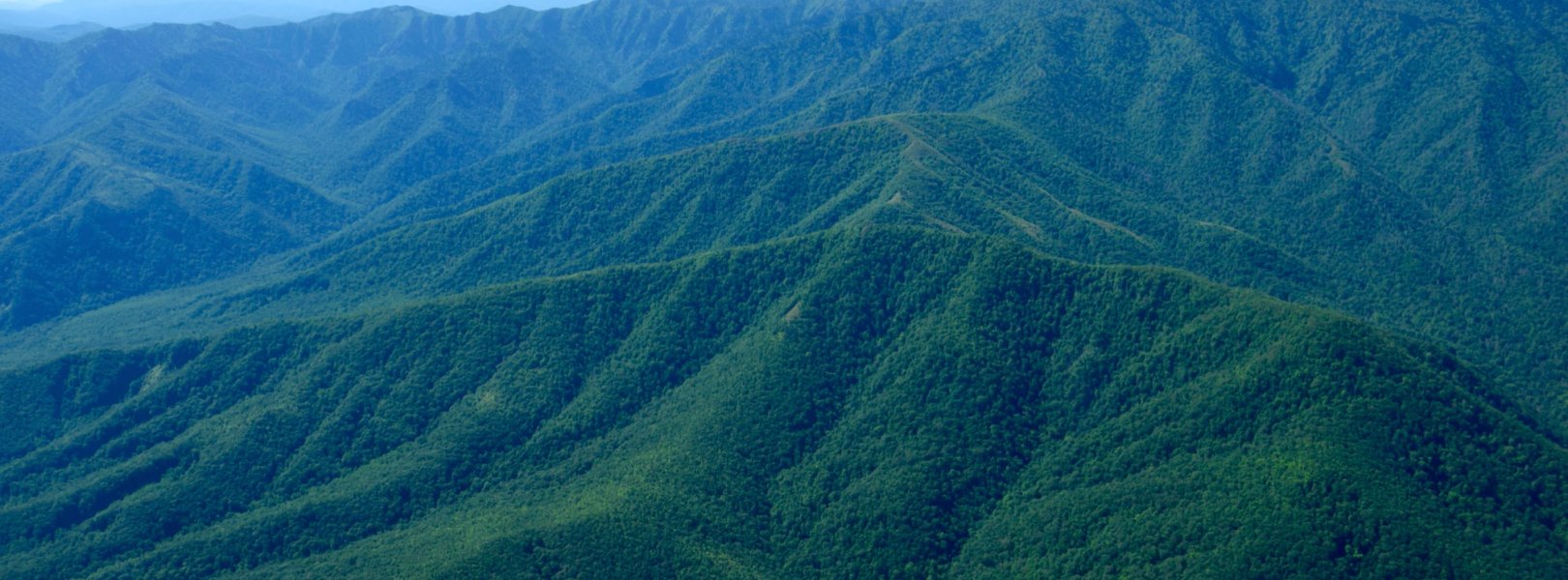
NSF NEON, Operated by Battelle

Main navigation

  • About Us
    • Overview
      • Spatial and Temporal Design
      • History
    • Vision and Management
    • Advisory Groups
      • Science, Technology & Education Advisory Committee
      • Technical Working Groups (TWGs)
    • FAQ
    • Contact Us
      • Contact NEON Biorepository
      • Field Offices
    • User Accounts
    • Staff
    • Code of Conduct

    About Us

  • Data & Samples
    • Data Portal
      • Explore Data Products
      • Data Availability Charts
      • Spatial Data & Maps
      • Document Library
      • API & GraphQL
      • Prototype Data
      • External Lab Data Ingest (restricted)
    • Data Themes
      • Biogeochemistry
      • Ecohydrology
      • Land Cover and Processes
      • Organisms, Populations, and Communities
    • Samples & Specimens
      • Discover and Use NEON Samples
        • Sample Types
        • Sample Repositories
        • Sample Explorer
        • Megapit and Distributed Initial Characterization Soil Archives
      • Sample Processing
      • Sample Quality
      • Taxonomic Lists
    • Collection Methods
      • Protocols & Standardized Methods
      • Airborne Remote Sensing
        • Flight Box Design
        • Flight Schedules and Coverage
        • Daily Flight Reports
          • AOP Flight Report Sign Up
        • Camera
        • Imaging Spectrometer
        • Lidar
      • Automated Instruments
        • Site Level Sampling Design
        • Sensor Collection Frequency
        • Instrumented Collection Types
          • Meteorology
          • Phenocams
          • Soil Sensors
          • Ground Water
          • Surface Water
      • Observational Sampling
        • Site Level Sampling Design
        • Sampling Schedules
        • Observation Types
          • Aquatic Organisms
            • Aquatic Microbes
            • Fish
            • Macroinvertebrates & Zooplankton
            • Periphyton, Phytoplankton, and Aquatic Plants
          • Terrestrial Organisms
            • Birds
            • Ground Beetles
            • Mosquitoes
            • Small Mammals
            • Soil Microbes
            • Terrestrial Plants
            • Ticks
          • Hydrology & Geomorphology
            • Discharge
            • Geomorphology
          • Biogeochemistry
          • DNA Sequences
          • Pathogens
          • Sediments
          • Soils
            • Soil Descriptions
        • Optimizing the Observational Sampling Designs
    • Data Notifications
    • Data Guidelines and Policies
      • Acknowledging and Citing NEON
      • Publishing Research Outputs
      • Usage Policies
    • Data Management
      • Data Availability
      • Data Formats and Conventions
      • Data Processing
      • Data Quality
      • Data Product Bundles
      • Data Product Revisions and Releases
        • Release 2021
        • Release 2022
        • Release 2023
        • Release 2024
        • Release-2025
      • NEON and Google
      • Externally Hosted Data

    Data & Samples

  • Field Sites
    • About Field Sites and Domains
    • Explore Field Sites
    • Site Management Data Product

    Field Sites

  • Impact
    • Observatory Blog
    • Case Studies
    • Papers & Publications
    • Newsroom
      • NEON in the News
      • Newsletter Archive
      • Newsletter Sign Up

    Impact

  • Resources
    • Getting Started with NEON Data & Resources
    • Documents and Communication Resources
      • Papers & Publications
      • Document Library
      • Outreach Materials
    • Code Hub
      • Code Resources Guidelines
      • Code Resources Submission
      • NEON's GitHub Organization Homepage
    • Learning Hub
      • Science Videos
      • Tutorials
      • Workshops & Courses
      • Teaching Modules
    • Research Support Services
      • Field Site Coordination
      • Letters of Support
      • Mobile Deployment Platforms
      • Permits and Permissions
      • AOP Flight Campaigns
      • Research Support FAQs
      • Research Support Projects
    • Funding Opportunities

    Resources

  • Get Involved
    • Advisory Groups
      • Science, Technology & Education Advisory Committee
      • Technical Working Groups
    • Upcoming Events
    • NEON Ambassador Program
      • Exploring NEON-Derived Data Products Workshop Series
    • Research and Collaborations
      • Environmental Data Science Innovation and Inclusion Lab
      • Collaboration with DOE BER User Facilities and Programs
      • EFI-NEON Ecological Forecasting Challenge
      • NEON Great Lakes User Group
      • NEON Science Summit
      • NCAR-NEON-Community Collaborations
        • NCAR-NEON Community Steering Committee
    • Community Engagement
      • How Community Feedback Impacts NEON Operations
    • Science Seminars and Data Skills Webinars
      • Past Years
    • Work Opportunities
      • Careers
      • Seasonal Fieldwork
      • Internships
        • Intern Alumni
    • Partners

    Get Involved

  • My Account
  • Search

Search

Field Sites

  • About Field Sites and Domains
  • Explore Field Sites
  • Site Management Data Product

Breadcrumb

  1. Field Sites
  2. Great Smoky Mountains National Park NEON

Field Site

Great Smoky Mountains National Park NEON / GRSM

brown circle white drop icon

Gradient Terrestrial, TN, D07: Appalachians & Cumberland Plateau

GRSM landscape

About Field Sites

Great Smoky Mountains National Park, Twin Creeks (GRSM) is a terrestrial NEON site located in the mountains of southeastern Tennessee near the North Carolina border. It is comprised of 32.7 km2 (8080 acres) within the 2108 km2 (814 sq. mi.) Great Smoky Mountains National Park. GRSM is characterized by abundant rainfall, variable elevations, and an exceptional richness of biota hosted by closed-canopy deciduous old growth forests. As one of the largest protected areas in the eastern U.S., it is the most biodiverse park in the National Park system and the most visited. GRSM is part of NEON Domain 07 - Appalachians & Cumberland Plateau, which includes eastern Tennessee, most of Kentucky, southern Ohio, and parts of North Carolina, Georgia, Indiana, and Illinois. D07 includes four other NEON field sites, including two additional terrestrial sites and two aquatic sites. GRSM is colocated with the LECO aquatic field site. [1] [4]

Climate

The park’s altitude variation simulates the climate and habitat changes you would experience traveling north or south across the eastern United States. The cool, moist environment found in higher elevations is juxtaposed against the drier, warmer lowlands. Temperature ranges are dependent on elevation and can vary 6-11°C (10-20°F) from mountain base to top. Average annual rainfall also varies with these elevation changes, ranging from approximately 1400 mm (55 in.) in the lower valleys to over 2160 mm (85 in.) on some of the highest peaks. Mean annual temperature is 13.1°C (56°F) and mean annual precipitation is 1375 mm (55 in.). With the exception of the Pacific Northwest, the Great Smoky Mountain Park receives more annual rainfall than anywhere else in the contiguous United States. This heavy rainfall can cause extreme weather events such as flash flooding, particularly in the spring and summer months. During fall and winter, winds can become strong and damaging, reaching up to 80-100 mph as a result of a phenomenon known as mountain waves. [3] [4] [6] [7] [16]

Geology

The Great Smoky Mountains belong to the Snowbird Group, a geologic unit consisting of siltstone and sandstone. [2]

Soils

Climatic variations throughout the Great Smoky Mountains Park contribute to its diverse soil composition and chemistry. Soil parent materials consist of residuum, colluvium, and local alluvium weathered or derived from Precambrian-, Late Proterozoic- and Paleozoic-age crystalline (igneous and metasedimentary) and sedimentary rocks. Organic Horizon thickness ranges from 2-7 cm (0.75 - 2.75 in.) and notably, many fine, medium, and coarse roots were found in the surface horizons. Dominant soil series at this site are from the Spivey-Santeetlah-Nowhere complex. [9] [10] [11]

Hydrology

Light rainfall is the dominant form of precipitation at GRSM, governing the region's water cycle by accounting for 50-60% of a year’s total. Because it falls slowly and continuously, water efficiently infiltrates soil layers, percolating deep and recharging underground aquifers. [14]

Vegetation

Variations in elevation, rainfall, temperature, and geology in GRSM provide habitat for over 1600 species of flowering plants. In addition, the park is one of the largest stands of deciduous old growth forest in North America. The lower region forests are dominated by deciduous leafy trees including yellow poplar (Liriodendron tulipifera), red maple (Acer rubrum), and chestnut oak (Quercus montana). Spice bush (Lindera benzoin), mountain laurel (Kalmia latifolia), and rhododendron (Rhododendron maximum) dominate the dense understory. At higher altitudes, deciduous forests give way to coniferous trees like Fraser Fir (Abies fraseri), red cedar (Juniperus virginiana), and eastern hemlock (Tsuga canadensis). Of these species, 76 plants are listed as threatened or endangered in the states of Tennessee and North Carolina. Spreading avens (Geum radiatum), Virginia spiraea (Spiraea virginiana), and rock gnome lichen (Gymnoderma lineare) are federally listed threatened and endangered species that can be found in the park. [1]

Fauna

Animals of the Great Smoky Mountains National Park have been thoroughly documented since an inventory of all taxa began in 1998. Fauna present in the Great Smoky Mountains are representative of species found in both the northern and southern regions of the United States. Northern species have found suitable ecological niches in the park’s mountainous areas, allowing them to live far south of their present primary ranges, while southern species are found in the warmer lower valleys. Of the 66 mammal species that are recognized to inhabit the park, white-tailed deer (Odocoileus virginianus), black bear (Ursus americanus), groundhog, squirrel, and bat species are the most frequently seen. Notably, the park hosts high concentrations of black bears, 30 salamander species and a number of endangered species such as the northern flying squirrel (Glaucomys sabrinus), Red-cockaded Woodpecker (Leuconopticus borealis), Indiana bat (Myotis sodalis), spruce-fir moss spider (Microhexura montivaga), and the Smoky madtom (Noturus baileyi). NEON samples for and provides data on five types of wildlife: small mammals, birds, mosquitoes, ticks, and ground beetles. [4]

Past Land Management and Use

Designated as a National Park by the U.S. Congress in 1934, the Great Smoky Mountains National Park was officially dedicated by President Franklin D. Roosevelt in 1940. This designation was historically significant as it was the first national park paid for in part by the federal government. GRSM encompasses a rich mosaic of historical use including human influence from prehistoric Paleo Indians, 1880s European settlement and 20th century loggers. Prior to its establishment as a national park, many historic species were eradicated from the ecological framework including bison, elk, mountain lion, gray wolf, red wolf, river otter, and several species of fish. The extraordinary biodiversity exhibited in the park’s 2108 km2 (814 sq. mi.) of plant-covered, gently-contoured mountains led to its designation as one of the first UNESCO World Heritage Sites in 1983. The North American deciduous old growth forest was plagued by wildfires in late 2016, burning more than 10,000 acres of the park, including areas in the NEON sites. [1] [4] [12] [15]

Current Land Management and Use

The Great Smoky National Park is considered the most biodiverse and most visited national park in the United States. Management decisions are informed by available scientific data. The park encourages scientists and students from a multitude of institutions and organizations to contribute to current research, which is ultimately accessible to the public. In 1998, scientists began documenting all life forms found in the park, commonly referred to as an All Taxa Biodiversity Inventory. Since its inception, the project has documented over 19,000 species, with 1000 species that have never been seen anywhere else in the world. The park has over 100 active research permits currently issued, with scopes of study including fire impacts, water quality, fish, soils, geology, plants, mammals, birds, invertebrates, fungi, bacteria, precipitation, and pollution. In addition to the environmental data collection and research that the park hosts, the National Park Service has helped to reintroduce previously extirpated species including the river otter, elk, and peregrine falcon. [4] [13]

NEON Site Establishment

The NEON program site within the Great Smoky Mountains was established in November 2015. The Airborne Observation Platform (AOP) was flown over both sites collecting lidar data and hyperspectral and high-resolution RGB ortho-photos of the surrounding vegetation and landscape. Observational sampling also began in 2015. Two full seasons of organismal and biogeochemical data were collected before a significant wildfire in 2016. This site encompasses a sampling area of 32.72 km2, including distributed base plots and tower plots. TOS Distributed Plots were allocated at this site according to a spatially balanced and stratified-random design based on data from the 2006 National Land Cover Database, chosen for its consistent and comparable data availability across the United States. TOS Tower Plots were allocated according to a spatially balanced design in and around the NEON tower airshed. [1] [17]

Additional Resources

[1] Terrestrial Observation System (TOS) Site Characterization Report: Domain 07. NEON.DOC.003891vB

[2] U.S. Geological Survey, 2005, Mineral Resources Data System: U.S. Geological Survey, Reston, Virginia. https://mrdata.usgs.gov/mrds/

[3] PRISM Climate Group., Oregon State University, http://prism.oregonstate.edu, created 4 Feb 2004.

[4] https://www.nps.gov/grsm/learn/nature/index.htm

[5] https://www.nps.gov/grsm/learn/nature/dff7-focusnps1.htm

[6] NOAA. 2000. A Precipitation and Flook Climatology with Synoptic Features of Heavy Rainfall Across the Southern Appalachian Mountains. http://nwafiles.nwas.org/digest/papers/2000/Vol24No3/Pg3-Gaffin.pdf

[7] https://www.weather.gov/mrx/mountainwaves

[9] Smith, Tiffany. (2018). NEON Site-Level Plot Summary, Great Smoky Mountains National Park (GRSM), October 2018. https://data.neonscience.org/documents/10179/2361410/GRSM_Soil_SiteSumm…

[10] Soil Survey of Great Smoky Mountains National Park, Tennessee and North Carolina https://www.nrcs.usda.gov/Internet/FSE_MANUSCRIPTS/tennessee/TN640/0/GS…

[11] https://data.neonscience.org/megapit-details/tags/grsm/

[12] https://www.nps.gov/grsm/learn/historyculture/index.htm

[13] https://www.nps.gov/grsm/learn/nature/datasets.htm

[14] https://www.nasa.gov/topics/earth/features/smokies.html

[15] https://www.nps.gov/grsm/learn/management/globalcontext.htm

[16] https://www.nps.gov/grsm/planyourvisit/weather.htm

[17] https://www.neonscience.org/observatory/observatory-blog/neons-great-sm…

Field Site Information

Latitude/Longitude

35.68896, -83.50195

Geodetic Datum

WGS84

Location

Sevier County
TN, US

Elevation

Mean: 575m
Minimum: 426m
Maximum: 1978m

Mean Annual Temperature

13.1°C

Dominant Wind Direction

NW

Mean Canopy Height

30.0m

Dominant NLCD Classes

Deciduous Forest, Evergreen Forest

Colocated Site(s)

LeConte Creek NEON

Colocated Research

Great Smoky Mountains National Park-Elkmont National Atmospheric Deposition Program
UNESCO Southern Appalachian Man and the Biosphere International Reserve
Critical Zone Exploration Network
Ameriflux

Field Operations Office

154 Fairbanks Road, Fairbanks Plaza
Oak Ridge, TN 37830

Research Access

Non-NEON research activities are allowed in this area. Researchers must obtain their own permits with the site host(s).

Request Access

Observation Types

Remote Sensing

Remote sensing surveys of this field site collect lidar, spectrometer and high-resolution RGB camera data.

Meteorological Measurements

This site has a flux/meteorological tower that is 45 m (148 ft) tall with six measurement levels. The tower top extends above the vegetation canopy to allow sensors mounted at the top and along the tower to capture the full profile of atmospheric conditions from the top of the vegetation canopy to the ground. The tower collects physical and chemical properties of atmosphere-related processes, such as humidity, wind, and net ecosystem gas exchange. Precipitation data are collected by a tipping bucket at the top of the tower and a series of throughfalls located in the soil array.

Phenocams

One phenocam is attached to the top and the bottom of the tower. Here we show the images from the most recent hour. The full collection of images can be viewed on the Phenocam Gallery - click on either of the images below.

Tower top

NEON.D07.GRSM.DP1.10033

Tower bottom

NEON.D07.GRSM.DP1.10042

Soil Sensor Measurements

This site has five soil plots placed in an array within the airshed of the flux tower. Photosynthetically Active Radiation (PAR) at soil surface, soil heat flux, solar radiation, and throughfall are measured at the soil surface in each soil plot. Soil moisture, soil temperature, and CO2 concentration are measured at multiple depths in each soil plot.

Observational Sampling

At terrestrial sites, field ecologists observe birds and plants, and sample ground beetles, mosquitoes, small mammals, soil microbes, and ticks. Lab analyses are carried out to provide further data on DNA sequences, pathogens, soils, sediments, and biogeochemistry. Learn more about terrestrial observations or explore this site's data products.


Field Site Data

Site

Site Host

National Park Service

Site Access Allowed

Yes

Site URL

https://irma.nps.gov/rprs/

Site Access Details

The National Park Service is open to additional research activities taking place in this area. Apply via IRMA Permitting portal.

Operations Office

NEON Field Operations Office

Domain 07 Support Facility

NEON Field Operations Address

154 Fairbanks Road, Fairbanks Plaza
Oak Ridge, TN 37830

NEON Field Operations Phone

865.272.0055

Location

Latitude

35.68896

Longitude

-83.50195

Geodetic Datum

WGS84

UTM Northing

3952335.29m

UTM Easting

273599.88m

UTM Zone

17N

County

Sevier

State

TN

Country

US

Mean Elevation

575m

Minimum Elevation

426m

Maximum Elevation

1978m

Climate

Mean Annual Temperature

13.1°C

Mean Annual Precipitation

1375mm

Dominant Wind Direction

NW

Vegetation

Mean Canopy Height

30.0m

Dominant NLCD Classes

Deciduous Forest, Evergreen Forest

Average number of green days

220

Average first greenness increase date

90 DOY

Average peak green date

155 DOY

Average first greenness decrease date

215 DOY

Average minimum greenness date

310 DOY

Tower

Tower Height

45m

Number of Tower Levels

6

Soils

Megapit Soil Family

Loamy-skeletal - isotic - mesic Typic Humudepts

Soil Subgroup

Typic Humudepts


Gallery

  • Photos
  • Videos

No Video


Related Field Sites

Other Domain D07 Field Sites

blue circle white drop icon LeConte Creek NEON
Gradient Aquatic
brown circle white drop icon Mountain Lake Biological Station NEON
Gradient Terrestrial
brown square white mountain icon Oak Ridge NEON
Core Terrestrial
blue square white drop icon Walker Branch NEON
Core Aquatic

Other Field Sites in TN

blue circle white drop icon LeConte Creek NEON
Gradient Aquatic
brown square white mountain icon Oak Ridge NEON
Core Terrestrial
blue square white drop icon Walker Branch NEON
Core Aquatic
NSF NEON, Operated by Battelle

Follow Us:

Join Our Newsletter

Get updates on events, opportunities, and how NEON is being used today.

Subscribe Now

Footer

  • About Us
  • Newsroom
  • Contact Us
  • Terms & Conditions
  • Careers
  • Code of Conduct

Copyright © Battelle, 2025

The National Ecological Observatory Network is a major facility fully funded by the U.S. National Science Foundation.

Any opinions, findings and conclusions or recommendations expressed in this material do not necessarily reflect the views of the U.S. National Science Foundation.