NSF NEON, Operated by Battelle

Main navigation

  • About Us
    • Overview
      • Spatial and Temporal Design
      • History
    • Vision and Management
    • Advisory Groups
      • Science, Technology & Education Advisory Committee
      • Technical Working Groups (TWGs)
    • FAQ
    • Contact Us
      • Contact NEON Biorepository
      • Field Offices
    • User Accounts
    • Staff
    • Code of Conduct

    About Us

  • Data & Samples
    • Data Portal
      • Explore Data Products
      • Data Availability Charts
      • Spatial Data & Maps
      • Document Library
      • API & GraphQL
      • Prototype Data
      • External Lab Data Ingest (restricted)
    • Data Themes
      • Biogeochemistry
      • Ecohydrology
      • Land Cover and Processes
      • Organisms, Populations, and Communities
    • Samples & Specimens
      • Discover and Use NEON Samples
        • Sample Types
        • Sample Repositories
        • Sample Explorer
        • Megapit and Distributed Initial Characterization Soil Archives
      • Sample Processing
      • Sample Quality
      • Taxonomic Lists
    • Collection Methods
      • Protocols & Standardized Methods
      • Airborne Remote Sensing
        • Flight Box Design
        • Flight Schedules and Coverage
        • Daily Flight Reports
          • AOP Flight Report Sign Up
        • Camera
        • Imaging Spectrometer
        • Lidar
      • Automated Instruments
        • Site Level Sampling Design
        • Sensor Collection Frequency
        • Instrumented Collection Types
          • Meteorology
          • Phenocams
          • Soil Sensors
          • Ground Water
          • Surface Water
      • Observational Sampling
        • Site Level Sampling Design
        • Sampling Schedules
        • Observation Types
          • Aquatic Organisms
            • Aquatic Microbes
            • Fish
            • Macroinvertebrates & Zooplankton
            • Periphyton, Phytoplankton, and Aquatic Plants
          • Terrestrial Organisms
            • Birds
            • Ground Beetles
            • Mosquitoes
            • Small Mammals
            • Soil Microbes
            • Terrestrial Plants
            • Ticks
          • Hydrology & Geomorphology
            • Discharge
            • Geomorphology
          • Biogeochemistry
          • DNA Sequences
          • Pathogens
          • Sediments
          • Soils
            • Soil Descriptions
        • Optimizing the Observational Sampling Designs
    • Data Notifications
    • Data Guidelines and Policies
      • Acknowledging and Citing NEON
      • Publishing Research Outputs
      • Usage Policies
    • Data Management
      • Data Availability
      • Data Formats and Conventions
      • Data Processing
      • Data Quality
      • Data Product Bundles
      • Data Product Revisions and Releases
        • Release 2021
        • Release 2022
        • Release 2023
        • Release 2024
        • Release-2025
      • NEON and Google
      • Externally Hosted Data

    Data & Samples

  • Field Sites
    • About Field Sites and Domains
    • Explore Field Sites
    • Site Management Data Product

    Field Sites

  • Impact
    • Observatory Blog
    • Case Studies
    • Papers & Publications
    • Newsroom
      • NEON in the News
      • Newsletter Archive
      • Newsletter Sign Up

    Impact

  • Resources
    • Getting Started with NEON Data & Resources
    • Documents and Communication Resources
      • Papers & Publications
      • Document Library
      • Outreach Materials
    • Code Hub
      • Code Resources Guidelines
      • Code Resources Submission
      • NEON's GitHub Organization Homepage
    • Learning Hub
      • Science Videos
      • Tutorials
      • Workshops & Courses
      • Teaching Modules
    • Research Support Services
      • Field Site Coordination
      • Letters of Support
      • Mobile Deployment Platforms
      • Permits and Permissions
      • AOP Flight Campaigns
      • Research Support FAQs
      • Research Support Projects
    • Funding Opportunities

    Resources

  • Get Involved
    • Advisory Groups
      • Science, Technology & Education Advisory Committee
      • Technical Working Groups
    • Upcoming Events
    • NEON Ambassador Program
      • Exploring NEON-Derived Data Products Workshop Series
    • Research and Collaborations
      • Environmental Data Science Innovation and Inclusion Lab
      • Collaboration with DOE BER User Facilities and Programs
      • EFI-NEON Ecological Forecasting Challenge
      • NEON Great Lakes User Group
      • NEON Science Summit
      • NCAR-NEON-Community Collaborations
        • NCAR-NEON Community Steering Committee
    • Community Engagement
      • How Community Feedback Impacts NEON Operations
    • Science Seminars and Data Skills Webinars
      • Past Years
    • Work Opportunities
      • Careers
      • Seasonal Fieldwork
      • Internships
        • Intern Alumni
    • Partners

    Get Involved

  • My Account
  • Search

Search

Impact

  • Observatory Blog
  • Case Studies
  • Papers & Publications
  • Newsroom

Breadcrumb

  1. Impact
  2. Observatory Blog
  3. Prototyping Continued: Bridging the Gap From Land to Sky

Prototyping Continued: Bridging the Gap From Land to Sky

September 16, 2010

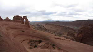
Delicate arch at Arches National Park near Moab

Prototyping events during the last three weeks have been integral to establishing a clear and consistent link between NEON organismal and airborne measurements, and are a critical step toward enabling future NEON users to obtain the most complete information possible about a NEON site from the ground to the sky. From mid-August through the first week of September, staff from NEON’s Airborne Observation Platform (AOP) and Fundamental Sentinel Unit (FSU) science teams headed to Florida to prototype planned methods for collecting and scaling data from the organismal level to satellite-based remote sensing level. During that time, AOP successfully conducted a series of pathfinder flights in conjunction with ground-based data collection carried out by FSU scientists. The relationship between data collected by the AOP team and the FSU team is particularly important; because the observatory will operate at the continental scale, the teams must ensure that AOP data can be validated and be interpreted similarly to FSU ground-based data collected in the same areas. Because AOP data will be collected at regional scales versus at a plot level by FSU, it will be possible for NEON to scale to the continental level by using AOP data in complement to FSU data.

During their visit to Florida, FSU staff and seasonal hires collected canopy structure, leaf area index and plant biodiversity measurements at the Ordway-Swisher Biological Station and a University of Florida pine plantation. The following week, the AOP team deployed the Jet Propulsion Laboratory’s (JPL) Airborne Visible/Infrared Airborne Spectrometer (AVIRIS) in a Twin Otter plane in partnership with NASA, as well as the National Center for Airborne Laser Mapping (NCALM) LiDAR system installed in a Piper Chieftan aircraft for a series of flights covering areas around and including the Ordway-Swisher Biological Station. They also conducted ground-based measurements such as vegetation characterization, sun and weather studies, and ground-based measurements of how plant canopies reflect light in order to calibrate and assess the quality of the airborne measurements. Additionally, the AOP team coordinated their measurements with Landsat, EO-1 and MODIS Terra satellite overpasses. This will allow NEON teams to investigate how scaling NEON’s data from the organismal to continental scale might work using the well-known satellite data as validation. The coincident satellite overpasses will also help the AOP team verify their field calibration methods by giving them the ability to compare their ground calibration results to a well-known, well-calibrated sensor.

Both the AOP and FSU teams collected datasets that will help them learn the best strategies for making measurements when NEON moves into the Operations phase. In addition, the teams learned valuable lessons from the experience that will guide future decisions and ensure future data collection goes smoothly. For example, the AOP team will use the experience to inform whether morning spectrometer data collection versus noon collection would work to avoid afternoon convective storms in susceptible regions. The FSU team was able to evaluate what types of equipment and methods work best for measuring vegetation, experiment with how adjustments to sample plot size and shape affect the quality of the data NEON will collect, and streamline the process for how NEON will hire seasonal field crews. Thanks to detailed plans developed by NEON scientists and local support by John Hayes, Steve Coates, Rosvel Bracho-Garillo and others on the UF team, prototyping activities went smoothly and were highly productive. NEON is also grateful for the time and support of NASA’s Terrestrial Ecology Research Program, the JPL AVIRIS team, and NCALM.
Share

Related Posts:

2024 in Photos: A Look Back Across the Observatory

December 30, 2024

Flux tower in snow

Update to foliar chlorophyll data quality issue related to sample storage temperature

November 4, 2024

Resolved: NEON Terrestrial Observation System (OS) Base plot subplot renaming

August 9, 2024

NSF NEON, Operated by Battelle

Follow Us:

Join Our Newsletter

Get updates on events, opportunities, and how NEON is being used today.

Subscribe Now

Footer

  • About Us
  • Newsroom
  • Contact Us
  • Terms & Conditions
  • Careers
  • Code of Conduct

Copyright © Battelle, 2025

The National Ecological Observatory Network is a major facility fully funded by the U.S. National Science Foundation.

Any opinions, findings and conclusions or recommendations expressed in this material do not necessarily reflect the views of the U.S. National Science Foundation.