NSF NEON, Operated by Battelle

Main navigation

  • About
    • NEON Overview
      • Vision and Management
      • Spatial and Temporal Design
      • History
    • About the NEON Biorepository
      • ASU Biorepository Staff
      • Contact the NEON Biorepository
    • Observatory Blog
    • Newsletters
    • Staff
    • FAQ
    • Contact Us

    About

  • Data
    • Data Portal
      • Data Availability Charts
      • API & GraphQL
      • Prototype Data
      • Externally Hosted Data
    • Data Collection Methods
      • Airborne Observation Platform (AOP)
      • Instrument System (IS)
        • Instrumented Collection Types
        • Aquatic Instrument System (AIS)
        • Terrestrial Instrument System (TIS)
      • Observational System (OS)
        • Observation Types
        • Observational Sampling Design
        • Sampling Schedules
        • Taxonomic Lists Used by Field Staff
        • Optimizing the Observational Sampling Designs
      • Protocols & Standardized Methods
    • Getting Started with NEON Data
      • neonUtilities for R and Python
      • Learning Hub
      • Code Hub
    • Using Data
      • Data Formats and Conventions
      • Released, Provisional, and Revised Data
      • Data Product Bundles
      • Usage Policies
      • Acknowledging and Citing NEON
      • Publishing Research Outputs
    • Data Notifications
    • NEON Data Management
      • Data Availability
      • Data Processing
      • Data Quality

    Data

  • Samples & Specimens
    • Biorepository Sample Portal at ASU
    • About Samples
      • Sample Types
      • Sample Repositories
      • Megapit and Distributed Initial Characterization Soil Archives
    • Finding and Accessing Sample Data
      • Species Checklists
      • Sample Explorer - Relationships and Data
      • Biorepository API
    • Requesting and Using Samples
      • Loans & Archival Requests
      • Usage Policies

    Samples & Specimens

  • Field Sites
    • Field Site Map and Info
    • Spatial Layers & Printable Maps

    Field Sites

  • Resources
    • Getting Started with NEON Data
    • Research Support Services
      • Field Site Coordination
      • Letters of Support
      • Mobile Deployment Platforms
      • Permits and Permissions
      • AOP Flight Campaigns
      • Research Support FAQs
      • Research Support Projects
    • Code Hub
      • neonUtilities for R and Python
      • Code Resources Guidelines
      • Code Resources Submission
      • NEON's GitHub Organization Homepage
    • Learning Hub
      • Tutorials
      • Workshops & Courses
      • Science Videos
      • Teaching Modules
    • Science Seminars and Data Skills Webinars
    • Document Library
    • Funding Opportunities

    Resources

  • Impact
    • Research Highlights
    • Papers & Publications
    • NEON in the News

    Impact

  • Get Involved
    • Upcoming Events
    • Research and Collaborations
      • Environmental Data Science Innovation and Inclusion Lab
      • Collaboration with DOE BER User Facilities and Programs
      • EFI-NEON Ecological Forecasting Challenge
      • NEON Great Lakes User Group
      • NCAR-NEON-Community Collaborations
    • Advisory Groups
      • Science, Technology & Education Advisory Committee
      • Technical Working Groups
    • NEON Ambassador Program
      • Exploring NEON-Derived Data Products Workshop Series
    • Partnerships
    • Community Engagement
    • Work Opportunities

    Get Involved

  • My Account
  • Search

Search

About

  • NEON Overview
  • About the NEON Biorepository
  • Observatory Blog
  • Newsletters
  • Staff
  • FAQ
  • Contact Us

Breadcrumb

  1. About
  2. Observatory Blog
  3. NEON Undertakes its First Natural Disaster Response to Colorado’s High Park Wildfire

NEON Undertakes its First Natural Disaster Response to Colorado’s High Park Wildfire

August 21, 2012

Twin Otter arrival at KBDU

In the largest study of its kind, NEON will collaborate with Colorado State University to provide airborne remote sensing data to study devastating wildfire effects. FORT COLLINS -- In response to one of the worst wildfires in Colorado history, scientists from the Warner College of Natural Resources at Colorado State University are leading a first of its kind, large-scale wildfire impact study on the High Park Fire in partnership with Colorado’s newest research facility, the National Ecological Observatory Network (NEON). The study will provide critical data to the communities still grappling with how to respond to major water quality, erosion and ecosystem restoration issues in an area spanning more than 136 square miles. “Wildfires are an increasingly important environmental issue in Colorado and across the country,” said Joyce Berry, dean of Warner College of Natural Resources. “This research project will enable land managers, policy makers and scientists to study the High Park wildfire’s behavior and impact in unprecedented scope, and help create solutions for restoration and mitigation.”

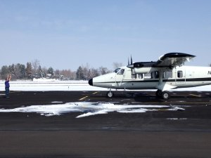
Supported by a National Science Foundation RAPID grant, the project will integrate airborne remote sensing data collected by NEON’s Airborne Observation Platform (AOP) with ground-based data from a targeted field campaign conducted by CSU researchers. This is the first time a comprehensive airborne remote sensing system of this caliber will be used to enhance research on wildfire causes and impacts. The system will be able to detect remaining vegetation, identify plant species, ash cover, soil properties and other details to help illustrate how the fire burned – over the span of the entire fire scar. “NEON’s airborne system will not only provide high definition 3D imagery, but will also collect rich ecological data over the entire fire area with exceptional detail - down to one yard,” said Tom Kampe, NEON assistant director for Remote Sensing. “NEON’s technology will provide researchers with almost as much information as if we walked the entire landscape, and when paired with CSU’s ground-based data and assessment – the comprehensive findings will allow land managers to make much more informed decisions for restoration.” The two-tiered research approach will allow a comprehensive assessment of the natural causes and impacts of the fire, and is expected to help the scientific and management communities understand how pre-existing conditions influenced the behavior and severity of the fire. It will also offer some understanding of how the fire’s patterns will affect ecosystem recovery, including vegetation, wildlife and water resources. The NEON High Park flights will run August 21-23 and will cover the entire High Park Fire scar and adjacent unburned areas including Lory State Park and the Hewlett Gulch fire. Data-rich aerial images and research findings will start to become available in fall of 2012.

CSU’s research team for the project is comprised of 11 scientists across multiple disciplines and is led by project principal investigator Michael Lefsky, associate professor in the Department of Ecosystem Science and Sustainability. The research project is being conducted in collaboration with local, state and federal agencies and land managers to enable solution-oriented results that will best support restoration needs of the community. “Findings from this research will support those working on recovery efforts in the region, such as the U.S. and State Forest Service and the Cities of Fort Collins and Greeley, both of whom have water supplies likely to be affected by post-fire erosion,” said Lefsky. “Our team will coordinate research efforts with stakeholders, share information and help set the stage for future collaborative initiatives that address the complex relationships between drought, fire and water supply.”

Learn more about NEON's airborne remote sensing capabilities.

Learn more about NEON's Assignable Assets program.

Share

Related Posts:

Unlocking the Secrets of Soil Microbial Metabolites

February 2, 2026

Petri dishes of bacteria cultures

Discontinuation of Select NEON Data Products

January 29, 2026

Resolved: NEON AOP Lidar Data Quality Issues Due to Mis-Classified Atmospheric Noise

January 23, 2026

NSF NEON, Operated by Battelle

Follow Us:

Join Our Newsletter

Get updates on events, opportunities, and how NEON is being used today.

Subscribe Now

Footer

  • About Us
  • Contact Us
  • Terms & Conditions
  • Careers
  • Code of Conduct

Copyright © Battelle, 2026

The National Ecological Observatory Network is a major facility fully funded by the U.S. National Science Foundation.

Any opinions, findings and conclusions or recommendations expressed in this material do not necessarily reflect the views of the U.S. National Science Foundation.