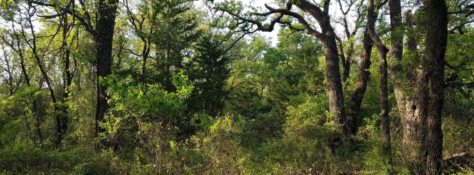
NSF NEON, Operated by Battelle

Main navigation

  • About
    • NEON Overview
      • Vision and Management
      • Spatial and Temporal Design
      • History
    • About the NEON Biorepository
      • ASU Biorepository Staff
      • Contact the NEON Biorepository
    • Observatory Blog
    • Newsletters
    • Staff
    • FAQ
    • Contact Us

    About

  • Data
    • Data Portal
      • Data Availability Charts
      • API & GraphQL
      • Prototype Data
      • Externally Hosted Data
    • Data Collection Methods
      • Airborne Observation Platform (AOP)
      • Instrument System (IS)
        • Instrumented Collection Types
        • Aquatic Instrument System (AIS)
        • Terrestrial Instrument System (TIS)
      • Observational System (OS)
        • Observation Types
        • Observational Sampling Design
        • Sampling Schedules
        • Taxonomic Lists Used by Field Staff
        • Optimizing the Observational Sampling Designs
      • Protocols & Standardized Methods
    • Getting Started with NEON Data
      • neonUtilities for R and Python
      • Learning Hub
      • Code Hub
    • Using Data
      • Data Formats and Conventions
      • Released, Provisional, and Revised Data
      • Data Product Bundles
      • Usage Policies
      • Acknowledging and Citing NEON
      • Publishing Research Outputs
    • Data Notifications
    • NEON Data Management
      • Data Availability
      • Data Processing
      • Data Quality

    Data

  • Samples & Specimens
    • Biorepository Sample Portal at ASU
    • About Samples
      • Sample Types
      • Sample Repositories
      • Megapit and Distributed Initial Characterization Soil Archives
    • Finding and Accessing Sample Data
      • Species Checklists
      • Sample Explorer - Relationships and Data
      • Biorepository API
    • Requesting and Using Samples
      • Loans & Archival Requests
      • Usage Policies

    Samples & Specimens

  • Field Sites
    • Field Site Map and Info
    • Spatial Layers & Printable Maps

    Field Sites

  • Resources
    • Getting Started with NEON Data
    • Research Support Services
      • Field Site Coordination
      • Letters of Support
      • Mobile Deployment Platforms
      • Permits and Permissions
      • AOP Flight Campaigns
      • Research Support FAQs
      • Research Support Projects
    • Code Hub
      • neonUtilities for R and Python
      • Code Resources Guidelines
      • Code Resources Submission
      • NEON's GitHub Organization Homepage
    • Learning Hub
      • Tutorials
      • Workshops & Courses
      • Science Videos
      • Teaching Modules
    • Science Seminars and Data Skills Webinars
    • Document Library
    • Funding Opportunities

    Resources

  • Impact
    • Research Highlights
    • Papers & Publications
    • NEON in the News

    Impact

  • Get Involved
    • Upcoming Events
    • Research and Collaborations
      • Environmental Data Science Innovation and Inclusion Lab
      • Collaboration with DOE BER User Facilities and Programs
      • EFI-NEON Ecological Forecasting Challenge
      • NEON Great Lakes User Group
      • NCAR-NEON-Community Collaborations
    • Advisory Groups
      • Science, Technology & Education Advisory Committee
      • Technical Working Groups
    • NEON Ambassador Program
      • Exploring NEON-Derived Data Products Workshop Series
    • Partnerships
    • Community Engagement
    • Work Opportunities

    Get Involved

  • My Account
  • Search

Search

Field Sites

  • Field Site Map and Info
  • Spatial Layers & Printable Maps

Breadcrumb

  1. Field Sites
  2. Lyndon B. Johnson National Grassland NEON

Field Site

Lyndon B. Johnson National Grassland NEON / CLBJ

brown square white mountain icon

Core Terrestrial, TX, D11: Southern Plains

Forest at the LBJ National Grassland (CLBJ) field site in Texas.

About Field Sites

Caddo – Lyndon B. Johnson National Grasslands (CLBJ) is a terrestrial NEON field site located in the Great Plains region of north-central Texas, about 50 km (30 mi.) northwest of Denton. CLBJ occupies approximately 80 km2 (20,000 acres) of public lands managed by the U.S. Forest Service. NEON samples 41.9 km2 (10,300 acres) of area at CLBJ. The site has fairly flat terrain and consists of a mosaic of oak-dominated forests and grasslands. CLBJ is part of NEON's Southern Plains Domain (D11), which stretches over the central sections of Texas and Oklahoma and includes portions of southern Kansas and southern New Mexico. D11 has three other NEON field sites, including one additional terrestrial and two aquatic sites, located in Texas and Oklahoma. CLBJ is colocated with the Pringle Creek (PRIN) aquatic field site. [1] [3]

Climate

The climate of CLBJ is typical of Northeast Texas, with hot, humid summers and cool, windy winters. Mean annual temperature is 17.5°C (63.5°F) and mean annual precipitation is 898 mm (35.4 in.), falling mostly from mid-April to late June. Violent thunderstorms over the southern plains - some of which produce high winds, hail, and tornadoes - provide much of the region’s spring rainfall. [6] [7]

Geology

The underlying geology of CLBJ is primarily interbedded sandstone and siltstone of the Antlers Sand Formation; some residuum and colluvium are derived from calcareous limestone of the Walnut Clay Formation and local alluvium. The region’s topography rolling and hilly due to differential erosion, becoming more rugged in the west. [2] [4] [5]

Soils

CLBJ soils are Udic Paleustalfs, according to the USGS Mineral Resources Database Duffau, Weatherford, Keeter, Pidcoke, Wise and Windthorst soils are all present at the site; Duffau and Windthorst are the most common, although Windthorst is considered transitional between Duffau and Weatherford. High-clay soils can inhibit tree growth due to low permeability. [4] [5]

Vegetation

The Caddo-LBJ National Grasslands has fairly flat terrain and consists of a mosaic of oak-dominated forest and grasslands. The dominant canopy species at CLBJ are post oak (Quercus stellate) and blackjack oak (Q. marilandica). Important grass species include little bluestem (Schizachyrium scoparium), big bluestem (Andropogon gerardi), Indiangrass (Sorghastrum nutans), and switchgrass (Panicum virgatum). [1] [8]

Fauna

CLBJ’s grasslands provide a diverse habitat for a variety of species, including white-tailed deer (Odocoileus virginianus), coyotes (Canis latrans), bobcats (Lynx rufus), red fox (Vulpes vulpes), bobwhite quail (Colinus virginianus), and turkey. The grasslands also host numerous small mammals, songbirds, and waterfowl, including the endangered Least Tern (Sternula antillarum athalassos). The threatened timber rattlesnake (Crotalus horridus) and Texas horned lizard (Phrynosoma corunutum) can also be found in the region. [3] [9] [10] [11]

Past Land Management and Use

Historically, the Caddo – LBJ National Grasslands were a large woodland area bordered by open prairie to the east and west. European settlers moved into the area in the 1800s under a variety of "Homestead Acts." The settlers fragmented and cleared the land for agricultural activities including grazing, ranching and growing crops. After a prolonged period of drought in the 1920s and 1930s, the U.S. government purchased homesteads experiencing soil erosion problems and returned them to public land status. In the 1950s, these lands were assigned to the U.S. Forest Service, which was tasked with managing and restoring the lands. To prevent further erosion, the U.S. Forest service built water retention levees and dams, creating many small ponds throughout the landscape. Originally, the grasslands were called the "Cross Timbers National Grassland," however, the grasslands were renamed the "Lyndon B. Johnson National Grasslands" in 1974 after the former president. Since that time, the U.S. Forest Service has a focused on "promoting better utilization of the land, providing work in the depressed area, and developing water-oriented recreation facilities." [12] [13] [14]

Current Land Management and Use

The Caddo-LBJ National Grasslands is a popular recreation area for hiking, hunting, fishing, and horseback riding. Cattle are grazed on parts of the site. Current management of the grasslands and the surrounding area uses prescribed burn to encourage the growth of natural plant communities and manage the composition of forest stands. Timber harvesting is limited to encourage regeneration; the Forest Service’s current management plan adds approximately 3 km2 (700 acres) of regeneration per year. [1] [5]

NEON Site Establishment

Plots were established at CLBJ in April 2016. In July 2016, the site underwent a sampling readiness review, and terrestrial observations and sampling began on July 29, 2016.

Additional Resources

[1] Terrestrial Observation System (TOS) Site Characterization Report: Domain 11. NEON.DOC.003894vB

[2] U.S. Geological Survey, 2005, Mineral Resources Data System: U.S. Geological Survey, Reston, Virginia. https://mrdata.usgs.gov/mrds/

[3] https://www.fs.usda.gov/detail/texas/about-forest/districts/?cid=fswdev…

[4] Robinson. (2017). NEON Site-Level Plot Summary, Caddo-LBJ National Grasslands (CLBJ). 2017. https://data.neonscience.org/documents/10179/2361410/CLBJ_Soil_SiteSumm…

[5] https://www.fs.usda.gov/Internet/FSE_DOCUMENTS/stelprdb5209820.pdf

[6] PRISM Climate Group., Oregon State University, http://prism.oregonstate.edu, created 4 Feb 2004.

[7] https://weatherspark.com/y/8158/Average-Weather-in-Decatur-Texas-United…

[8] http://ctufc.org/native-plants-of-the-cross-timbers/

[9] BirdLife International. 2018. Sternula antillarum. The IUCN Red List of Threatened Species 2018: e.T22694673A132567260. https://dx.doi.org/10.2305/IUCN.UK.20182.RLTS.T22694673A132567260.en. Downloaded on 18 May 2020.

[10] Hammerson, G.A. 2007. Crotalus horridus. The IUCN Red List of Threatened Species 2007: e.T64318A12765920. https://dx.doi.org/10.2305/IUCN.UK.2007.RLTS.T64318A12765920.en. Downloaded on 18 May 2020.

[11] Hammerson, G.A. 2007. Phrynosoma cornutum. The IUCN Red List of Threatened Species 2007: e.T64072A12741535. https://dx.doi.org/10.2305/IUCN.UK.2007.RLTS.T64072A12741535.en. Downloaded on 18 May 2020.

[12] TPWD (Texas Parks and Wildlife Department). 2013. “Cross Timbers and Prairies Ecological Region.” Texas Parks and Wildlife. Accessed April 3, 2013. http://www.tpwd.state.tx.us/landwater/land/habitats/cross_timbers/ecore….

[13] Drenner, Matthew S., Stanley I. Dodson, Ray W. Drenner, and John E. Pinder III. 2009. “Crustacean Zooplankton Community Structure in Temporary and Permanent Grassland Ponds.” Hydrobiologia 632: 225-233.

[14] Dow, Fred, and Suzanne Dow. (2005). U. S. National Forest Campground Guide: Southern Region (pp. 323-330). Moon Canyon Publishing. books.google.com/books/about/U_S_National_Forest_Campground_Guide.html?id=3tHoj-MsbZMC.

Field Site Information

Latitude/Longitude

33.40123, -97.57

Geodetic Datum

WGS84

Location

Wise County
TX, US

Elevation

Mean: 272m
Minimum: 258m
Maximum: 343m

Mean Annual Temperature

17.5°C

Dominant Wind Direction

S

Mean Canopy Height

13.0m

Dominant NLCD Classes

Deciduous Forest, Grassland/Herbaceous

Colocated Site(s)

Pringle Creek NEON

Colocated Research

Critical Zone Exploration Network

Field Operations Office

1200 South Woodrow, Suite 100
Denton, TX 76205

Research Access

If your proposed research requires access to field sites where NEON is present, we can help.

Request Access

Observation Types

Remote Sensing

Remote sensing surveys of this field site collect lidar, spectrometer and high-resolution RGB camera data.

Meteorological Measurements

This site has a flux/meteorological tower that is 22 m (62 ft) tall with five measurement levels. The tower top extends above the vegetation canopy to allow sensors mounted at the top and along the tower to capture the full profile of atmospheric conditions from the top of the vegetation canopy to the ground. The tower collects physical and chemical properties of atmosphere-related processes, such as humidity, wind, and net ecosystem gas exchange. Precipitation data are collected by a Double Fence Intercomparison Reference (DFIR) near the tower and a series of throughfalls located in the soil array.

Phenocams

One phenocam is attached to the top and the bottom of the tower. Here we show the images from the most recent hour. The full collection of images can be viewed on the Phenocam Gallery - click on either of the images below.

Tower top

NEON.D11.CLBJ.DP1.10033

Tower bottom

NEON.D11.CLBJ.DP1.10042

Soil Sensor Measurements

This site has five soil plots placed in an array within the airshed of the flux tower. Photosynthetically Active Radiation (PAR) at soil surface, soil heat flux, solar radiation, and throughfall are measured at the soil surface in each soil plot. Soil moisture, soil temperature, and CO2 concentration are measured at multiple depths in each soil plot.

Observational Sampling

At terrestrial sites, field ecologists observe birds and plants, and sample ground beetles, mosquitoes, small mammals, soil microbes, and ticks. Lab analyses are carried out to provide further data on DNA sequences, pathogens, soils, sediments, and biogeochemistry. Learn more about terrestrial observations or explore this site's data products.


Field Site Data

Site

Site Host

Caddo-LBJ National Grasslands

Site URL

https://www.fs.usda.gov/detail/texas/about-forest/districts/?cid=fswdev3_008440

Site Access Details

Please do not contact the site host. Site host requests NEON review and approval of all external research projects at the site, and that coordination be directly through the NEON Domain 11 Manager. External research requests are limited at this site.

Operations Office

NEON Field Operations Office

Domain 11 Support Facility

NEON Field Operations Address

1200 South Woodrow, Suite 100
Denton, TX 76205

NEON Field Operations Phone

940.222.4259

Location

Latitude

33.40123

Longitude

-97.57

Geodetic Datum

WGS84

UTM Northing

3696682.44m

UTM Easting

632982.22m

UTM Zone

14N

County

Wise

State

TX

Country

US

Mean Elevation

272m

Minimum Elevation

258m

Maximum Elevation

343m

Terrestrial Sampling Boundary Area

41.88km^2

Climate

Mean Annual Temperature

17.5°C

Mean Annual Precipitation

926mm

Dominant Wind Direction

S

Vegetation

Mean Canopy Height

13.0m

Dominant NLCD Classes

Deciduous Forest, Grassland/Herbaceous

Average number of green days

260

Average first greenness increase date

60 DOY

Average peak green date

135 DOY

Average first greenness decrease date

175 DOY

Average minimum greenness date

295; 320 DOY

Tower

Tower Height

22m

Number of Tower Levels

5

Soils

Megapit Soil Family

Fine - mixed - active - thermic Udic Paleustalfs

Soil Subgroup

Udic Paleustalfs


Gallery

  • Photos
  • Videos

No Video


Related Field Sites

Other Domain D11 Field Sites

blue circle white drop icon Blue River NEON
Gradient Aquatic
brown circle white drop icon Marvin Klemme Range Research Station NEON
Gradient Terrestrial
blue square white drop icon Pringle Creek NEON
Core Aquatic

Other Field Sites in TX

blue square white drop icon Pringle Creek NEON
Core Aquatic
NSF NEON, Operated by Battelle

Follow Us:

Join Our Newsletter

Get updates on events, opportunities, and how NEON is being used today.

Subscribe Now

Footer

  • About Us
  • Contact Us
  • Terms & Conditions
  • Careers
  • Code of Conduct

Copyright © Battelle, 2026

The National Ecological Observatory Network is a major facility fully funded by the U.S. National Science Foundation.

Any opinions, findings and conclusions or recommendations expressed in this material do not necessarily reflect the views of the U.S. National Science Foundation.