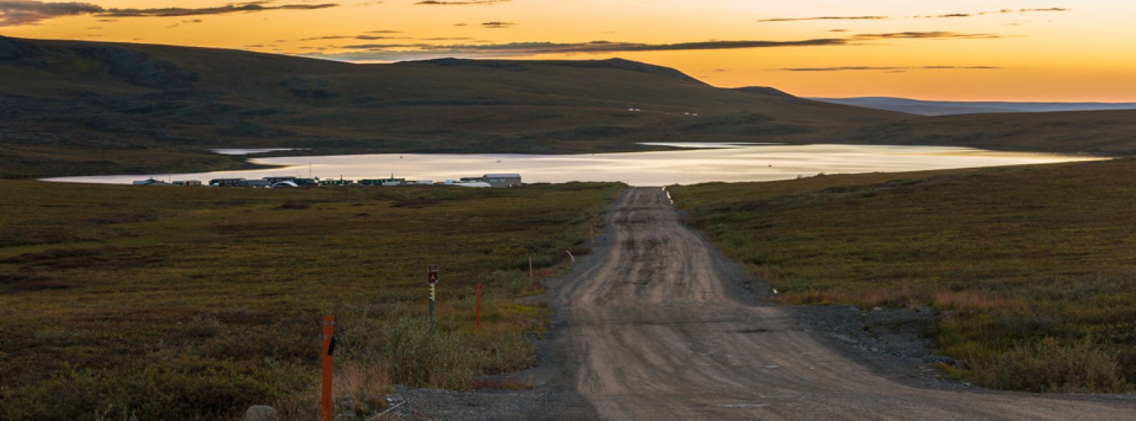
NSF NEON, Operated by Battelle

Main navigation

  • About Us
    • Overview
      • Spatial and Temporal Design
      • History
    • Vision and Management
    • Advisory Groups
      • Science, Technology & Education Advisory Committee
      • Technical Working Groups (TWGs)
    • FAQ
    • Contact Us
      • Contact NEON Biorepository
      • Field Offices
    • User Accounts
    • Staff
    • Code of Conduct

    About Us

  • Data & Samples
    • Data Portal
      • Explore Data Products
      • Data Availability Charts
      • Spatial Data & Maps
      • Document Library
      • API & GraphQL
      • Prototype Data
      • External Lab Data Ingest (restricted)
    • Data Themes
      • Biogeochemistry
      • Ecohydrology
      • Land Cover and Processes
      • Organisms, Populations, and Communities
    • Samples & Specimens
      • Discover and Use NEON Samples
        • Sample Types
        • Sample Repositories
        • Sample Explorer
        • Megapit and Distributed Initial Characterization Soil Archives
      • Sample Processing
      • Sample Quality
      • Taxonomic Lists
    • Collection Methods
      • Protocols & Standardized Methods
      • Airborne Remote Sensing
        • Flight Box Design
        • Flight Schedules and Coverage
        • Daily Flight Reports
          • AOP Flight Report Sign Up
        • Camera
        • Imaging Spectrometer
        • Lidar
      • Automated Instruments
        • Site Level Sampling Design
        • Sensor Collection Frequency
        • Instrumented Collection Types
          • Meteorology
          • Phenocams
          • Soil Sensors
          • Ground Water
          • Surface Water
      • Observational Sampling
        • Site Level Sampling Design
        • Sampling Schedules
        • Observation Types
          • Aquatic Organisms
            • Aquatic Microbes
            • Fish
            • Macroinvertebrates & Zooplankton
            • Periphyton, Phytoplankton, and Aquatic Plants
          • Terrestrial Organisms
            • Birds
            • Ground Beetles
            • Mosquitoes
            • Small Mammals
            • Soil Microbes
            • Terrestrial Plants
            • Ticks
          • Hydrology & Geomorphology
            • Discharge
            • Geomorphology
          • Biogeochemistry
          • DNA Sequences
          • Pathogens
          • Sediments
          • Soils
            • Soil Descriptions
        • Optimizing the Observational Sampling Designs
    • Data Notifications
    • Data Guidelines and Policies
      • Acknowledging and Citing NEON
      • Publishing Research Outputs
      • Usage Policies
    • Data Management
      • Data Availability
      • Data Formats and Conventions
      • Data Processing
      • Data Quality
      • Data Product Bundles
      • Data Product Revisions and Releases
        • Release 2021
        • Release 2022
        • Release 2023
        • Release 2024
        • Release-2025
      • NEON and Google
      • Externally Hosted Data

    Data & Samples

  • Field Sites
    • About Field Sites and Domains
    • Explore Field Sites
    • Site Management Data Product

    Field Sites

  • Impact
    • Observatory Blog
    • Case Studies
    • Papers & Publications
    • Newsroom
      • NEON in the News
      • Newsletter Archive
      • Newsletter Sign Up

    Impact

  • Resources
    • Getting Started with NEON Data & Resources
    • Documents and Communication Resources
      • Papers & Publications
      • Document Library
      • Outreach Materials
    • Code Hub
      • Code Resources Guidelines
      • Code Resources Submission
      • NEON's GitHub Organization Homepage
    • Learning Hub
      • Science Videos
      • Tutorials
      • Workshops & Courses
      • Teaching Modules
    • Research Support Services
      • Field Site Coordination
      • Letters of Support
      • Mobile Deployment Platforms
      • Permits and Permissions
      • AOP Flight Campaigns
      • Research Support FAQs
      • Research Support Projects
    • Funding Opportunities

    Resources

  • Get Involved
    • Advisory Groups
      • Science, Technology & Education Advisory Committee
      • Technical Working Groups
    • Upcoming Events
    • NEON Ambassador Program
      • Exploring NEON-Derived Data Products Workshop Series
    • Research and Collaborations
      • Environmental Data Science Innovation and Inclusion Lab
      • Collaboration with DOE BER User Facilities and Programs
      • EFI-NEON Ecological Forecasting Challenge
      • NEON Great Lakes User Group
      • NEON Science Summit
      • NCAR-NEON-Community Collaborations
        • NCAR-NEON Community Steering Committee
    • Community Engagement
      • How Community Feedback Impacts NEON Operations
    • Science Seminars and Data Skills Webinars
      • Past Years
    • Work Opportunities
      • Careers
      • Seasonal Fieldwork
      • Internships
        • Intern Alumni
    • Partners

    Get Involved

  • My Account
  • Search

Search

Field Sites

  • About Field Sites and Domains
  • Explore Field Sites
  • Site Management Data Product

Breadcrumb

  1. Field Sites
  2. Toolik Lake NEON

Field Site

Toolik Lake NEON / TOOK

blue circle white drop icon

Gradient Aquatic, AK, D18: Tundra

Toolik Lake at sunset

About Field Sites

Toolik Lake (TOOK) is an aquatic NEON field site located in the northern foothills of Alaska’s Brooks Range in a 63.7 km2 (15,700 acre) watershed. The lake is one of the largest in the area and is part of a lake district consisting of numerous kettle lakes formed by glaciers. These lakes and their outflows, along with runoff from snowmelt and rain, provide Toolik Lake with its water supply. Next to the lake is the Toolik Field Station, operated and managed by the Institute of Arctic Biology at the University of Alaska Fairbanks with cooperative agreement support from the Division of Polar Programs, Directorate for Geosciences at the National Science Foundation. TOOK is part of the NEON Tundra Domain (D18), which includes the northern and western parts of Alaska. D18 hosts three other NEON field sites in Alaska: one aquatic and two terrestrial. TOOK is colocated with the TOOL terrestrial site and near the Oksrukuyik Creek (OKSR) aquatic site. [1] [2]

Climate

The climate at TOOK is characterized by long, cold winters; short, cool summers; and extreme seasonal variation. In the absence of sunlight, winters are long and bitterly cold, with temperatures sometimes reaching -40°C (-40°F) or lower. The summer period brings 24-hour solar input for much of June-August; as a result, it is the only time of year where average temperatures exceed 0°C (32°F). TOOK has an average mean temperature of -9°C (16°F) and it receives a mean annual precipitation of 316 mm (12.4 in). [6] [22]

Geology

Toolik Lake is situated on glacial and alluvial deposits aged 120-150 thousand years ago (Itkillik 1, late Pleistocene) and 25-11.5 thousand years ago (Itkillik II, late Pleistocene). Glacial outwash extends into the lake, creating multiple shoals and bays. The substrate within the lake is made up of cobble and silt. [1] [14]

Soils

TOOK sits in a continuous permafrost zone, although taliks—small pockets of non-frozen material—often exist beneath lakes and rivers. TOOK is located on rolling till plains and moraines. The lowlands have a thick organic layer, while the higher located soils are gelic (frost-churned) and exposed at the surface. The soils at the nearby terrestrial site, TOOL, are characterized as Typic Histoturbels in the order Gelisols. These soils contain permafrost and have a thick layer of organic matter at the surface and are often saturated for long periods of time. The high organic matter in the soils at TOOL is mostly due to persistent cold temperatures that limit decomposition and promote the accumulation of organic material from vegetation. This organic material insulates the underlying permafrost. [7] [8] [9] [13]

Hydrology

Toolik Lake is part of a lake district consisting of numerous kettle lakes formed by glaciers. The lake is fed by snowmelt, rain, and a system of streams and smaller kettle lakes with headwaters in the Brooks Range, located to the south. Ice forms on the lake in early October and completely disappears by late June. It is thermally stratified through much of July and August. It extremely oligotrophic, has a surface area of 1.48 km2 (366 acres), volume of 12,602,474 m3 (445 million ft3), and a maximum depth of 26.2 m (86 ft.). Its outlet is a tributary of the Kuparuk River. [1] [11] [12]

Vegetation

The Arctic tundra is composed of hundreds of meters of permafrost - soil that remains consistently frozen for two or more years and leads to low plant diversity. Vegetation cover in the Toolik Lake area is mainly tundra shrubs and herbaceous flowering plants. The dominant shrubs include willows (Salix spp.), blueberry (Vaccinium uliginosum), and dwarf birch (Betula nana). There is little to no overhanging vegetation around the lake as the shrubs are typically less than 1 m (3.3 ft.) tall. [1]

Fauna

NEON provides data on the only five fish species that inhabit Toolik Lake. They are lake trout (Salvelinus namaycush), burbot (Lota lota), slimy sculpin (Cottus cognatus), arctic grayling (Thymallus arcticus), and round whitefish (Prosopium cylindraceum). Other common fish in nearby lakes and streams are Dolly Varden (Salvelinus malma) Arctic Char (Salvelinus alpinus). [3] [15]

Past Land Management and Use

The Brooks Range has been populated for centuries by Alaskan native groups, the Iñupiat and Athabascan, and by their ancestors for thousands of years before that. The Iñupiat are a part of the Inuit culture, and their traditional lands extend along the northern coast from the western edge of Alaska into Canada. They hunt mostly aquatic animals such as bowhead and beluga whales, seals, walruses, and other marine mammals. They fish and gather berries, roots, and shoots. The inland Iñupiat also hunt caribou, mountain sheep, bears, and moose. The Athabascan's traditional lands comprise the interior of Alaska and western Canada. They hunt and fish for moose, caribou, and salmon, and gather seasonal plants and berries. Settlers of European descent began moving into Alaska in the 1800s, and by the late 19th century the Alaskan natives’ semi-nomadic lifestyles had been greatly altered and they began to settle into villages. Although their way of life has changed with the introduction of new technologies and different cultures, many communities continue to hunt and fish as their ancestors did.

Access to the interior areas of Alaska’s North Slope was very limited until the construction of the Alaska oil pipeline and Dalton Highway in 1974-1976. In July 1975, The University of Alaska – Fairbanks Institute of Marine Science installed a 16-foot travel trailer at the north end of Toolik Lake, officially establishing the Toolik Lake Field Station. Toolik Lake was also selected as the aquatic research site for the Research on Arctic Tundra Environments (RATE) project, which was supported by the National Science Foundation (NSF). After the RATE project came the Arctic Lake Process Study (ALPS), which studied controls over key ecosystem processes, and the Tests of Arctic Predictions (TAPS) project, which studied experimental manipulations of aquatic ecosystems. In the late 1970s, the Department of Energy (DOE) supported research into the effects of oil spills. Toolik Lake became a part of the Long-Term Ecological Research (LTER) program in 1987. Research that followed included studies on basic biology and biogeochemistry of Toolik Lake and surrounding lakes and ponds, nutrient cycles, trophic structure and food webs, and linkages between terrestrial and aquatic ecosystems. [3] [4] [16] [18] [19] [20]

Current Land Management and Use

The Toolik Field Station is operated and managed by the Institute of Arctic Biology at the University of Alaska Fairbanks (UAF). It is supported by the Division of Polar Programs, Directorate for Geosciences at the National Science Foundation (NSF). It is also a part of the Arctic Long-Term Research Program, which is located in the foothills of the Brooks Range and includes the Toolik Lake and upper Kuparuk River watersheds. Most ongoing research projects at Toolik are studying the effects of climate change on various ecosystem functions, such as trophic structure and food webs, nutrient exchange, and hydrological fluxes. [3] [4] [17]

NEON Site Establishment

The aquatic observation system (AOS) for Toolik Lake began sampling in November 2016. The aquatic instrumentation system (AIS) began streaming in November 2017. The surface water sampling strategy for D18 Toolik Lake is based on annual air temperature data collected from NOAA National Climatic Data Center (NCDC) and from the near-real time NEON data collected at the meteorological stations. Because Toolik Lake is ice-covered throughout part of the year, surface water samples can be taken on a semi-monthly basis combined with more intensive sampling around ice-on and ice-off, while organismal sampling is based on accumulation of growing degree days throughout the season.

Additional Resources

[1] D18 Aquatic Instrument System (AIS) Site Characterization Report. NEON.DOC.001671

[2] Terrestrial Observation System (TOS) Site Characterization Report: Domain 18NEON.DOC.003901vB

[3] Toolik Field Station: Institute of Arctic Biology. https://toolik.alaska.edu/

[4] National Science Foundation, LTER Network: Arctic LTER. https://lternet.edu/site/arctic-lter/

[5] NOAA: National Centers for Environmental Information. https://www.ncdc.noaa.gov/data-access/land-based-station-data/land-base…

[6] Institute for Arctic Biology, University of Alaska, Fairbanks, 2016. Toolik field station fact sheet.

[7] NEON Site Level Plot Summary, Toolik Lake (TOOL), March 2019.

[8]Overview of Environmental and Hydrogeologic Conditions at Barrow, Alaska. U.S. Geological Survey. 1994. https://pubs.usgs.gov/of/1994/0322/report.pdf

[9] Swanson, D. K. (2002). Soil Survey of Gerstle River Area, Alaska. pg 209

[10] Crump, Byron & Adams, Heather & Hobbie, John & Kling, George. (2007). Crump BC, Adams HE, Hobbie JE, Kling GW.. Biogeography of bacterioplankton in lakes and streams of an Arctic Tundra catchment. Ecology 88: 1365-1378. Ecology. 88. 10.1890/06-0387.

[11] Hobbie, J. E., Corliss, T. L., & Peterson, B. J. (1983). Seasonal patterns of bacterial abundance in an arctic lake. Arctic and Alpine Research, 15(2), 253-259.

[12] Toolik Field Station. Institute of Arctic Biology. https://toolik.alaska.edu/gis/maps/maps.php?category=thematic

[13] Michael SanClements, Robert H Lee, E D Ayres, Keli Goodman, Morgan Jones, David Durden, Katherine Thibault, Rommel Zulueta, Joshua Roberti, Claire Lunch, Adrian Gallo, Collaborating with NEON, BioScience, Volume 70, Issue 2, February 2020, Page 107, https://doi.org/10.1093/biosci/biaa005

[14] U.S. Geological Survey, 2005, Mineral Resources Data System: U.S. Geological Survey, Reston, Virginia. https://mrdata.usgs.gov/mrds/

[15] NEON Data Portal. DP1.20107.001. Retrieved from https://data.neonscience.org/data-products/explore

[16] Institute of Arctic Biology: IAB History Timeline. https://www.iab.uaf.edu/about/timeline

[17] National Science Foundation. https://www.nsf.gov/news/mmg/mmg_disp.jsp?med_id=78188&from=

[18] Alaska: Gates of the Arctic National Park and Preserve. https://www.nps.gov/articles/gatesarctic.htm

[19] University of Alaska Fairbanks: Inupiaq. https://fna.community.uaf.edu/alaska-native-cultures/inupiaq/

[20] Athabascans of Interior Alaska. http://ankn.uaf.edu/curriculum/Athabascan/Athabascans/appendix_a.html

[21] Toolik Field Station: Environmental Data Center https://toolik.alaska.edu/edc/biotic_monitoring/plant_phenology.php

[22] National Oceanic and Atmospheric Administration National Centers for Environmental Information’s (NCEI) 1981-2010 climate normals (NCEI 2015).

Field Site Information

Latitude/Longitude

68.630692, -149.61064

Geodetic Datum

WGS84

Location

North Slope County
AK, US

Elevation

Mean: 715m

Mean Annual Temperature

-9.0°C

Dominant NLCD Classes

Dwarf Scrub

Colocated Site(s)

Toolik Field Station NEON

Colocated Research

North Slope Science Initiative
Arctic LTER
University of Alaska - Toolik Field Station
Toolik Field Station National Atmospheric Deposition Program
NOAA U.S. Climate Reference Network

Field Operations Office

3352 College Rd.
Fairbanks, AK 99709

Research Access

Non-NEON research activities are allowed in this area. Researchers must obtain their own permits with the site host(s).

Request Access

Observation Types

Remote Sensing

Remote sensing surveys of this field site collect lidar, spectrometer and high-resolution RGB camera data.

Meteorological Measurements

This site has one meteorological station located in the riparian area and one meteorological station above water on a buoy. The met stations are outfitted with the a subset of the same sensors used at terrestrial sites. Measurements include wind speed and direction, air temperature, barometric pressure, relative humidity, shortwave radiation, and PAR.

Phenocams

Land-water interface


Field Site Data

Site

Site Host

Bureau of Land Management

Site Access Allowed

Yes

Site URL

https://toolik.alaska.edu/user_guide/permits.php

Site Access Details

Reseachers should coordinate with the site manager and submit a site research permit via Toolik Field Station.

Operations Office

NEON Field Operations Office

Domain 18/19 Support Facility

NEON Field Operations Address

3352 College Rd.
Fairbanks, AK 99709

NEON Field Operations Phone

907.459.5040

Location

Latitude

68.630692

Longitude

-149.61064

Geodetic Datum

WGS84

UTM Northing

7615309.61m

UTM Easting

393866.96m

UTM Zone

6N

County

North Slope

State

AK

Country

US

Mean Elevation

715m

Climate

Mean Annual Temperature

-9.0°C

Mean Annual Precipitation

316mm

Vegetation

Dominant NLCD Classes

Dwarf Scrub

Watershed

USGS HUC

h19060401

Watershed Name

Kuparuk River

Geology

USGS Geology Unit

A002.PS001_102

USGS Geology Name

Water

USGS Lithologic Constituents

Water

USGS Geology Age

Holocene (0.0117 to 0 Ma)


Gallery

  • Photos
  • Videos

Related Field Sites

Other Domain D18 Field Sites

blue square white drop icon Oksrukuyik Creek NEON
Core Aquatic
brown square white mountain icon Toolik Field Station NEON
Core Terrestrial
brown circle white drop icon Utqiaġvik NEON
Gradient Terrestrial

Other Field Sites in AK

blue square white drop icon Caribou Creek NEON
Core Aquatic
brown square white mountain icon Caribou-Poker Creeks Research Watershed NEON
Core Terrestrial
brown circle white drop icon Delta Junction NEON
Gradient Terrestrial
brown circle white drop icon Healy NEON
Gradient Terrestrial
blue square white drop icon Oksrukuyik Creek NEON
Core Aquatic
brown square white mountain icon Toolik Field Station NEON
Core Terrestrial
brown circle white drop icon Utqiaġvik NEON
Gradient Terrestrial
NSF NEON, Operated by Battelle

Follow Us:

Join Our Newsletter

Get updates on events, opportunities, and how NEON is being used today.

Subscribe Now

Footer

  • About Us
  • Newsroom
  • Contact Us
  • Terms & Conditions
  • Careers
  • Code of Conduct

Copyright © Battelle, 2025

The National Ecological Observatory Network is a major facility fully funded by the U.S. National Science Foundation.

Any opinions, findings and conclusions or recommendations expressed in this material do not necessarily reflect the views of the U.S. National Science Foundation.