NSF NEON, Operated by Battelle

Main navigation

  • About
    • NEON Overview
      • Vision and Management
      • Spatial and Temporal Design
      • History
    • About the NEON Biorepository
      • ASU Biorepository Staff
      • Contact the NEON Biorepository
    • Observatory Blog
    • Newsletters
    • Staff
    • FAQ
    • Contact Us

    About

  • Data
    • Data Portal
      • Data Availability Charts
      • API & GraphQL
      • Prototype Data
      • Externally Hosted Data
    • Data Collection Methods
      • Airborne Observation Platform (AOP)
      • Instrument System (IS)
        • Instrumented Collection Types
        • Aquatic Instrument System (AIS)
        • Terrestrial Instrument System (TIS)
      • Observational System (OS)
        • Observation Types
        • Observational Sampling Design
        • Sampling Schedules
        • Taxonomic Lists Used by Field Staff
        • Optimizing the Observational Sampling Designs
      • Protocols & Standardized Methods
    • Getting Started with NEON Data
      • neonUtilities for R and Python
      • Learning Hub
      • Code Hub
    • Using Data
      • Data Formats and Conventions
      • Released, Provisional, and Revised Data
      • Data Product Bundles
      • Usage Policies
      • Acknowledging and Citing NEON
      • Publishing Research Outputs
    • Data Notifications
    • NEON Data Management
      • Data Availability
      • Data Processing
      • Data Quality

    Data

  • Samples & Specimens
    • Biorepository Sample Portal at ASU
    • About Samples
      • Sample Types
      • Sample Repositories
      • Megapit and Distributed Initial Characterization Soil Archives
    • Finding and Accessing Sample Data
      • Species Checklists
      • Sample Explorer - Relationships and Data
      • Biorepository API
    • Requesting and Using Samples
      • Loans & Archival Requests
      • Usage Policies

    Samples & Specimens

  • Field Sites
    • Field Site Map and Info
    • Spatial Layers & Printable Maps

    Field Sites

  • Resources
    • Getting Started with NEON Data
    • Research Support Services
      • Field Site Coordination
      • Letters of Support
      • Mobile Deployment Platforms
      • Permits and Permissions
      • AOP Flight Campaigns
      • Research Support FAQs
      • Research Support Projects
    • Code Hub
      • neonUtilities for R and Python
      • Code Resources Guidelines
      • Code Resources Submission
      • NEON's GitHub Organization Homepage
    • Learning Hub
      • Tutorials
      • Workshops & Courses
      • Science Videos
      • Teaching Modules
    • Science Seminars and Data Skills Webinars
    • Document Library
    • Funding Opportunities

    Resources

  • Impact
    • Research Highlights
    • Papers & Publications
    • NEON in the News

    Impact

  • Get Involved
    • Upcoming Events
    • Research and Collaborations
      • Environmental Data Science Innovation and Inclusion Lab
      • Collaboration with DOE BER User Facilities and Programs
      • EFI-NEON Ecological Forecasting Challenge
      • NEON Great Lakes User Group
      • NCAR-NEON-Community Collaborations
    • Advisory Groups
      • Science, Technology & Education Advisory Committee
      • Technical Working Groups
    • NEON Ambassador Program
      • Exploring NEON-Derived Data Products Workshop Series
    • Partnerships
    • Community Engagement
    • Work Opportunities

    Get Involved

  • My Account
  • Search

Search

Field Sites

  • Field Site Map and Info
  • Spatial Layers & Printable Maps

Breadcrumb

  1. Field Sites
  2. Como Creek NEON

Field Site

Como Creek NEON / COMO

blue square white drop icon

Core Aquatic, CO, D13: Southern Rockies & Colorado Plateau
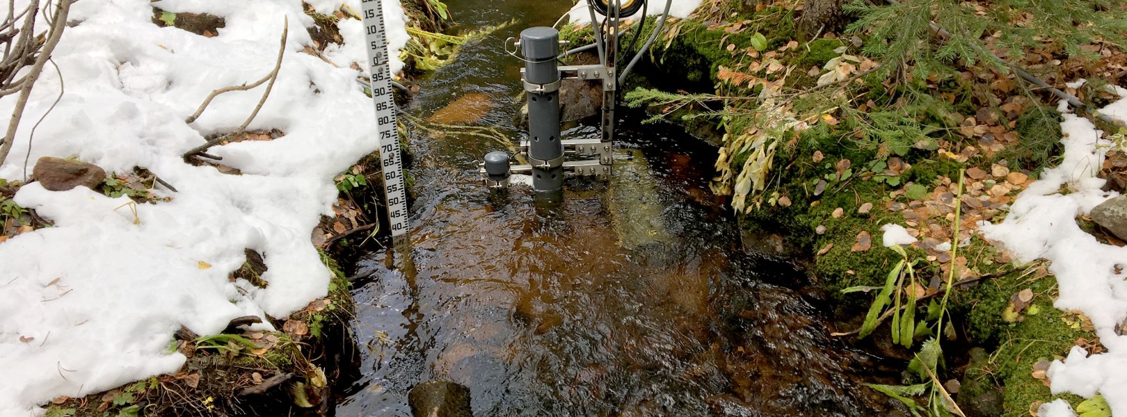
Stream sensors at COMO in the snow

About Field Sites

Como Creek (COMO) is an aquatic NEON field site located in the Rocky Mountains in north-central Colorado, about 89 km (55 mi.) northwest of Denver. Managed by the U.S. Forest Service, this area has remained relatively undisturbed for the past 50 years with no development, logging, or fire in the 4.9 km2 (1211 acre) watershed. Snowmelt dominates the hydrologic and nutrient flux in this system. COMO is home to the threatened greenback cutthroat trout (*Oncorhynchus clarkia stomias*), which spawns in the creek, and thus walking in the stream is prohibited during certain times of the year. Willows line the stream bank and the canopy consists of aspen, spruce, and lodgepole pine. At COMO, NEON works alongside many other research parties including the Niwot Ridge Long Term Ecological Research Station and the Boulder Creek Critical Zone Observatory. COMO is part of NEON's Southern Rockies and Colorado Plateau Domain (D13). D13 has one other aquatic site and two terrestrial sites. COMO is colocated with the terrestrial site Niwot Ridge Mountain Research Station (NIWO). [1]

Climate

COMO is located in the Southern Rockies, which have a climate characterized by the drastic changes in elevation, leading to dramatic differences in precipitation and temperature over very short distances. In general, precipitation decreases and temperature increases with a decrease in elevation. COMO lies at an elevation of over 3000 m (9842 ft.), and consequently it experiences cold and long winters with snow cover lasting from October through June. Freezing temperatures are possible year-round. Snow is the main form of precipitation; however, the area receives a large amount of precipitation in the summer from afternoon thunderstorms. Humidity is generally low. The mean annual temperature 2°C (35.6°F) at COMO and the mean annual precipitation is 841 mm (33 in.). [5] [6]

Geology

The geology at this site is characteristic of schist, migmatite, and biotitic gneiss. [2]

Soils

The watershed surrounding COMO has generally thin soils overlying a parent material of granite. [3]

Hydrology

Snowmelt dominates the hydrologic and nutrient flux in this 4.9 km2 (1211 acre) watershed. Peak streamflow occurs in the summer (June) of each year and sharply declines throughout late summer. Discharge remains very low through the winter months. While weather systems from across the continental divide are the most common source of precipitation, spring and early summer thunderstorms can also contribute to the flow of the creek. [1] [3]

Vegetation

The surrounding area is dominated by conifers including lodgepole pine (Pinus contorta), limber pine (Pinus flexilis), and Engelmann spruce (Picea engelmannii). Aspen trees (Populus tremuloids) can also be found in the area. [3] [4]

Fauna

Aquatic organisms collected at this site include aquatic microbes, macroinvertebrates, microalgae, macroalgae, and plants.

Past Land Management and Use

The area has experienced multiple ecological disturbances throughout history, including stand-replacing fires, episodic insect outbreaks, and occasional wind damage. In the early 1900s the logging industry clear cut the forest. The area is encompassed within Niwot Ridge, which was established as a site in the NSF sponsored Long-Term Ecological Research (LTER) Program in 1980. [4]

Current Land Management and Use

COMO is part of the Niwot Ridge Biosphere Reserve and Experimental Ecology Reserve within the Roosevelt National Forest. The land is managed by the U.S. Forest Service. This area has an active history of ecological research, including the Niwot Ridge LTER which is administered through the Institute of Arctic and Alpine Research. [3] [4]

NEON Site Establishment

COMO was established as a site in 2015. AOS operations began December 2015 with AIS operations starting 2 years later. The nearby tower began data collection in 2017.

Additional Resources

[1] Aquatic Instrument System (AIS) Site Characterization Report: Domain 13. NEON.DOC.002068vB

[2] U.S. Geological Survey, 2005, Mineral Resources Data System: U.S. Geological Survey, Reston, Virginia. https://mrdata.usgs.gov/mrds/

[3] Lewis & Grant (1979). Changes in the Output of Ions from a Watershed as a Result of the Acidification of Precipitation

[4] https://www.nrs.fs.fed.us/data/lcms/niwot/

[5] https://climate.colostate.edu/climate_long.html

[6] PRISM Climate Group., Oregon State University, http://prism.oregonstate.edu, created 4 Feb 2004.

Field Site Information

Latitude/Longitude

40.034962, -105.544164

Geodetic Datum

WGS84

Location

Boulder County
CO, US

Elevation

Mean: 3021m

Mean Annual Temperature

2.0°C

Dominant NLCD Classes

Shrub/Scrub

Colocated Site(s)

Niwot Ridge NEON

Colocated Research

Boulder Creek CZO
Niwot Ridge Southeast National Atmospheric Deposition Program
University of Colorado
NOAA Earth System Research Laboratories Global Monitoring Laboratory

Field Operations Office

1685 38th Street, Suite 100
Boulder, CO 80301

Research Access

If your proposed research requires access to field sites where NEON is present, we can help.

Request Access

Observation Types

Remote Sensing

Remote sensing surveys of this field site collect lidar, spectrometer and high-resolution RGB camera data.

Meteorological Measurements

This site has a meteorological station located in the riparian area. The met station is outfitted with the a subset of the same sensors used at terrestrial sites. Measurements include wind speed and direction, air temperature, barometric pressure, relative humidity, shortwave radiation, and PAR.

Phenocams

A phenocam is pointed toward the land-water interface of the site. Here we show the images from the most recent hour. The full collection of images can be viewed on the Phenocam Gallery - click on the image below.

NEON.D13.COMO.DP1.20002


Field Site Data

Site

Site Host

University of Colorado Boulder

Site URL

https://www.colorado.edu/mrs/

Site Access Details

Please coordinate efforts with the site manager to submit a site research permit (applications open in mid-Feb and closes May). Site is behind a locked gate, arrange with NEON Domain Manager for access. During winter months (early Nov-late May) road is closed to truck usage and only possible by a specialized vehicle (deep snow) or snowshoe/ski 1 mile up road.

Operations Office

NEON Field Operations Office

Domain 10/13 Support Facility

NEON Field Operations Address

1685 38th Street, Suite 100
Boulder, CO 80301

NEON Field Operations Phone

720.836.2439

Location

Latitude

40.034962

Longitude

-105.544164

Geodetic Datum

WGS84

UTM Northing

4431779.63m

UTM Easting

453513.67m

UTM Zone

13N

County

Boulder

State

CO

Country

US

Mean Elevation

3021m

Climate

Mean Annual Temperature

2.0°C

Mean Annual Precipitation

841mm

Vegetation

Dominant NLCD Classes

Shrub/Scrub

Watershed

USGS HUC

h10190005

Watershed Name

St. Vrain

Geology

USGS Geology Unit

COXb;0

USGS Geology Name

Biotitic gneiss, schist, and migmatite

USGS Lithologic Constituents

Biotitic gneiss, schist, and migmatite

USGS Geology Age

Early Proterozoic


Gallery

  • Photos
  • Videos

Related Field Sites

Other Domain D13 Field Sites

brown circle white drop icon Moab NEON
Gradient Terrestrial
brown square white mountain icon Niwot Ridge NEON
Core Terrestrial
blue circle white drop icon West St. Louis Creek NEON
Gradient Aquatic

Other Field Sites in CO

blue square white drop icon Arikaree River NEON
Core Aquatic
brown square white mountain icon Central Plains Experimental Range NEON
Core Terrestrial
brown square white mountain icon Niwot Ridge NEON
Core Terrestrial
brown circle white drop icon North Sterling NEON
Gradient Terrestrial
brown circle white drop icon Rocky Mountains NEON
Gradient Terrestrial
blue circle white drop icon West St. Louis Creek NEON
Gradient Aquatic
NSF NEON, Operated by Battelle

Follow Us:

Join Our Newsletter

Get updates on events, opportunities, and how NEON is being used today.

Subscribe Now

Footer

  • About Us
  • Contact Us
  • Terms & Conditions
  • Careers
  • Code of Conduct

Copyright © Battelle, 2026

The National Ecological Observatory Network is a major facility fully funded by the U.S. National Science Foundation.

Any opinions, findings and conclusions or recommendations expressed in this material do not necessarily reflect the views of the U.S. National Science Foundation.