NSF NEON, Operated by Battelle

Main navigation

  • About Us
    • Overview
      • Spatial and Temporal Design
      • History
    • Vision and Management
    • Advisory Groups
      • Science, Technology & Education Advisory Committee
      • Technical Working Groups (TWGs)
    • FAQ
    • Contact Us
      • Contact NEON Biorepository
      • Field Offices
    • User Accounts
    • Staff
    • Code of Conduct

    About Us

  • Data & Samples
    • Data Portal
      • Explore Data Products
      • Data Availability Charts
      • Spatial Data & Maps
      • Document Library
      • API & GraphQL
      • Prototype Data
      • External Lab Data Ingest (restricted)
    • Data Themes
      • Biogeochemistry
      • Ecohydrology
      • Land Cover and Processes
      • Organisms, Populations, and Communities
    • Samples & Specimens
      • Discover and Use NEON Samples
        • Sample Types
        • Sample Repositories
        • Sample Explorer
        • Megapit and Distributed Initial Characterization Soil Archives
      • Sample Processing
      • Sample Quality
      • Taxonomic Lists
    • Collection Methods
      • Protocols & Standardized Methods
      • Airborne Remote Sensing
        • Flight Box Design
        • Flight Schedules and Coverage
        • Daily Flight Reports
          • AOP Flight Report Sign Up
        • Camera
        • Imaging Spectrometer
        • Lidar
      • Automated Instruments
        • Site Level Sampling Design
        • Sensor Collection Frequency
        • Instrumented Collection Types
          • Meteorology
          • Phenocams
          • Soil Sensors
          • Ground Water
          • Surface Water
      • Observational Sampling
        • Site Level Sampling Design
        • Sampling Schedules
        • Observation Types
          • Aquatic Organisms
            • Aquatic Microbes
            • Fish
            • Macroinvertebrates & Zooplankton
            • Periphyton, Phytoplankton, and Aquatic Plants
          • Terrestrial Organisms
            • Birds
            • Ground Beetles
            • Mosquitoes
            • Small Mammals
            • Soil Microbes
            • Terrestrial Plants
            • Ticks
          • Hydrology & Geomorphology
            • Discharge
            • Geomorphology
          • Biogeochemistry
          • DNA Sequences
          • Pathogens
          • Sediments
          • Soils
            • Soil Descriptions
        • Optimizing the Observational Sampling Designs
    • Data Notifications
    • Data Guidelines and Policies
      • Acknowledging and Citing NEON
      • Publishing Research Outputs
      • Usage Policies
    • Data Management
      • Data Availability
      • Data Formats and Conventions
      • Data Processing
      • Data Quality
      • Data Product Bundles
      • Data Product Revisions and Releases
        • Release 2021
        • Release 2022
        • Release 2023
        • Release 2024
        • Release-2025
      • NEON and Google
      • Externally Hosted Data

    Data & Samples

  • Field Sites
    • About Field Sites and Domains
    • Explore Field Sites
    • Site Management Data Product

    Field Sites

  • Impact
    • Observatory Blog
    • Case Studies
    • Papers & Publications
    • Newsroom
      • NEON in the News
      • Newsletter Archive
      • Newsletter Sign Up

    Impact

  • Resources
    • Getting Started with NEON Data & Resources
    • Documents and Communication Resources
      • Papers & Publications
      • Document Library
      • Outreach Materials
    • Code Hub
      • Code Resources Guidelines
      • Code Resources Submission
      • NEON's GitHub Organization Homepage
    • Learning Hub
      • Science Videos
      • Tutorials
      • Workshops & Courses
      • Teaching Modules
    • Research Support Services
      • Field Site Coordination
      • Letters of Support
      • Mobile Deployment Platforms
      • Permits and Permissions
      • AOP Flight Campaigns
      • Research Support FAQs
      • Research Support Projects
    • Funding Opportunities

    Resources

  • Get Involved
    • Advisory Groups
      • Science, Technology & Education Advisory Committee
      • Technical Working Groups
    • Upcoming Events
    • NEON Ambassador Program
      • Exploring NEON-Derived Data Products Workshop Series
    • Research and Collaborations
      • Environmental Data Science Innovation and Inclusion Lab
      • Collaboration with DOE BER User Facilities and Programs
      • EFI-NEON Ecological Forecasting Challenge
      • NEON Great Lakes User Group
      • NEON Science Summit
      • NCAR-NEON-Community Collaborations
        • NCAR-NEON Community Steering Committee
    • Community Engagement
      • How Community Feedback Impacts NEON Operations
    • Science Seminars and Data Skills Webinars
      • Past Years
    • Work Opportunities
      • Careers
      • Seasonal Fieldwork
      • Internships
        • Intern Alumni
    • Partners

    Get Involved

  • My Account
  • Search

Search

Field Sites

  • About Field Sites and Domains
  • Explore Field Sites
  • Site Management Data Product

Breadcrumb

  1. Field Sites
  2. Black Warrior River NEON

Field Site

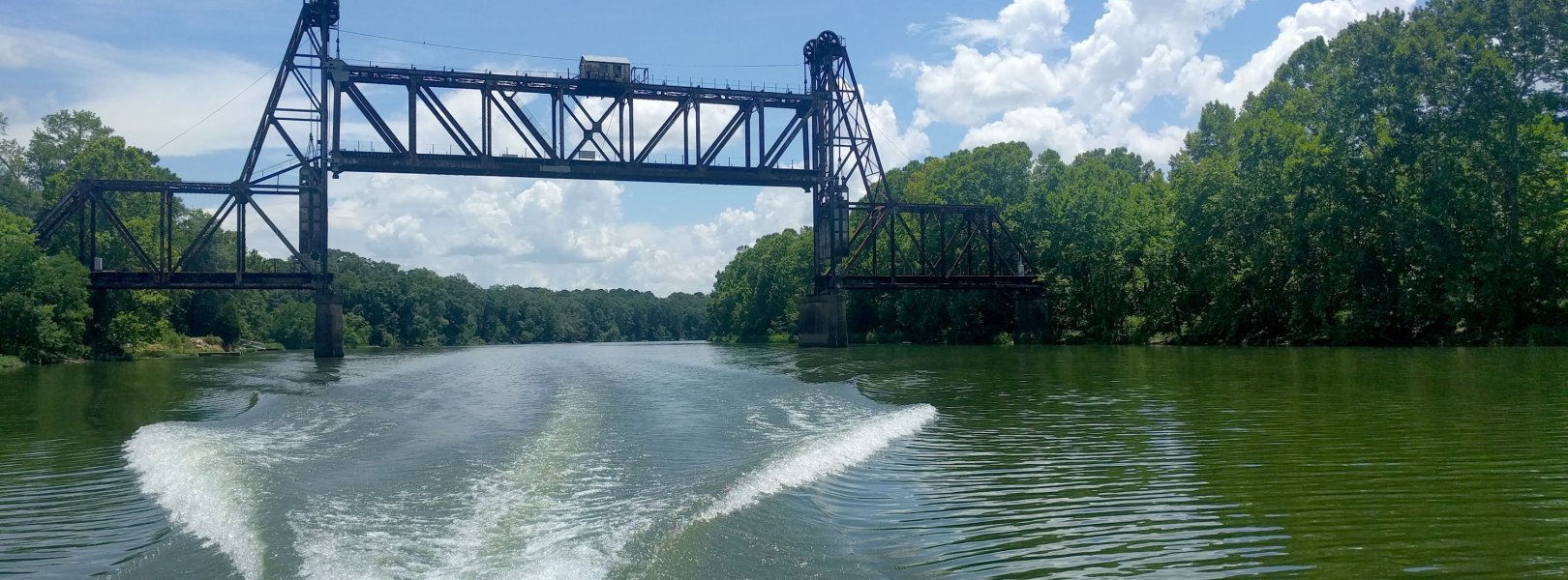
Black Warrior River NEON / BLWA

blue circle white drop icon

Gradient Aquatic, AL, D08: Ozarks Complex

Bridge over the BLWA aquatic site

About Field Sites

The Black Warrior River site (BLWA) is an aquatic site on the Black Warrior River in west-central Alabama. The site sits in the lower extent of the river’s 16,160 km2 (nearly 4 million acre) watershed, 11 km upriver from its confluence with the Tombigbee River. As a navigable river, it is managed by the U.S. Army Corps of Engineers; the property used to access BLWA is privately owned. The site is forested, and the topography is flat with shallow depressions. The river is impacted by a series of locks and dams, coal-fired steam power plants, and urban and agricultural use. BLWA is part of NEON's Ozarks Complex Domain (D08). D08 includes 2 other aquatic field sites and 3 terrestrial field sites. BLWA is colocated with the terrestrial site at Dead Lake (DELA). [1]

Climate

West-central Alabama has a subtropical climate with hot summers, mild winters, and year-round precipitation. Summers are hot and humid, dominated by maritime tropical air from the Gulf of Mexico and the Atlantic. This warm, moist air contributes to the formation of convection storms and thunderstorms in the region, causing major precipitation pulses in the Black Warrior River basin. These events affect nutrient and organic matter flux, sediment transport, and the river’s biota. The mean average annual temperature is 17.6°C (63.7°F) and the average annual precipitation is about 1370 mm (54 in.). The area is subject to tornadoes and hurricanes annually. [1] [3] [5] [12]

Geology

The Black Warrior River has a meandering channel with geomorphological features including oxbow lakes, flood plain steps, and steam terraces. The river is located in the Southern Coastal Plain, an area bounded by an erosional scarp from the Atlantic shoreline during the Mesozoic; the region was exposed and submerged below sea level several times, leaving marine deposits of sand and carbonates as well as riverine deposits of clay, silt, sand, and gravel. At the BLWA site, there are Quartenary-aged alluvial, coastal, and terrace deposits. Upstream alluvial deposits are primarily sourced from the Cretaceous Eutaw and Tuscaloosa formations. [2] [7] [11]

Soils

BLWA is located in the Blackland Prairie or "Blackbelt," an area known for its nutrient-rich, dark soil. These soils are primarily clays and loam that weather into nutrient rich soils that can bake in the summer and become adhesive when wet. Major soil series at DELA, the colocated terrestrial NEON site, include Angie and Leaf, with lesser areas of Cahaba, Dulac, and inclusions of Annemaine. These soils are characterized by thin organic horizons, and deep (over two meters to bedrock) alluvial deposits of largely clayey sediment. The most dominant soil types are well drained and have an increase in clay content with increased depth. [2] [3]

Hydrology

The Black Warrior River begins at the confluence of the Locust, Mulberry, and Sipsey Forks in northern Alabama and ends at its confluence with the Tombigbee River near Demopolis, AL. The river drains from a 16,160 km2 (nearly 4 million acre) watershed, or 12.2% of Alabama’s land area. The river is managed as an inland waterway with a system of locks and dams that significantly reduces the flow in the river, creating a series of lentic environments in the river, reducing lateral connectivity between the river channel and its floodplain and off-channel areas, and resulting in high discharge pulses at BLWA. The streams in the lower section of the watershed are generally glide/pool, low gradient, and habitat poor. Streams in the northern section of the lower Black Warrior watershed flow year round due to sand and gravel aquifers in the area; whereas, streams in the southern section will usually go dry or flow will become quite low. The watershed is subject to major precipitation pulses from tropical storms and hurricanes. These major events affect nutrient and organic matter flux, sediment transport, and biota along the gradient as they propagate downstream. [3] [6] [7] [8]

Vegetation

Broadleaf deciduous forest with concentrations of low needleleaf evergreen trees and patches of bluestem prairie are typical of the lower reach of the Black Warrior watershed and along riverine systems throughout the region. In the lowland, hardwood tree species dominate, including black gum (Nyssa sylvatica), sweetgum (Liquidambar spp.), elm (Ulmus spp.), ash (Fraxinus spp.), and various oak species. Upland areas feature a higher concentration of pine species. [2] [3] [8]

Fauna

Some common fish species in the area include bass, bluegill, and channel catfish. Additionally, the Black Warrior basin is home to several uncommon fish species, including Cahaba shiner (Notropis cahabae), coal darter (Percina brevicauda), and Tuskaloosa darter (Etheostoma douglasi). The basin has an estimated 50 species of freshwater mussel, including nine species listed as threatened or endangered under the Endangered Species Act. NEON collects data on macroinvertebrates at BLWA. [3] [7]

Past Land Management and Use

The Black Warrior River has undergone significant changes in adjacent population, land use, and flow regime in the last 200 years. Perhaps the most significant is the construction of the lock and dam system, which began in 1888 and spurred the development of industry along the river. Before this, passage on the Black Warrior River by steamboats and barges was limited to high water and ended at Tuscaloosa. The river’s development into an inland waterway led to a management focus on the maintenance of a single shipping channel, which has contributed to a significant loss in lateral connectivity of the main channel to its floodplains and off-channel areas. Regional vegetation has also undergone changes in recent history. On a broad scale, upland forests once managed by Native Americans through the use of controlled burns were heavily logged for timber production and land clearing by European settlers. In terms of wetland ecology, the Black Warrior River historically featured vast canebrakes, or dense monotypic stands of giant cane (Arundinaria gigantea); while giant cane is still found near creeks, rivers, and in forests, these extensive stands no longer exist. Canebrakes served as important ecosystems, sediment traps, and a resource for Native Americans (with applications ranging from its harvest as a potherb to its use as a construction material), but were largely destroyed by livestock overgrazing after European settlement. [3] [4] [8] [9] [10]

Current Land Management and Use

The Black Warrior River is managed by the U.S. Army Corps of Engineers as an inland waterway with a series of six locks and dams. The river forms part of the Warrior-Tombigbee Waterway, which is heavily used for barge transportation and moves more than 25 million tons of products and materials each year. The river is also used recreationally, and popular activities include hunting, fishing, canoeing, kayaking, and boating. BLWA is located in the Major Land Resources Area 133A (the Southern Coastal Plain), where the primary land-use is timber production, followed by cropland and pastureland [7]. [1] [3]

NEON Site Establishment

Site characterization and initial dry-runs of observational sampling at BLWA occurred in 2016, followed by the first publication of observational data in 2017. Permitting constraints with the U.S. Army Corps of Engineers and the flow and sedimentation regimes of the river necessitated the installation of on-shore infrastructure on private land as well as an overall modified site design compared to typical aquatic sites. This included the addition of a level gauge at the site which can continuously monitor water level. Instrumentation at the site, which includes a profiling buoy and the aforementioned level gauge, went live and began streaming data in 2018. [1]

Additional Resources

  1. Aquatic Instrument System (AIS) Site Characterization Report: Domain 08. NEON.DOC.001370vB
  2. Depew, Steve. (2016). NEON Site-Level Plot Summary: Dead Lake (DELA), August 2016. 
  3. Alabama Department of Environmental Management. Black Warrior River Watershed Management Plan. 440 pp.
  4. Wells, Thomas L. & C. Hobson Bryan. 2012. Policy Implications of Aging and Manipulated River Systems: A Case Study of the Black Warrior River. IAIA12 Conference Proceedings.
  5. PRISM Climate Group, Oregon State University
  6. NEON (National Ecological Observatory Network). 2020. Data Product DP1.20275.001, Riparian composition and structure. Provisional data downloaded from https://data.neonscience.org on May 22, 2020.
  7. Land Resource Regions and Major Land Resource Areas of the United States, the Caribbean, and the Pacific Basin
  8. Kier Klepzig, Richard Shelfer, and Zanethia Choice. 2014. Outlook for Coastal Plain Forests: A Subregional Report from the Southern Forest Futures Project. USDA. pp 1-84.
  9. Barone, J. A., Beck, J. W., Potter, M. B., Sneed, S. R., Stephenson, K. E., & Dollar, E. J., II. 2008. Distribution of canebrakes in 19th century Alabama. Journal of the Alabama Academy of Science, 79(1), 1+. Retrieved from https://link.gale.com/apps/doc/A179501612/AONE?u=oregon_sl&sid=AONE&xid=dd596795
  10. USDA Plant Guide: Giant Cane, Arundinaria gigantea
  11. U.S. Geological Survey, 2005, Mineral Resources Data System: U.S. Geological Survey, Reston, Virginia. 
  12. NOAA National Centers for Environmental Information, State Climate Summaries 2022, Alabama. 

Field Site Information

Latitude/Longitude

32.541529, -87.798151

Geodetic Datum

WGS84

Location

Greene County
AL, US

Elevation

Mean: 22m

Mean Annual Temperature

17.6°C

Dominant NLCD Classes

Woody Wetlands

Colocated Site(s)

Dead Lake NEON

Colocated Research

U.S. Army Corps of Engineers

Field Operations Office

6050 Mimosa Circle, Suite C
Tuscaloosa, AL 35405

Research Access

Non-NEON research activities are allowed in this area. Researchers must obtain their own permits with the site host(s).

Request Access

Observation Types

Remote Sensing

Remote sensing surveys of this field site collect lidar, spectrometer and high-resolution RGB camera data.

Meteorological Measurements

This site has a meteorological station above water on a buoy. The met station is outfitted with the a subset of the same sensors used at terrestrial sites. Measurements include wind speed and direction, air temperature, barometric pressure, relative humidity, shortwave radiation, and PAR. For meteorological data at this site, query its colocated terrestrial site, DELA.

Phenocams

A phenocam is pointed toward the land-water interface of the site. Here we show the images from the most recent hour. The full collection of images can be viewed on the Phenocam Gallery - click on the image below.

NEON.D08.BLWA.DP1.20002


Field Site Data

Site

Site Host

US Army Corps of Engineers

Site Access Allowed

Limited

Site URL

https://www.usace.army.mil/

Site Access Details

This area is primarily intended to provide recreational opportunities and is also classified as a hunting area. As such, access is very limited but potentially possible.

Site Host

Private

Site Access Allowed

Very Limited

Site Access Details

Very limited available via private land owner.

Operations Office

NEON Field Operations Office

Domain 08 Support Facility

NEON Field Operations Address

6050 Mimosa Circle, Suite C
Tuscaloosa, AL 35405

NEON Field Operations Phone

205.409.9039

Location

Latitude

32.541529

Longitude

-87.798151

Geodetic Datum

WGS84

UTM Northing

3600743.44m

UTM Easting

425055.82m

UTM Zone

16N

County

Greene

State

AL

Country

US

Mean Elevation

22m

Climate

Mean Annual Temperature

17.6°C

Mean Annual Precipitation

1372mm

Vegetation

Dominant NLCD Classes

Woody Wetlands

Watershed

USGS HUC

h03160113

Watershed Name

Lower Black Warrior

Geology

USGS Geology Unit

ALHalt;0

USGS Geology Name

Alluvial, coastal and low terrace deposits

USGS Lithologic Constituents

Beach sand and alluvium

USGS Geology Age

Holocene


Gallery

  • Photos
  • Videos

No Video


Related Field Sites

Other Domain D08 Field Sites

brown circle white drop icon Dead Lake NEON
Gradient Terrestrial
brown circle white drop icon Lenoir Landing NEON
Gradient Terrestrial
blue circle white drop icon Lower Tombigbee River NEON
Gradient Aquatic
blue square white drop icon Mayfield Creek NEON
Core Aquatic
brown square white mountain icon Talladega National Forest NEON
Core Terrestrial

Other Field Sites in AL

brown circle white drop icon Dead Lake NEON
Gradient Terrestrial
brown circle white drop icon Lenoir Landing NEON
Gradient Terrestrial
blue circle white drop icon Lower Tombigbee River NEON
Gradient Aquatic
blue square white drop icon Mayfield Creek NEON
Core Aquatic
brown square white mountain icon Talladega National Forest NEON
Core Terrestrial
NSF NEON, Operated by Battelle

Follow Us:

Join Our Newsletter

Get updates on events, opportunities, and how NEON is being used today.

Subscribe Now

Footer

  • About Us
  • Newsroom
  • Contact Us
  • Terms & Conditions
  • Careers
  • Code of Conduct

Copyright © Battelle, 2025

The National Ecological Observatory Network is a major facility fully funded by the U.S. National Science Foundation.

Any opinions, findings and conclusions or recommendations expressed in this material do not necessarily reflect the views of the U.S. National Science Foundation.