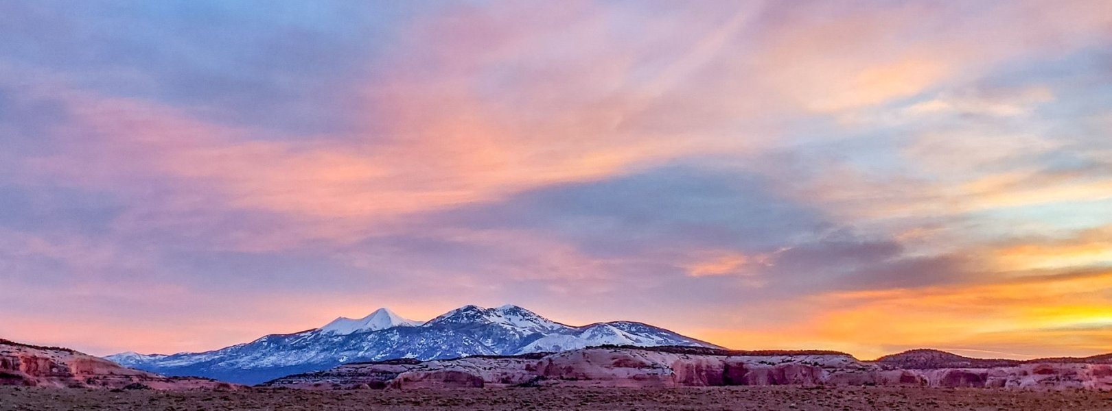
NSF NEON, Operated by Battelle

Main navigation

  • About Us
    • Overview
      • Spatial and Temporal Design
      • History
    • Vision and Management
    • Advisory Groups
      • Science, Technology & Education Advisory Committee
      • Technical Working Groups (TWGs)
    • FAQ
    • Contact Us
      • Contact NEON Biorepository
      • Field Offices
    • User Accounts
    • Staff
    • Code of Conduct

    About Us

  • Data & Samples
    • Data Portal
      • Explore Data Products
      • Data Availability Charts
      • Spatial Data & Maps
      • Document Library
      • API & GraphQL
      • Prototype Data
      • External Lab Data Ingest (restricted)
    • Data Themes
      • Biogeochemistry
      • Ecohydrology
      • Land Cover and Processes
      • Organisms, Populations, and Communities
    • Samples & Specimens
      • Discover and Use NEON Samples
        • Sample Types
        • Sample Repositories
        • Sample Explorer
        • Megapit and Distributed Initial Characterization Soil Archives
      • Sample Processing
      • Sample Quality
      • Taxonomic Lists
    • Collection Methods
      • Protocols & Standardized Methods
      • Airborne Remote Sensing
        • Flight Box Design
        • Flight Schedules and Coverage
        • Daily Flight Reports
          • AOP Flight Report Sign Up
        • Camera
        • Imaging Spectrometer
        • Lidar
      • Automated Instruments
        • Site Level Sampling Design
        • Sensor Collection Frequency
        • Instrumented Collection Types
          • Meteorology
          • Phenocams
          • Soil Sensors
          • Ground Water
          • Surface Water
      • Observational Sampling
        • Site Level Sampling Design
        • Sampling Schedules
        • Observation Types
          • Aquatic Organisms
            • Aquatic Microbes
            • Fish
            • Macroinvertebrates & Zooplankton
            • Periphyton, Phytoplankton, and Aquatic Plants
          • Terrestrial Organisms
            • Birds
            • Ground Beetles
            • Mosquitoes
            • Small Mammals
            • Soil Microbes
            • Terrestrial Plants
            • Ticks
          • Hydrology & Geomorphology
            • Discharge
            • Geomorphology
          • Biogeochemistry
          • DNA Sequences
          • Pathogens
          • Sediments
          • Soils
            • Soil Descriptions
        • Optimizing the Observational Sampling Designs
    • Data Notifications
    • Data Guidelines and Policies
      • Acknowledging and Citing NEON
      • Publishing Research Outputs
      • Usage Policies
    • Data Management
      • Data Availability
      • Data Formats and Conventions
      • Data Processing
      • Data Quality
      • Data Product Bundles
      • Data Product Revisions and Releases
        • Release 2021
        • Release 2022
        • Release 2023
        • Release 2024
        • Release-2025
      • NEON and Google
      • Externally Hosted Data

    Data & Samples

  • Field Sites
    • About Field Sites and Domains
    • Explore Field Sites
    • Site Management Data Product

    Field Sites

  • Impact
    • Observatory Blog
    • Case Studies
    • Papers & Publications
    • Newsroom
      • NEON in the News
      • Newsletter Archive
      • Newsletter Sign Up

    Impact

  • Resources
    • Getting Started with NEON Data & Resources
    • Documents and Communication Resources
      • Papers & Publications
      • Document Library
      • Outreach Materials
    • Code Hub
      • Code Resources Guidelines
      • Code Resources Submission
      • NEON's GitHub Organization Homepage
    • Learning Hub
      • Science Videos
      • Tutorials
      • Workshops & Courses
      • Teaching Modules
    • Research Support Services
      • Field Site Coordination
      • Letters of Support
      • Mobile Deployment Platforms
      • Permits and Permissions
      • AOP Flight Campaigns
      • Research Support FAQs
      • Research Support Projects
    • Funding Opportunities

    Resources

  • Get Involved
    • Advisory Groups
      • Science, Technology & Education Advisory Committee
      • Technical Working Groups
    • Upcoming Events
    • NEON Ambassador Program
      • Exploring NEON-Derived Data Products Workshop Series
    • Research and Collaborations
      • Environmental Data Science Innovation and Inclusion Lab
      • Collaboration with DOE BER User Facilities and Programs
      • EFI-NEON Ecological Forecasting Challenge
      • NEON Great Lakes User Group
      • NEON Science Summit
      • NCAR-NEON-Community Collaborations
        • NCAR-NEON Community Steering Committee
    • Community Engagement
      • How Community Feedback Impacts NEON Operations
    • Science Seminars and Data Skills Webinars
      • Past Years
    • Work Opportunities
      • Careers
      • Seasonal Fieldwork
      • Internships
        • Intern Alumni
    • Partners

    Get Involved

  • My Account
  • Search

Search

Field Sites

  • About Field Sites and Domains
  • Explore Field Sites
  • Site Management Data Product

Breadcrumb

  1. Field Sites
  2. Moab NEON

Field Site

Moab NEON / MOAB

brown circle white drop icon

Gradient Terrestrial, UT, D13: Southern Rockies & Colorado Plateau

View of sunrise from the flux tower at MOAB

About Field Sites

The NEON site at Moab (MOAB) is a terrestrial field site about 40 km (25 mi.) south of the town of Moab in San Juan County, Utah, on the Colorado Plateau. Its sampling area is 50km2 (12,355 acres) on land managed by the Bureau of Land Management. The terrain at the tower site is flat with a very shallow slope towards the southwest. This is a key design element because the winds mostly come from this direction, allowing NEON to best measure dust generation and deposition. Vegetation is a mix of grasses and forbs with a uniform distribution, and the site is lightly grazed. The structure of this type of vegetation is representative of the dominant vegetation of the region. MOAB is part of NEON's Southern Rockies and Colorado Plateau Domain (D13). D13 includes one other terrestrial site and two aquatic sites. MOAB is not colocated with an aquatic field site. MOAB is managed out of the D15 Support Facility in Salt Lake City, UT. [2] [9]

Climate

MOAB is located on the Colorado Plateau, a high desert region that experiences cold winters, hot summers, and wide temperature fluctuations between day and night. Due to the region's relatively high elevation, the area experiences cold winters. Summer days are typically hot and can reach 38°C (100°F), but summer nights are cool. The average annual temperature at the site is 10.1°C (50°F). The average annual precipitation is low compared to other NEON sites at 320 mm (12.6 in.). However, the region receives large quantities of precipitation in the form of late summer thunderstorms. These monsoons bring violent storm cells that cause flash floods. [11] [13]

Geology

The geology at this site is composed of eolian deposits overlying sandstones and mudstones. The major nearby geologic units are Morrison, Entrada, Carmel, and Navajo Formations, which were formed during the Jurassic period. [3] [10]

Soils

The predominant soil series encountered at MOAB are Begay, Ignacio, Mivida, Rizno, and Windwhistle. [3]

Hydrology

MOAB is within the Colorado River watershed. Water flows northwest from the NEON site and into Hatch Wash. [3]

Vegetation

Dominant plant species around the tower include fourwing saltbush (Atriplex canescens), Mormon tea (Ephedra viridis), and blue grama (Bouteloua gracilis). Pinyon Pine (Pinus edulis) and Utah Juniper (Juniperus osteosperma) make up the canopy composition in the higher elevations. [2]

Fauna

Just a few of the animals living near the MOAB site include pronghorn (Antilocapra americana), American black bear (Ursus americanus), midget faded rattlesnake (Crotalus concolor), and giant hairy scorpion (Hadrurus arizonensis). NEON samples for ticks, mosquitoes, beetles, birds, and small mammals. Some animals frequently sampled include Pinyon deermouse (Peromyscus truei), North American deermouse (Peromyscus maniculatus), and northern grasshopper mouse (Onychomys leucogaster). [1]

Past Land Management and Use

As early as 10,000 years ago, the Ancestral Puebloans inhabited Moab, followed later by the Núu-agha-tʉvʉ-pʉ̱ (Ute). Mormon missionaries tried to settle in Moab in 1855, but Ute resistance rendered the attempt unsuccessful until the first permanent settlement in 1877. In the 1890s, the population grew as mining and the building of the railroad commenced. Mining for uranium started in 1952 and nearly tripled the population in three years; this mining operation ceased around 1983. Moab is also home to the USGS Southwest Biological Science Center, conducting terrestrial and aquatic research in the area. In 2009, The Nature Conservancy opened the Canyonlands Research Center to study climate change and develop sustainable land management practices. The town of Moab is also considered a gateway to a few national parks, so the region attracts vast numbers of visitors each year. [4] [5] [7] [8]

Current Land Management and Use

The site is on Bureau of Land Management (BLM) administered property. The BLM has a multiple-use approach to land management, as outlined in Resource Management Plans, prepared in accordance with the Federal Land Policy and Management Act. The overarching land use in the area is rangeland. The site is also open to the public and includes the Looking Glass Rock and Wilson Arch recreation areas. [2] [3]

NEON Site Establishment

Plot establishment at MOAB was initiated in May 2015. Both TOS and TIS data collection methods were operational by August 2017, signaling transition to full operations.

Additional Resources

[1] Rissler, Erik, et. al. (2017). NEON Site-Specific EHS Plan D13RT1 MOAB.

[2] Terrestrial Observation System (TOS) Site Characterization Report: Domain 13. NEON.DOC.003896vB

[3] Parslow,Victor. (2017) NEON Site Level Plot Summary, MOAB (MOAB), July 2017. United States Department of Agriculture. https://data.neonscience.org/documents/10179/2361410/MOAB_Soil_SiteSumm…

[4] https://native-land.ca/maps/territories/ute/

[5] https://www.grandcountyutah.net/387/History

[6] https://www.blm.gov/about/how-we-manage

[7] https://www.usgs.gov/centers/sbsc

[8] https://www.nature.org/en-us/get-involved/how-to-help/places-we-protect…

[9] Terrestrial Instrument System (TIS, FIU) Site Characterization Supporting Data: Domain 13. NEON.DOC.011063vD

[10] U.S. Geological Survey, 2005, Mineral Resources Data System: U.S. Geological Survey, Reston, Virginia. https://mrdata.usgs.gov/mrds/

[11] https://statesummaries.ncics.org/chapter/ut/

[12] https://www.nps.gov/arch/planyourvisit/weather.htm

[13] PRISM Climate Group., Oregon State University, http://prism.oregonstate.edu, created 4 Feb 2004.

Field Site Information

Latitude/Longitude

38.248283, -109.38827

Geodetic Datum

WGS84

Location

San Juan County
UT, US

Elevation

Mean: 1799m
Minimum: 1722m
Maximum: 2039m

Mean Annual Temperature

10.1°C

Dominant Wind Direction

SSW

Mean Canopy Height

0.2m

Dominant NLCD Classes

Evergreen Forest, Shrub/Scrub

Colocated Research

Critical Zone Exploration Network
Ameriflux

Field Operations Office

2992 South Main Street
South Salt Lake City, UT 84115

Research Access

Non-NEON research activities are allowed in this area. Researchers must obtain their own permits with the site host(s).

Request Access

Observation Types

Remote Sensing

Remote sensing surveys of this field site collect lidar, spectrometer and high-resolution RGB camera data.

Meteorological Measurements

This site has a flux/meteorological tower that is 8 m (26 ft) tall with four measurement levels. The tower top extends above the vegetation canopy to allow sensors mounted at the top and along the tower to capture the full profile of atmospheric conditions from the top of the vegetation canopy to the ground. The tower collects physical and chemical properties of atmosphere-related processes, such as humidity, wind, and net ecosystem gas exchange. Precipitation data may be collected by a tipping bucket at the top of the tower, a Double Fence Intercomparison Reference (DFIR) near the tower.

Phenocams

One phenocam is attached to the top and the bottom of the tower. Here we show the images from the most recent hour. The full collection of images can be viewed on the Phenocam Gallery - click on either of the images below.

Tower top

NEON.D13.MOAB.DP1.10033

Tower bottom

NEON.D13.MOAB.DP1.10042

Soil Sensor Measurements

This site has five soil plots placed in an array within the airshed of the flux tower. Photosynthetically Active Radiation (PAR) at soil surface, soil heat flux, and solar radiation are measured at the soil surface in each soil plot. Soil moisture, soil temperature, and CO2 concentration are measured at multiple depths in each soil plot.

Observational Sampling

At terrestrial sites, field ecologists observe birds and plants, and sample ground beetles, mosquitoes, small mammals, soil microbes, and ticks. Lab analyses are carried out to provide further data on DNA sequences, pathogens, soils, sediments, and biogeochemistry. Learn more about terrestrial observations or explore this site's data products.


Field Site Data

Site

Site Host

Bureau of Land Management

Site Access Allowed

Yes

Site URL

https://www.blm.gov/office/moab-field-office

Site Access Details

Reseachers should coordinate with the site manager.

Operations Office

NEON Field Operations Office

Domain 15 Support Facility

NEON Field Operations Address

2992 South Main Street
South Salt Lake City, UT 84115

NEON Field Operations Phone

385.235.7975

Location

Latitude

38.248283

Longitude

-109.38827

Geodetic Datum

WGS84

UTM Northing

4234596.51m

UTM Easting

641031.47m

UTM Zone

12N

County

San Juan

State

UT

Country

US

Mean Elevation

1799m

Minimum Elevation

1722m

Maximum Elevation

2039m

Climate

Mean Annual Temperature

10.1°C

Mean Annual Precipitation

319mm

Dominant Wind Direction

SSW

Vegetation

Mean Canopy Height

0.2m

Dominant NLCD Classes

Evergreen Forest, Shrub/Scrub

Average number of green days

215

Average first greenness increase date

85 DOY

Average peak green date

165 DOY

Average first greenness decrease date

225 DOY

Average minimum greenness date

300 DOY

Tower

Tower Height

8m

Number of Tower Levels

4

Soils

Megapit Soil Family

Coarse-loamy - mixed - superactive - mesic Ustic Haplocalcids

Soil Subgroup

Ustic Haplocalcids


Gallery

  • Photos
  • Videos

No Video


Related Field Sites

Other Domain D13 Field Sites

blue square white drop icon Como Creek NEON
Core Aquatic
brown square white mountain icon Niwot Ridge NEON
Core Terrestrial
blue circle white drop icon West St Louis Creek NEON
Gradient Aquatic

Other Field Sites in UT

brown square white mountain icon Onaqui NEON
Core Terrestrial
blue square white drop icon Red Butte Creek NEON
Core Aquatic
NSF NEON, Operated by Battelle

Follow Us:

Join Our Newsletter

Get updates on events, opportunities, and how NEON is being used today.

Subscribe Now

Footer

  • About Us
  • Newsroom
  • Contact Us
  • Terms & Conditions
  • Careers
  • Code of Conduct

Copyright © Battelle, 2025

The National Ecological Observatory Network is a major facility fully funded by the U.S. National Science Foundation.

Any opinions, findings and conclusions or recommendations expressed in this material do not necessarily reflect the views of the U.S. National Science Foundation.