NSF NEON, Operated by Battelle

Main navigation

  • About Us
    • Overview
      • Spatial and Temporal Design
      • History
    • Vision and Management
    • Advisory Groups
      • Science, Technology & Education Advisory Committee
      • Technical Working Groups (TWGs)
    • FAQ
    • Contact Us
      • Contact NEON Biorepository
      • Field Offices
    • User Accounts
    • Staff
    • Code of Conduct

    About Us

  • Data & Samples
    • Data Portal
      • Explore Data Products
      • Data Availability Charts
      • Spatial Data & Maps
      • Document Library
      • API & GraphQL
      • Prototype Data
      • External Lab Data Ingest (restricted)
    • Data Themes
      • Biogeochemistry
      • Ecohydrology
      • Land Cover and Processes
      • Organisms, Populations, and Communities
    • Samples & Specimens
      • Discover and Use NEON Samples
        • Sample Types
        • Sample Repositories
        • Sample Explorer
        • Megapit and Distributed Initial Characterization Soil Archives
      • Sample Processing
      • Sample Quality
      • Taxonomic Lists
    • Collection Methods
      • Protocols & Standardized Methods
      • Airborne Remote Sensing
        • Flight Box Design
        • Flight Schedules and Coverage
        • Daily Flight Reports
          • AOP Flight Report Sign Up
        • Camera
        • Imaging Spectrometer
        • Lidar
      • Automated Instruments
        • Site Level Sampling Design
        • Sensor Collection Frequency
        • Instrumented Collection Types
          • Meteorology
          • Phenocams
          • Soil Sensors
          • Ground Water
          • Surface Water
      • Observational Sampling
        • Site Level Sampling Design
        • Sampling Schedules
        • Observation Types
          • Aquatic Organisms
            • Aquatic Microbes
            • Fish
            • Macroinvertebrates & Zooplankton
            • Periphyton, Phytoplankton, and Aquatic Plants
          • Terrestrial Organisms
            • Birds
            • Ground Beetles
            • Mosquitoes
            • Small Mammals
            • Soil Microbes
            • Terrestrial Plants
            • Ticks
          • Hydrology & Geomorphology
            • Discharge
            • Geomorphology
          • Biogeochemistry
          • DNA Sequences
          • Pathogens
          • Sediments
          • Soils
            • Soil Descriptions
        • Optimizing the Observational Sampling Designs
    • Data Notifications
    • Data Guidelines and Policies
      • Acknowledging and Citing NEON
      • Publishing Research Outputs
      • Usage Policies
    • Data Management
      • Data Availability
      • Data Formats and Conventions
      • Data Processing
      • Data Quality
      • Data Product Bundles
      • Data Product Revisions and Releases
        • Release 2021
        • Release 2022
        • Release 2023
        • Release 2024
        • Release-2025
      • NEON and Google
      • Externally Hosted Data

    Data & Samples

  • Field Sites
    • About Field Sites and Domains
    • Explore Field Sites
    • Site Management Data Product

    Field Sites

  • Impact
    • Observatory Blog
    • Case Studies
    • Papers & Publications
    • Newsroom
      • NEON in the News
      • Newsletter Archive
      • Newsletter Sign Up

    Impact

  • Resources
    • Getting Started with NEON Data & Resources
    • Documents and Communication Resources
      • Papers & Publications
      • Document Library
      • Outreach Materials
    • Code Hub
      • Code Resources Guidelines
      • Code Resources Submission
      • NEON's GitHub Organization Homepage
    • Learning Hub
      • Science Videos
      • Tutorials
      • Workshops & Courses
      • Teaching Modules
    • Research Support Services
      • Field Site Coordination
      • Letters of Support
      • Mobile Deployment Platforms
      • Permits and Permissions
      • AOP Flight Campaigns
      • Research Support FAQs
      • Research Support Projects
    • Funding Opportunities

    Resources

  • Get Involved
    • Advisory Groups
      • Science, Technology & Education Advisory Committee
      • Technical Working Groups
    • Upcoming Events
    • NEON Ambassador Program
      • Exploring NEON-Derived Data Products Workshop Series
    • Research and Collaborations
      • Environmental Data Science Innovation and Inclusion Lab
      • Collaboration with DOE BER User Facilities and Programs
      • EFI-NEON Ecological Forecasting Challenge
      • NEON Great Lakes User Group
      • NEON Science Summit
      • NCAR-NEON-Community Collaborations
        • NCAR-NEON Community Steering Committee
    • Community Engagement
      • How Community Feedback Impacts NEON Operations
    • Science Seminars and Data Skills Webinars
      • Past Years
    • Work Opportunities
      • Careers
      • Seasonal Fieldwork
      • Internships
        • Intern Alumni
    • Partners

    Get Involved

  • My Account
  • Search

Search

Field Sites

  • About Field Sites and Domains
  • Explore Field Sites
  • Site Management Data Product

Breadcrumb

  1. Field Sites
  2. Wind River Experimental Forest NEON

Field Site

Wind River Experimental Forest NEON / WREF

brown square white mountain icon

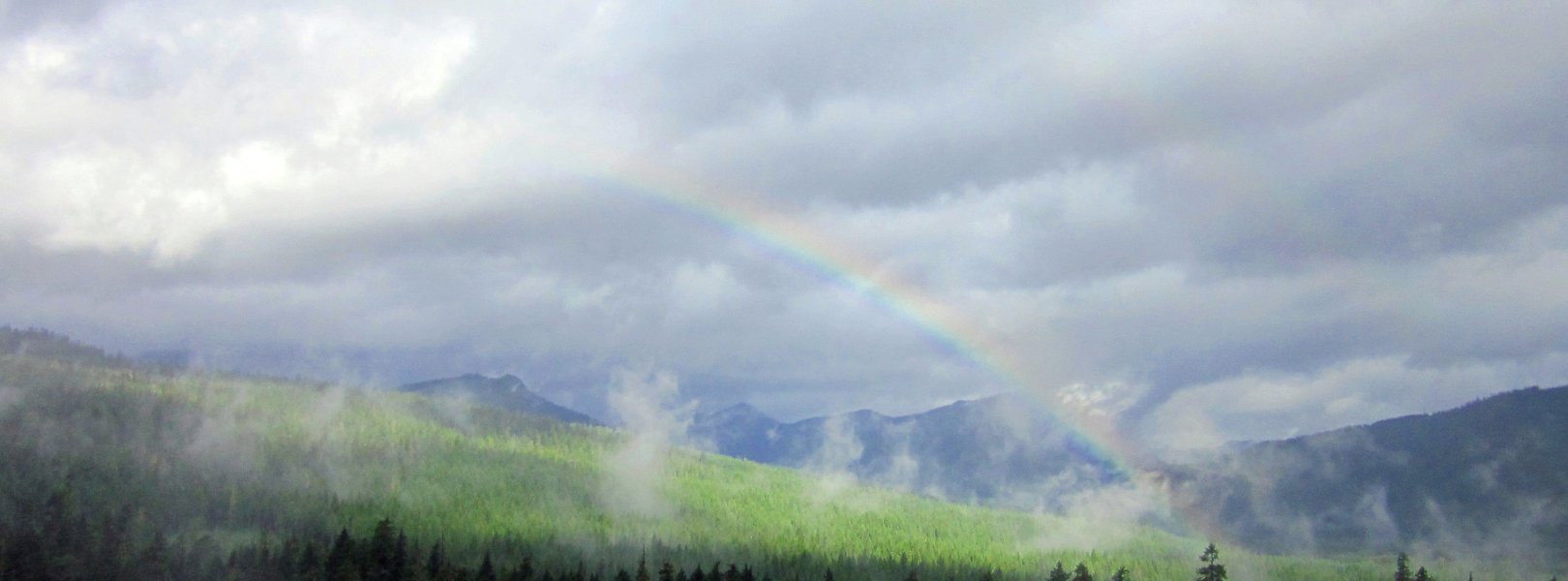
Core Terrestrial, WA, D16: Pacific Northwest

Rainbow at WREF field site

About Field Sites

Wind River Experimental Forest (WREF) is a terrestrial NEON field site located 60 km (37 mi.) northeast of Vancouver, WA. The 42 km2 (10,400 acre) site lies within the Wind River Experimental Forest in the south central area of the Gifford Pinchot National Forest, which is managed by the U.S. Forest Service. While best known for its old-growth Douglas fir (Pseudotsuga menziesii) and western hemlock (Tsuga heterophylla) stands, the forest is a mosaic of tree ages due to management practices and wildfire history. Known as the cradle of forestry in the Pacific Northwest, the Wind River Experimental Forest has a long history of ecology and silviculture studies. WREF is located in NEON's Pacific Northwest Domain (D16), which is bounded by the Pacific on the west and Canada on the north. It includes the eastern halves of Washington and Oregon and parts of northern California. The Domain hosts three other field sites: two aquatic and one additional terrestrial. It is near the MART aquatic site. [1]

Climate

The climate of WREF is significantly influenced by its close proximity to the Columbia River Gorge, with secondary orographic lifting effects from the Cascade Range. Warm, dry summers and cool, wet winters are the norm, with approximately 2225 mm (87.6 in.) of annual precipitation in the form of rain and snow and a mean annual temperature of 9.2°C (49°F). Interannual variation plays a major role in yearly precipitation levels; the El Niño Southern Oscillation is a driving force behind warmer, drier years, which lead to an increased chance of drought and wildfires. [5] [10]

Geology

The geology of the majority of plots at WREF are defined by Pleistocene-age basalt and andesite flows of the Trout Creek formation, often covered by volcanic mudflows and ejecta. The remaining plots are situated five kilometers away on steep mountain slopes formed of volcanoclastic breccias and tuffs. [3] [8]

Soils

Soils in the vast majority of plots at WREF are derived from andesite and basalt bedrock, supplemented by airborne pumice and volcanic ash. The minority originate from chemically and physically weathered volcanoclastic tuffs and breccias. Despite differences in parent material, WREF soils classify as Vitric Hapludands and are part of the Stabler or Stabler taxadjunct series. This series, as with most volcanic soils in the Pacific Northwest, displays andic properties deriving from a significant percentage of weathered volcanic glass present in the soil. [2] [3]

Hydrology

The two divisions of the experimental forest are named for their permanent tributaries of the Wind River: Trout Creek to the west, and Panther Creek to the east. Other small permanent and ephemeral streams drain into the creeks. The Wind River itself originates about 25 km (15 mi.) north of the forest and its watershed covers over 580 km2 (225 sq. mi.), supporting a fifth-order system of streams that flow south into the Columbia River Gorge. [9]

Vegetation

Often more than 450 years old, older stands in Wind River Experimental Forest are dominated by Douglas fir (Pseudotsuga menziesii), western hemlock (Tsuga heterophylla), and Pacific silver fir (Abies amabilis). Canopy species throughout the rest of forest include grand fir (Abies grandis), noble fir (Abies procera), Pacific dogwood (Cornus nuttallii), Western red cedar (Thuja plicata), and red alder (Alnus rubra). The understory includes vine maple (Acer circinatum), salal (Gaultheria shallon), and Oregon grape (Mahonia aquifolium). [1]

Fauna

The Wind River Experimental Forest supports many large mammals including elk (Cervus canadensis), black-tailed deer (Odocoileus hemionus columbianus), bobcat (Lynx rufus), cougar (Puma concolor), coyote (Canis latrans), black bear (Ursus americanus), marten (Martes americana), several species of weasels, and many species of small mammals including the Douglas squirrel (Tamiasciurus douglasii). Birds of all sizes inhabit the forest, including the Northern spotted owl (Strix occidentalis caurina), which is federally listed as a threatened species. [1]

Past Land Management and Use

Forest research began in the Wind River Valley in 1909 with the establishment of a seedling nursery aimed to repopulate local areas devastated by the severe wildfires of the early 20th century, including the 1902 Yacolt Burn. In the same year, long-term studies of Douglas-fir (Pseudotsuga menziesii) ecology were initiated by Thornton T. Munger in old-growth stands within the valley. Establishment of an arboretum and experimental station in the early 1910s and the official establishment of the Wind River Experimental Forest in 1932 solidified the area as a center of research which became the cornerstone of Douglas-fir silviculture and management in the Pacific Northwest. [4] [6]

Current Land Management and Use

Managed cooperatively by the U.S. Forest Service Pacific Northwest Research Station and Gifford Pinchot National Forest, the Wind River Experimental Forest has been home to silvicultural studies and forest research since 1909, with many decades-long projects continuing to this day. The 1994 installation of a 75 m (250 ft.) canopy crane allowed researchers to access over 24,000 m2 (6 acres) of old-growth canopy and study tree physiology, canopy-atmosphere gas exchange, nutrient cycling, epiphyte biology, climate monitoring, and much more. The crane was removed in 2011, but the 70 m (230 ft.) tower remains, sporting sensors and data collectors used by NEON and other organizations to monitor gas exchange, carbon flux, and isotope data. Besides forest research, the experimental forest is also managed for logging and day-use recreational activities, including several kilometers of the Pacific Crest National Scenic Trail. [6]

NEON Site Establishment

TOS Distributed Plots were allocated at WREF according to a spatially balanced and stratified-random design. The 2006 National Land Cover Database (NLCD) was selected for stratification because of the consistent and comparable data availability across the United States. TOS Tower Plots were allocated according to a spatially balanced design in and around the NEON tower airshed. Due to increased hiking times at this site, plot allocation was constrained to areas near roads and hiking trails. TOS and TIS sampling began in June and July 2018, respectively. [1]

Additional Resources

[1] Terrestrial Observation System (TOS) Site Characterization Report: Domain 16. NEON.DOC.003899vA

[2] McDaniel, P. A., & Wilson, M. A. (2007). Physical and Chemical Characteristics of Ash-influenced Soils of Inland Northwest Forests. In Volcanic-Ash-¬Derived Forest Soils of the Inland Northwest: Properties and Implications for Management and Restoration. 9-10 November 2005; Coeur d'Alene, ID (pp. 31–45). Proceedings RMRS-P-44; Fort Collins, CO: U.S. Department of Agriculture, Forest Service, Rocky Mountain Research Station. Retrieved from https://www.fs.fed.us/rm/pubs/rmrs_p044/rmrs_p044_031_045.pdf

[3] Dahlke, Erik. (2019). NEON Site-Level Plot Summary, Wind River Experimental Forest (WREF), March 2019. https://data.neonscience.org/documents/10179/2361410/WREF_Soil_SiteSumm…

[4] Shaw, D., & Greene, S. (2003). Wind River Canopy Crane research facility and Wind River Experimental Forest. The Bulletin of the Ecological Society of America, 84(3), 115–121. https://andrewsforest.oregonstate.edu/sites/default/files/lter/pubs/pdf…

[5] PRISM Climate Group., Oregon State University, http://prism.oregonstate.edu, created 4 Feb 2004.

[6] [7] https://www.fs.usda.gov/pnw/pubs/brochures/wind-river-print.pdf

[8] U.S. Geological Survey, 2005, Mineral Resources Data System: U.S. Geological Survey, Reston, Virginia. https://mrdata.usgs.gov/mrds/

[9] https://fortress.wa.gov/ecy/publications/publications/0410037.pdf

[10] https://www.fs.fed.us/pnw/pubs/pnw_gtr977.pdf

Field Site Information

Latitude/Longitude

45.82049, -121.95191

Geodetic Datum

WGS84

Location

Skamania County
WA, US

Elevation

Mean: 351m
Minimum: 300m
Maximum: 1008m

Mean Annual Temperature

9.2°C

Dominant Wind Direction

NW

Mean Canopy Height

50.0m

Dominant NLCD Classes

Evergreen Forest

Colocated Research

Wind River Experimental Forest
Critical Zone Exploration Network
Ameriflux

Field Operations Office

1211 SE Cardinal Court, Suite 120
Vancouver, WA 98683

Research Access

Non-NEON research activities are allowed in this area. Researchers must obtain their own permits with the site host(s).

Request Access

Observation Types

Remote Sensing

Remote sensing surveys of this field site collect lidar, spectrometer and high-resolution RGB camera data.

Meteorological Measurements

This site has a flux/meteorological tower that is 74 m (243 ft) tall with eight measurement levels. The tower top extends above the vegetation canopy to allow sensors mounted at the top and along the tower to capture the full profile of atmospheric conditions from the top of the vegetation canopy to the ground. The tower collects physical and chemical properties of atmosphere-related processes, such as humidity, wind, and net ecosystem gas exchange. Precipitation data are collected by a tipping bucket at the top of the tower, a Double Fence Intercomparison Reference (DFIR) near the tower, and a series of throughfalls located in the soil array.

Phenocams

One phenocam is attached to the top and the bottom of the tower. Here we show the images from the most recent hour. The full collection of images can be viewed on the Phenocam Gallery - click on either of the images below.

Tower top

NEON.D16.WREF.DP1.10033

Tower bottom

NEON.D16.WREF.DP1.10042

Soil Sensor Measurements

This site has five soil plots placed in an array within the airshed of the flux tower. Photosynthetically Active Radiation (PAR) at soil surface, soil heat flux, solar radiation, and throughfall are measured at the soil surface in each soil plot. Soil moisture, soil temperature, and CO2 concentration are measured at multiple depths in each soil plot.

Observational Sampling

At terrestrial sites, field ecologists observe birds and plants, and sample ground beetles, mosquitoes, small mammals, soil microbes, and ticks. Lab analyses are carried out to provide further data on DNA sequences, pathogens, soils, sediments, and biogeochemistry. Learn more about terrestrial observations or explore this site's data products.


Field Site Data

Site

Site Host

Pacific Northwest Research Station; US Forest Service

Site Access Allowed

Yes

Site URL

https://www.fs.usda.gov/pnw/

Site Access Details

Reseachers should coordinate with the site manager and submit a site research permit. Various on-going research projects to be aware of at site.

Operations Office

NEON Field Operations Office

Domain 16 Support Facility

NEON Field Operations Address

1211 SE Cardinal Court, Suite 120
Vancouver, WA 98683

NEON Field Operations Phone

360.566.2857

Location

Latitude

45.82049

Longitude

-121.95191

Geodetic Datum

WGS84

UTM Northing

5074636.87m

UTM Easting

581417.80m

UTM Zone

10N

County

Skamania

State

WA

Country

US

Mean Elevation

351m

Minimum Elevation

300m

Maximum Elevation

1008m

Climate

Mean Annual Temperature

9.2°C

Mean Annual Precipitation

2225mm

Dominant Wind Direction

NW

Vegetation

Mean Canopy Height

50.0m

Dominant NLCD Classes

Evergreen Forest

Average number of green days

175

Average first greenness increase date

115 DOY

Average peak green date

165 DOY

Average first greenness decrease date

210 DOY

Average minimum greenness date

290 DOY

Tower

Tower Height

74m

Number of Tower Levels

8

Geology

USGS Geology Unit

WAQv;0

USGS Geology Name

Pleistocene-Recent volcanic rocks

USGS Lithologic Constituents

Predominantly dark-gray to black vesicular basalt; olivine-rich in part. Includes andesite flows and pyroclastic rocks.

USGS Geology Age

Pleistocene to Holocene

Soils

Megapit Soil Family

Medial - amorphic - mesic Typic Hapludands

Soil Subgroup

Typic Hapludands


Gallery

  • Photos
  • Videos

No Video


Related Field Sites

Other Domain D16 Field Sites

brown circle white drop icon Abby Road NEON
Gradient Terrestrial
blue square white drop icon Martha Creek NEON
Core Aquatic
blue circle white drop icon McRae Creek NEON
Gradient Aquatic

Other Field Sites in WA

brown circle white drop icon Abby Road NEON
Gradient Terrestrial
blue square white drop icon Martha Creek NEON
Core Aquatic
NSF NEON, Operated by Battelle

Follow Us:

Join Our Newsletter

Get updates on events, opportunities, and how NEON is being used today.

Subscribe Now

Footer

  • About Us
  • Newsroom
  • Contact Us
  • Terms & Conditions
  • Careers
  • Code of Conduct

Copyright © Battelle, 2025

The National Ecological Observatory Network is a major facility fully funded by the U.S. National Science Foundation.

Any opinions, findings and conclusions or recommendations expressed in this material do not necessarily reflect the views of the U.S. National Science Foundation.