NSF NEON, Operated by Battelle

Main navigation

  • About Us
    • Overview
      • Spatial and Temporal Design
      • History
    • Vision and Management
    • Advisory Groups
      • Science, Technology & Education Advisory Committee
      • Technical Working Groups (TWGs)
    • FAQ
    • Contact Us
      • Contact NEON Biorepository
      • Field Offices
    • User Accounts
    • Staff
    • Code of Conduct

    About Us

  • Data & Samples
    • Data Portal
      • Explore Data Products
      • Data Availability Charts
      • Spatial Data & Maps
      • Document Library
      • API & GraphQL
      • Prototype Data
      • External Lab Data Ingest (restricted)
    • Data Themes
      • Biogeochemistry
      • Ecohydrology
      • Land Cover and Processes
      • Organisms, Populations, and Communities
    • Samples & Specimens
      • Discover and Use NEON Samples
        • Sample Types
        • Sample Repositories
        • Sample Explorer
        • Megapit and Distributed Initial Characterization Soil Archives
      • Sample Processing
      • Sample Quality
      • Taxonomic Lists
    • Collection Methods
      • Protocols & Standardized Methods
      • Airborne Remote Sensing
        • Flight Box Design
        • Flight Schedules and Coverage
        • Daily Flight Reports
          • AOP Flight Report Sign Up
        • Camera
        • Imaging Spectrometer
        • Lidar
      • Automated Instruments
        • Site Level Sampling Design
        • Sensor Collection Frequency
        • Instrumented Collection Types
          • Meteorology
          • Phenocams
          • Soil Sensors
          • Ground Water
          • Surface Water
      • Observational Sampling
        • Site Level Sampling Design
        • Sampling Schedules
        • Observation Types
          • Aquatic Organisms
            • Aquatic Microbes
            • Fish
            • Macroinvertebrates & Zooplankton
            • Periphyton, Phytoplankton, and Aquatic Plants
          • Terrestrial Organisms
            • Birds
            • Ground Beetles
            • Mosquitoes
            • Small Mammals
            • Soil Microbes
            • Terrestrial Plants
            • Ticks
          • Hydrology & Geomorphology
            • Discharge
            • Geomorphology
          • Biogeochemistry
          • DNA Sequences
          • Pathogens
          • Sediments
          • Soils
            • Soil Descriptions
        • Optimizing the Observational Sampling Designs
    • Data Notifications
    • Data Guidelines and Policies
      • Acknowledging and Citing NEON
      • Publishing Research Outputs
      • Usage Policies
    • Data Management
      • Data Availability
      • Data Formats and Conventions
      • Data Processing
      • Data Quality
      • Data Product Bundles
      • Data Product Revisions and Releases
        • Release 2021
        • Release 2022
        • Release 2023
        • Release 2024
        • Release-2025
      • NEON and Google
      • Externally Hosted Data

    Data & Samples

  • Field Sites
    • About Field Sites and Domains
    • Explore Field Sites
    • Site Management Data Product

    Field Sites

  • Impact
    • Observatory Blog
    • Case Studies
    • Papers & Publications
    • Newsroom
      • NEON in the News
      • Newsletter Archive
      • Newsletter Sign Up

    Impact

  • Resources
    • Getting Started with NEON Data & Resources
    • Documents and Communication Resources
      • Papers & Publications
      • Document Library
      • Outreach Materials
    • Code Hub
      • Code Resources Guidelines
      • Code Resources Submission
      • NEON's GitHub Organization Homepage
    • Learning Hub
      • Science Videos
      • Tutorials
      • Workshops & Courses
      • Teaching Modules
    • Research Support Services
      • Field Site Coordination
      • Letters of Support
      • Mobile Deployment Platforms
      • Permits and Permissions
      • AOP Flight Campaigns
      • Research Support FAQs
      • Research Support Projects
    • Funding Opportunities

    Resources

  • Get Involved
    • Advisory Groups
      • Science, Technology & Education Advisory Committee
      • Technical Working Groups
    • Upcoming Events
    • NEON Ambassador Program
      • Exploring NEON-Derived Data Products Workshop Series
    • Research and Collaborations
      • Environmental Data Science Innovation and Inclusion Lab
      • Collaboration with DOE BER User Facilities and Programs
      • EFI-NEON Ecological Forecasting Challenge
      • NEON Great Lakes User Group
      • NEON Science Summit
      • NCAR-NEON-Community Collaborations
        • NCAR-NEON Community Steering Committee
    • Community Engagement
      • How Community Feedback Impacts NEON Operations
    • Science Seminars and Data Skills Webinars
      • Past Years
    • Work Opportunities
      • Careers
      • Seasonal Fieldwork
      • Internships
        • Intern Alumni
    • Partners

    Get Involved

  • My Account
  • Search

Search

Field Sites

  • About Field Sites and Domains
  • Explore Field Sites
  • Site Management Data Product

Breadcrumb

  1. Field Sites
  2. Chase Lake National Wildlife Refuge NEON

Field Site

Chase Lake National Wildlife Refuge NEON / WOOD

brown square white mountain icon

Core Terrestrial, ND, D09: Northern Plains

Flux tower at WOOD field site in North Dakota

About Field Sites

Woodworth (WOOD) is a terrestrial NEON field site located just east of Woodworth, North Dakota. The land is managed by the U.S. Fish and Wildlife Service and the U.S. Geological Survey as part of the larger Chase Lake National Wildlife Refuge (NWR). WOOD is ecompassed in the heart of the Missouri Coteau, on a 10.4 km2 (2561 acre) Waterfowl Production Area dedicated to research by the U.S. Fish and Wildlife Service. NEON sampling at WOOD occurs across a sampling area of 11 km2 (2718 acres). The region includes a patchwork of grasslands, agricultural, and wetland/aquatic communities embedded in small agrarian communities. The site is a restored prairie located in an undulating matrix of small lakes, ponds, and ephemeral prairie potholes formed by glaciers 10,000 years ago. It is part of NEON's Northern Plains Domain (D09), which includes two other terrestrial field sites and two aquatic field sites. [1] [2] [12]

Climate

North Dakota has continental climate characterized by vast variations in both seasonal and daily temperatures. Air flow throughout the region creates windy conditions. In the winter, arctic air masses create cold and dry conditions. Summer airflow from the Northern Pacific air masses bring warmer dry conditions, while occasional tropical air flow creates warm and wet conditions. This highly variably shift in air masses ultimately provides North Dakota with moderate precipitation annually of around 330-508 mm (13-20 in.). Average annual temperature ranges from 2.8-6.1°C (37-43°F), with winters often below -17.8°C (0°F) and summers above 32°C (90°F). The mean annual temperature in the vicinity is 4.9°C (40.8°F) and mean annual precipitation is 495 mm (19.5 in.). Preipitation varies from year to year, with more precipitation falling during the summer months when thunderstorm activity is the highest. Weather exhibits extreme variability, with periodic droughts, hailstorms, fluctuations in temperature, and frequent strong winds. The most severe storms can produce hail, tornadoes, or damaging straight-line winds. [4] [7] [16]

Geology

The geology at this site is composed of river sediments (sand and gravel), underlain by the Coleharbor Formation. Parent materials at WOOD consist of late Wisconsin glacial deposits and outwash. [8] [14]

Soils

Soils at this site are dominated by Mollisols in the subgroup Typic Haplustolls, with lesser proportions classified in the Inceptisols Order. The soils have textures of Fine-Loamy with lesser proportions of fine, fine-loamy over sandy, sandy-skeletal, and sandy textures. There is no major stream drainage and surface runoff flows into many pothole depressions that are typically inundated for several weeks in spring and summer. [1] [8] [12]

Hydrology

WOOD lies in a region characterized by an undulating matrix of small lakes, ponds, and ephemeral prairie potholes. The colocated aquatic site PRPO is a year-long depressional freshwater wetland which fills with snowmelt and rain during the spring and summer storms. [1] [5 [13]

Vegetation

The Northern Plains Domain is dominated by prairie grasslands, including a combination of short and mid-stature grasses, and croplands. Dominant vegetation types include blue grama (Bouteloua gracilis) and green needle grass (Nassella viridula). Tame grasses, legumes, and many species of wildflower are also present. [1] [12]

Fauna

Chase Lake NWR where WOOD is located is home to the largest breeding colony of American White pelicans (Pelecanus erythrorhynchos) and several other species of water birds such as California gulls (Larus californicus), snowy egrets (Egretta thula), and double-crested cormorants (Phalacrocorax auritus). Other fauna include elk (Cervus canadensis), white-tailed deer (Odocoileus virginianus), red fox (Vulpes vulpes), coyote (Canis latrans), plains spadefoot toad (Spea bombifrons), smooth green snake (Opheodrys vernalis), sharp-tailed grouse (Tympanuchus phasianellus), and several other species of birds and small mammals. NEON provides data on five types of wildlife at WOOD: birds, small mammals, ground beetles, mosquitoes, and ticks. [3] [10]

Past Land Management and Use

Native American presence in the area dates back to 10,000 years ago, following the retreat of the continental glaciers. Before European settlers arrived, the Dakota or Lakota nation, as well as the Assiniboine, Cheyenne, Mandan, Hidatsa, and Arikara groups were present in what is now North Dakota. Native Americans and Euro-Americans came into contact in the 18th Century and further American settlement commenced in 1861 following the establishment of North Dakota as a territory. WOOD is part of the larger Chase Lake NWR, which was established in 1908 as a reserve and breeding ground for native birds and is the fifteenth oldest refuge in the country. Since 1969, this site has been used for studying the response of wildlife to applied treatments of grazing, burning, idling, and annual cropping. The U.S. Fish and Wildlife Service conducts annual wildlife surveys to determine the size and health of nesting bird populations around the lake. The site has been historically tilled, cultivated, and grazed. [1] [3] [11] [12] [15]

Current Land Management and Use

The U.S. Geological Survey and U.S. Fish and Wildlife Service manage the Larger Chase Lake National Wildlife Refuge where WOOD is located. At Chase Lake NWR, all but 1 km2 (230 acres) of the 19.5 km2 (4,835 acres) are designated as wilderness area. Land management at Chase NWR is focused on maintaining the biological diversity, integrity, and overall environmental health of the ecosystem in and around the lake. Private landowners play a role in protecting the wetlands and grasslands in the Prairie Pothole Region, which serve as critical migration and breeding habitat for birds. The primary human activities here are research and wilderness recreation, including bird watching. Limited trapping is allowed in the NWR with proper permits. Historically, grazing bison and wildfires caused by lightning helped evolve and shape the mixed-grass prairie. Current land management at WOOD is focused on continuing this cycle by re-seeding with native plant species and using light cattle grazing and prescribed burns to promote the growth of native species. [1] [3] [6] [9] [11]

NEON Site Establishment

NEON site characterization at WOOD was completed in 2014. Plot establishment was completed and terrestrial observations and sampling began in 2014. The site transitioned to operations in October 2015, and the terrestrial instrumentation system came online and started streaming data in 2016.

Additional Resources

[1] Terrestrial Observation System (TOS) Site Characterization Report: Domain 09. NEON.DOC.003893vB

[2] North Dakota Geological Survey: https://www.dmr.nd.gov/ndgs/ndnotes/ndn1.asp

[3] USFWS: https://www.fws.gov/refuge/Chase_Lake/about.html

[4] North Dakota Game and Fish: https://gf.nd.gov/wildlife/habitats/climate

[5] Aquatic Instrument System (AIS) Site Characterization Report: Domain 09. NEON.DOC.001670vB

[6] USFWS: https://www.fws.gov/refuge/chase_lake_wmd/easements/wetland.html

[7] https://statesummaries.ncics.org/chapter/nd/

[8] Parsley, J. (2016). NEON Site-Level Plot Summary, Woodworth (WOOD), July 2016. https://data.neonscience.org/documents/10179/2361410/WOOD_Soil_SiteSumm…

[9] USFWS: https://www.fws.gov/refuge/Chase_Lake/visit/visitor_activities.html

[10] Herman, G. S. and Johnson, L. A. (2008). Habitats of North Dakota, North Dakota Studies Project.

[11] USFWS: https://www.fws.gov/refuge/Chase_Lake/what_we_do/resource_management.ht…

[12] Terrestrial Instrument System (TIS, FIU) Site Characterization Supporting Data: Domain 09. NEON.DOC.011055

[13] https://www.epa.gov/wetlands/prairie-potholes

[14] U.S. Geological Survey, 2005, Mineral Resources Data System: U.S. Geological Survey, Reston, Virginia. https://mrdata.usgs.gov/mrds/

[15] State Historical Society of North Dakota: https://www.history.nd.gov/ndhistory/firstpeople.html

[16] PRISM Climate Group, Oregon State University, http://prism.oregonstate.edu, created 4 Feb 2004.

Field Site Information

Latitude/Longitude

47.1282, -99.241334

Geodetic Datum

WGS84

Location

Stutsman County
ND, US

Elevation

Mean: 591m
Minimum: 569m
Maximum: 606m

Mean Annual Temperature

4.9°C

Dominant Wind Direction

NW

Mean Canopy Height

1.0m

Dominant NLCD Classes

Emergent Herbaceous Wetlands, Grassland/Herbaceous

Colocated Site(s)

Prairie Pothole NEON

Colocated Research

Chase Lake National Wildlife Refuge
Woodworth National Atmospheric Deposition Program
Critical Zone Exploration Network
Ameriflux

Field Operations Office

1503 Business Loop East
Jamestown, ND 58401

Research Access

Non-NEON research activities are allowed in this area. Researchers must obtain their own permits with the site host(s).

Request Access

Observation Types

Remote Sensing

Remote sensing surveys of this field site collect lidar, spectrometer and high-resolution RGB camera data.

Meteorological Measurements

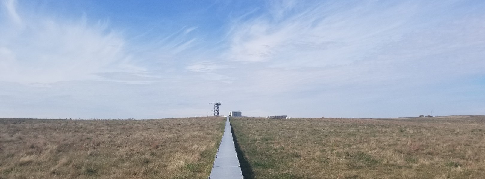
This site has a flux/meteorological tower that is 8 m (26 ft) tall with four measurement levels. The tower top extends above the vegetation canopy to allow sensors mounted at the top and along the tower to capture the full profile of atmospheric conditions from the top of the vegetation canopy to the ground. The tower collects physical and chemical properties of atmosphere-related processes, such as humidity, wind, and net ecosystem gas exchange. Precipitation data are collected by a Double Fence Intercomparison Reference (DFIR) near the tower.

Phenocams

One phenocam is attached to the top and the bottom of the tower. Here we show the images from the most recent hour. The full collection of images can be viewed on the Phenocam Gallery - click on either of the images below.

Tower top

NEON.D09.WOOD.DP1.10033

Tower bottom

NEON.D09.WOOD.DP1.10042

Soil Sensor Measurements

This site has five soil plots placed in an array within the airshed of the flux tower. Photosynthetically Active Radiation (PAR) at soil surface, soil heat flux, and solar radiation are measured at the soil surface in each soil plot. Soil moisture, soil temperature, and CO2 concentration are measured at multiple depths in each soil plot.

Observational Sampling

At terrestrial sites, field ecologists observe birds and plants, and sample ground beetles, mosquitoes, small mammals, soil microbes, and ticks. Lab analyses are carried out to provide further data on DNA sequences, pathogens, soils, sediments, and biogeochemistry. Learn more about terrestrial observations or explore this site's data products.


Field Site Data

Site

Site Host

US Fish and Wildlife Service

Site Access Allowed

Yes

Site URL

https://www.fws.gov/refuge/chase_lake/

Site Access Details

This site host welcomes and encourages additional research activities related to the US Fish And Wildlife mission.

Operations Office

NEON Field Operations Office

Domain 09 Support Facility

NEON Field Operations Address

1503 Business Loop East
Jamestown, ND 58401

NEON Field Operations Phone

701.952.6728

Location

Latitude

47.1282

Longitude

-99.241334

Geodetic Datum

WGS84

UTM Northing

5219442.04m

UTM Easting

481694.72m

UTM Zone

14N

County

Stutsman

State

ND

Country

US

Mean Elevation

591m

Minimum Elevation

569m

Maximum Elevation

606m

Climate

Mean Annual Temperature

4.9°C

Mean Annual Precipitation

494mm

Dominant Wind Direction

NW

Vegetation

Mean Canopy Height

1.0m

Dominant NLCD Classes

Emergent Herbaceous Wetlands, Grassland/Herbaceous

Average number of green days

170

Average first greenness increase date

120 DOY

Average peak green date

180 DOY

Average first greenness decrease date

210 DOY

Average minimum greenness date

290 DOY

Tower

Tower Height

8m

Number of Tower Levels

4

Geology

USGS Geology Unit

NDQcrh;0

USGS Geology Name

Coleharbor Formation- River Sediment- Collapsed River Sediment

USGS Lithologic Constituents

Sand and gravel

USGS Geology Age

Pleistocene

Soils

Megapit Soil Family

Coarse-loamy over sandy or sandy-skeletal - mixed - superactive - frigid Typic Haplustolls

Soil Subgroup

Typic Haplustolls


Gallery

  • Photos
  • Videos

No Video


Related Field Sites

Other Domain D09 Field Sites

brown circle white drop icon Dakota Coteau Field Site NEON
Gradient Terrestrial
brown circle white drop icon Northern Great Plains Research Laboratory NEON
Gradient Terrestrial
blue circle white drop icon Prairie Lake NEON
Gradient Aquatic
blue square white drop icon Prairie Pothole NEON
Core Aquatic

Other Field Sites in ND

brown circle white drop icon Dakota Coteau Field Site NEON
Gradient Terrestrial
brown circle white drop icon Northern Great Plains Research Laboratory NEON
Gradient Terrestrial
blue circle white drop icon Prairie Lake NEON
Gradient Aquatic
blue square white drop icon Prairie Pothole NEON
Core Aquatic
NSF NEON, Operated by Battelle

Follow Us:

Join Our Newsletter

Get updates on events, opportunities, and how NEON is being used today.

Subscribe Now

Footer

  • About Us
  • Newsroom
  • Contact Us
  • Terms & Conditions
  • Careers
  • Code of Conduct

Copyright © Battelle, 2025

The National Ecological Observatory Network is a major facility fully funded by the U.S. National Science Foundation.

Any opinions, findings and conclusions or recommendations expressed in this material do not necessarily reflect the views of the U.S. National Science Foundation.