Puu Makaala Natural Area Reserve NEON (PUUM) Soil Descriptions
Distributed Soils Reports
Pedon Descriptions
Pit‐level observations and field measurements reported using the standard NRCS format. They contain volume estimates for coarse fragments > 20 mm where applicable.
Site Level Plot Summary
A narrative summary that places the sampled soil pedons in the broader context of soils and geomorphology for the entire NEON site.
Megapit Image
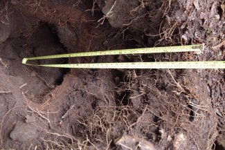
D20 PUUM megapit soil profile 0-103 cm
Megapit Pedon Description
| Print Date | Feb 4 2019 |
|---|---|
| Description Date | Jun 11 2018 |
| Describer | Jacqueline Vega |
| Site ID | S2018HI001100_MP |
| Pedon ID | S2018HI001100_MP |
| Lab Source ID | KSSL |
| Lab Pedon # | 18N1178 |
| Soil Name as Described/Sampled | Keamoku |
| Classification | Medial-skeletal, amorphic, isomesic Typic Hapludands |
| Pedon Type | correlates to named soil |
| Pedon Purpose | laboratory sampling site |
| Taxon Kind | series |
| Geomorphic Setting | ash field on mauna loa volcano shield volcano on hawaii island |
| Upslope Shape | concave |
| Cross Slope Shape | linear |
| Particle Size Control Section | 0 to 100 cm. |
| Description origin | NASIS |
| State | Hawaii |
| County | Hawaii |
| MLRA | 162 -- Humid and Very Humid Organic Soils on Lava Flows |
| Soil Survey Area | 2-KEA -- Kealakekua, Hawaii HI801 -- Island of Hawaii Area, Hawaii |
| Map Unit | 602 -- Keamoku stony medial loam, 3 to 10 percent slopes |
| Quad Name | Kulani, Hawaii |
| Std Latitude | 19.5532710 |
| Std Longitude | -155.3172790 |
| Latitude | 19 degrees 33 minutes 11.80 seconds north |
| Longitude | 155 degrees 19 minutes 2.20 seconds west |
| Datum | WGS84 |
| Primary Earth Cover | Tree cover |
| Secondary Earth Cover | Tropical |
| Parent Material | volcanic ash derived from igneous rock over aa lava |
| Surface Fragments | 5.0 percent nonflat subangular very strongly cemented 76- to 249-millimeter aa lava fragments and 2.0 percent nonflat subangular very strongly cemented 250- to 599-millimeter aa lava fragments |
| Description database | KSSL |
| Diagnostic Features | hemic soil materials 0 to 2 cm. andic soil properties 2 to 90 cm. mollic epipedon 2 to 90 cm. cambic horizon 17 to 90 cm. lithologic discontinuity 17 to 110 cm. |
| Slope (%) | 5.0 |
| Elevation (meters) | 1,689.3 |
| Aspect (deg) | 20 |
| MAAT (C) | 14.0 |
| MAP (mm) | 2,459 |
| Frost-Free Days | 365 |
| Drainage Class | well |
| Horizon Details |
Oe--0 to 2 centimeters (0.0 to 0.8 inches); mucky peat; structureless massive; loose, loose, nonsticky, nonplastic; low excavation difficulty; slightly acid, pH 6.5, pH indicator solutions; clear smooth boundary. Lab sample # 18N05147 A--2 to 17 centimeters (0.8 to 6.7 inches); black (10YR 2/1) medial silt loam; weak fine granular, and weak medium granular structure; soft, very friable, slightly sticky, slightly plastic; weakly smeary; low excavation difficulty; very fine roots throughout and medium roots throughout and fine roots throughout; very fine irregular and fine irregular pores; 3 percent nonflat angular moderately cemented 2 to 75-millimeter aa lava fragments; strongly acid, pH 5.5, pH indicator solutions; clear irregular boundary. Lab sample # 18N05147 2Bw1--17 to 59 centimeters (6.7 to 23.2 inches); 85 percent very dark brown (10YR 2/2) and 15 percent black (10YR 2/1) cobbly medial silt loam; weak medium subangular blocky structure; slightly hard, friable, slightly sticky, slightly plastic; weakly smeary; high excavation difficulty; very fine roots throughout and very coarse roots and medium roots throughout and fine roots throughout and coarse roots; very fine irregular and fine irregular pores; 2 percent nonflat angular very strongly cemented 250 to 599-millimeter aa lava fragments and 10 percent nonflat angular moderately cemented 2 to 75-millimeter aa lava fragments and 20 percent nonflat angular very strongly cemented 76 to 249-millimeter aa lava fragments; strongly acid, pH 5.5, pH indicator solutions; gradual wavy boundary. Lab sample # 18N05148. 25 percent, extremely weakly cemented, charcoal fragments, black N 2/0. 2Bw2--59 to 90 centimeters (23.2 to 35.4 inches); very dark brown (7.5YR 2.5/2) cobbly medial fine sandy loam; weak medium subangular blocky structure; slightly hard, friable, nonsticky, slightly plastic; moderate excavation difficulty; medium roots throughout and fine roots throughout and coarse roots; 2 percent nonflat angular very weakly cemented 2 to 75-millimeter pumice fragments and 15 percent nonflat angular very strongly cemented 76 to 249-millimeter aa lava fragments; abrupt wavy boundary. Lab sample # 18N05149. 25 percent, extremely weakly cemented, charcoal fragments, black N2/0. 3C--90 to 110 centimeters (35.4 to 43.3 inches); cobbles; extremely high excavation difficulty; 100 percent nonflat angular very strongly cemented 250 to 599-millimeter aa lava fragments. |
Credits: This megapit soil pedon description was generously created by USDA Natural Resource Conservation Service staff, with particular thanks to Larry West, Jon Hempel, and numerous field staff.