NSF NEON, Operated by Battelle

Main navigation

  • About
    • NEON Overview
      • Vision and Management
      • Spatial and Temporal Design
      • History
    • About the NEON Biorepository
      • ASU Biorepository Staff
      • Contact the NEON Biorepository
    • Observatory Blog
    • Newsletters
    • Staff
    • FAQ
    • Contact Us

    About

  • Data
    • Data Portal
      • Data Availability Charts
      • API & GraphQL
      • Prototype Data
      • Externally Hosted Data
    • Data Collection Methods
      • Airborne Observation Platform (AOP)
      • Instrument System (IS)
        • Instrumented Collection Types
        • Aquatic Instrument System (AIS)
        • Terrestrial Instrument System (TIS)
      • Observational System (OS)
        • Observation Types
        • Observational Sampling Design
        • Sampling Schedules
        • Taxonomic Lists Used by Field Staff
        • Optimizing the Observational Sampling Designs
      • Protocols & Standardized Methods
    • Getting Started with NEON Data
      • neonUtilities for R and Python
      • Learning Hub
      • Code Hub
    • Using Data
      • Data Formats and Conventions
      • Released, Provisional, and Revised Data
      • Data Product Bundles
      • Usage Policies
      • Acknowledging and Citing NEON
      • Publishing Research Outputs
    • Data Notifications
    • NEON Data Management
      • Data Availability
      • Data Processing
      • Data Quality

    Data

  • Samples & Specimens
    • Biorepository Sample Portal at ASU
    • About Samples
      • Sample Types
      • Sample Repositories
      • Megapit and Distributed Initial Characterization Soil Archives
    • Finding and Accessing Sample Data
      • Species Checklists
      • Sample Explorer - Relationships and Data
      • Biorepository API
    • Requesting and Using Samples
      • Loans & Archival Requests
      • Usage Policies

    Samples & Specimens

  • Field Sites
    • Field Site Map and Info
    • Spatial Layers & Printable Maps

    Field Sites

  • Resources
    • Getting Started with NEON Data
    • Research Support Services
      • Field Site Coordination
      • Letters of Support
      • Mobile Deployment Platforms
      • Permits and Permissions
      • AOP Flight Campaigns
      • Research Support FAQs
      • Research Support Projects
    • Code Hub
      • neonUtilities for R and Python
      • Code Resources Guidelines
      • Code Resources Submission
      • NEON's GitHub Organization Homepage
    • Learning Hub
      • Tutorials
      • Workshops & Courses
      • Science Videos
      • Teaching Modules
    • Science Seminars and Data Skills Webinars
    • Document Library
    • Funding Opportunities

    Resources

  • Impact
    • Research Highlights
    • Papers & Publications
    • NEON in the News

    Impact

  • Get Involved
    • Upcoming Events
    • Research and Collaborations
      • Environmental Data Science Innovation and Inclusion Lab
      • Collaboration with DOE BER User Facilities and Programs
      • EFI-NEON Ecological Forecasting Challenge
      • NEON Great Lakes User Group
      • NCAR-NEON-Community Collaborations
    • Advisory Groups
      • Science, Technology & Education Advisory Committee
      • Technical Working Groups
    • NEON Ambassador Program
      • Exploring NEON-Derived Data Products Workshop Series
    • Partnerships
    • Community Engagement
    • Work Opportunities

    Get Involved

  • My Account
  • Search

Search

Breadcrumb

  1. Data Collection Methods
  2. Soils
  3. Soil Descriptions
  4. Caribou-Poker Creeks Research Watershed NEON (BONA) Soil Descriptions

Caribou-Poker Creeks Research Watershed NEON (BONA) Soil Descriptions

Distributed Soils Reports

Pedon Descriptions

Pit‐level observations and field measurements reported using the standard NRCS format. They contain volume estimates for coarse fragments > 20 mm where applicable.

Download

Site Level Plot Summary

A narrative summary that places the sampled soil pedons in the broader context of soils and geomorphology for the entire NEON site.
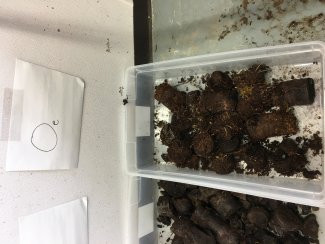
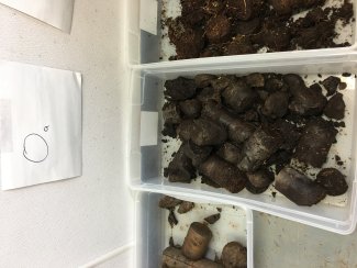
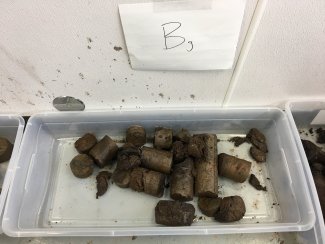
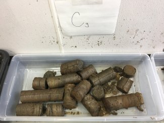
Download

Megapit Images

soil profile

D19 BONA megapit soil profile 0-8 cm

soil profile

D19 BONA megapit soil profile 8-17 cm

soil profile

D19 BONA megapit soil profile 17-33 cm

soil profile

D19 BONA megapit soil profile 33-51 cm

soil profile

D19 BONA megapit soil profile 51-83 cm

soil profile

D19 BONA megapit soil profile 83-126 cm

soil profile

D19 BONA megapit soil profile 126-188 cm

soil profile

D19 BONA megapit soil profile

Download All Images

Megapit Pedon Description

Print Date Feb 21 2018
Description Date Mar 22 2017
Site ID S2017AK090001_MP
Pedon ID S2017AK090001_MP
Lab Source ID KSSL
Lab Pedon # 17N0581
Soil Name as Described/Sampled Saulich
Classification Coarse-silty, mixed, superactive, subgelic Typic Histoturbels
Pedon Purpose research site
Taxon Kind series
Geomorphic Setting None Assigned
Particle Size Control Section 25 to 100 cm.
Description origin NASIS
MLRA 231 -- Interior Alaska Highlands
Soil Survey Area AK642 -- North Star Area, Alaska
Std Latitude 65.1533333
Std Longitude -147.0519400
Parent Material organic material over silty eolian deposits and/or silty colluvium
Description database KSSL
Diagnostic Features histic epipedon 0 to 22 cm.
aquic conditions 10 to 56 cm.
cryoturbation 22 to 38 cm.
permafrost 56 to 198 cm.
Drainage Class poorly
Horizon Details

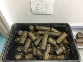
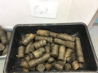
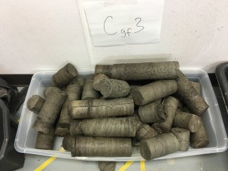
Oe--0 to 10 centimeters (0.0 to 3.9 inches); black (7.5YR 2.5/1) rubbed peat; 0 percent unspecified fragments. Lab sample # 17N02991

Oa--10 to 22 centimeters (3.9 to 8.7 inches); very dark brown (10YR 2/2) rubbed mucky peat; 0 percent unspecified fragments. Lab sample # 17N02992

Bg/Oajj--22 to 38 centimeters (8.7 to 15.0 inches); dark grayish brown (10YR 4/2) broken face stratified mucky peat to silt loam; 65 percent medium prominent irregular 5YR 3/4), moist, masses of oxidized iron throughout; 0 percent unspecified fragments. Lab sample # 17N02993

Cg--38 to 56 centimeters (15.0 to 22.0 inches); dark gray (5Y 4/1) broken face silt; 10 percent medium prominent irregular 7.5YR 4/6), moist, masses of oxidized iron throughout; 0 percent unspecified fragments. Lab sample # 17N02994. Horizon contains up to 50% visible ice in lenses

Cgf1--56 to 88 centimeters (22.0 to 34.6 inches); dark gray (2.5Y 4/1) broken face silt loam; 18 percent medium prominent irregular 7.5YR 4/6), moist, masses of oxidized iron throughout; 0 percent unspecified fragments. Lab sample # 17N02995

Cgf2--88 to 131 centimeters (34.6 to 51.6 inches); dark gray (2.5Y 4/1) broken face silt loam; 20 percent medium prominent irregular 10YR 4/4), moist, masses of oxidized iron throughout; 0 percent unspecified fragments. Lab sample # 17N02996

Cgf3--131 to 193 centimeters (51.6 to 76.0 inches); dark grayish brown (2.5Y 4/2) broken face silt loam; 5 percent medium prominent irregular 10YR 5/8), moist, masses of oxidized iron throughout; 0 percent unspecified fragments. Lab sample # 17N02997

Credits: This megapit soil pedon description was generously created by USDA Natural Resource Conservation Service staff, with particular thanks to Larry West, Jon Hempel, and numerous field staff.

NSF NEON, Operated by Battelle

Follow Us:

Join Our Newsletter

Get updates on events, opportunities, and how NEON is being used today.

Subscribe Now

Footer

  • About Us
  • Contact Us
  • Terms & Conditions
  • Careers
  • Code of Conduct

Copyright © Battelle, 2026

The National Ecological Observatory Network is a major facility fully funded by the U.S. National Science Foundation.

Any opinions, findings and conclusions or recommendations expressed in this material do not necessarily reflect the views of the U.S. National Science Foundation.