NSF NEON, Operated by Battelle

Main navigation

  • About
    • NEON Overview
      • Vision and Management
      • Spatial and Temporal Design
      • History
    • About the NEON Biorepository
      • ASU Biorepository Staff
      • Contact the NEON Biorepository
    • Observatory Blog
    • Newsletters
    • Staff
    • FAQ
    • Contact Us

    About

  • Data
    • Data Portal
      • Data Availability Charts
      • API & GraphQL
      • Prototype Data
      • Externally Hosted Data
    • Data Collection Methods
      • Airborne Observation Platform (AOP)
      • Instrument System (IS)
        • Instrumented Collection Types
        • Aquatic Instrument System (AIS)
        • Terrestrial Instrument System (TIS)
      • Observational System (OS)
        • Observation Types
        • Observational Sampling Design
        • Sampling Schedules
        • Taxonomic Lists Used by Field Staff
        • Optimizing the Observational Sampling Designs
      • Protocols & Standardized Methods
    • Getting Started with NEON Data
      • neonUtilities for R and Python
      • Learning Hub
      • Code Hub
    • Using Data
      • Data Formats and Conventions
      • Released, Provisional, and Revised Data
      • Data Product Bundles
      • Usage Policies
      • Acknowledging and Citing NEON
      • Publishing Research Outputs
    • Data Notifications
    • NEON Data Management
      • Data Availability
      • Data Processing
      • Data Quality

    Data

  • Samples & Specimens
    • Biorepository Sample Portal at ASU
    • About Samples
      • Sample Types
      • Sample Repositories
      • Megapit and Distributed Initial Characterization Soil Archives
    • Finding and Accessing Sample Data
      • Species Checklists
      • Sample Explorer - Relationships and Data
      • Biorepository API
    • Requesting and Using Samples
      • Loans & Archival Requests
      • Usage Policies

    Samples & Specimens

  • Field Sites
    • Field Site Map and Info
    • Spatial Layers & Printable Maps

    Field Sites

  • Resources
    • Getting Started with NEON Data
    • Research Support Services
      • Field Site Coordination
      • Letters of Support
      • Mobile Deployment Platforms
      • Permits and Permissions
      • AOP Flight Campaigns
      • Research Support FAQs
      • Research Support Projects
    • Code Hub
      • neonUtilities for R and Python
      • Code Resources Guidelines
      • Code Resources Submission
      • NEON's GitHub Organization Homepage
    • Learning Hub
      • Tutorials
      • Workshops & Courses
      • Science Videos
      • Teaching Modules
    • Science Seminars and Data Skills Webinars
    • Document Library
    • Funding Opportunities

    Resources

  • Impact
    • Research Highlights
    • Papers & Publications
    • NEON in the News

    Impact

  • Get Involved
    • Upcoming Events
    • Research and Collaborations
      • Environmental Data Science Innovation and Inclusion Lab
      • Collaboration with DOE BER User Facilities and Programs
      • EFI-NEON Ecological Forecasting Challenge
      • NEON Great Lakes User Group
      • NCAR-NEON-Community Collaborations
    • Advisory Groups
      • Science, Technology & Education Advisory Committee
      • Technical Working Groups
    • NEON Ambassador Program
      • Exploring NEON-Derived Data Products Workshop Series
    • Partnerships
    • Community Engagement
    • Work Opportunities

    Get Involved

  • My Account
  • Search

Search

Field Sites

  • Field Site Map and Info
  • Spatial Layers & Printable Maps

Breadcrumb

  1. Field Sites
  2. Pu'u Maka'ala Natural Area Reserve NEON

Field Site

Pu'u Maka'ala Natural Area Reserve NEON / PUUM

brown square white mountain icon

Core Terrestrial, HI, D20: Pacific Tropical

Misty forest at the Hawaiian PUUM field site

About Field Sites

Pu‘u Maka‘ala Natural Area Reserve (PUUM) is a terrestrial NEON field site located in the South Hilo district on the Big Island of Hawai‘i. The 75.7 km2 (18,700 acre) reserve is managed by the Hawaii Department of Natural Resources. NEON samples 47.2 km2 (11,662.5 acres) at the reserve. Situated along an elevation gradient of 853 - 1899 m (2800 - 6230 ft.) on Mauna Loa, it features a range of habitat types, from shrubby grasslands to wet rainforest. The unique endemic diversity coupled with threats from invasive species makes Pu‘u Maka‘ala a compelling location to conduct long-term ecological research. The reserve is dedicated solely for the purpose of conservation, making the area extremely important for the protection of native species. PUUM is the only field site of the NEON Pacific Tropical Domain (D20), which includes all of the Hawaiian islands. [1] [2]

Climate

Rain is frequent, as is moisture from fog, as prevailing northeast trade winds bring regular precipitation. Located on the northeast side of Mauna Loa, the reserve receives an average rainfall of 2656.8mm (104.6 in.) per year. Occasionally, large weather systems, including hurricanes, bring extremely heavy rain events. Despite Hawaii's low latitude, PUUM's elevation leads to moderate daily temperatures, ranging from near freezing to hot at the extremes. The average annual temperature is 12.7°C (54.9°F). Hotter and wetter weather occur at lower elevation zones in the reserve. [2] [5] [12]

Geology

In Pu‘u Maka‘ala Natural Area Reserve, the lava flow substrate age can be as recent as 1942 to as old as 8000 BCE. Extreme geologic disturbance in the form of volcanic activity has occurred historically, the latest being in 1942, and part of the reserve is downslope of potential eruption sites on Mauna Loa. The 1984 Mauna Loa lava flow comes within 1.6 km (1 mi.) of the Reserve. The geology can be described as Pāhoehoe and ʻAʻā of the Kaʻū Basalt. [2] [10]

Soils

NRCS has classified the areas within the reserve to have over 25 different soil types, ranging from very deep at lower elevation to very shallow or nonexistent at higher elevation. Soils are well drained due to the abundant precipitation. [2]

Hydrology

Soils are well drained, and there are no bodies of water aside from sparse bogs in the reserve. [2]

Vegetation

Since the reserve spans across elevational gradients with varying substrate age, there are several plants considered to be dominant in different areas. Pu‘u Maka‘ala NAR is primarily ʻōhiʻa (Metrosideros polymorpha), with a dense understory of hapu‘u tree ferns (Cibotium glaucum and Cibotium menziesii). In areas with older substrate, koa (Acacia koa) can tower up to 36 meters. In areas with younger substrate, or where there was previous grazing, the ecosystem can be classified as montane grassland, with native and non-native grasses. In the lowlands, non-native Strawberry Guava (Psidium cattleianum) encroaches upon and can dominate native ʻōhiʻa forests. Across the entire site, there are more than 160 endemic plant and fern species. [2]

Fauna

Pu‘u Maka‘ala Natural Area Reserve provides habitat for a dozen native bird species, including 6 honeycreepers (subfamily Drepanidinae). The reserve serves as an area of significant importance for bird protection from avian malaria, since it is partially above the elevation at which mosquitoes generally are found. Feral boars are found in lowland areas of the reserve, but because Hawaii DLNR management involves fencing, trapping, and other redirection mechanisms, they are generally not found at higher elevations. Notably, in 2017, San Diego Zoo Global began managing the re-introduction of a small population of the previously extinct-in-the-wild Hawaiian Crow (Corvus hawaiiensis) in Pu‘u Maka‘ala. Also present in the reserve is Hawaii's only endemic land mammal, the Hawaiian Hoary Bat (Lasiurus cinereus semotus). [1] [2] [6] [7]

Past Land Management and Use

Despite the lack of archaeological findings in Pu‘u Maka‘ala, cultural documents reveal a rich history of native Hawaiians using the land for bird hunting, timber harvest, and medicinal plant gathering. More recently, the reserve has been partially used for logging and ranching. In some lower elevation areas of the preserve, there is a history of military testing of chemical and biological weapons.

Various eruptions and lava flows from Mauna Loa have provided regular disturbance on the geological scale in Pu‘u Maka‘ala. Ungulate trampling, nest predation and noxious weed invasion underline the modern environmental disturbance history and ongoing threats to the reserve. Two invasive fungi pathogens, ROD canker disease (Ceratocystis huliohia) and ROD wilt disease (Ceratocystis lukuohia), have had devastating impacts to regional ʻōhiʻa forest communities, rapidly killing ʻōhiʻa trees (Metrosideros polymorpha). Yet, today most of the area in which NEON operates has been largely unimpacted by the fungi. [2] [3] [9]

Current Land Management and Use

In 2005, the entirety of Pu‘u Maka‘ala Natural Area Reserve was dedicated solely to conservation. To strengthen the forest connectivity, NARS staff also routinely conduct outplanting of koa and ʻōhiʻa trees in areas previously used for cattle ranching. Pu‘u Maka‘ala's native ecological resources have benefitted greatly from partnership with adjacent landowners, such as Three Mountain Alliance, Kamehameha Schools, and National Park Service. [2]

NEON Site Establishment

Plot establishment of PUUM began in 2017, and the site was reviewed for sampling readiness in 2018. Dry runs of observational sampling began in late 2018. Instrumentation systems went online and began producing data in May 2019.

Additional Resources

[1] Terrestrial Observation System (TOS) Site Characterization Report: Domain 20. NEON.DOC.003903vB.

[2] Pu‘u Maka‘ala Natural Area Reserve (NAR) Management Plan, Pu‘u Maka‘ala Natural Area Reserve (NAR) Management Plan (2013).

[3] Kumu Pono Associates. (2004). HE MO‘OLELO ‘ĀINA: A CULTURAL STUDY OF THE PU‘U MAKA‘ALA NATURAL AREA RESERVE DISTRICTS OF HILO AND PUNA, ISLAND OF HAWAI‘I . HE MO‘OLELO ‘ĀINA: A CULTURAL STUDY OF THE PU‘U MAKA‘ALA NATURAL AREA RESERVE DISTRICTS OF HILO AND PUNA, ISLAND OF HAWAI‘I.

[4] Megapit Details - NEON Data. (n.d.). Retrieved from https://data.neonscience.org/megapit-details/tags/puum/

[5] HURRICANES In Hawaii. (n.d.). Retrieved from https://www.soest.hawaii.edu/MET/Faculty/businger/poster/hurricane/

[6] As Climate Warms Hawaiian Forest Birds Lose More Ground to Mosquitoes. (2015, July). Retrieved May 2020, from https://www.usgs.gov/news/climate-warms-hawaiian-forest-birds-lose-more…

[7] Swaisgood, R. (2018). Alalā Conservation: Back from the Brink. Saving Species, 2, 2–3. Retrieved from https://institute.sandiegozoo.org/sites/default/files/Saving Species 2018 Vol 2(3).pdf

[8] TOS Protocol and Procedure: Soil Biogeochemical and Microbial Sampling. NEON.DOC.014048vJ. https://data.neonscience.org/documents/10179/2139401/NEON.DOC.014048vJ/…

[9] RAPID ʻŌHIʻA DEATH. (n.d.). Retrieved May 20, 2020, from https://cms.ctahr.hawaii.edu/rod/

[10] ] U.S. Geological Survey, 2005, Mineral Resources Data System: U.S. Geological Survey, Reston, Virginia. https://mrdata.usgs.gov/mrds/

[11] Terrestrial Instrument System (TIS, FIU) Site Characterization Supporting Data: Domain 20. NEON.DOC.011084vB

[12] National Oceanic and Atmospheric Administration National Centers for Environmental Information’s (NCEI) 1981-2010 climate normals (NCEI 2015).

Field Site Information

Latitude/Longitude

19.55309, -155.31731

Geodetic Datum

WGS84

Location

Hawaii County
HI, US

Elevation

Mean: 1685m
Minimum: 1034m
Maximum: 1877m

Mean Annual Temperature

12.7°C

Mean Canopy Height

20.0m

Dominant NLCD Classes

Evergreen Forest

Colocated Research

Natural Area Reserve
Critical Zone Exploration Network
Ameriflux

Field Operations Office

60 Nowelo Street
Hilo, Hawaii 96720

Research Access

If your proposed research requires access to field sites where NEON is present, we can help.

Request Access

Observation Types

Remote Sensing

Remote sensing surveys of this field site collect lidar, spectrometer and high-resolution RGB camera data.

Meteorological Measurements

This site has a flux/meteorological tower that is 32 m (105 ft) tall with six measurement levels. The tower top extends above the vegetation canopy to allow sensors mounted at the top and along the tower to capture the full profile of atmospheric conditions from the top of the vegetation canopy to the ground. The tower collects physical and chemical properties of atmosphere-related processes, such as humidity, wind, and net ecosystem gas exchange. Precipitation data are collected by a Double Fence Intercomparison Reference (DFIR) near the tower, and a series of throughfalls located in the soil array.

Phenocams

One phenocam is attached to the top and the bottom of the tower. Here we show the images from the most recent hour. The full collection of images can be viewed on the Phenocam Gallery - click on either of the images below.

Tower top

NEON.D20.PUUM.DP1.10033

Tower bottom

NEON.D20.PUUM.DP1.10042

Soil Sensor Measurements

This site has five soil plots placed in an array within the airshed of the flux tower. Photosynthetically Active Radiation (PAR) at soil surface, soil heat flux, solar radiation, and throughfall are measured at the soil surface in each soil plot. Soil moisture, soil temperature, and CO2 concentration are measured at multiple depths in each soil plot.

Observational Sampling

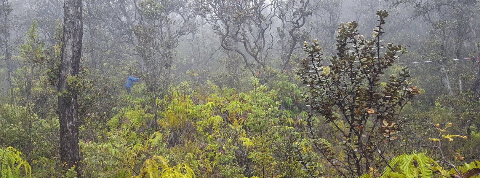
At terrestrial sites, field ecologists observe birds and plants, and sample ground beetles, mosquitoes, small mammals, soil microbes, and ticks. Lab analyses are carried out to provide further data on DNA sequences, pathogens, soils, sediments, and biogeochemistry. Learn more about terrestrial observations or explore this site's data products. Please note that the small mammal sampling protocol does not take place at this field site due to endangered species requirements.


Field Site Data

Site

Site Host

Hawaii Division of Forestry and Wildlife

Site URL

https://dlnr.hawaii.gov/ecosystems/nars/permits/

Site Access Details

Please coordinate efforts with the site manager at least 3-6 months prior to any planned start dates.

Operations Office

NEON Field Operations Office

Domain 20 Support Facility

NEON Field Operations Address

60 Nowelo Street
Hilo, Hawaii 96720

Location

Latitude

19.55309

Longitude

-155.31731

Geodetic Datum

WGS84

UTM Northing

2163673.63m

UTM Easting

256868.72m

UTM Zone

5N

County

Hawaii

State

HI

Country

US

Mean Elevation

1685m

Minimum Elevation

1034m

Maximum Elevation

1877m

Terrestrial Sampling Boundary Area

47.20km^2

Climate

Mean Annual Temperature

12.7°C

Mean Annual Precipitation

2657mm

Vegetation

Mean Canopy Height

20.0m

Dominant NLCD Classes

Evergreen Forest

Average number of green days

365

Tower

Tower Height

32m

Number of Tower Levels

6

Soils

Megapit Soil Family

Medial-skeletal - amorphic - isomesic Typic Hapludands

Soil Subgroup

Typic Hapludands


Gallery

  • Photos
  • Videos

No Video


NSF NEON, Operated by Battelle

Follow Us:

Join Our Newsletter

Get updates on events, opportunities, and how NEON is being used today.

Subscribe Now

Footer

  • About Us
  • Contact Us
  • Terms & Conditions
  • Careers
  • Code of Conduct

Copyright © Battelle, 2026

The National Ecological Observatory Network is a major facility fully funded by the U.S. National Science Foundation.

Any opinions, findings and conclusions or recommendations expressed in this material do not necessarily reflect the views of the U.S. National Science Foundation.