Spotlight
NEON Ambassador Spotlight: Kit Lewers
August 2, 2026
The NEON Ambassador Program empowers researchers and educators to expand awareness and use of NEON data, resources and expertise across scientific and educational communities. Through training, mentorship and community-building activities, Ambassadors help more people engage with NEON data and advance open, continental-scale ecology.
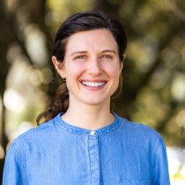
Meet Kit Lewers: Lewers is a Ph.D. candidate in information science at the University of Colorado – Boulder and a NASA FINESST Fellow. Her research focuses on how technical infrastructure can help scientists work across disciplinary boundaries, especially in fields that depend on large, complex datasets. She is particularly interested in building bridges between remote sensing, ecology, and biodiversity informatics.
Her Ambassador Experience
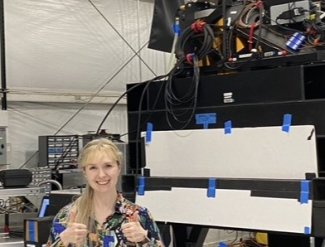
Lewers joined the NEON Ambassador Program because of her interest in hyperspectral remote sensing and the NEON Airborne Observation Platform (AOP). After working with airborne hyperspectral imagery through NASA’s BioSCape project, she became interested in how similar data could be used across instruments, platforms and research communities. The Ambassador program gave her a way to learn directly from the people who collect, process, and support NEON remote sensing data.
A major focus of her Ambassador work has been exploring how NASA’s ISOFIT, an open-source tool for processing imaging spectrometer data, can be used with NEON AOP data. Through the program, Lewers has been able to connect with NEON AOP experts, ask technical questions, and better understand how NEON data can support cross-instrument comparison and broader data interoperability.
The program has also given Lewers hands-on exposure to the AOP data workflow. She has observed pre- and post-season calibration of NEON’s imaging spectrometers, learned more about how flight planning supports data collection during peak greenness, and gained a deeper understanding of the processes that make AOP data reliable and useful for researchers. She credits NEON staff, including John Adler, Mark Helmlinger and John Musinsky, among others, with helping her build those connections and better understand the people and processes behind the data.
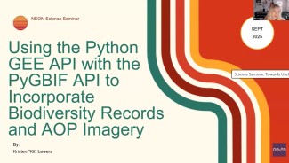
Kit Lewers presenting "Using the Python GEE API with the PyGBIF API to Incorporate Biodiversity Records and AOP Imagery" during the September 9, 2025 NEON Science Seminar.
Lewers has also used her Ambassador experience to support broader data training. In a webinar for the Global Biodiversity Information Facility (GBIF), she demonstrated how NEON hyperspectral data and NEON Biorepository data can be used together to explore ecological change before and after disturbance events. In preparation for the webinar, Lewers authored a data skills tutorial exploring the use of NEON Biorepository and AOP data, now available through NEON’s learning hub. For Lewers, these experiences support a larger goal: helping researchers connect data across remote sensing, ecology, and biodiversity informatics.
“Now I actually have a community of practice and people that I can discuss questions that I have with. That has been extremely valuable, because I am an information and computer scientist more than a remote sensing scientist. I just happen to know a lot about remote sensing now.”
-Kit Lewers
About Her Work: Making Hyperspectral Data More Interoperable
What’s the question?
How can open tools help researchers make hyperspectral remote sensing data more consistent and usable across instruments, platforms, and scientific communities?
The big picture:
Hyperspectral imaging instruments collect detailed information about light reflected from Earth’s surface. These spectral signatures can help scientists study plants, soils, water, and other materials across broad areas. But before researchers can use those data, they need to account for atmospheric effects and other sources of “noise” between the ground and the sensor. Tools that make this process more consistent can help scientists compare data across instruments and make remote sensing data more useful for ecology, biodiversity science, and other fields.
How she did it:
Lewers is working with ISOFIT, or Imaging Spectrometer Optimal FITting, an open-source algorithm developed by NASA’s Jet Propulsion Laboratory. ISOFIT helps convert radiance, or the light measured by an airborne or spaceborne sensor, into reflectance, which is the information researchers use to better understand surface characteristics. Lewers describes reflectance as the step that allows researchers to see the spectral signature of Earth surface features without atmospheric conditions confounding the view.
Her work with NEON focuses on how ISOFIT can be applied to NEON AOP data. NEON currently produces hyperspectral reflectance data through established atmospheric correction workflows. By exploring ISOFIT with NEON data, Lewers is looking at how open, shared processing tools could support comparisons between NEON imagery and data from NASA or other hyperspectral instruments.
NEON offers a rare opportunity for this kind of work because its AOP includes multiple imaging spectrometers of the same design. In some cases, NEON has flown these instruments “nose to tail,” one after another, over the same area. These flights allow researchers to compare how similar instruments capture the same landscape under real-world conditions.
Lewers is especially interested in how ISOFIT can account for factors such as solar geometry, including how the angle of the sun may influence the light reaching the sensor. By testing these approaches with NEON data, she is helping explore how researchers can better compare imagery across instruments and improve confidence when combining remote sensing datasets. For Lewers, that is part of a larger goal: building technical infrastructure that helps remote sensing, ecology, and biodiversity informatics work together more effectively.
NEON data and resources used