NSF NEON | Open Data to Understand our Ecosystems logo

Main navigation

  • About Us
    • Overview
      • Spatial and Temporal Design
      • History
      • Management
    • Advisory Groups
      • Advisory Committee: STEAC
      • Technical Working Groups (TWGs)
    • FAQ
    • Contact Us
      • Field Offices
    • User Accounts
    • Staff

    About Us

  • Data & Samples
    • Data Portal
      • Explore Data Products
      • Spatial Data & Maps
      • Document Library
      • API & GraphQL
      • Prototype Data
        • Prototype Data Ingest
      • External Lab Data Ingest (restricted)
    • Samples & Specimens
      • Discover and Use NEON Samples
        • Sample Types
        • Sample Repositories
        • Sample Explorer
        • Megapit and Distributed Initial Characterization Soil Archives
        • Excess Samples
      • Sample Processing
      • Sample Quality
      • Taxonomic Lists
    • Collection Methods
      • Protocols & Standardized Methods
      • AIrborne Remote Sensing
        • Flight Box Design
        • Flight Schedules and Coverage
        • Daily Flight Reports
        • Camera
        • Imaging Spectrometer
        • Lidar
      • Automated Instruments
        • Site Level Sampling Design
        • Sensor Collection Frequency
        • Instrumented Collection Types
          • Meteorology
          • Phenocams
          • Soil Sensors
          • Ground Water
          • Surface Water
      • Observational Sampling
        • Site Level Sampling Design
        • Sampling Schedules
        • Observation Types
          • Aquatic Organisms
            • Aquatic Microbes
            • Fish
            • Macroinvertebrates & Zooplankton
            • Periphyton, Phytoplankton, and Aquatic Plants
          • Terrestrial Organisms
            • Birds
            • Ground Beetles
            • Mosquitoes
            • Small Mammals
            • Soil Microbes
            • Terrestrial Plants
            • Ticks
          • Hydrology & Geomorphology
            • Discharge
            • Geomorphology
          • Biogeochemistry
          • DNA Sequences
          • Pathogens
          • Sediments
          • Soils
    • Data Policies & Citation Guidelines
    • Data Notifications
    • Data Management
      • Data Availability
      • Data Formats and Conventions
      • Data Processing
      • Data Quality
      • Data Product Revisions and Releases
        • Release 2021
      • Externally Hosted Data

    Data & Samples

  • Field Sites
    • About Field Sites and Domains
    • Explore Field Sites
    • Site Management Data Product

    Field Sites

  • Impact
    • Observatory Blog
    • Case Studies
    • Spotlights
    • Papers & Publications
    • Newsroom
      • NEON in the News
      • Newsletter Archive

    Impact

  • Resources
    • Getting Started with NEON Data & Resources
    • Documents and Communication Resources
      • Papers & Publications
      • Document Library
    • Code Hub
      • Code Resources Guidelines
      • Code Resources Submission
      • NEON's GitHub Organization Homepage
    • Learning Hub
      • Science Videos
      • Tutorials
      • Workshops & Courses
      • Teaching Modules
      • Faculty Mentoring Networks
      • Data Education Fellows
    • Research Support and Assignable Assets
      • Field Site Coordination
      • Letters of Support
      • Mobile Deployment Platforms
      • Permits and Permissions
      • AOP Flight Campaigns
      • Excess Samples
    • Funding Opportunities
    • Community Forum

    Resources

  • Get Involved
    • Advisory Groups
    • Upcoming Events
    • Past Events
    • Community Engagement
    • Work Opportunities
      • Careers
      • Seasonal Fieldwork
      • Postdoctoral Fellows
      • Internships
        • Intern Alumni
    • Partners

    Get Involved

  • My Account
  • Search

Search

Impact

  • Observatory Blog
  • Case Studies
  • Spotlights
  • Papers & Publications
  • Newsroom

Breadcrumb

  1. Impact
  2. Observatory Blog
  3. White House Climate Data Initiative Addresses Climate Change Through Open Data

White House Climate Data Initiative Addresses Climate Change Through Open Data

April 9, 2014

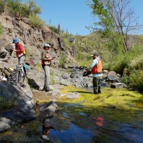
On March 19, 2014, the White House launched the Climate Data Initiative (CDI), part of President Obama's Climate Action Plan launched in June 2013.  The Climate Action Plan is the Administration's blueprint for domestic and international efforts to prepare for the impacts of climate change and reduce carbon emissions.  The CDI is meant to spur the innovative use of open machine-readable government data to help communities deal with the impacts of climate change. 

I attended the CDI launch, courtesy of the White House and the Foundation for Earth Science (the Foundation is the governance entity of the Federation of Earth Science Information Partners ESIP: of which NEON is a member institution).  In addition to announcing the web portal climate.data.gov, the event also showcased the role of the private sector in accelerating the innovative use of open data through public-private partnerships.   Dr. John Holdren, President Obama's science advisor and Director of the White House Office of Science and Technology Policy, opened the event to a packed room of invited guests in the Eisenhower Executive Office Building's auditorium.  Notable speakers included John Podesta (Counselor to President Obama), Jack Dangermond (Founder and CEO of Esri), and Kathryn Sullivan (recently confirmed NOAA Administrator).   

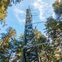
In earlier events, Dr. Sullivan highlighted the role environmental intelligence, which she defined as "timely, actionable information, developed from reliable and authoritative science, that gives us foresight about future conditions."  Once fully commissioned, NEON will also play a role in providing the data and information to advance the type of continental-scale science that will ultimately be useful for decision-making and resource management.  Regardless of whether NEON's calibrated or gridded-model data products are incorporated into climate.data.gov or the upcoming ecosystems.data.gov, we anticipate those data products to be widely used in innovative spatio-temporal analyses: from simple regressions to complex data assimilation models.   

Those analyses will help inform questions of broader societal-relevance, including ameliorating the impacts of climate change.  The ongoing work by the informatics community on provenance ("history") and scientific workflows will help provide that linkage between NEON's data and information and how it impacts societal benefit areas like agriculture, health, and energy.

Share

Related Posts:

Mapping Tree Mortality in the Pacific Southwest
May 20, 2020
What’s That Tree? This Neural Net Can Tell You
June 17, 2020
Mapping the Aftermath of a Hurricane
July 15, 2020
NEON Logo

Follow Us:

Join Our Newsletter

Get updates on events, opportunities, and how NEON is being used today.

Subscribe Now

Footer

  • My Account
  • About Us
  • Newsroom
  • Contact Us
  • Terms & Conditions
  • Careers

Copyright © Battelle, 2019-2020

The National Ecological Observatory Network is a major facility fully funded by the National Science Foundation.

Any opinions, findings and conclusions or recommendations expressed in this material do not necessarily reflect the views of the National Science Foundation.